Photographic Thoughts — 05/02/2021 to 05/08/2021

“Taking pictures is like tiptoeing into the kitchen late at night and stealing Oreo cookies.” — Diane Arbus

Thank you for all the new views and likes from last week. It helps keep me going. Enjoy my blog post!

Enjoy this week’s rambling mind of a mechanical engineer and photographer.

Sunday, 05/02/2021: Posted photo — Seeds.

Settings: Canon EOS 60D, ISO 200, f/5.6, 1/1600 s, 62 mm

These are the pods of one of the sweet birches, or cheery birch, trees in our yard. This is a wonderful time of year when the trees and flowers are starting to bloom. They bloom later in our area because of elevation. Some locations, such as Worcester and Boston, have their trees and plants in full bloom.

Sweet birch pods

Information section of this blog. There are four Common Birch Species according to the Treehuggers website. The four most common birch species in North America are:

Paper birch (Betula papyrifera): Also known as canoe birch, silver birch, or white birch, this is the species more widely recognized as the iconic birch. In its native environment, it can be found in forest borders across the northern and central U.S. Its bark is dark when the tree is young, but quickly develops the characteristic bright white bark that peels so readily in thick layers that it was once used to make bark canoes. The species grows to about 60 feet tall but is relatively short-lived. It is susceptible to borer insects and is no longer used widely in landscape design due to its susceptibility to damage.

River birch (Betula nigra): Sometimes called black birch, this species has a much darker trunk than the paper birch, but still has the characteristic flaky surface. In its native environment, it is common to the eastern third of the U.S. Its trunk has a much rougher, coarser appearance than most of the other birches, and it is bigger than the paper birch, sometimes growing to 80 feet or more. It prefers moist soil, and although short-lived, it is relatively immune to most diseases. It is a common choice in residential landscape design.

Yellow birch (Betula alleghaniensis): This tree is native to forests of the northeast U.S. and is also known as the swamp birch since it is often found in marshy areas. It is the largest of the birches, easily growing to 100 feet in height. It has silvery-yellow bark that peels in very thin layers. Its bark does not have the thick layers seen in paper birches nor the very rough texture seen in river birches.

Sweet birch (Betula lenta): This species, also known in some areas as the cherry birch, is native to the eastern U.S., especially the Appalachian region. Growing to 80 feet, its bark is dark in color, but unlike the dark river birch, the skin is relatively tight and smooth, with deep vertical scores. From a distance, the impression is of a smooth, silver bark marked by irregular vertical black lines.

Monday, 05/03/2021: Posted photo — Clouds.

Settings: Canon EOS 60D, ISO 200, f/4, 1/125 s, 25 mm.

Here are some clouds I saw this morning before the rain. I liked the texture and colors in the clouds, so I took the photo. Here is a little information about clouds.

Clouds

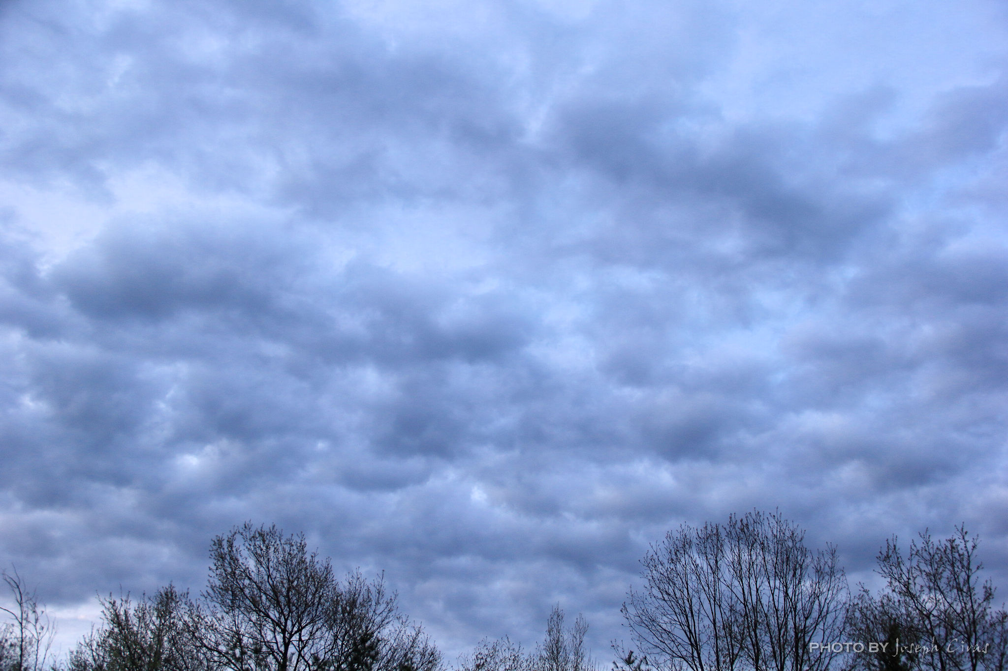
While it is true that clouds contain water, they are not made of water vapor. If they were, you would not be able to see them. The air around us is partially made up of invisible water vapor. The cooler air causes the water droplets to start to stick to things like bits of dust, ice, or sea salt. It is only when that water vapor cools and condenses into liquid water droplets or solid ice crystals that visible clouds form. Clouds are important for many reasons. Rain and snow are two of those reasons. At night, clouds reflect heat and keep the ground warmer. During the day, clouds make shade that can keep us cooler.

Tuesday, 05/04/2021: Posted photo — Maple Growth.

Settings: Canon EOS 60D, ISO 400, f/7.1, 1/160 s, 106 mm.

Like the photo I took on Sunday, trees are budding in our yard. These are the leaves on one of the many sugar maples in our year. I have posted photos of these trees in the fall with their colorful leaves and during the winter/spring with they are tapped to make maple syrup.

How do I know this is a sugar maple and not a red maple? What is the difference between a sugar maple and a red maple? A Red maple has red twigs and buds (and red leaves in the fall and red flowers in the spring). The leaves of sugar maple, on the other hand, generally turn yellow or golden in the fall, and sugar maples have brown twigs and buds.

Sugar maple leaves starting to bud

The look great when they are in bloom. They do not look so great when I must rake the leaves in the fall. I would not have it any other way. I enjoy living in an area with many trees.

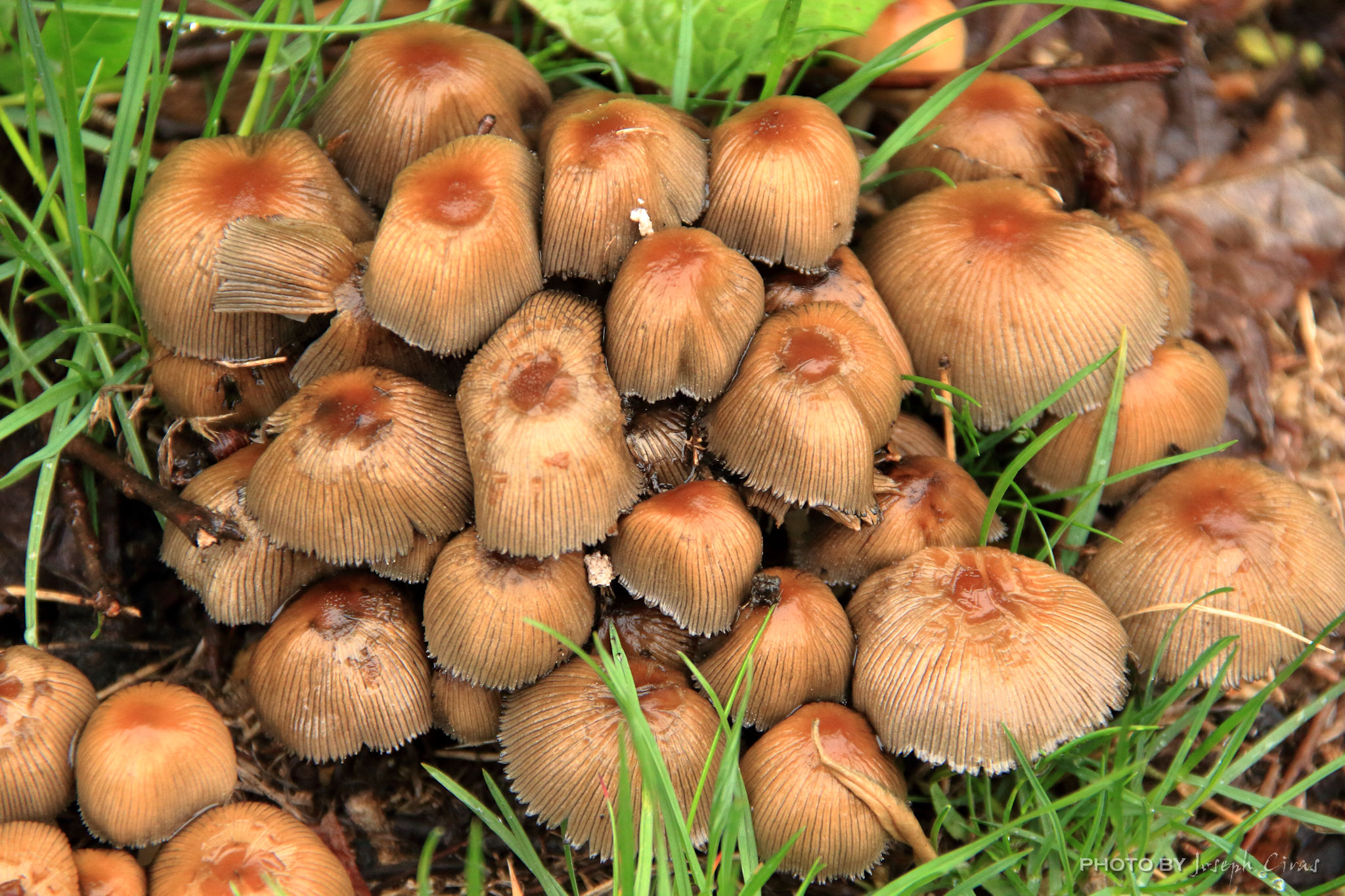
Wednesday, 05/05/2021: Posted photo — Mushrooms.

Settings: Canon EOS 60D, ISO 1000, f/5.6, 1/125 s, 100 mm.

These are mushroom that grew almost overnight due to the rain in recent days. I just like the clustering of them.

Although mushrooms are classified as vegetables, technically they are not plants, but part of the kingdom called fungi. Mushrooms are low in calories, have virtually no fat and no cholesterol, and are very low in sodium. Fungus, plural fungi, any of about 144,000 known species of organisms of the kingdom Fungi, which includes the yeasts, rusts, smuts, mildews, molds, and mushrooms. There are also many funguslike organisms, including slime molds and oomycetes (water molds), that do not belong to kingdom Fungi but are often called fungi. Mushrooms with white gills are often poisonous. So are those with a ring around the stem and those with a volva. Because the volva is often underground, it is important to dig around the base of a mushroom to look for it. Mushrooms with a red color on the cap or stem are also either poisonous or strongly hallucinogenic.

Mushrooms after the rains

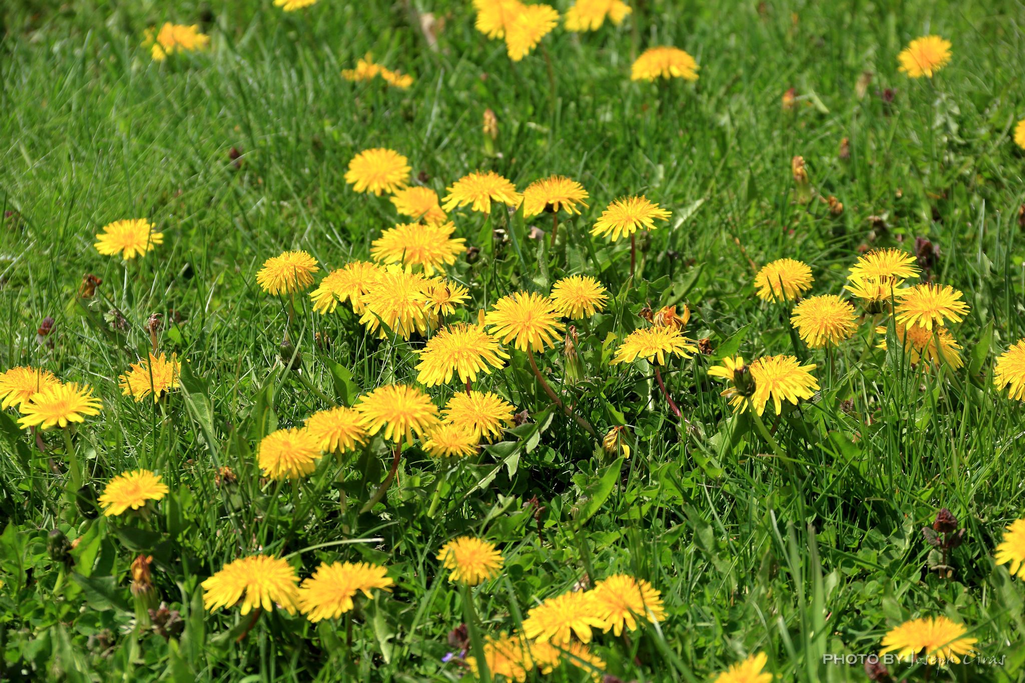
Thursday, 05/06/2021: Posted photo — Dandelions.

Settings: Canon EOS 60D, ISO 100, f/7.1, 1/320 s, 87 mm.

Dandelion is a plant with yellow flowers. Taraxacum officinale is the most common variety of this plant, and it grows in many parts of the world. Botanists consider dandelions to be herbs. People use the leaves, stem, flower, and root of the dandelion for medicinal purposes.

There are five ways to eat dandelions according to Michigan State University:

  1. Dandelion green salad: This is the simplest way to use dandelion greens. Simply pick young greens (older ones are more bitter) and add them to a tossed salad. While you can make a salad out of just the dandelion greens, it tends to be too bitter for many people, especially kids.
  2. Sauteed greens: Cooking dandelions eliminates some of the bitterness. First boil the greens for about 5 minutes, then transfer to a pan with hot olive oil and garlic, and sauté for 3-5 minutes. Eat as is or add to other dishes like pasta or scrambled eggs.
  3. Dandelion fritters: Collect flower heads and wash them. Then batter in a flour, egg, and milk batter mix. Add to a pan with hot oil and cook until brown, just like pancakes. Serve with a drizzle of honey or applesauce.
  4. Baking with dandelion petals: The petals of the flower are extremely versatile. Collect flower heads and then remove the petals from the heads. These can be stored in a plastic bag in the freezer for longer keeping. Add petals to just about anything you can bake like muffins, bread, cookies, or quiche. They can also be added to things like hamburgers. The amount to use varies on your personal liking. Try adding a cup of petals to the mix the next time you make muffins or burgers.
  5. Dandelion root coffee/tea: This by far the most labor-intensive use of dandelion but some say it is worth the effort. Collect and wash dandelion roots. Chop or food process the roots and dry in a food dehydrator or the oven at 250 degrees Fahrenheit until thoroughly dry. Once dry, roast them in the oven at 350 F until they turn brown (but not burnt). Put roots and water in a pan and bring to boil (2 Tbs root to 16 oz water), then simmer for 20 minutes. Strain and drink.

People either use chemicals to kill them or they pull up the dandelions to get them off their lawns. According to Bob Vila, to dig up the dandelions, as any plant is more easily pulled from the ground if the soil is moist, first use the watering can to dampen the soil around the dandelion, and wait a few minutes for the moisture to settle in. Then, work a weeding knife down along the base of the dandelion in two or three places. Push the soil away from the root of the plant by wiggling the knife. Finally, grasp the base of the plant between your fingers and gently pull. If it still feels stuck, work the weeding knife around some more, and then gently pull out the entire taproot with the dandelion.

Here is a way to kill dandelions without using chemicals. Simply pouring vinegar over the dandelions changes the acidity in the soil for long enough to kill the weeds. For a faster punch, mix pickling vinegar with boiling water in equal parts for your dandelion killer. Pickling vinegar has more acid that distilled white vinegar, so it makes a more effective herbicide.

Dandelion

There is much information in this week’s blog. Wonder if I will be keeping it up for the remainder of the week.

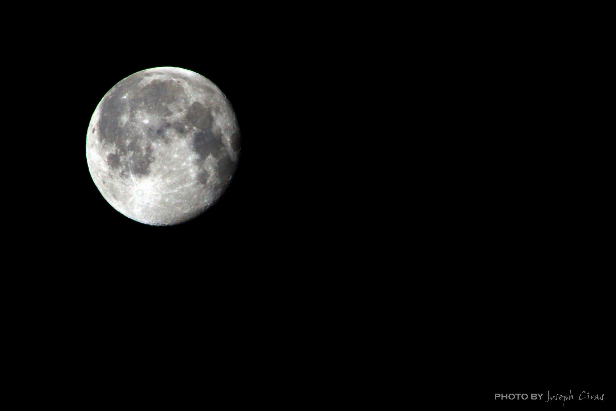
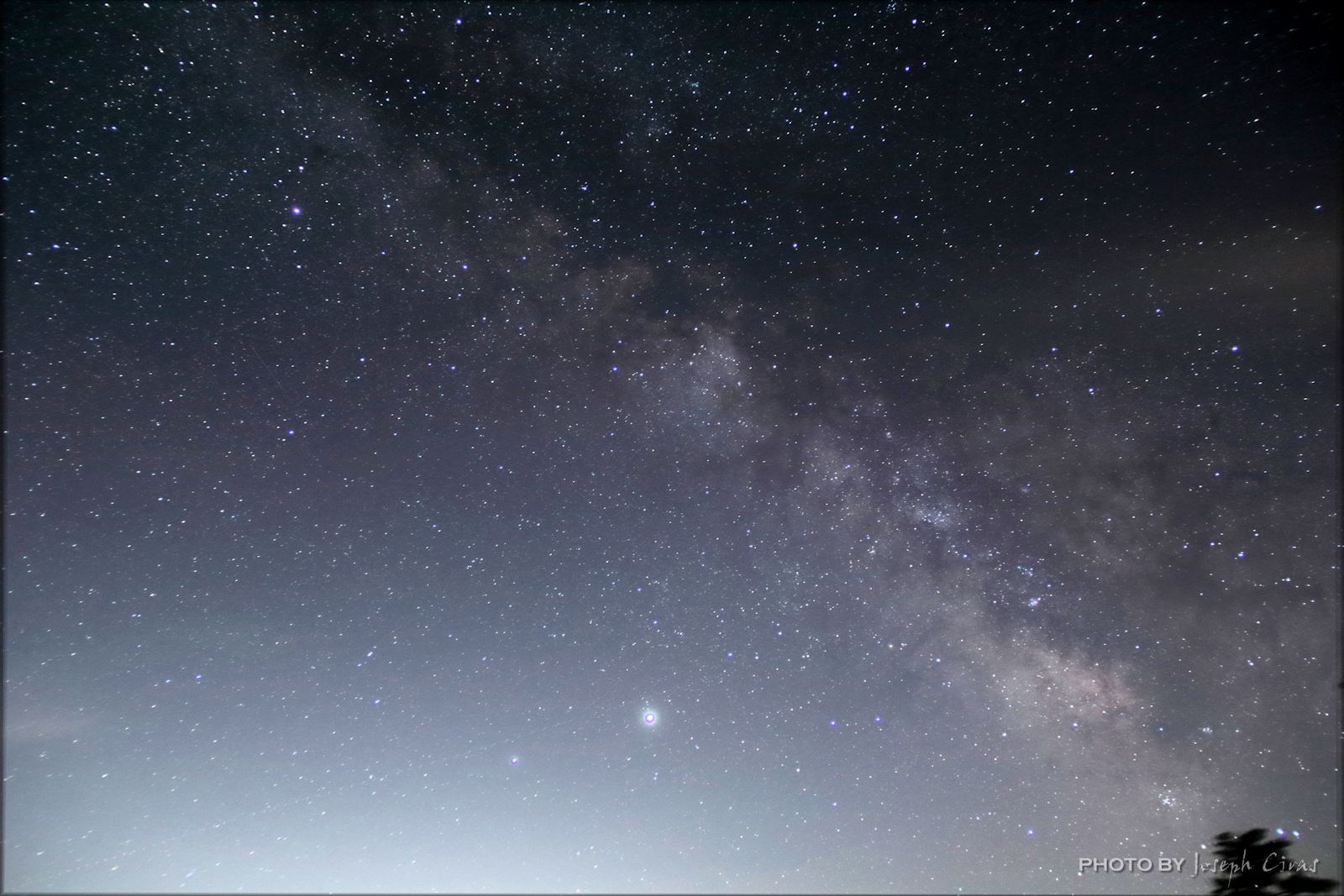
Friday, 05/07/2021: Post photo — Milky Way.

Settings: Canon EOS 60D, ISO 3200, f/3.5, 1/20 s, 18 mm.

These are some of the first “good” photos that I have taken of the Milky Way. The vertical Milky Way was taken at the Needles section of Canyonland National Park. This was the first photo of the Milky Way that I liked. I learned much about my settings and techniques while taking this photo. I made may rookie errors, such as incorrect camera settings and not taking a series of photos to stake. The Needles section of Canyonland National Park is one of the dark sky areas in the Unites States. This photo was taken very early in the morning, 2 a.m., after the moon had set. The second, or diagonal photo, was taken last year when we were observing the Comet Neowise.

The Milky Way is the galaxy that contains our Solar System, with the name describing the galaxy’s appearance from Earth: a hazy band of light seen in the night sky formed from stars that cannot be individually distinguished by the naked eye.

The Milky Way from Canyonlands National Park

This photo has been included in my blog at the request of another blogger. Thank you for the request. Posting this photo is incentive for me to get out and make the adjustments to my camera settings and post processing to get a better photo of the Milky Way. As with my moon photos, I need to get out and practice more.

Milky Way during my comet observation

Quick starting camera setting: ISO 2500, Shutter Speed 25 sec, and Aperture f/2.8 (or as wide as possible). A good steady tripod and a dark sky are also needed. There are many websites and books on how to photograph the Milky Way. And as a reminder when your camera is on a tripod, turn off image stabilization, or vibration stabilization, on your camera. With these settings on your photos will not be in focus.

Saturday, 05/08/2021: Post photo — Double Falls.

Settings: Canon EOS 60D, ISO 100, f/22, 1/10 s, 18 mm.

These falls are located at the end of Snows Millpond and lead into Whitman River. The building above the falls is a papermill. There are still a few papermills operating in the nearby town.

Snows Millpond is a reservoir located just 2.8 miles from Fitchburg. Fishermen will find a variety of fish including largemouth bass and others here. Alternate names for this reservoir include Snow Mill Pond and Snows Mill Pond.

Double falls

The Whitman River is an 8.4-mile-long (13.5 km) river in Massachusetts that flows through Ashburnham, Westminster, and Fitchburg. It arises from Lake Wampanoag in Ashburnham, travels through a couple of ponds in Westminster, and ultimately joins Phillips Brook in Fitchburg to form the North Nashua River. The North Nashua River flows 19.9 miles (32.0 km), generally southeastward, past Fitchburg and joins the South Nashua River, about 5 miles (8.0 km) below its issuance from the Wachusett Reservoir, to form the Nashua River. The Nashua River is 37.5 miles (60.4 km) long and is a tributary of the Merrimack River. The Merrimack River is a 117-mile-long (188 km) river that rises at the confluence of the Pemigewasset and Winnipesaukee rivers in Franklin, New Hampshire, flows southward into Massachusetts, and then flows northeast until it empties into the Gulf of Maine at Newburyport.

That is all for now. Until next week, be safe.

For more photo of other project I have work, visit my website: https://photobyjosephciras.weebly.com/ or visit me on Facebook at https://www.facebook.com/PhotobyJosephCiras/.

COVID is real! Be safe out there, keep your social distance, and remember to always wear your mask and wash your hands.

Photographic Thoughts—04/18/2021 to 04/24/2021

“A portrait is not made in the camera but on either side of it.” — Edward Steichen

Thank you for all the new views and likes from last week. It helps keep me going. Enjoy my blog post!

Sunday, 04/18/2021: Posted photo—American Bison.

Settings: Canon EOS DIGITAL REBEL XS, ISO 320, f/6.3, 1/320 s, 300 mm

While at Wind Cave National Park in Hot Springs, SD we wanted to see some bison. Bison Flats seems to be a good place possible see bison. Bison Flats to the left, what is that to the right, let us explore. It is a herd of 300 bison! No need to go to Bison Flats. What a sight to see. So graceful for such large animals.

From the National Park website: “Discover the Biodiversity of the Prairie. Bison, elk, and other wildlife roam the rolling prairie grasslands and forested hillsides of one of America’s oldest national parks. Below the remnant island of intact prairie sits Wind Cave, one of the longest and most complex caves in the world. Named for barometric winds at its entrance, this maze of passages is home to boxwork, a unique formation rarely found elsewhere.”

Such an amazing place to visit. As with all the National Parks, Wind Cave offers some great views and wonderful exploring. We were situated below a hill at out campsite. We were joking about seeing a herd of bison or elk stampeding over the hill while we were sleeping.

American bison

The next day we explored the cave and then wanted to see bison. As you can see from the posted photo, we did see bison. We saw the bull and then the herd follow him. What a great sight to see nature in action.

Monday, 04/19/2021: Posted photo—Fish Story.

Settings: Canon EOS 60D, ISO 400, f/7.1, 1/320 s, 135 mm.

Stopped by the Old Mill today after work to take my photo. When I arrive at the duck pond, I do not know the location of the ducks and geese in the pond. Today, when I arrived, this goose was near the duck house and was eating some bread that someone had given it a few minutes before. When this goose saw me, he stood up and started flapping his wings and squawking.

Goose at the Old Mill duck pond

I took a series of photos and saw this one with the wings spread as if it was telling me a fish story. Maybe it was about a fish he saw, maybe it was about a hawk or eagle he saw earlier, or maybe it was about something else. I just like the way this photo came out.

Tuesday, 04/20/2021: Posted photo—Rug.

Settings: Canon EOS 60D, ISO 400, f/7.1, 1/40 s, 47 mm.

Need a photo? Sitting outside watching a two-year-old playing? Sitting on an outdoor carpet? That is what happened today. I looked at the carpet and saw this pattern and took this photo. The contrast between the white and the green caught my eye. I have seen this before, but this time I took a photo of it. We have had this outdoor rug, or carpet, for a few years now and it is still in good condition.

Always keep you eyes open for a photo opportunity. You never know when one will appear.

Pattern on outdoor rug or carpet

Wednesday, 04/21/2021: Posted photo—Grape Hyacinths.

Settings: Canon EOS 60D, ISO 100, f/7.1, 1/125 s, 60 mm

Grape hyacinths (Muscari) look much like little miniature hyacinths. These plants are smaller and only get about 6 to 8 inches (16 to 20 cm.) high. Each grape hyacinth flower looks like it has little beads all strung together up and down the stem of the plant.

Grape hyacinths do not need a whole lot of care after they flower. They do fine with natural rainfall and do not need fertilizer. Once their leaves die off, you can cut them back. In the fall, new leaves will grow, which will remind you of the pretty grape hyacinth flower to look forward to coming spring once more.

Grape hyacinths

These grape hyacinths are growing at my mother’s house in her front yard. I have seen this plant on my travels and this was the first day that I saw them at her house. I got down low to the ground and took this photo. I like the pattern that is on each one of the beads.

Thursday, 04/22/2021: Posted photo—Sunset.

Settings: Canon EOS 60D, ISO 200, f/7.1, 1/500 s, 135 mm.

Another summit sunset photo

Seven Principles of Leave No Trace (LNT)

  1. Plan Ahead and Prepare
  2. Travel and Camp on Durable Surfaces
  3. Dispose of Waste Properly
  4. Leave What You Find
  5. Minimize Campfire Impacts
  6. Respect Wildlife
  7. Be Considerate of Other Visitors

hikeSafe Hiker Responsibility Code (per Safe Hiking in New Hampshire)

You are responsible for:

  1. Knowledge and gear. Become self reliant by learning about the terrain, conditions, local weather and your equipment before you start.
  2. To leave your plans. Tell someone where you are going, the trails you are hiking, when you’ll return and your emergency plans.
  3. To stay together. When you start as a group, hike as a group, end as a group. Pace your hike to the slowest person.
  4. To turn back. Weather changes quickly in the mountains. Fatigue and unexpected conditions can also affect your hike. Know your limitations and when to postpone your hike. The mountains will be there another day.
  5. For emergencies. Even if you are headed out for just an hour, an injury, severe weather or a wrong turn could become life threatening. Don’t assume you will be rescued; know how to rescue yourself.
  6. To share the hiker code with others.

Why did I start this post with the LTN principles and the hikeSafe principles? I went on a hike tonight with a new group for the first time. I am looking for a group to hike with once this madness is over an I wanted to try this group out. One of the questions that I askes was the first principle of LNT and the second one listed in the hikeSafe Hiker Responsibility Code, what is the route we are taking and how long to the hikes last. The answer was the hikes last about two hours and we make up the route as we go. Not the answers I was looking to hear. These are experienced hikers, and I would like to hike with them again. One of the things a leader must do is to know the group and select the trail that is best for most of the people. The trail may not be good for all, but the trail should be selected before the hike to the LNT and hikeSafe principles can be followed.

When I hike, I leave my planned route with my son or wife if my son is hiking with me. I estimate the return time and let them know that also. I do not stray from that route just incase something happens to me; people can come looking for me in the reverse order of my hike.

Here are the ten essentials that you should always take on a hike:

Ten Essential Systems

  1. Navigation: Map, compass, altimeter, GPS device, personal locator beacon (PLB) or satellite messenger.
  2. Headlamp: Plus extra batteries.
  3. Sun protection: Sunglasses, sun-protective clothes and sunscreen.
  4. First aid: Including foot care and insect repellent (as needed).
  5. Knife: Plus a gear repair kit.
  6. Fire: Matches, lighter, tinder and/or stove.
  7. Shelter: Carried at all times (can be a light emergency bivy).
  8. Extra food: Beyond the minimum expectation.
  9. Extra water: Beyond the minimum expectation.
  10. Extra clothes: Beyond the minimum expectation.

Now about the photo. This is the sunset from the summit of Wachusett Mountain. It was very windy at the summit, so I only took a few photos. I like the way this one came out because of the colors and shading. Nature is amazing. No two sunsets are the same and each one is worth the hike.

I am hoping to see the sunset again with this group. I will try again to hike with them and to enjoy the company of other hikers.

Always follow the seven LNT Principles, the hikeSafe Hiker Responsibility Code, and carry the Ten Essentials when on the trail, no matter how short the hike.

Friday, 04/23/2021: Post photo—Turkey.

Settings: Canon EOS 60D, ISO 3200, f/7.1, 1/50 s, 135 mm

After a long-winded and venting post yesterday, today will be short.

As I was driving into work today, I was stopped by a rafter of turkeys. I have seen these turkeys off the side of the road when either arriving at work or leaving work. Today they were standing in the road and I had to move slowly towards them to get them to move. This one was just standing there looking at me as if it wanted to know what I was doing.

Turkey blocking the road

Saturday, 04/24/2021: Post photo—Treads.

Settings: Samsung SM-G930V (Galaxy S7), ISO 200, f/1.7, 1/24 s, 4 mm.

I took a risk today that we will not be getting any more snow. I took my car in to change out my snow tires. I got up early to bring time in since the place I bring my car is very busy on the weekends. I had to wait three hours before they could take me. I wanted to go early so I could get my Saturday hike in before the crowds. The early hike did not happen, so I hike on a back trail that most people do not hike much later than I wanted. The summit was crowded by not overcrowded as much as it could be.

While on the summit I took some bearings: Boston is at 172°, Mount Monadnock is at 338°, and the city of Worcester is at 84°. Boston and Worcester were not very clear to see. Knowing the mountain, I know the general direction of these cities. These cities are the two biggest cities in New England.

Snow tire treads

In case you are wondering, the photo is of the treads on Bridgestone Blizzak Snow tires. I liked the pattern. They look like they could grip the snow very well.

For more photo of other project I have work, visit my website: https://photobyjosephciras.weebly.com/ or visit me on Facebook at https://www.facebook.com/PhotobyJosephCiras/. COVID is real! Be safe out there, keep your social distance, and remember to always wear your mask and wash your hands. I get my second COVID vaccination on Wednesday this week. Get vaccinated!

Photographic Thoughts—03/28/2021 to 04/03/2021

“What makes photography a strange invention is that the primary raw materials are light and time.” — John Berger

Thank you for all the new views and likes from last week. It helps keep me going. Enjoy my blog post!

Sunday, 03/28/2021: Posted photo—Upton School.

Settings: Canon EOS 60D, ISO 400, f/5.6, 1/500 s, 32 mm

Part of the National Register of Historic Places, the Upton School was used as a high school from 1912 to 1960, and as an elementary school until 1994 when a new elementary school was built. The Westminster Historical Society purchased the building in 1997. It is in the Westminster Village-Academy Hill Historic District. The building is now vacant and there has been much discussion around town as to what to do with it.

Upton School, Westminster, MA

Interesting fact: Under Federal Law, the listing of a property in the National Register places no restrictions on what a non-federal owner may do with their property up to and including destruction, unless the property is involved in a project that receives Federal assistance, usually funding or licensing/permitting. However, before this occurs, you can, or the property owner should contact the State historic preservation office (SHPO.) The SHPO is the state agency that oversees historic preservation efforts in their state. There may be state or local preservation laws that the owner should be aware of before they undertake a project with a historic property.

Monday, 03/29/2021: Posted photo—Drive By Falls.

Settings: Canon EOS 60D, ISO 100, f/36, 1/10 s, 55 mm.

I have driven by the Steamline Trail Park in West Fitchburg several times, not thinking anything of it. It is not a spectacular park or a very big park from what I have seen from the road. As I was driving past it today, I noticed a dam with water flowing over the dam. It might be because there are not any leaves on the trees yet. I stopped in to take this photo.

I found out that the park is 4.15 acre and is located at 465 Westminster Street, and includes a parking lot and walking trail along the Nashua River and Flag Brook. This park is the first implementation of the City of Fitchburg’s plans to develop a network of trails along the Nashua River, connecting to trails in Leominster and Westminster.

A steam line is a pipe that carries steam from one building to another. The steam was used to run turbines and other industrial equipment in factories. Fitchburg was a factory town. Many of the factories are no longer in operation and the steam distribution lines are still visible and are being taken down due to safety concerns.

The falls at Steamline Trail Park

Time to go exploring.

Tuesday, 03/30/2021: Posted photo—Waning Gibbous Moon.

Settings: Canon EOS 60D, ISO 200, f/16, 1/125 s, 300 mm.

A waning gibbous moon at 95.3% this morning. I saw the moon rise last night. It was large and reddish and a wonderful site. On my ride into work today, the moon was lighting my way calling to me to take its photo. I have taken many photos of the moon. Some with my “moon” lens and some with my 300 mm lens. This one was taken handheld with my 300 mm lens as I was getting out of my car to go into work.

Morning moon

Sometimes the subject of a photograph just calls to you.

Wednesday, 03/31/2021: Posted photo—Corrugation.

Settings: Canon EOS 60D, ISO 800, f/5.6, 1/40 s, 49 mm

According to the dictionary: “corrugation — the act of shaping into parallel ridges and grooves. change of shape — an action that changes the shape of something.”

Corrugated paper

If you look closely at a piece of corrugated cardboard, you will see a wavy texture in between. This creates the strength and rigidness that prevents the cardboard from folding on itself like paper would. Cardboard boxes have been around for a very long time, as early as 1817, when the first commercial box was invented from paperboard in England. But it was not until the 1890s that a cardboard box with layers of corrugated cardboard was first developed and used for shipping. A decade later, these corrugated boxes were starting to replace the traditional wooden crates and boxes.

This photo was taking of a roll of corrugated paper that I came across in my travels today. This photo is an example of the subject just calling on me to take its photo. I just love when a subject corporates at this roll of corrugated paper did.

Thursday, 04/01/2021: Posted photo—Lake Louise.

Settings: Canon EOS DIGITAL REBEL XS, ISO 200, f/13, 1/250 s, 29 mm

“Lake Louise is a hamlet in Banff National Park in the Canadian Rockies, known for its turquoise, glacier-fed lake ringed by high peaks and overlooked by a stately chateau. Hiking trails wind up to the Lake Agnes Tea House for bird’s-eye views. There is a canoe dock in summer, and a skating rink on the frozen lake in winter. The Lake Louise Ski Resort features a wildlife interpretive center at the top of a gondola.” ― Google

Elevation: 5,249’

Area: 222 acres

Province: Alberta

Lake Louise, Alberta Canada

We had a great visit to Lake Louise a few years ago when we were on our Northern National Park tour. That trip too us to, ready: Glacier National Park, MT; Waterton-Glacier Lakes National Park, Alberta, Canada; Banff National Park, Alberta, Canada; Jasper National Park, Jasper, Canada; Northern Cascades National Park, WA; Olympic National Park, WA; Mount St. Helens National Volcanic Monument, WA; Mt. Rainier National Park, WA; Craters of the Moon National Monument and Preserve, ID; Grand Tetons National Park, WY; Yellowstone National Park, WY; Devils Tower National Monument, WY; Wind Cave National Park, SD; Crazy Horse Memorial, SD; Mount Rushmore National Memorial, SD; Badlands National Park, SD; Mall of America, Bloomington, MN; and the Field of Dreams Movie Site, Dyersville, IA.

Friday, 04/02/2021: Post photo—Worcester City Hall.

Settings: Samsung SM-G930V, ISO 50, f/1.7, 1/5040 s, 4 mm

City Hall is located on the western end of City Hall Common has been the center of Worcester’s government for many years. In colonial days, the meetinghouse was situated here, and in 1825, a plain Greek Revival style town hall was built here. After Worcester became a city in 1848, this building served as City Hall for another 50 years, until it was finally replaced on April 28, 1898 by a much larger and more elaborate building on the same spot.

Designed by the prominent Boston firm of Peabody & Stearns, it reflects the Renaissance Revival architecture that was gaining popularity in public buildings at the turn of the 20th century. City Hall bears some resemblance to the Boston Public Library, which had been completed several years earlier, but it also includes a 205-foot tower in the center of the Main Street facade.

City Hall was not quite 10 years old when the first photo was taken, and not much has changed to its exterior appearance since then. Nearly 120 years after its completion, it remains the fourth tallest building in the city, and it remains in use as the seat of the city government. Along with the Worcester Common, the building is listed on the National Register of Historic Places.

On July 4, 1776, Worcester publisher Isaiah Thomas gave the first public reading of the Declaration of Independence from the steps of the Old South Meeting House, which was on what is now Worcester Common.

City Hall, Worcester, MA

Worcester is my hometown and I happily return when I can. Worcester is also the second most populated city in New England with Boston being the first.

Saturday, 04/03/2021: Post photo—Second Appointment.

Settings: Samsung SM-G930V, ISO 160, f/1.7, 1/30 s, 4 mm.

BioNTech, Fosun Pharma, Pfizer vaccine is a COVID-19 vaccine authorized by FDA and recommended by the CDC for use in the US for a limited population. From the CDC website: “Based on evidence from clinical trials, the Pfizer-BioNTech vaccine was 95% effective at preventing laboratory-confirmed COVID-19 illness in people without evidence of previous infection.” For this vaccine to fully protect you, a second shot must be given 21 days after the first shot.

Getting vaccinated is easy. The signup for the vaccination is the hardest part. Due to a high demand for the vaccines, it may be difficult to get an appointment. Keep trying. It will save lives. Remember my footer: COVID is real! Be safe out there, keep your social distance, and remember to always wear your mask and wash your hands. I have lost an aunt to COVID and I know others that have died from it. I also know people that did not know that they had it or had very mild symptoms. Please take it seriously and get vaccinated when you can.

Vaccine appointment card

For more photo of other project I have work, visit my website: https://photobyjosephciras.weebly.com/ or visit me on Facebook at https://www.facebook.com/PhotobyJosephCiras/.

COVID is real! Be safe out there, keep your social distance, and remember to always wear your mask and wash your hands.

Photographic Thoughts—03/07/2021 to 03/13/2021

“There is one thing the photograph must contain, the humanity of the moment.” —Robert Frank

Thank you for all the new views and likes from last week. It helps keep me going. Enjoy my blog post!

This week’s post will be short. I will explain why later in this month.

Sunday, 03/07/2021: Posted photo—Reference Mark 8.

Settings: Canon EOS 60D, ISO 100, f/7.1, 1/500 s, 55 mm

This was my fifth hike in seven days on Wachusett Mountain. Just as last Sunday, I hiked with my son and two of his friends this time. This was a shorter hike than I did on Saturday for no reason. I did take the kids, young adults, up one of the more difficult trails on the mountain. The steep part of Jack Frost Trail was pure ice with no snow cover. I took this trail on Saturday and wanted to see how they would handle it today. They only did it once, I did it twice. Like last week, I wanted to challenge myself to get to the trailhead before them. I knew that they would get there first this week since, when I established the challenge, they only have a flat trail to hike and I had to go back up the steep, icy trail and then back down the other side. They arrived at the trailhead about ten minutes before I did. Still a fun day and they like the challenge.

Reference mark on the summit of Wachusett Mountain

This photo is of a National Geodetic Survey (NGS) reference mark. A reference mark differs from a benchmark in that reference marks point to benchmark. There are three reference marks on the summit of Wachusett Mountain. There used to be four but one of them must have been removed when they were putting in the new watch tower. Either that or I have not been able to find it yet. A benchmark can either show location or elevation. A benchmark for location can be a random point determined by the surveyor or it could be something permanent in nature such as the corner of a concrete pad or a survey monument. A benchmark for elevation can be given a random elevation number or the exact number of feet above sea level can be determined.

One of my rules is that you are not on the summit of a mountain until you touch the benchmark. If there is not benchmark, they I need to look at my map and/or GPS device to estimate the location of the summit.

Monday, 03/08/2021: Posted photo—Walkway.

Settings: Canon EOS 60D, ISO 400, f/14, 1/10 s, 40 mm.

The walkways at the Old Mill Restaurant are covered walkways. They are very picturesque year-round but especially this time of year with snow on the rocks and the water gently flowing under the walkways.

This photo is not as easy to take as you would think. There is a busy road that goes in front of the restaurant, so you must time your shot not to have any vehicles in it. You also need to walk down to the stream to get the correct angle for the shot. That is not an issue during most of the year. Today I had to walk on icy snow to get into position. Not a problem for me but could be a problem for some.

A covered walkway at the Old Mill Restaurant

A covered bridge, or a covered walkway, is a timber-truss bridge with a roof, decking, and siding, which in most covered bridges, or walkways, create an almost complete enclosure. The purpose of the covering is to protect the wooden structural members from the weather. “The first long covered bridge in America, with a 55-meter (180-foot) center span, was built by Timothy Palmer, a Massachusetts millwright, over the Schuylkill River at Philadelphia in 1806. Covered timber-truss bridges soon spanned rivers from Maine to Florida and rapidly spread westward. There is no evidence of timber-truss bridges, with or without covering, in the ancient world, but the 13th-century sketchbook of the French architect Villard de Honnecourt depicts a species of truss bridge, and the Italian Andrea Palladio’s “Treatise on Architecture” (1570) describes four designs.” — Encyclopedia Britannica.

Tuesday, 03/09/2021: Posted photo—Cirrus Clouds.

Settings: Canon EOS 60D, ISO 400, f/7.1, 1/400 s, 47 mm.

Cirrus Clouds (“Delicate cloud streaks”)

Typical Altitude: 16,500–45,000 ft
Precipitation: None that reaches ground
Composition: Ice crystals
Formation: Fall streaks of ice crystals in upper troposphere winds.

Cirrus Clouds or contrails?

Cirrus clouds are the highest of all clouds and are composed entirely of ice crystals. Cirrus clouds are precipitating clouds, although the ice crystals evaporate high above the earth’s surface. The crystals, caught in 100–150 mph winds, create wisps of cloud.

This morning I saw four well defined “x’s” in the sky and thought that this would be a good photograph. The white was a wonderful contrast to the morning blue sky. These cloud formations do not last very long because of the high winds that form them.

Some people think these are contrails. The condensation trail left behind jet aircrafts are called contrails. Contrails form when hot humid air from jet exhaust mixes with environmental air of low vapor pressure and low temperature. The mixing is a result of turbulence generated by the engine exhaust. I am not sure about that, so I am sticking with calling them Cirrus clouds.

Wednesday, 03/10/2021: Posted photo—Watch Tower.

Settings: Samsung SM-G930V, ISO 200, f/1.7, 1/18 s, 4 mm.

On February 27, 2014 this new 80-foot steel fire tower was installed on the summit of the Wachusett Mountain state reservation in Princeton. The structure replaces the old tower which was built in 1966.

I cannot believe it has been so many years since it was open. I still remember when they were constructing it. We would hike to the summit and watch it being built over a few months.

The new watchtower on the summit of Wachusett Mountain

Here is a photo of the old watch tower in the winter.

The old watchtower in winter on the summit of Wachusett Mountain

Thursday, 03/11/2021: Posted photo— Kolding Denmark.

Settings: KODAK DC3200 DIGITAL CAMERA, n/a, f/3.6, 1/90 s, n/a mm.

This was one of the very first travel photos I have taken. I took this photo on my first of three trips to Denmark. Kolding is a Danish seaport located at the head of Kolding Fjord in the Region of Southern Denmark. It is the seat of Kolding Municipality. It is a transportation, commercial, and manufacturing center, and has numerous industrial companies, principally geared towards shipbuilding.

One thing I like about this photo is that you can see the age of the building. If you look at the side walls, they are warped due to the age of the building and the material that was used to make it.

House in downtown Kolding Denmark

One day I will go back to Denmark with my family. Great place to visit.

Friday, 03/12/2021: Post photo— Two Summits.

Settings: Samsung SM-G930V, ISO 200, f/7.1, 1/13 s, 4 mm

On Sunday, I wrote about the difference between reference marks and benchmarks. These are the two benchmarks on the summit of Wachusett Mountain. The one that looks like a plate is one of the original benchmarks that was moved during the construction of one of the hotels that were on the summit. The one with inside the triangle is the current Wachusett Reset benchmark. This is the benchmark to which the three reference marks point.

The old and new benchmarks on the summit of Wachusett Mountain

Saturday, 03/13/2021: Post photo—Gatehouse.

Settings: Canon EOS 60D, ISO 100, f/7.1, 1/320 s, 36 mm

A gatehouse outlet works or valve house for a dam is a structure housing sluice gates, valves, or pumps (in which case it is more accurately called a pumping station). Many gatehouses are strictly utilitarian, but especially in the nineteenth century, some were very elaborate.

Wyman Pond was constructed by the City of Fitchburg in1892 as a compensating reservoir to provide water to the mills downstream. It was rarely used and soon became a summer getaway for area residents. Trolleys ran right to the gatehouse for those wanting to spend an afternoon at Sunne’s Beach. Its popularity soon sprouted summer cottages all around the lake which now are mostly year-round homes.

I love the old architecture of this gatehouse. The stone walls and slate roof shows how it was constructed.

Gatehouse at Wyman Pond in Westminster, MA

For more photo of other project I have work, visit my website: https://photobyjosephciras.weebly.com/ or visit me on Facebook at https://www.facebook.com/PhotobyJosephCiras/.

COVID is real! Be safe out there, keep your social distance, and remember to always wear your mask and wash your hands.

Photographic Thoughts—02/14/2021 to 02/20/2021

“If you are out there shooting, things will happen for you. If you’re not out there, you’ll only hear about it.” — Jay Maisel

Thank you for all the new views and likes from last week. It helps keep me going. Enjoy my blog post!

Sunday 02/14/2021: Posted photo—Snow on Swing.

Settings: Samsung SM-G930V (Galaxy S7), ISO 50, f/1.7, 1/198 s, 4 mm

It in St. Valentine’s Day today. “St. Valentine is the patron saint of love, young people, and happy marriages. He died in 269. Saint Valentine, officially known as Saint Valentine of Rome, is a third-century Roman saint widely celebrated on February 14 and commonly associated with ‘courtly love.’

Although not much of St. Valentine’s life is reliably known, and whether or not the stories involve two different saints by the same name is also not officially decided, it is highly agreed that St. Valentine was martyred and then buried on the Via Flaminia to the north of Rome.

In 1969, the Roman Catholic Church removed St. Valentine from the General Roman Calendar, because so little is known about him. However, the church still recognizes him as a saint, listing him in the February 14 spot of Roman Martyrolgy.” — Catholic Online

I did not post a photo about St. Valentine’s Day today. Too many people on the site in which I do my photo project did and I wanted to be different.

We are currently in a snow cycle. If it snows on a Tuesday, it will snow every Tuesday for a few weeks before changing days. I went out snowshoeing on our property and like the look of the snow on the swings. This is not the greatest photo of snow on swings that I have taken, but it will be a memory of this day for future reference.

One of the swings in our back yard

Monday 02/15/2021: Posted photo—Hiking Buddies.

Settings: Canon EOS DIGITAL REBEL XS, ISO 100, f/9, 1/125 s, 50 mm.

Lost Lake is a relatively small mountain lake located near the much larger Saint Mary Lake in Montana. Despite the name, Lost Lake is very easy to find. It is just off the famous Going-to-the-Sun Road in Glacier National Park.

We hiked along the Lost Lake Trail in Glacier National Park, part of the time with these travel companions. The trail is a 2.8-mile (4.5-kilometer) loop trail that begins and ends at the same trailhead, or segments can be done as there-and-back. The trail had a deep covering of snow at some locations. Something you cannot tell from this photo. One of the great things about national parks is that wild animals can be wild. Most people respect the animals, and they respect most people.

Mountain Goat Hiking Companions

We were on our way to Waterton Lakes National Park in Canada as part of our northern national park tour a few years ago.

Here are a couple more photos from Glacier National Park for your enjoyment.

Lost Lake, Glacier National Park
Lake McDonald, Glacier National Park
Prince of Wales Hotel, Waterton Lakes National Park

Tuesday 02/16/2021: Posted photo—Ice.

Settings: Canon EOS 60D, ISO 100, f/5.6, 1/30 s, 55 mm.

Today was an interesting day. When I was going to my car this morning to start it up, the ground looked like it was just wet. One step on our walkway and found out it was ice. I did not fall, my foot slipped out a little from under me. I gingerly walked to my car to start it and then to the woodshed to get some salt to place on the walkway and driveway. When I started my car, I took out my “junk” microspikes to walk on the ice and to put the salt down safely. I drove to work carefully and keep my microspikes on when I walked from my car to into the office.

Many other people in the office were surprised by the ice. I most cases, it was a very thin layer of black ice. The roads were not bad since they were treated well. I was thinking on my way to work that it is a good thing that I have my snow tires on in these conditions. If it were earlier in the season, late November, or early December, I may not have changed out my tires and would not be able to make it up the hill to work.

One good thing about the ice, and being a photographer and outdoors person, is that the ice forms a great layer on trees and bushes. Not great in most cases because ice buildup could lead to power outages as it did in the Winter of 2008, but wonderful to look at.

Bush covered with ice

Today’s photo is one of ice buildup on a conifer bush. I hope you enjoy.

Now it is time to clean up the mess the rain and freezing rain has left behind. Need to destroy some ice dams on my roof so that water does not get into my house.

Wednesday 02/17/2021: Posted photo—Winter at Dusk.

Settings: Canon EOS 60D, ISO 200, f/7, 1/99 s, 55 mm.

Wachusett Mountain from Round Meadow Pond.

As noted in a previous post, there is more sunlight in the evening now. On my way home from work, I stopped by to see how the mountain looked at this time of day. I did not know if it would be too dark to take this photo. It was not, so I took this photo.

Wachusett Mountain from Round Meadow Pond a dusk

It had to be a fast photo today because I needed to get home for Ash Wednesday mass. Ash Wednesday is a solemn reminder of human mortality and the need for reconciliation with God and marks the beginning of the penitential Lenten season.

Thursday 02/18/2021: Posted photo—Snowshoes.

Settings: Samsung SM-G930V (Galaxy S7), ISO 160, f/1.7, 1/30 s, 4 mm

“Snowshoeing is known to have been practiced in present-day central Asia about 6,000 years ago. It is believed that as these ancestors to the Inuits and Native Americans, migrated from Asia to North America, they brought the snowshoes with them, which were modified slabs of wood. It was not too long before this evolved into the white ash framed snowshoes with the raw hide lacing that we associate with snowshoeing today.

Until the 1970’s, snowshoes were used primarily for employment and survival rather than recreation, and the primary materials utilized in the construction were wood (white ash) and rawhide. The wooden snowshoes are generally categorized in three different styles or shapes. The oval shaped bear paw was designed for use in forested conditions where maneuverability was most important. The truly long (46+ inches) Yukon snowshoe was developed for traversing deep powder-covered open areas, common in the Northwest. The beavertail seemed to take advantage of the best features of both the bear paw and the Yukon, and has been utilized in all types of snow conditions.” — United States Snowshoe Association

My well traveled snowshoes

These snowshoes have many miles on them and have made me travel safety over many mountains. They are considered backcountry snowshoes. Many hikers have smaller, lighter, snowshoes, but I need these snowshoes for my weight. If I were to have the smaller, lighter snowshoes, I would need to have outriggers on them when I am using them in fluffy, deep snow.

Friday 02/19/2021: Post photo—Footprint in the Snow.

Settings: Canon EOS 60D, ISO 100, f/7.1, 1/640 s, 55 mm

Needed a photo. Dusting of snow on a cleared driveway. One foot. One photo.

My footprint

“For I found her when the snow was on the ground. I traced her little footprints in the snow. I found her little footprints in the snow, Lord. I bless that happy day that Nellie lost her way. For I found her when the snow was on the ground. I dropped in to see her, she was a big round moon.” — Bill Monroe – Footprints In The Snow

Saturday 02/20/2021: Post photo—Application.

Settings: Samsung SM-G930V ( S7), ISO 64, f/1.7, 1/60 s, 4 mm

Servicemens Readjustment Act (1944)

While World War II was still being fought, the Department of Labor estimated that, after the war, 15 million men and women who had been serving in the armed services would be unemployed. To reduce the possibility of postwar depression brought on by widespread unemployment, the National Resources Planning Board, a White House agency, studied postwar manpower needs as early as 1942 and in June 1943 recommended a series of programs for education and training. The American Legion designed the main features of what became the Serviceman’s Readjustment Act and pushed it through Congress. The bill unanimously passed both chambers of Congress in the spring of 1944. President Franklin D. Roosevelt signed it into law on June 22, 1944, just days after the D-day invasion of Normandy.

American Legion publicist Jack Cejnar called it “the GI Bill of Rights,” as it offered Federal aid to help veterans adjust to civilian life in the areas of hospitalization, purchase of homes and businesses, and especially, education. This act provided tuition, subsistence, books and supplies, equipment, and counseling services for veterans to continue their education in school or college.

This is a copy of my father’s application for Servicemens Readjustment Act. He served in the Navy in World War II from 11/30/43 to 02/26/46 as a Fireman First Class.

My father’s application for the GI Bill

My father used the money from the GI Bill to purchase the house that my mother still lives in.

Usual statement: That is all for this week. Hope you enjoyed my thoughts and constructive criticism is always wanted. I do not take criticism personally, just an opportunity to better my photography and writing skills.

For more photo of other project I have work, visit my website: https://photobyjosephciras.weebly.com/ or visit me on Facebook at https://www.facebook.com/PhotobyJosephCiras/.