Thank you for all the new views and likes from last week, it helps keep me inspired.
Some photos that I took this week.
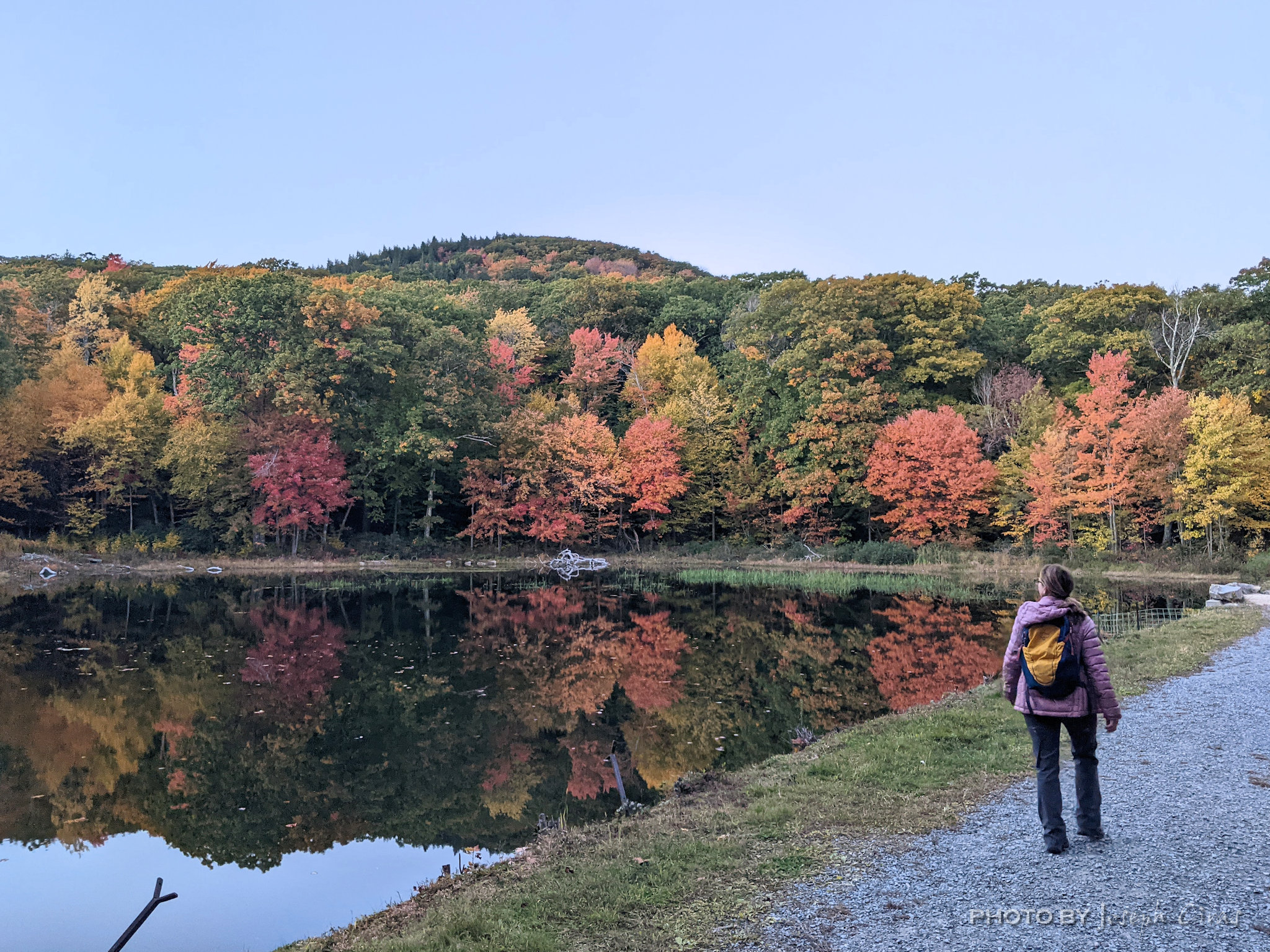
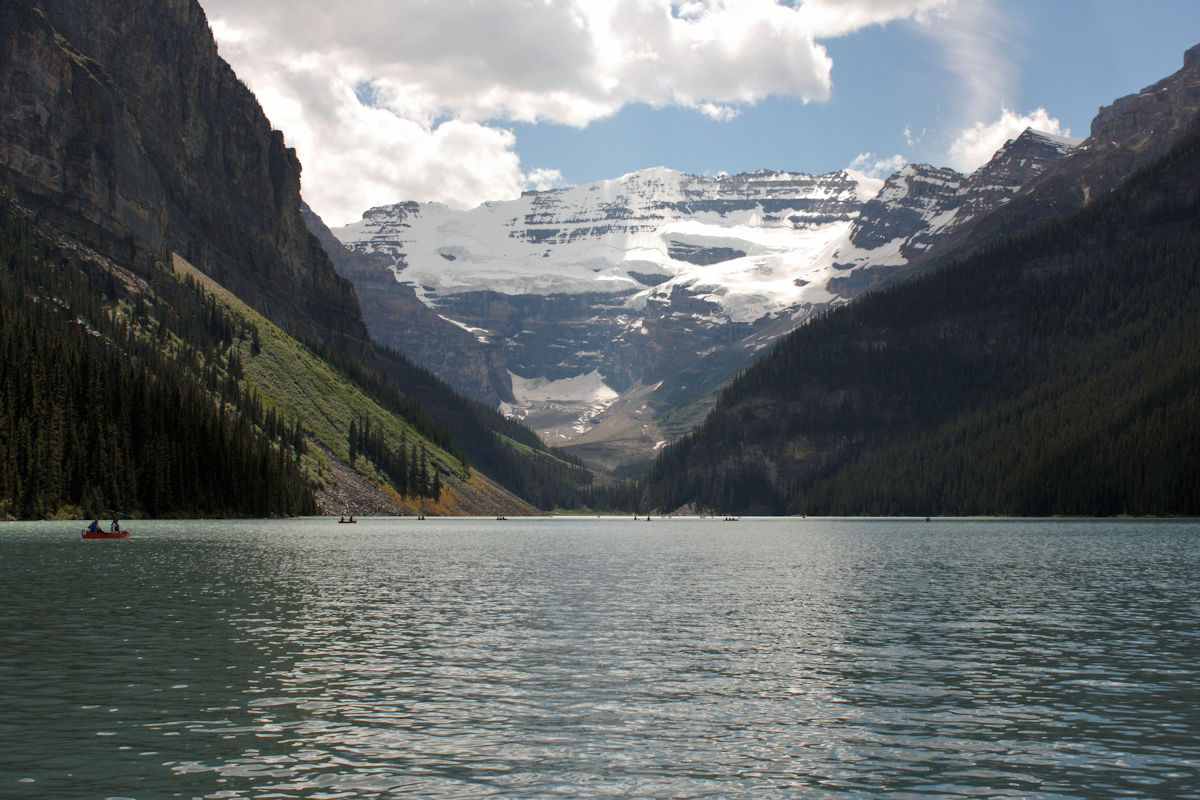
Sunday, 10/02/2022: Posted photo — Echo Lake.
My hike today took the group past Echo Lake. As we hiked past Echo Lake, the reflection of the foliage caught my eye, I took out my cell photo and took a photo of the scene. The hill you are looking at is not the summit. It is just one of the hills that you need to climb prior to getting to the summit.
Monday, 10/03/2022: Posted photo — Full Moon near Boston.
Looking at the moon rise from the summit of Wachusett Mountain. I thought about taking my good camera on my hike tonight but did not since the weather was unpredictable.
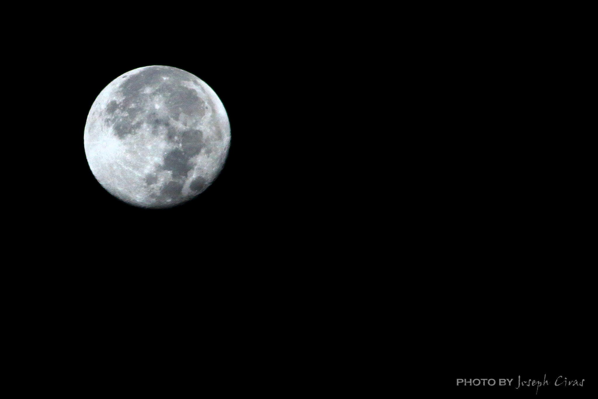
Tuesday, 10/04/2022: Posted photo — Full Moon.
Since I was not able to take a photo of the moon last night, I took a photo of the moon this morning on my way to work.
We had some rain overnight. The rain brought out the bright colors in the foliage.
Thursday, 10/06/2022: Posted photo — Trio of Leaves.
I wanted to get an artistic photo today so I picked up a trio of leaves and took a photo of them.
Friday, 10/07/2022: Post photo — Cloudy Day Foliage.
I take a photo of these trees every year. I do like the color of the foliage in the rain.
Saturday, 10/08/2022: Post photo — Maple Leaf.
Our property has many sugar maples on it. This is a leaf on one of the trees. Our neighbor taps our trees every year in the spring to make maple syrup.
“Photograph: a picture painted by the sun without instruction in art.” — Ambrose Bierce
Thank you for all the new views and likes from last week, it helps keep me inspired.
Here are some random photos from my first photo book. My second photo book is in process. I am looking for someone to print and sell my books are a reasonable price point.
Sunday, 09/25/2022: Posted photo — Dunefield.
A dune field located in Great Sand Dunes National Park, Colorado. Being on the dunes was like being in the middle of a desert. What impressed me is how far away from the park you can see the dunes.
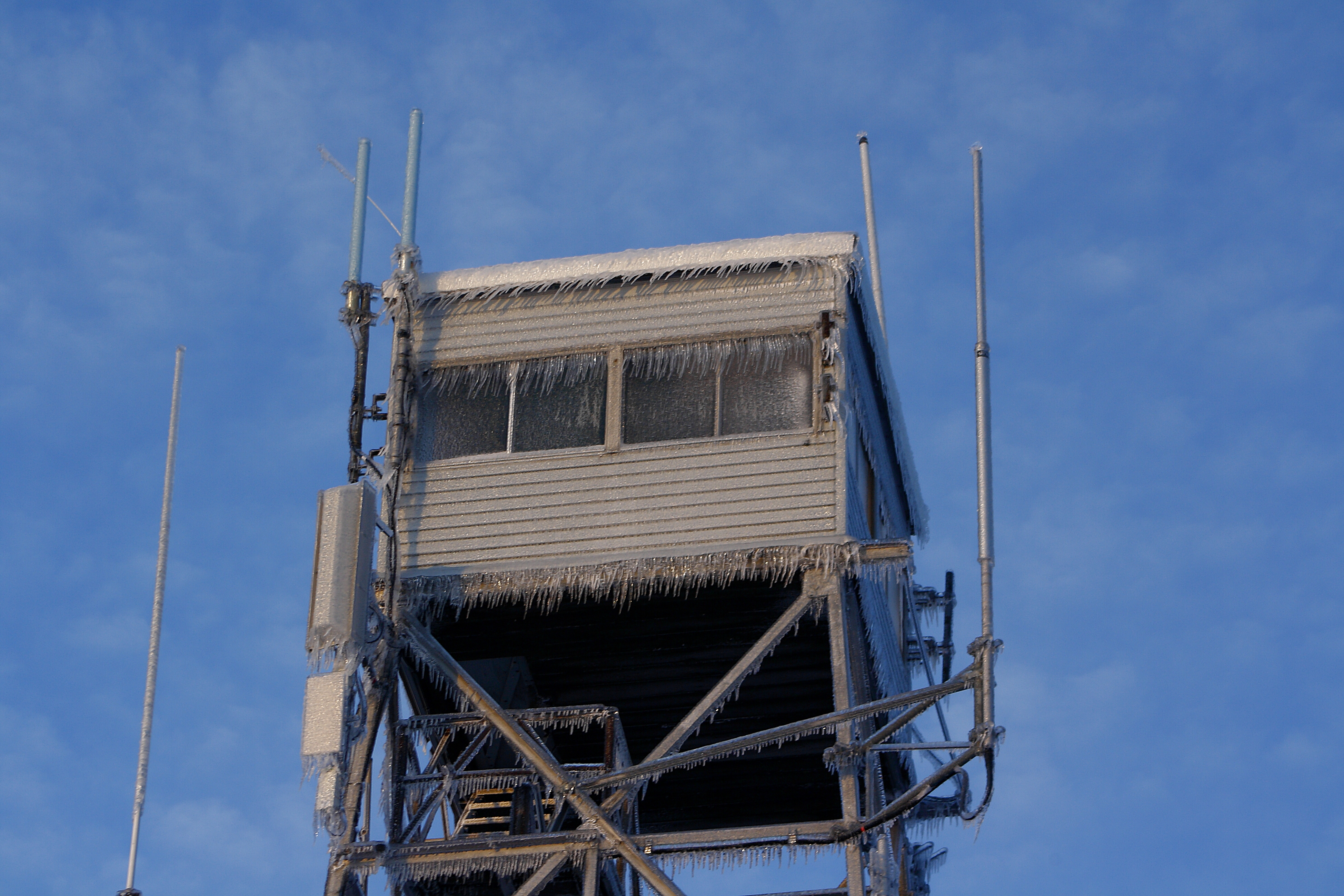
This is a photo of the old watch tower on Wachusett Mountain. You can clearly see the wind blow ice on the tower.
Tuesday, 09/27/2022: Posted photo — The Golden Rule.
My niece got married this past weekend. She married one of my son’s friends, a great guy. He asked my son if he could date his cousin. I found a verse in the Bible, took off my wedding ring to take this photo. This is a photo that I have wanted to take for a while.
Balance Rock in Arches National Park. This is not the traditional view of Balance Rock, but I like it.
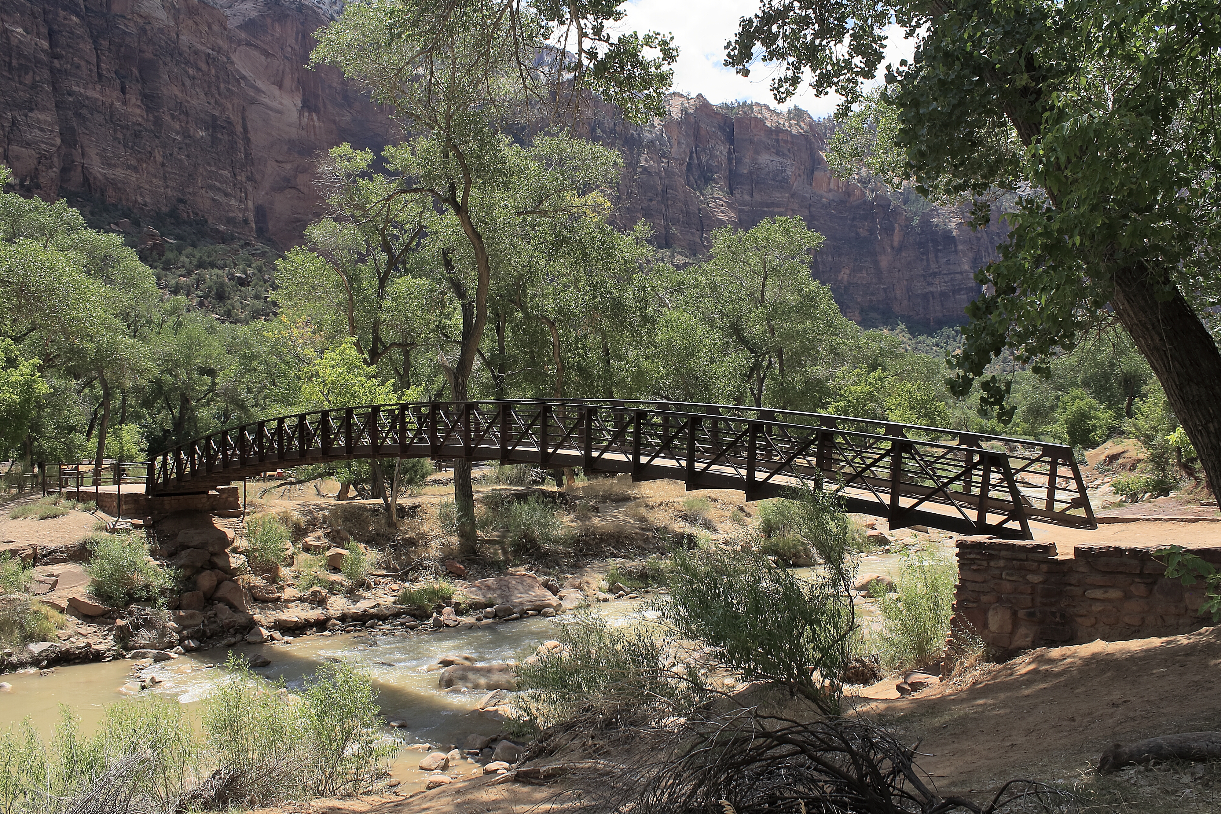
Thursday, 09/29/2022: Posted photo — Footbridge of the Virgin River.
I saw this bridge at Zion National Park and took this photo. I liked the way the bridge was situated with the view of the cliffs and the water.
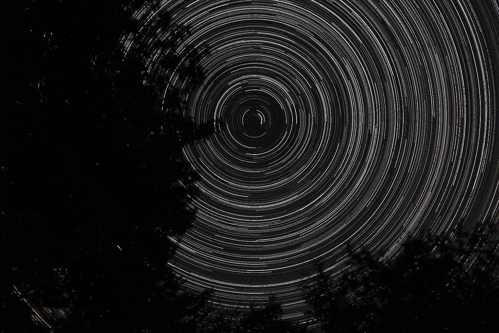
Friday, 09/30/2022: Post photo — Star Trail.
Every once and awhile I have an urge to take a star trail photo. I set up my camera, point north to the stars, set my timer on 20 seconds and unlimited shots, go to bed and let either drain my camera battery of fill my SD card. I have a stacking program that I use to create my star trail.
Saturday, 10/01/2022: Post photo — Reflection Lakes.
One of my favorite photos and the cover photo of my first photo book. Just loved the stillness of the water and the reflection of Mount Rainier.
“Once you learn to care, you can record images with your mind or on film. There is no difference between the two.” — Anonymous
Thank you for all the new views and likes from last week, it helps keep me inspired.
This week we travel to Cape Cod Massachusetts and visit some of the lighthouses. I am posting from each of the lighthouse webpages since my niece and one of my son’s best friends are getting married this Saturday and I have relatives staying with us. This leaves my little time to be creative.
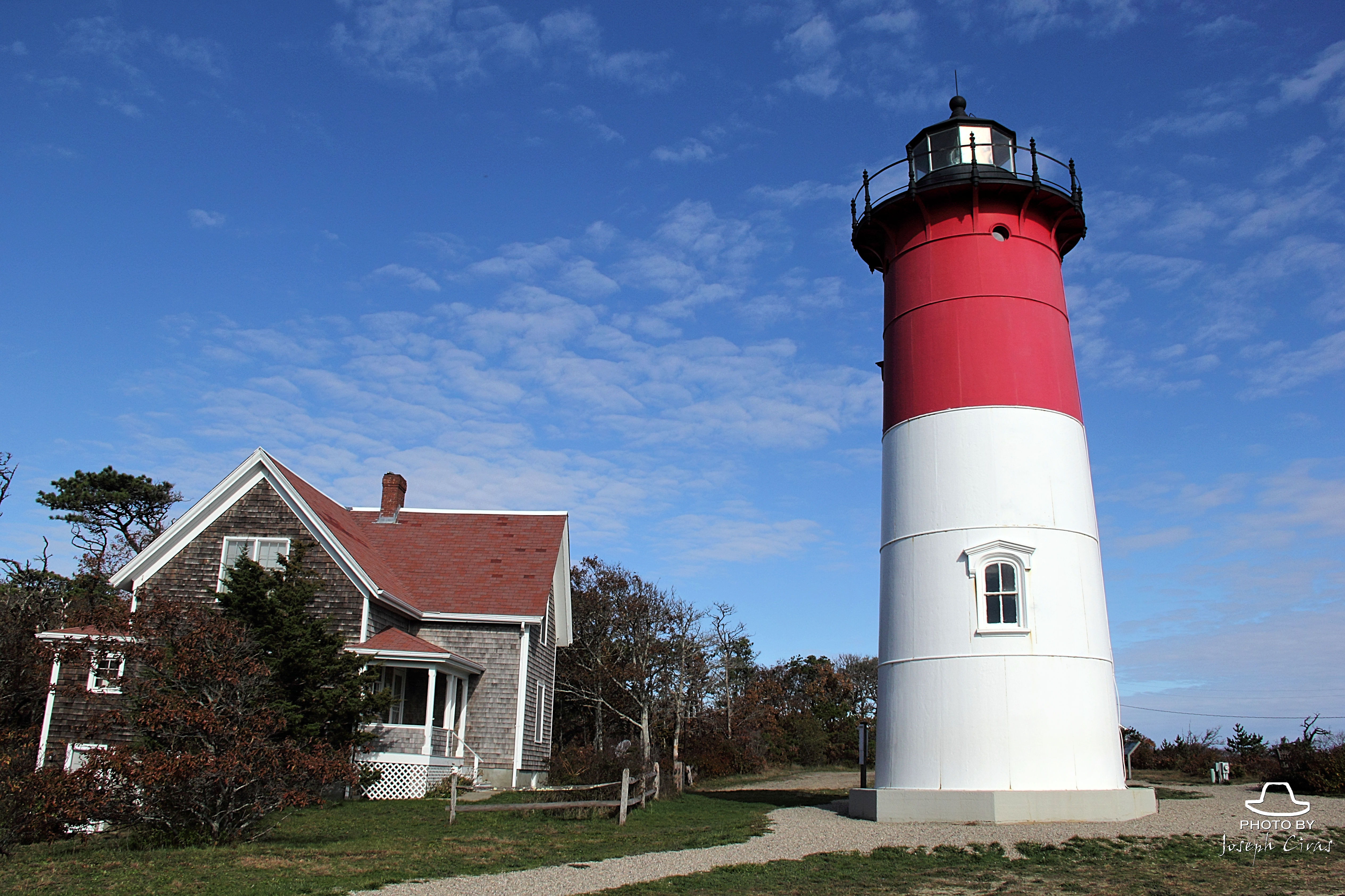
Sunday, 09/18/2022: Posted photo — Nauset Light.
Nauset Light, the most well-known and photographed lighthouse on Cape Cod, is located within the boundaries of the Cape Cod National Seashore. It is an important part of Eastham’s cultural and maritime history. In 1993 a group of citizens in Eastham formed the Nauset Light Preservation Society (NLPS), a non-profit volunteer organization whose original mission was to rescue the lighthouse. Through the successful efforts of the NLPS the Nauset Lighthouse was moved approximately 300 feet back from the edge of a sixty-foot high eroding cliff in 1996. Though no longer under the auspices of the United States Coast Guard, Nauset Light serves as a private aid to navigation used by the fishing fleets and small recreational boaters who navigate close to the shore. https://www.nausetlight.org/mission
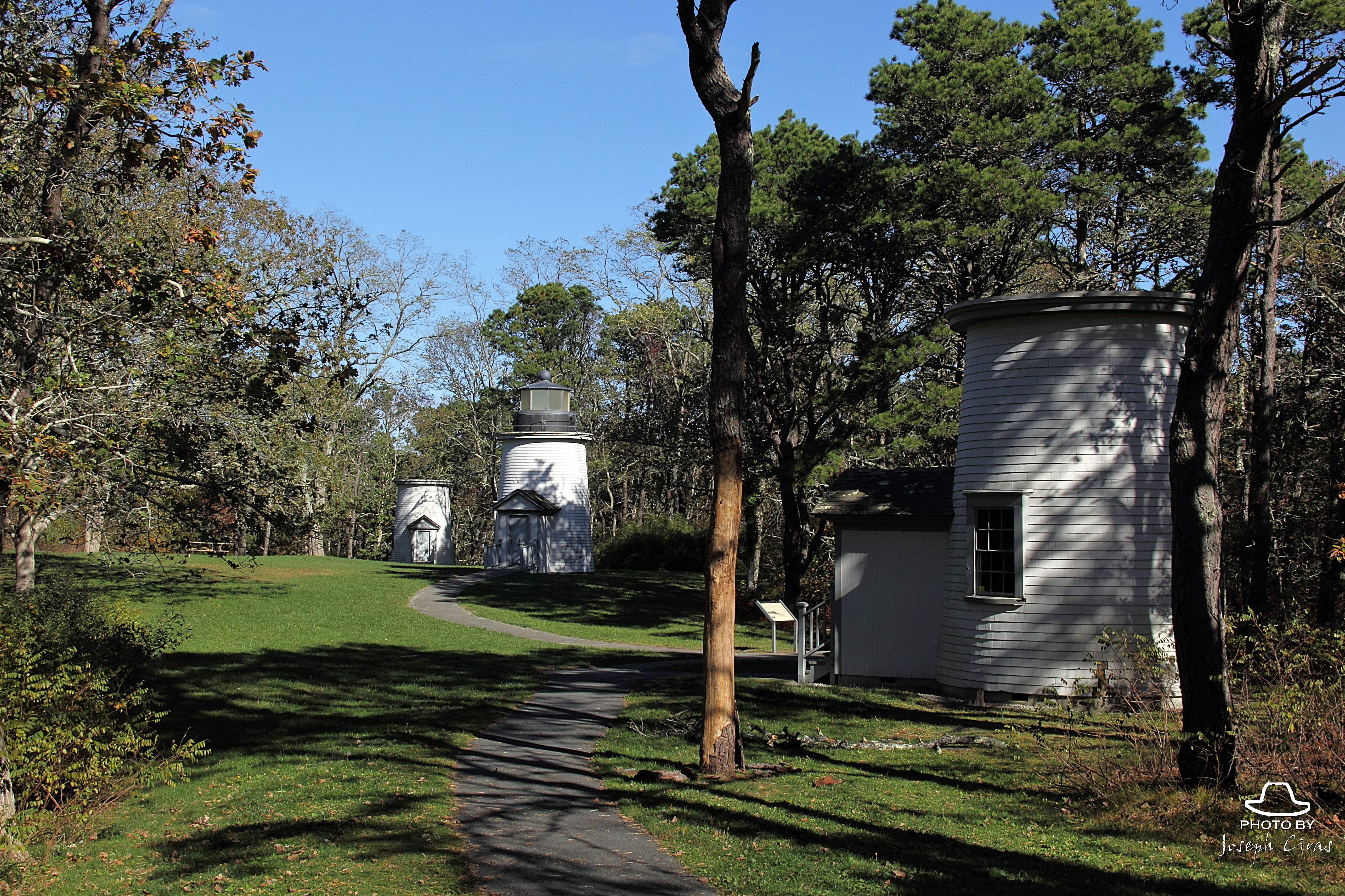
Monday, 09/19/2022: Posted photo — Three Sisters.
An 1836 petition by Eastham residents concerned about loved ones at sea caused the Boston Marine Society to recommend to the United States Congress the construction of the Nauset Lights. Congress granted $10,000, and the contract was awarded to Winslow Lewis, the lowest bidder at $6549.
Three 15-foot high masonry towers were built. The lights soon gained the nickname “The Three Sisters” because from sea they looked like women in white dresses with black hats.
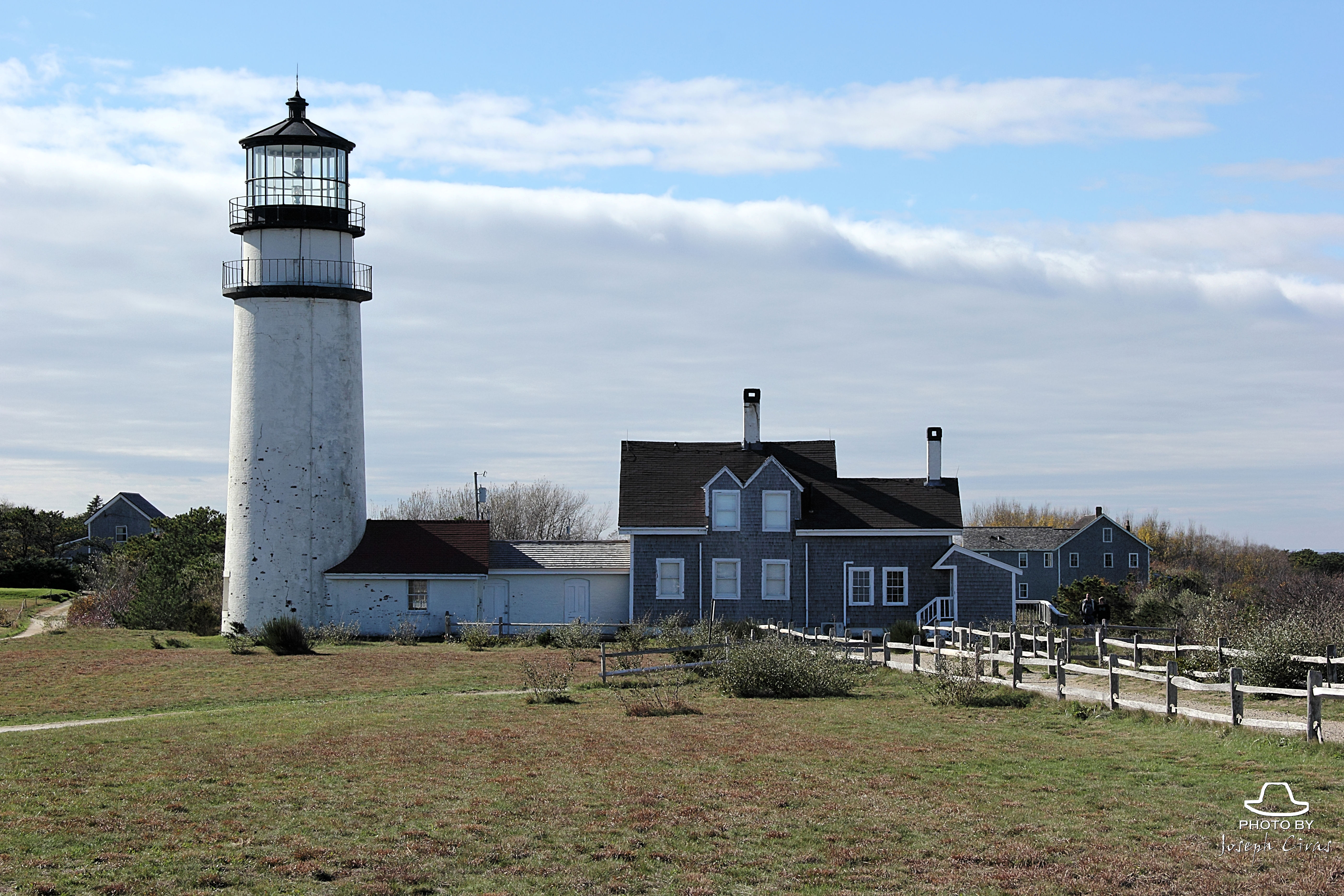
Highland Light Station, also known as Cape Cod Light, is located on Outer Cape Cod within Cape Cod National Seashore in North Truro. Commissioned by George Washington and established in 1797 as the 20th light station in the United States, the original 45-foot tall wooden tower and keeper’s dwelling were built more than 500 feet from the edge of a 125-foot-tall clay cliff. A new brick lighthouse was erected near the original tower in 1831. The present 66-foot-tall brick light tower, keeper’s house, and generator shed replaced the previous structures in 1857. An enclosed walkway connects the tower and the one-and-one-half-story, L-shaped, Queen-Anne-style keeper’s dwelling. https://www.highlandlighthouse.org/history
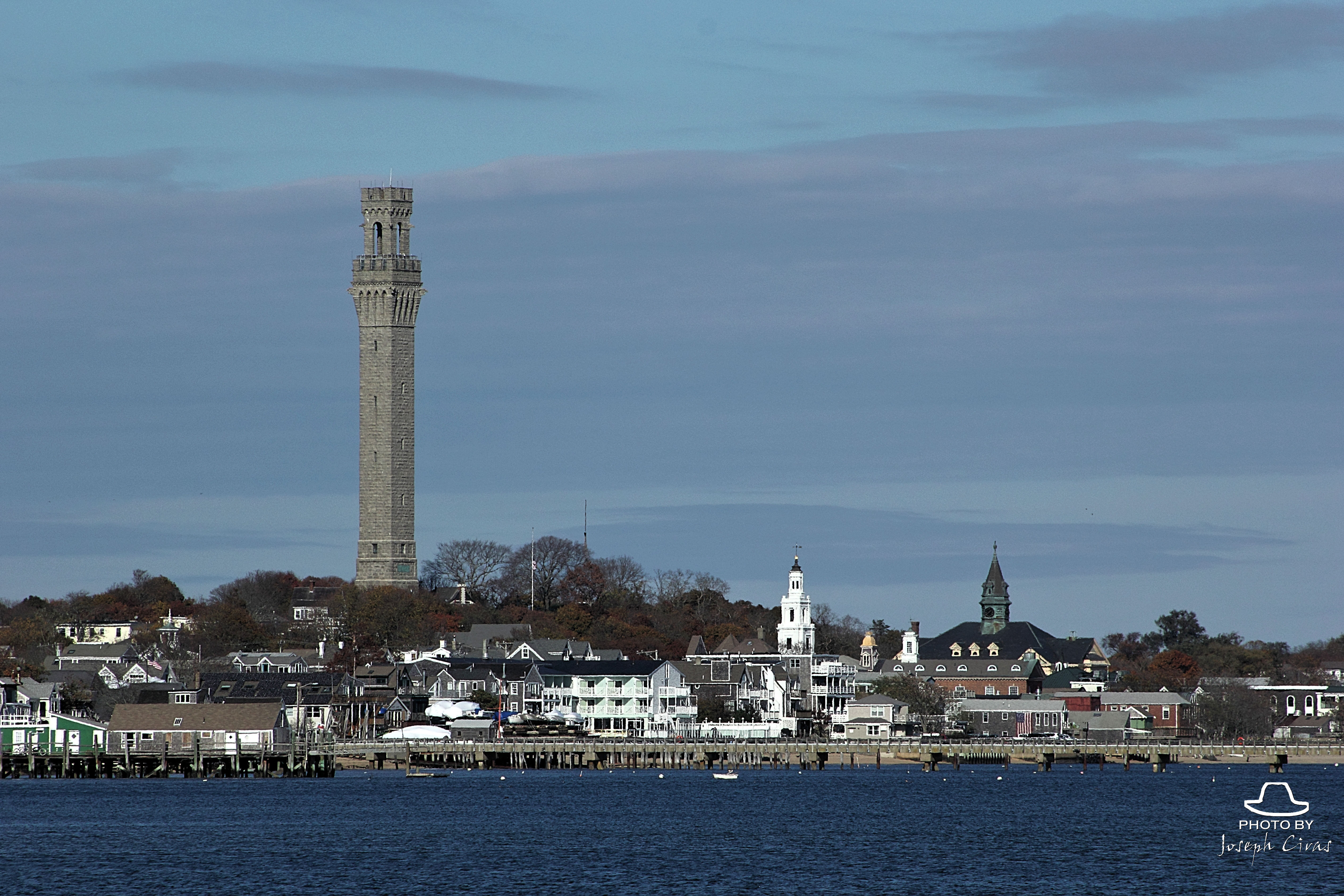
The Pilgrim Monument was founded in 1892 as the Cape Cod Pilgrim Memorial Association—Cape Cod’s oldest not-for-profit organization. Its purpose is to commemorate the Mayflower Pilgrims’ first landing in the New World in Provincetown, in November 1620. Here the Pilgrims spent 5 weeks exploring the tip of Cape Cod, before they sailed on to Plymouth. They also drew up and signed the Mayflower Compact, which established the rule of law for the new land. https://www.pilgrim-monument.org/pilgrim-monument/
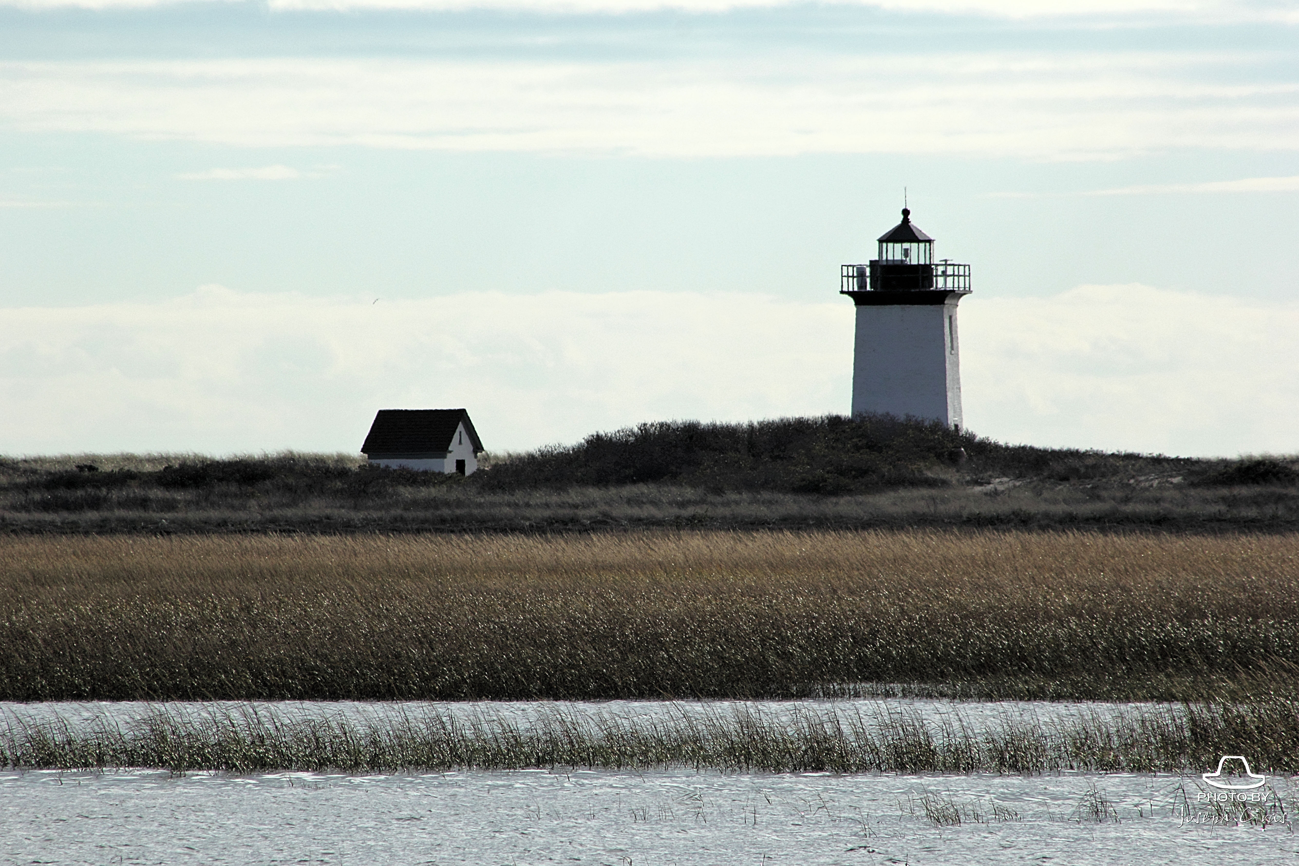
Thursday, 09/22/2022: Posted photo — Wood End Light Lookout Station.
Located approximately one and one half miles across Provincetown Harbor from Provincetown, Wood End Light Lookout Station is situated on several acres of sand and dunes with no other structures in sight. It was first illuminated on November 20, 1872 to guide mariners into busy Provincetown Harbor. https://www.nps.gov/nr/travel/maritime/woo.htm
Friday, 09/23/2022: Post photo — Chatham Light.
Chatham Lighthouse, in its origin, was placed on Cape Cods Southeastern location. The present lighthouse is one of six that were built in the Cape. This area entertained a great deal of maritime traffic. However, the waters of Cape Cod were brutal to many ships that graced its shores.
The coastline of Cape Cod is rumored responsible for over 3500 wrecked vessels (1850 through 1980). Those who sailed close to the Chatham shores tell tales of ghostly images that lured ships to what seemed like, safety; only to have their hopes dashed against the rugged shores of the Cape.
“I really believe there are things nobody would see if I didn’t photograph them.” — Diane Arbus
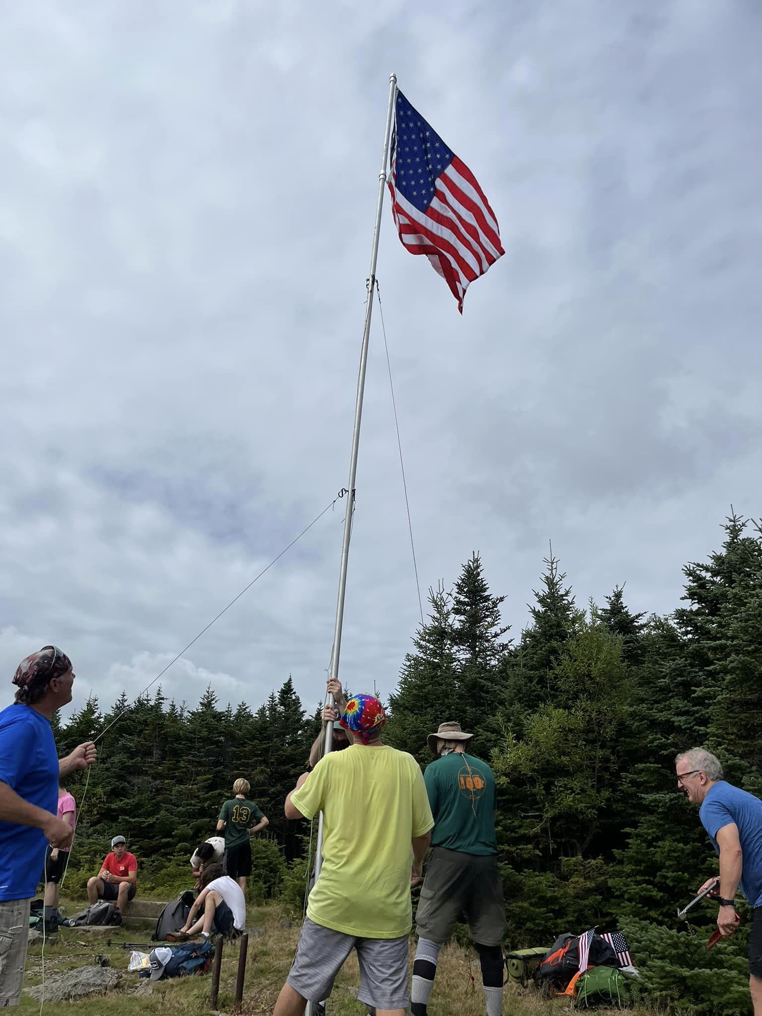
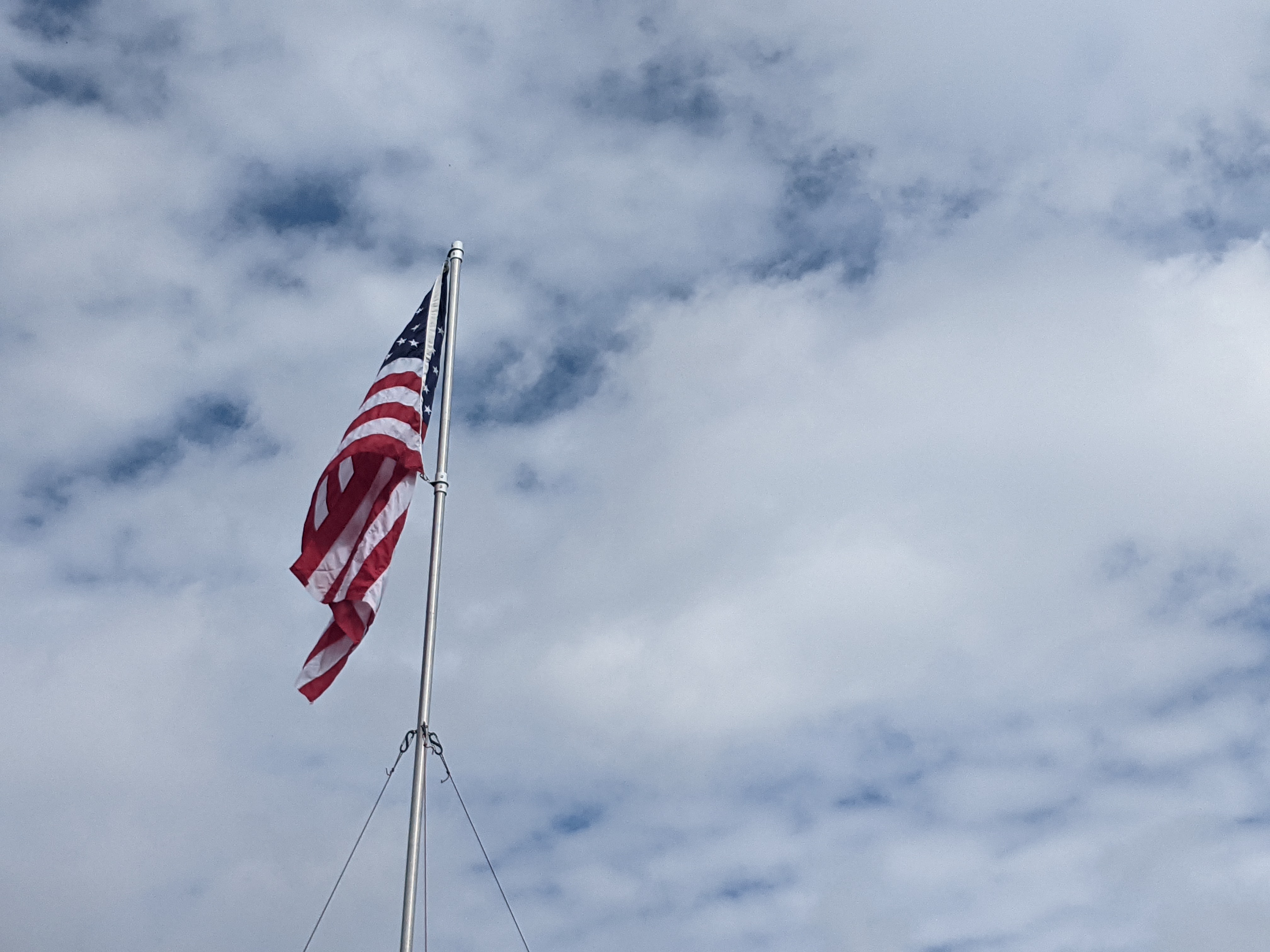
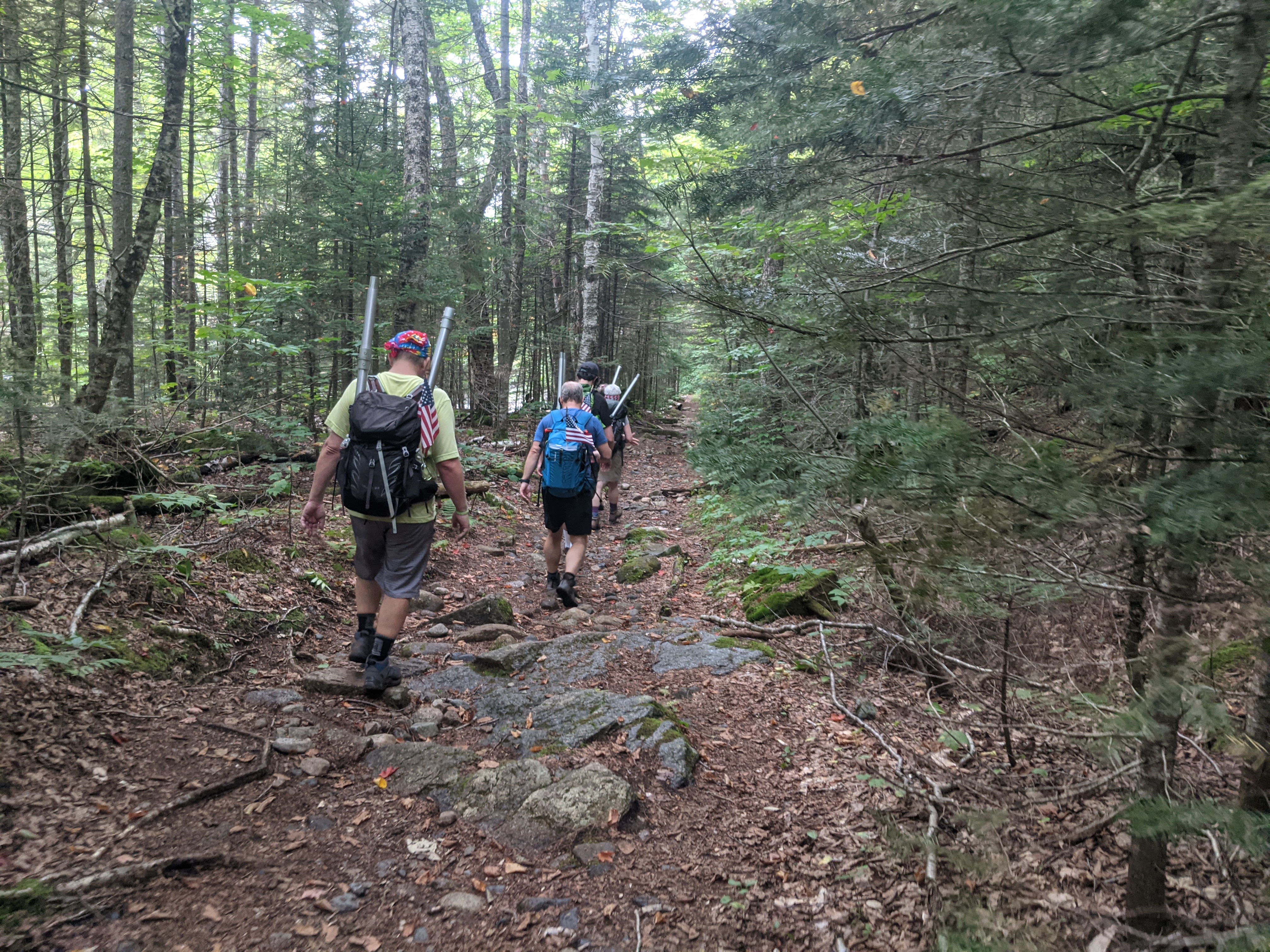
From the Flags on the 48 website: “On September 11th, 2001 the consciousness of United States of America was undeniably altered by overwhelming and devastating acts of terrorism, so far reaching in their intensity that our country will forever carry the scars. Thousands of lives were lost in a fleeting moment, immeasurable families shattered, and countless hearts broken.
We in the hiking community continue to honor the deceased with a tribute: flying the American flag atop all 48 four-thousand foot and higher mountains in New Hampshire on Sunday, September 11. By demonstrating our steadfast unity in this challenging endeavor, we also hope to express our unwavering support to the families, friends, and communities whose losses are beyond comprehension and whose suffering we remember in our hearts.”
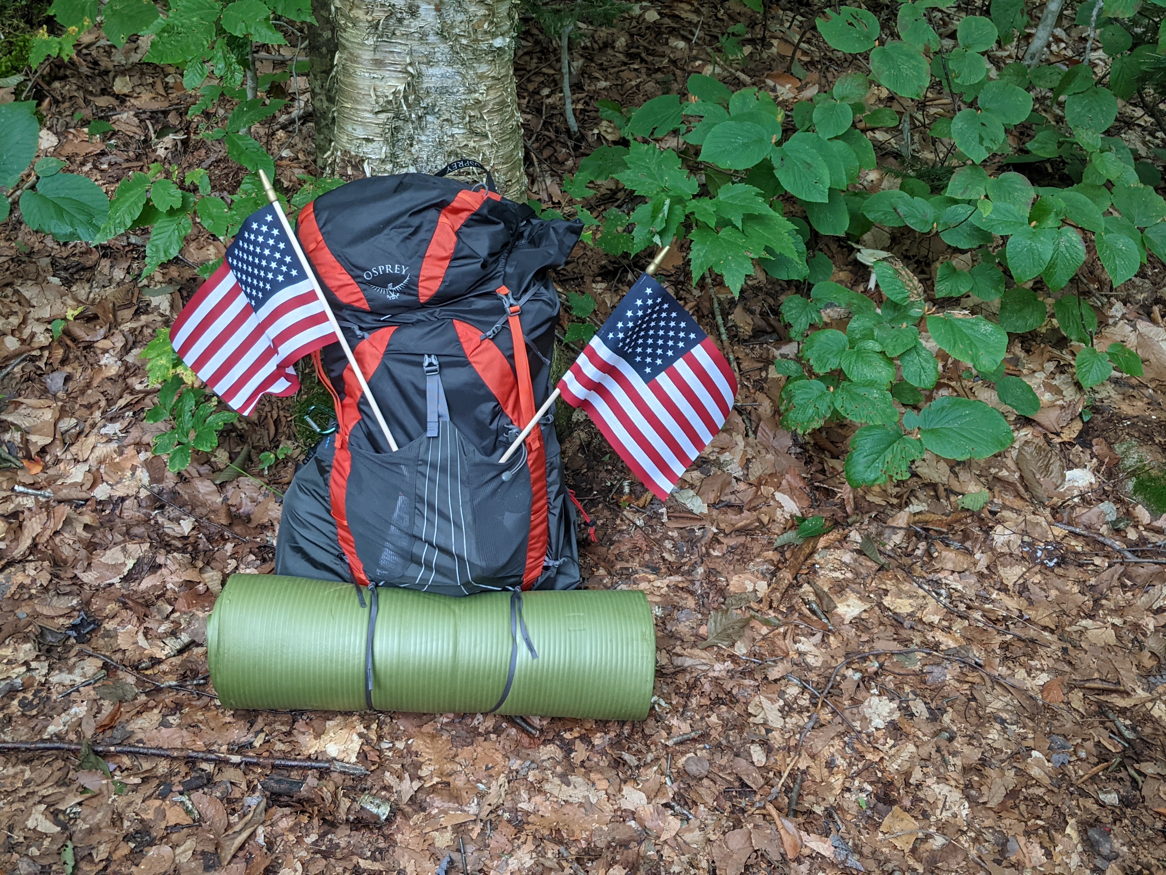
This event is the highlight of my year. One that I was training for after breaking my ankle. My goal was to get back in shape after an almost five-month period to be able to hike in this event.
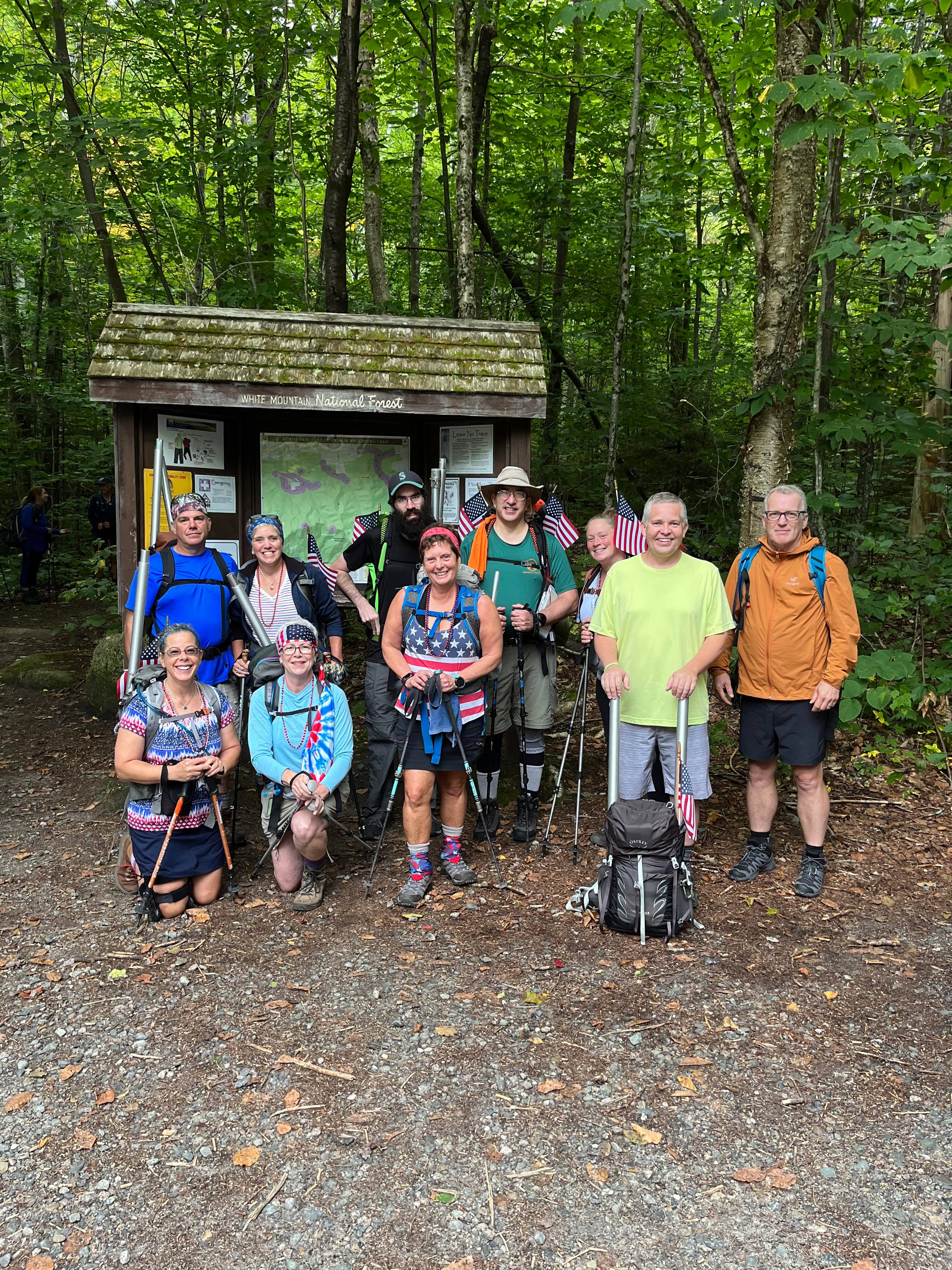
My pack, ready to go on the hike.
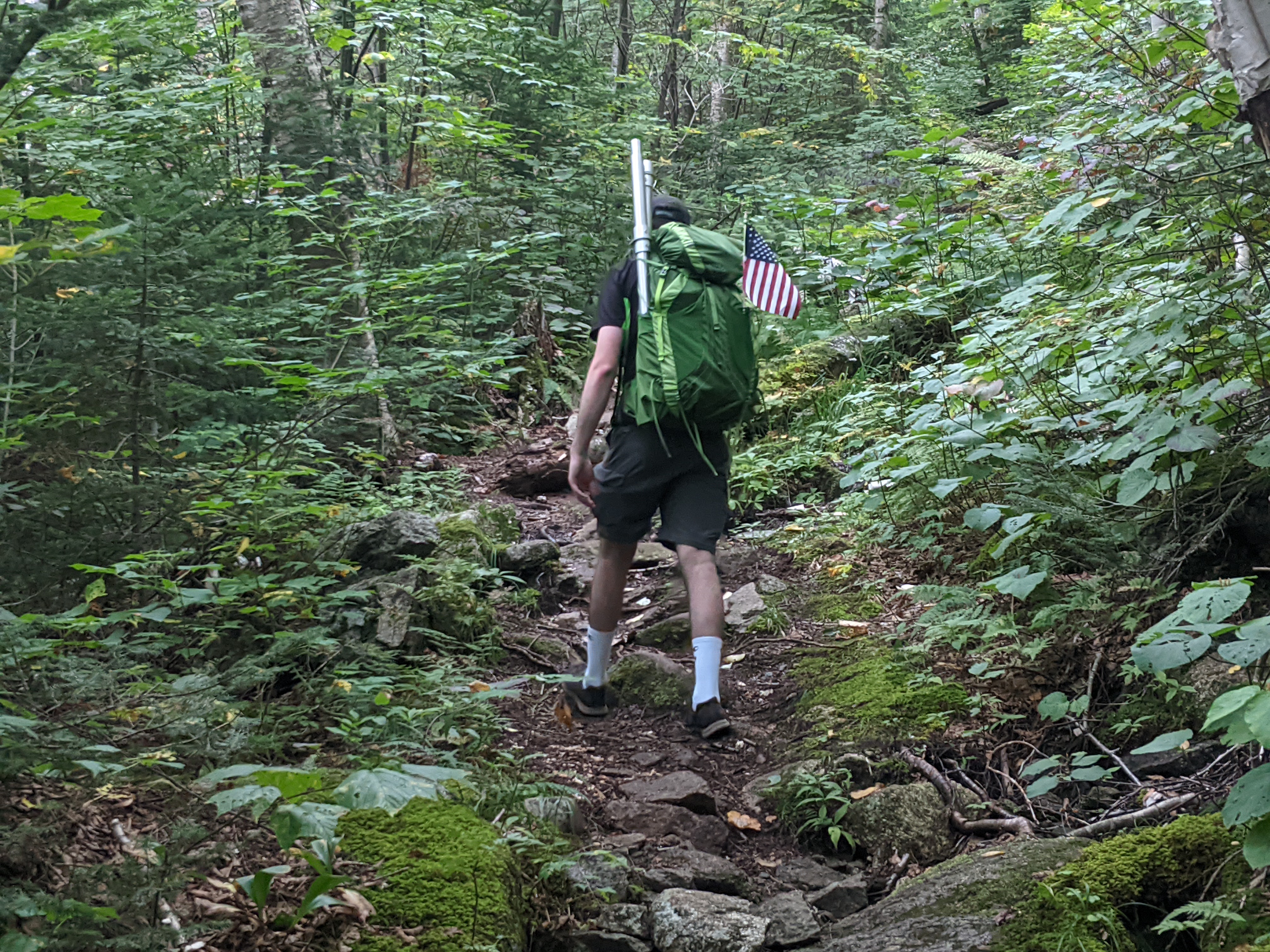
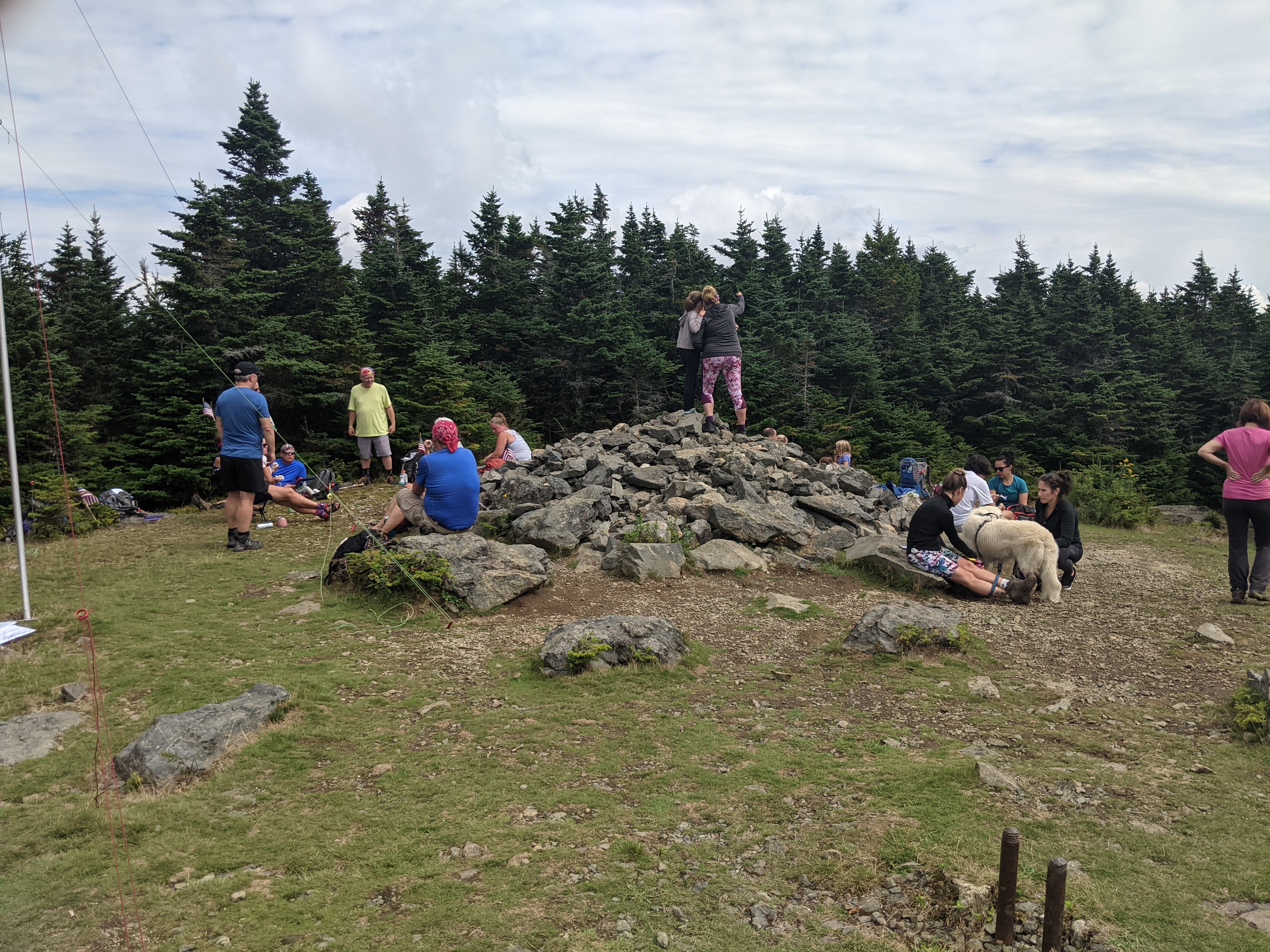
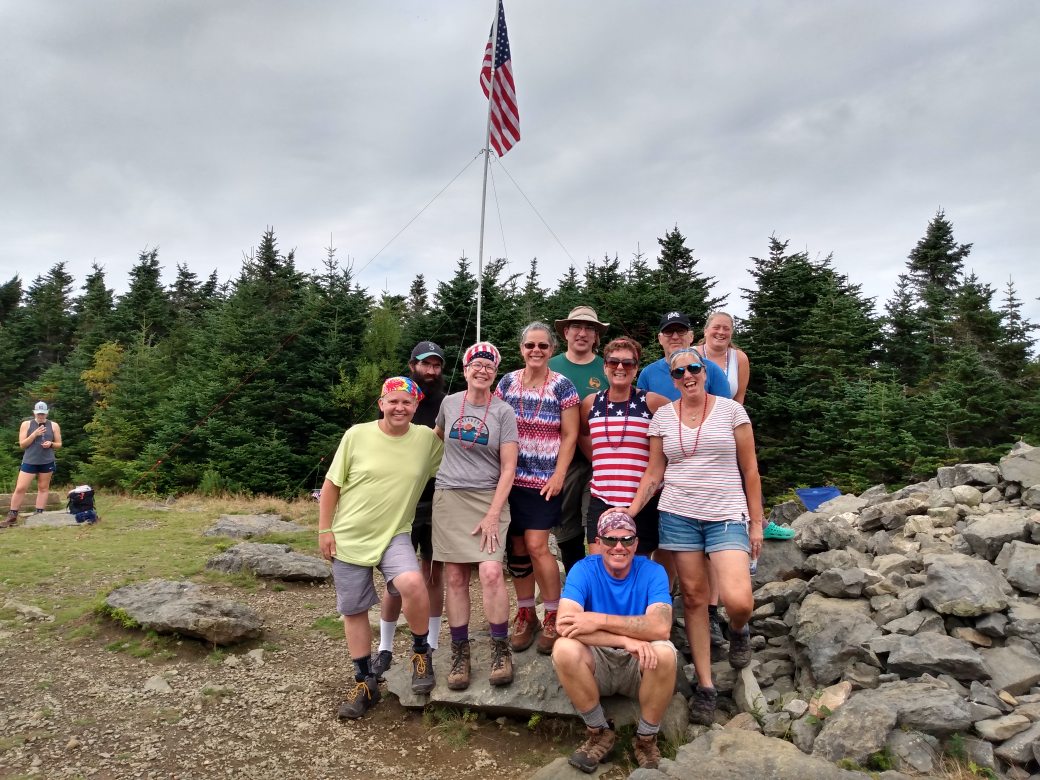
This year marks the 13th year that I have been doing this hike. Good weather, bad weather, heat, cold, rain, and wind could not stop our group from doing this annual hike. The mountain we did this year was rated as an easy hike, Mount Hale, at 4,054 feet. One of the shorter mountains and the easiest 4,000 footer in the White Mountains. The hike took us up a well established bushwhack trail that had little rock or roots on it which was welcomed for my recovering ankle. One other person was also glad since she had ankle surgery the week after I did. Her surgery was not as extensive as mine so she recovered and was out hiking faster that I did. It is called the Fire Warden Trail and it could have been used by the fire warden when hiking to the summit. On the summit, there are posts in the ground that were used to anchor the old fire tower.
The traditional trailhead photo
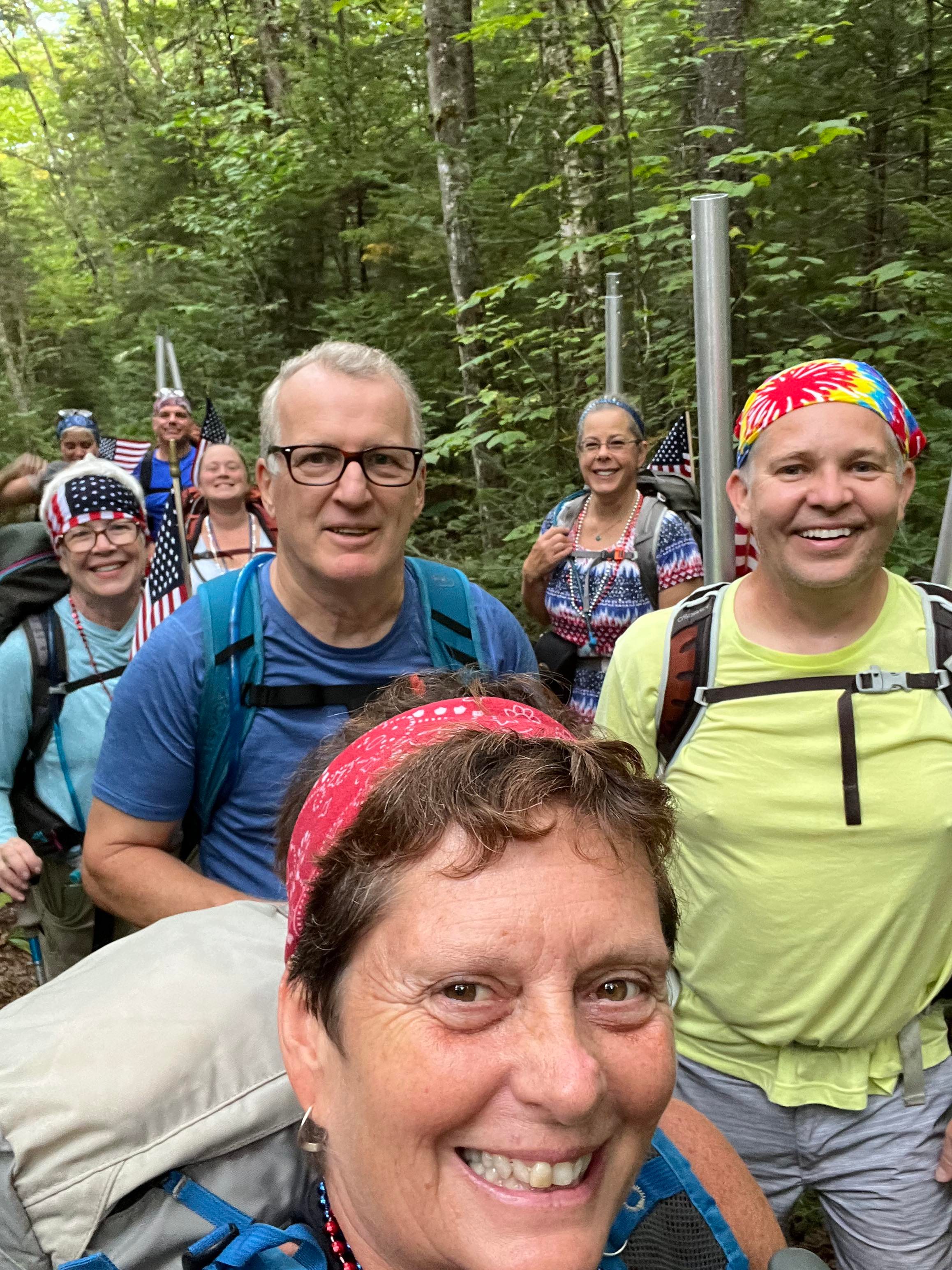
The ten people in our group have been doing this hike together for many years. We start out the hike with a group photo. I like to say that we do this incase someone gets lost and we have a photo of them. Since we were doing a trial that was not on any maps, the name of the trail or the mountain was not on the trailhead information board.
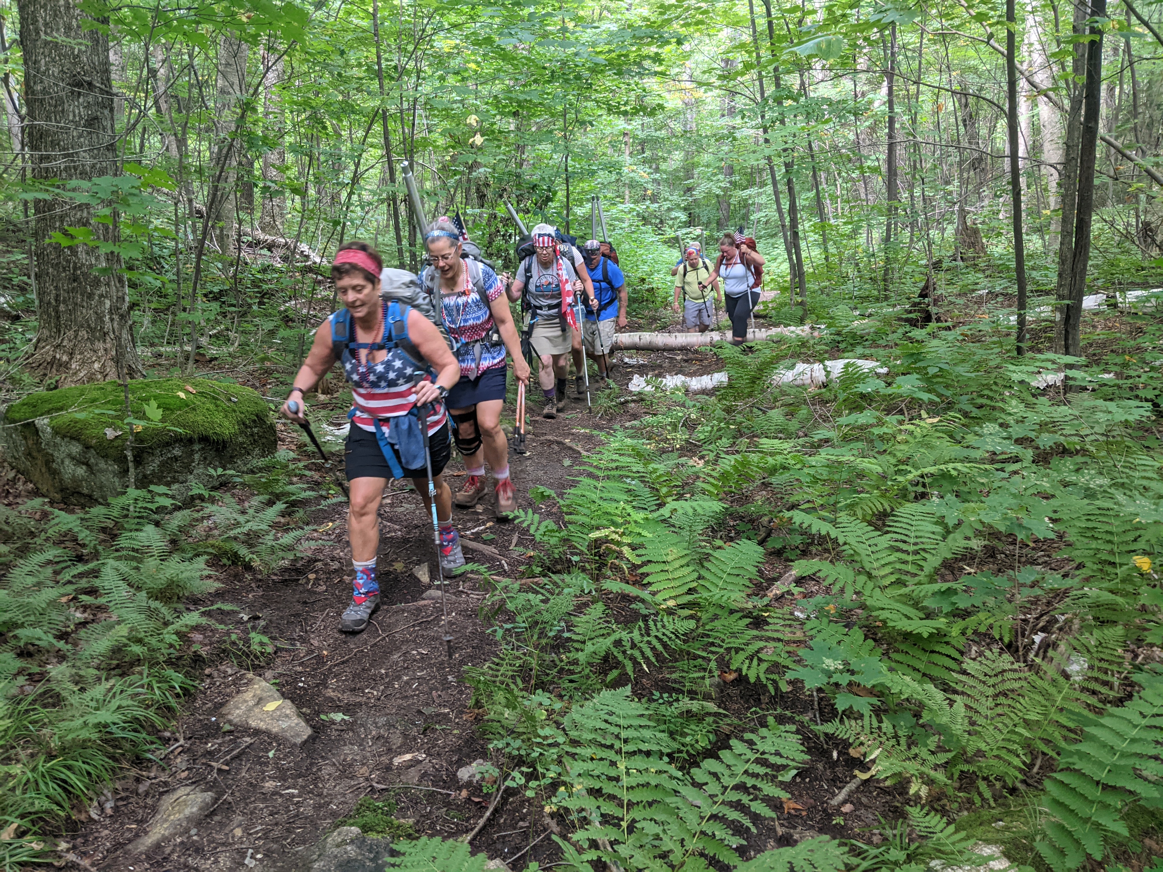
The group of use stayed together for the hike. As I stated in the opening statements, this was an easy trail. We gave ourselves four hours to reach the summit and set up our flag. It took up two and a half hours hiking very slowly so we would not reach the summit to early.
Group photo on the accent. Taken by a member of the group. My son and I are in the lead.
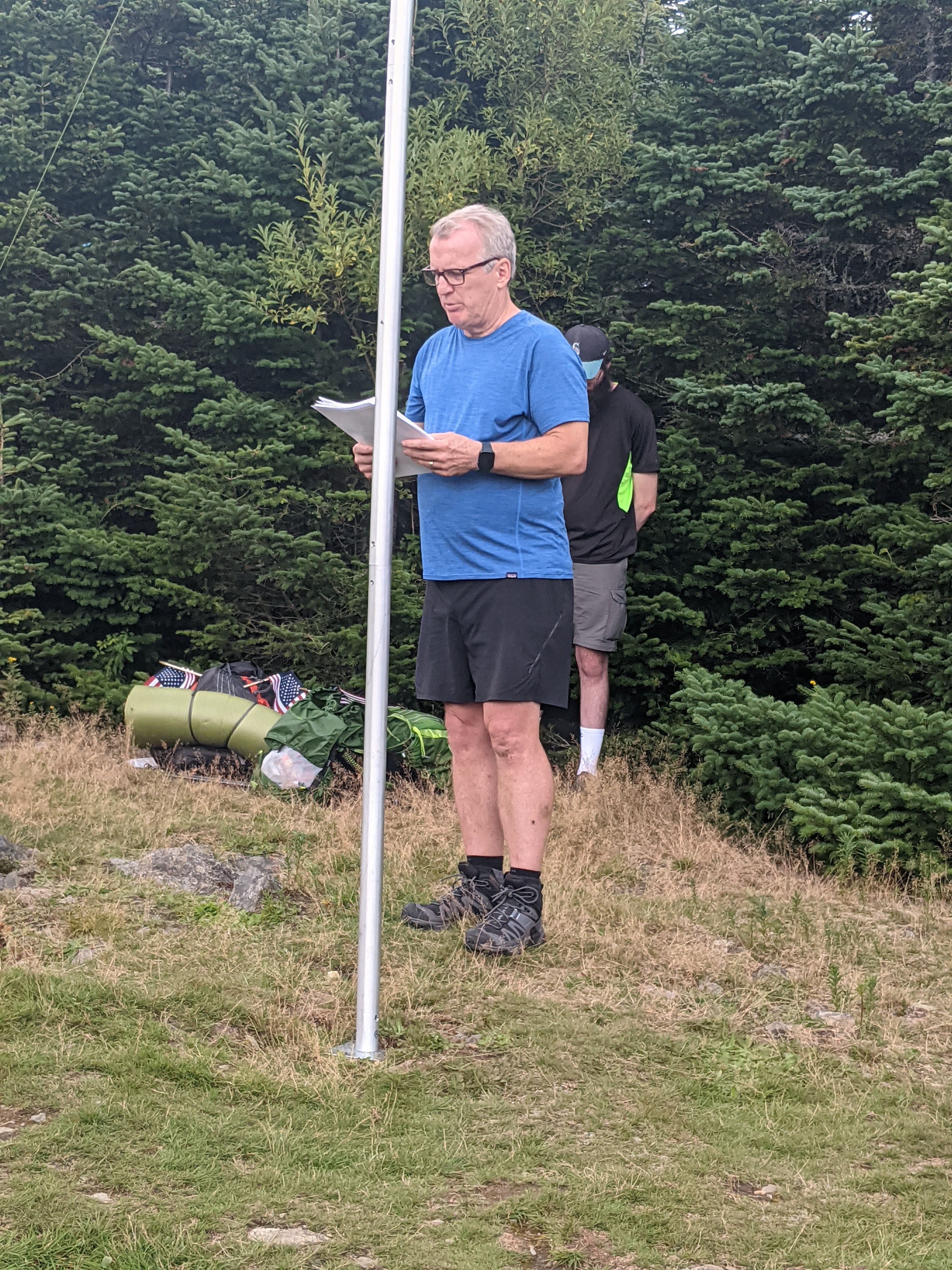
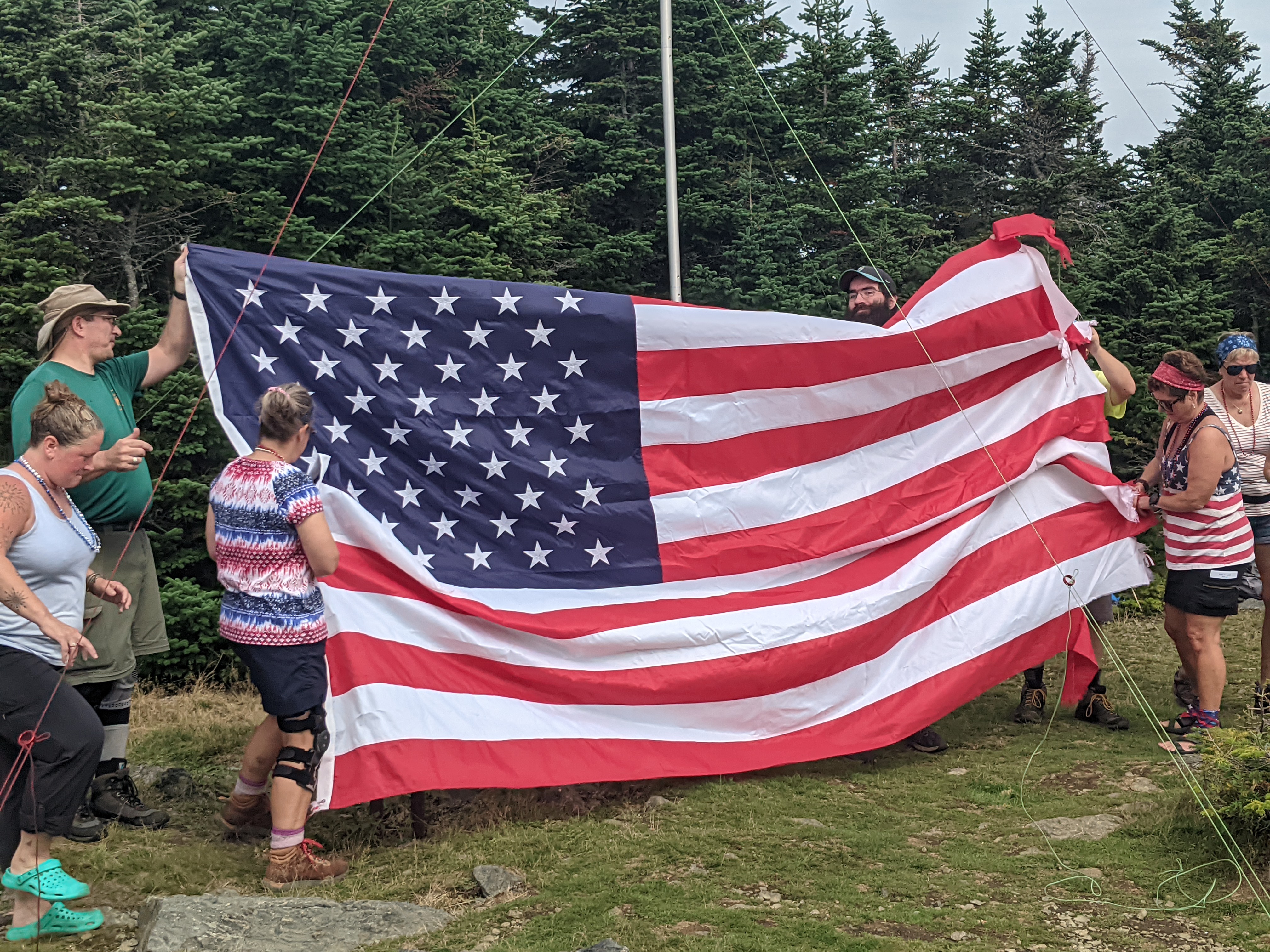
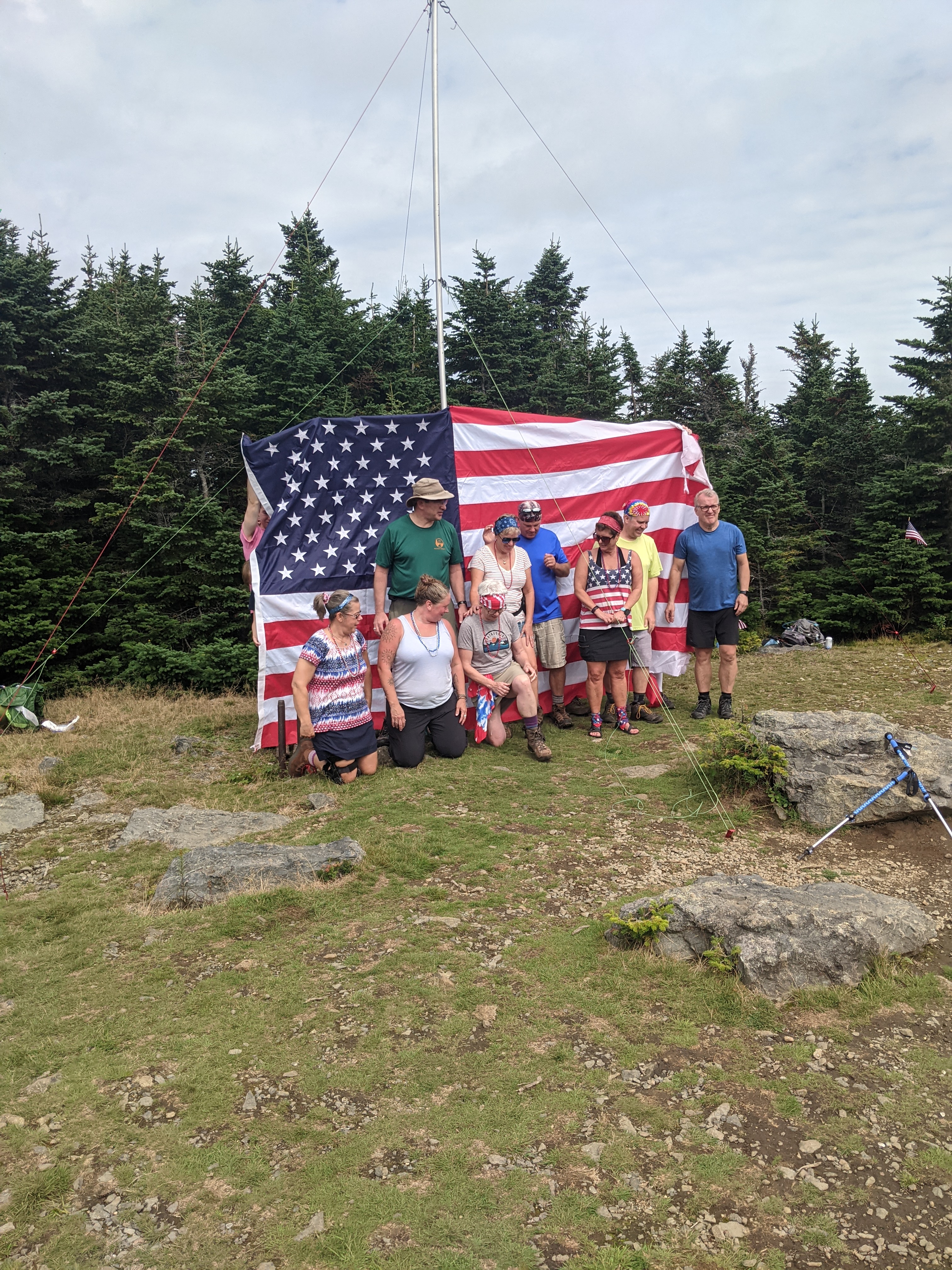
At the summit we worked together to set up our flag. Mount Hale has a wide-open summit, so we had plenty of room to set up the flag. Some of the summits are tight, and most have some room. There is no view of the neighboring mountains from the summit, just on the hike up.
Setting up the flag on a humid day. My son is holding the pole. I am in the green shirt.Securing the flag
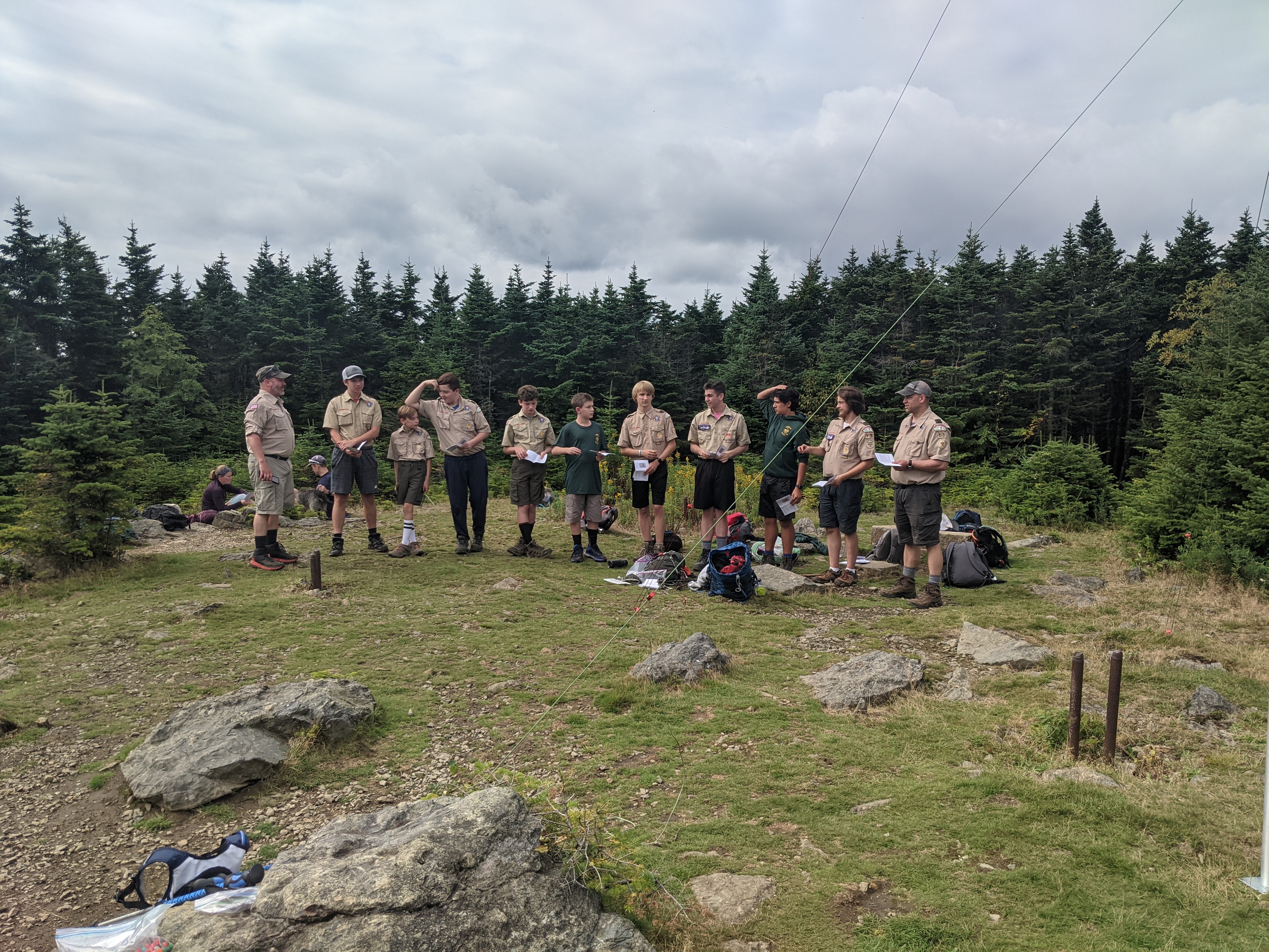
Once on the summit, we had a moving tribute by Boy Scout Troop 13 from Pepperell, MA and by a member of our group. Our group has been taking one or two names of the victims from each site and talking about what they did prior to that memorable day.
Boy Scout TroupOur group’s tribute with my son bowing his head in the background
We flew our flag from noon until 2 p.m. and the hiked down. It is always a great honor to be part of this tribute. Looking forward to the hike next year.
All ready to be displayed
If you in the area and up for a hike, please join me.
Group photo on summitSpreading out a flagGroup photo in front of a flag flown at the company I work at
“Taking pictures is like tiptoeing into the kitchen late at night and stealing Oreo cookies.” — Diane Arbus
Thank you for all the new views and likes from last week, it helps keep me inspired.
This week is full of sunrises and sunsets.
Sunday, 07/31/2022: Posted photo — Sunrise at the Beach.
On one of my past vacations, I took a sunrise walk on the beach with my camera. During the walk, I saw this great sunrise. I stopped and took this photo.
I just loved the way the sunrise looked as we walked to the beach. I timed it to get the bird in the photo.
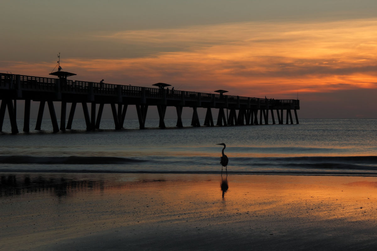
Tuesday, 08/02/2022: Posted photo — Sunrise at the Pier.
One of my trips to Jacksonville Beach Florida, I took another sunrise walk. I saw this heron near the shore and near the pier. I just loved the silhouette of the bird, so I took this shot.
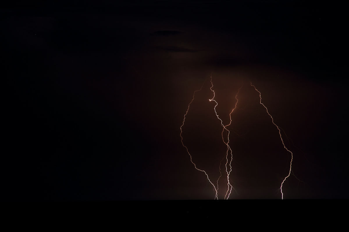
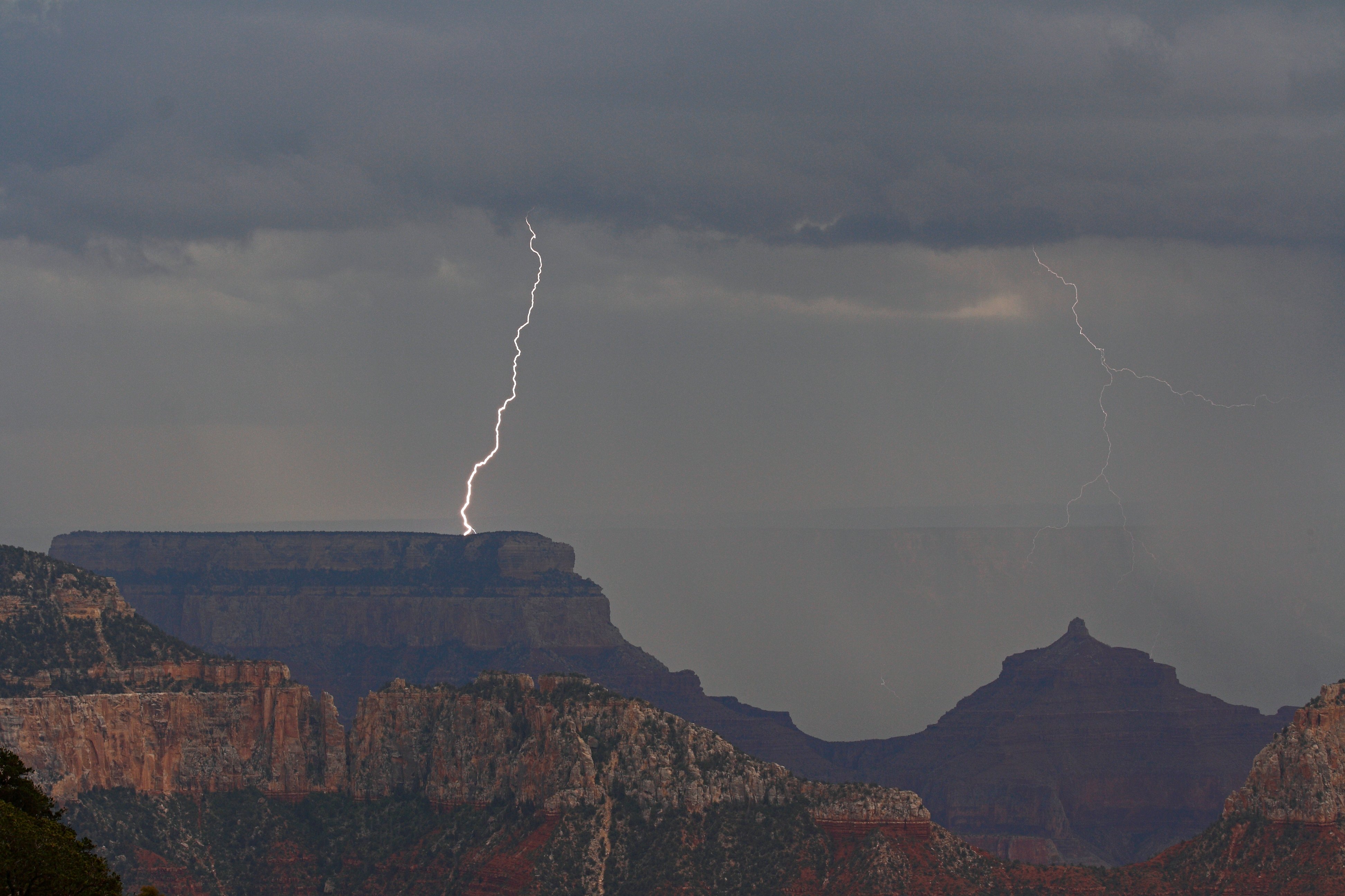
Wednesday, 08/03/2022: Posted photo — Lightning at Sea.
We had a condo on the beach and there was a storm at sea. I set my camera on my tripod and set the timer for 15 second. I liked the way this photo came out but was disappointed that I did not set my timer at 30 seconds.
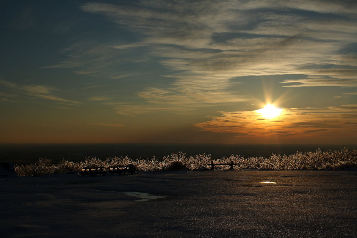
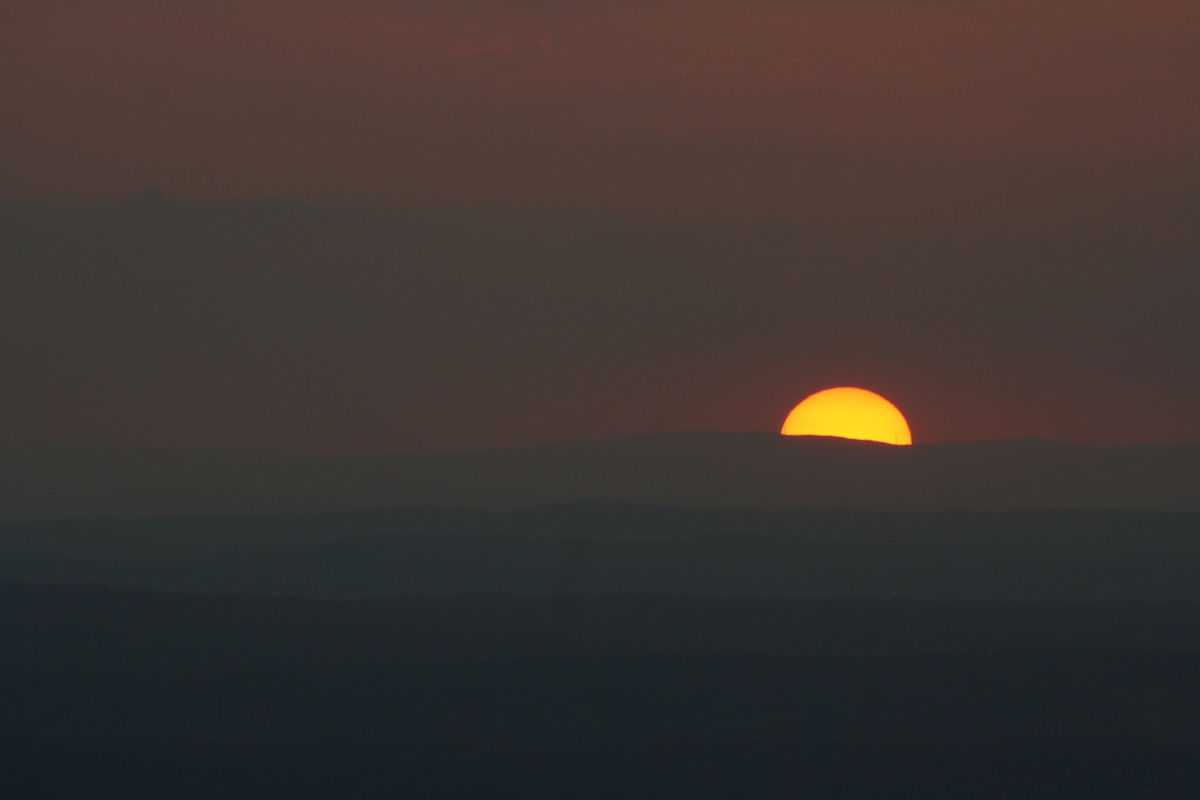
Thursday, 08/04/2022: Posted photo — Sunrise on Wachusett.
Morning winter hike up Wachusett Mountain for sunrise. There was a small coating of ice on the summit. The sunshine on the ice took a great photo.
Friday, 08/05/2022: Post photo — Sunset at the Cape.
One thing my wife and I do is have a weekend away on Cape Cod during the off season. This was one of the sunsets we saw.
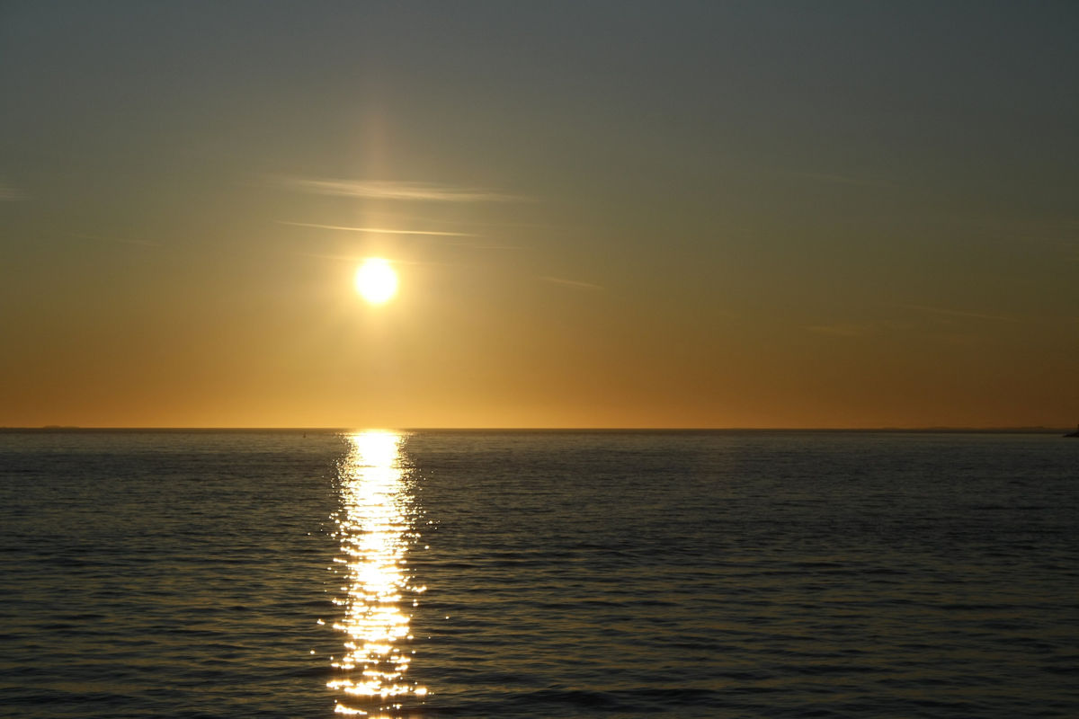
Saturday, 08/06/2022: Post photo — Sunset on Wachusett.
Here is a pleasant sunset from the summit of Wachusett Mountain.
“Photography is a way of feeling, of touching, of loving. What you have caught on film is captured forever… It remembers little things, long after you have forgotten everything.” — Aaron Siskind
Thank you for all the new views and likes from last week, it helps keep me inspired.
Here are some more photos of a road trip we took. Looking forward to traveling again this summer. Hiking will be limited, but I will pick up my 50th state (North Dakota).
This week’s blog will only contain information that I have referenced off various web sites. This was the easiest way for me to describe each location. I could ramble on and on about the wonders and beauties of each of these parks.
Settings: Canon EOS DIGITAL REBEL XS, ISO 200, f/7.1, 1/400 s, 150 mm.
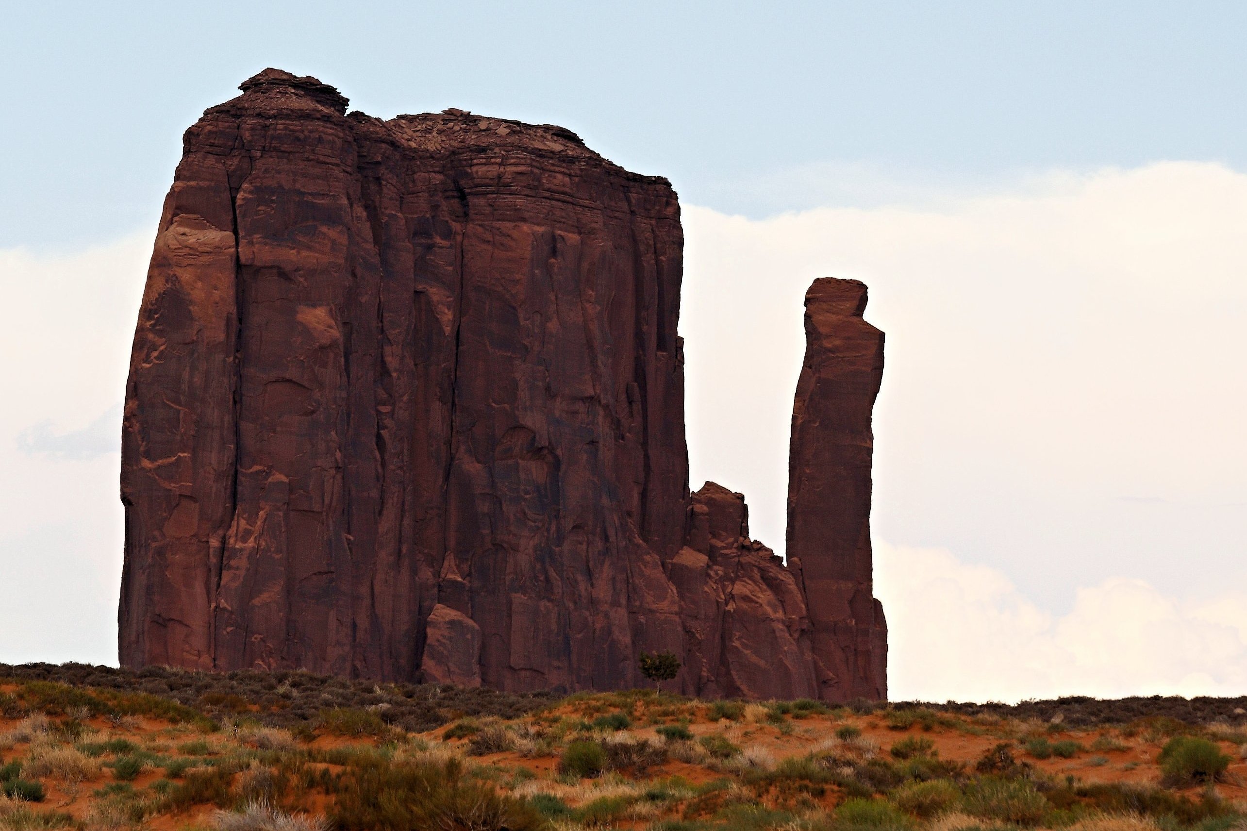
“Monument Valley, a red-sand desert region on the Arizona-Utah border, is known for the towering sandstone buttes of Monument Valley Navajo Tribal Park. The park, frequently a filming location for Western movies, is accessed by the looping, 17-mile Valley Drive. The famous, steeply sloped Mittens buttes can be viewed from the road or from overlooks such as John Ford’s Point.” ― Google
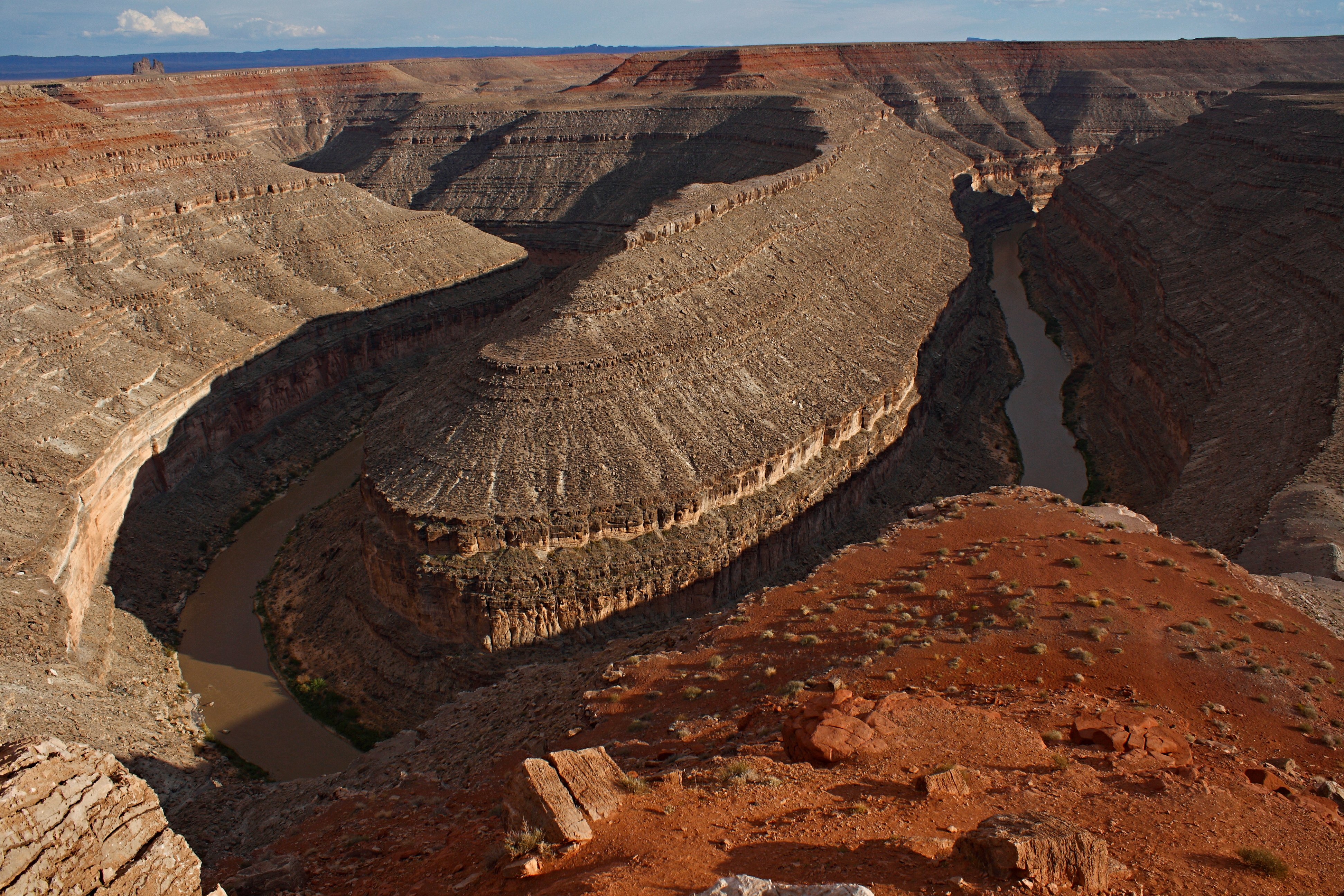
Monday, 04/04/2022: Posted photo — Goosnecks State Park.
Settings: Canon EOS DIGITAL REBEL XS, ISO 200, f/11, 1/250 s, 18 mm.
“On the edge of a deep canyon above the sinuous river meander known as a gooseneck, this small park affords impressive views of one of the most striking examples of an entrenched river meander on the North American continent. The San Juan River twists and turns through the meander, flowing a distance of over six miles while advancing one and a half miles west on its way to Lake Powell. Gaze at the results of 300 million years of geological activity, where the San Juan River winds and carves its way through the desert 1,000 feet below.” — https://stateparks.utah.gov/parks/goosenecks/
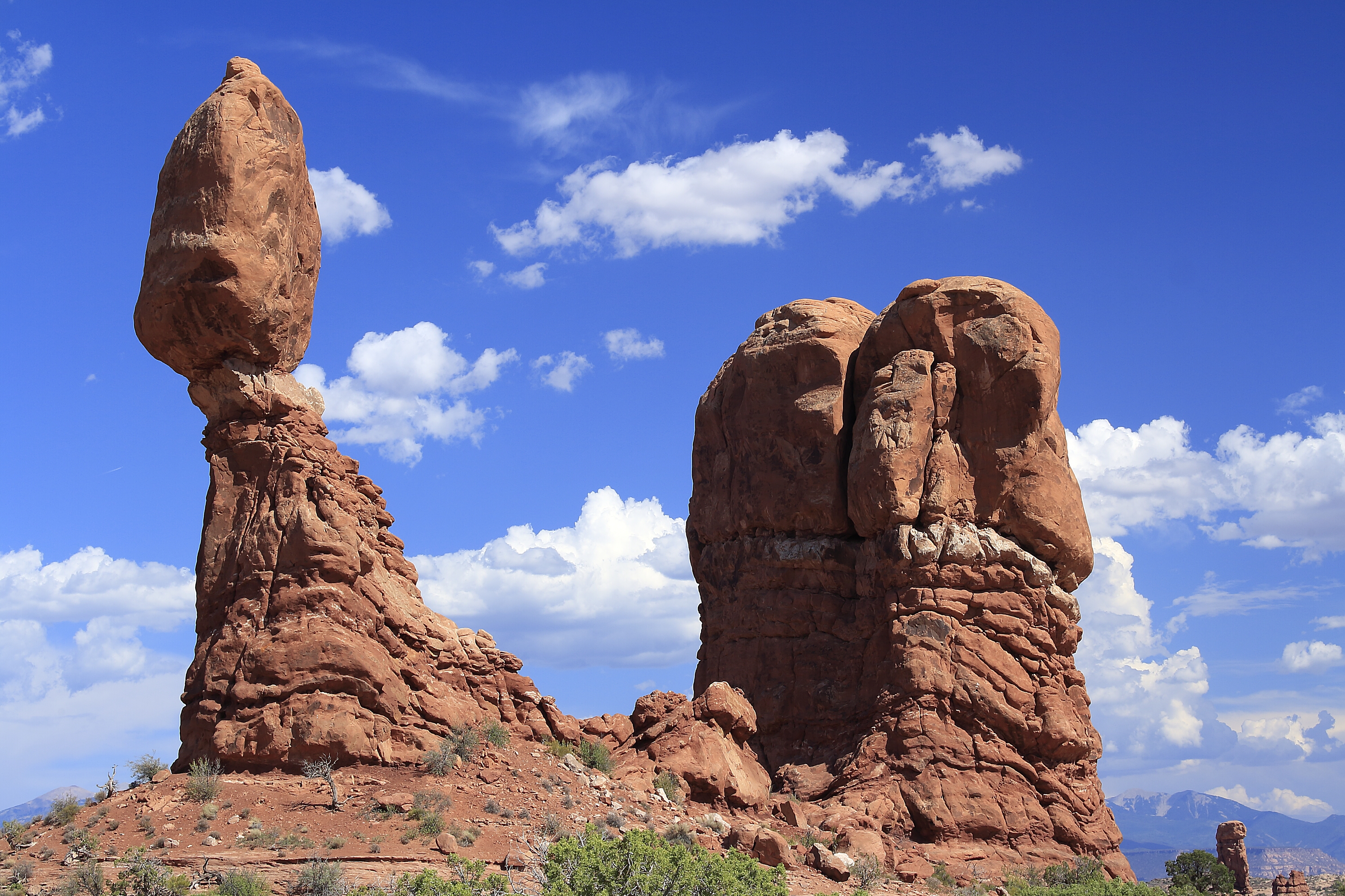
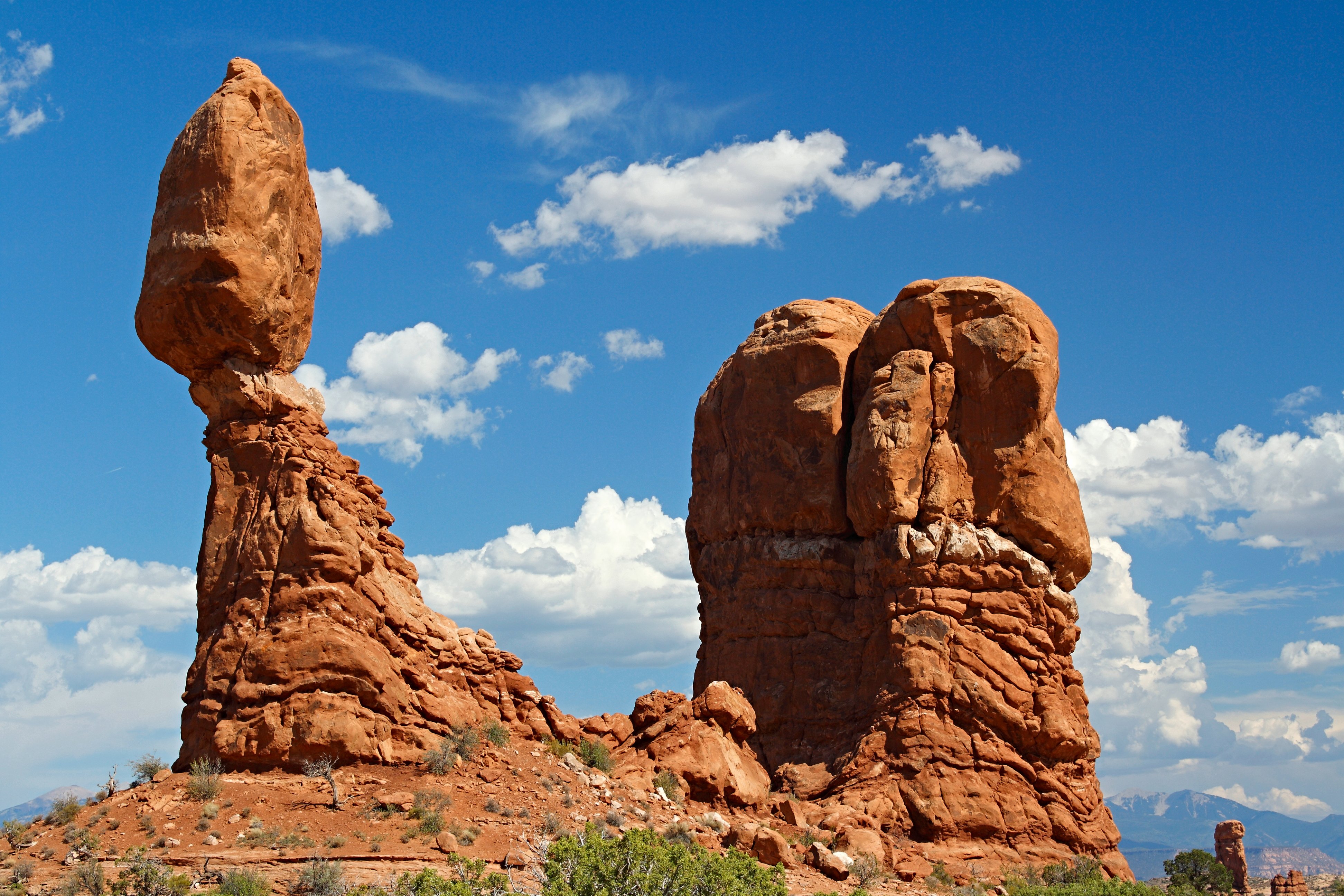
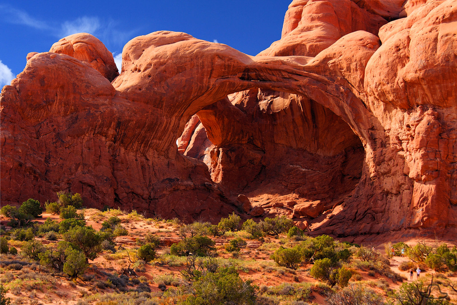
Tuesday, 04/05/2022: Posted photo — Balance Rock.
Settings: Canon EOS DIGITAL REBEL XS, ISO 100, f/8, 1/125 s, 45 mm.
Arches National Park
“Balanced Rock, one of the most iconic features in the park, stands a staggering 128 feet (39m) tall. While this formation may appear to be an epic balancing act, it’s actually not balanced at all. The slick rock boulder of Entrada Sandstone sits attached to its eroding pedestal of Dewey Bridge mudstone. The exposure of these two rock strata layers are ideal for the formation of arches and balanced rocks.” — https://www.nps.gov/arch/planyourvisit/balancedrock.htm
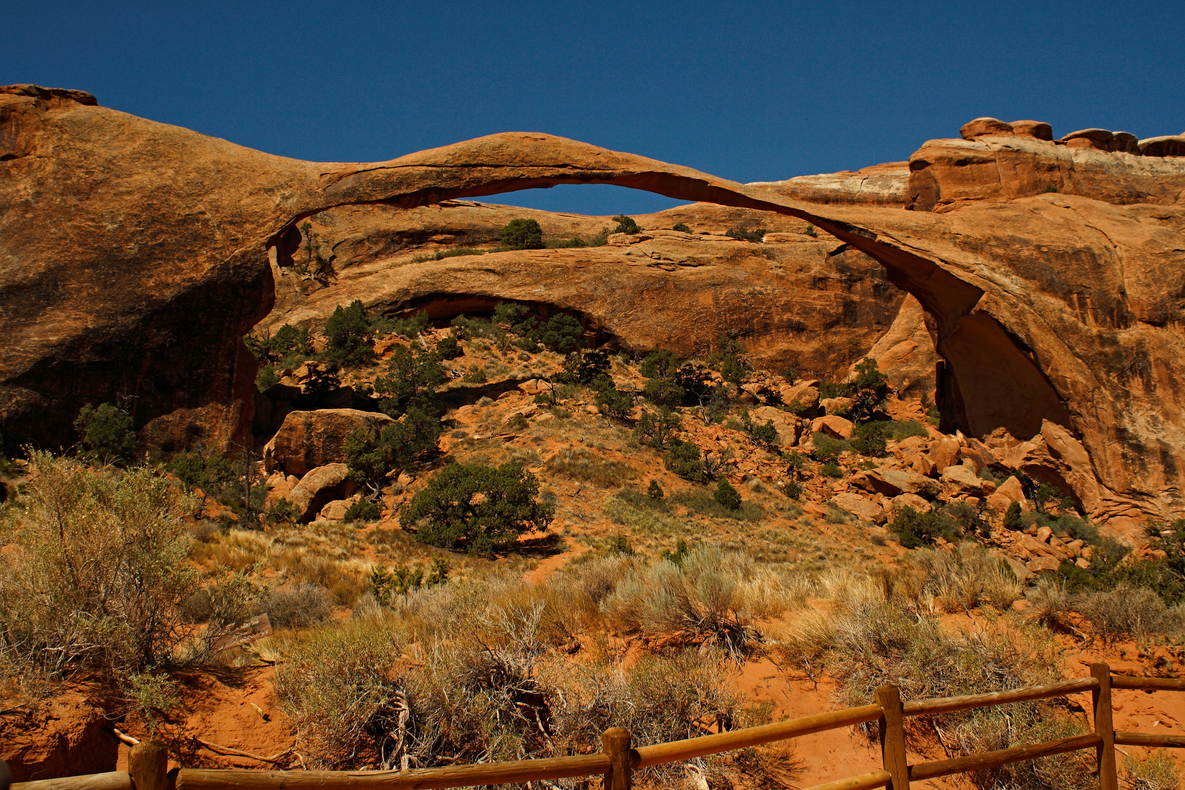
Settings: Canon EOS DIGITAL REBEL XS, ISO 200, f/8, 1/125 s, 24 mm.
Arches National Park
“Landscape Arch is the longest arch in North America with a light opening of 306 feet (93.3 meters). This awe-inspiring expanse is only 6 feet (1.8 meters) in diameter at its narrowest. Large segments of the arch came crashing down in the 1990s – proof that the park’s landscape can change dramatically in a instant. Although other arches have fallen, Landscape Arch still hangs on by a very thin thread.” — https://www.nps.gov/arch/planyourvisit/devils-garden.htm
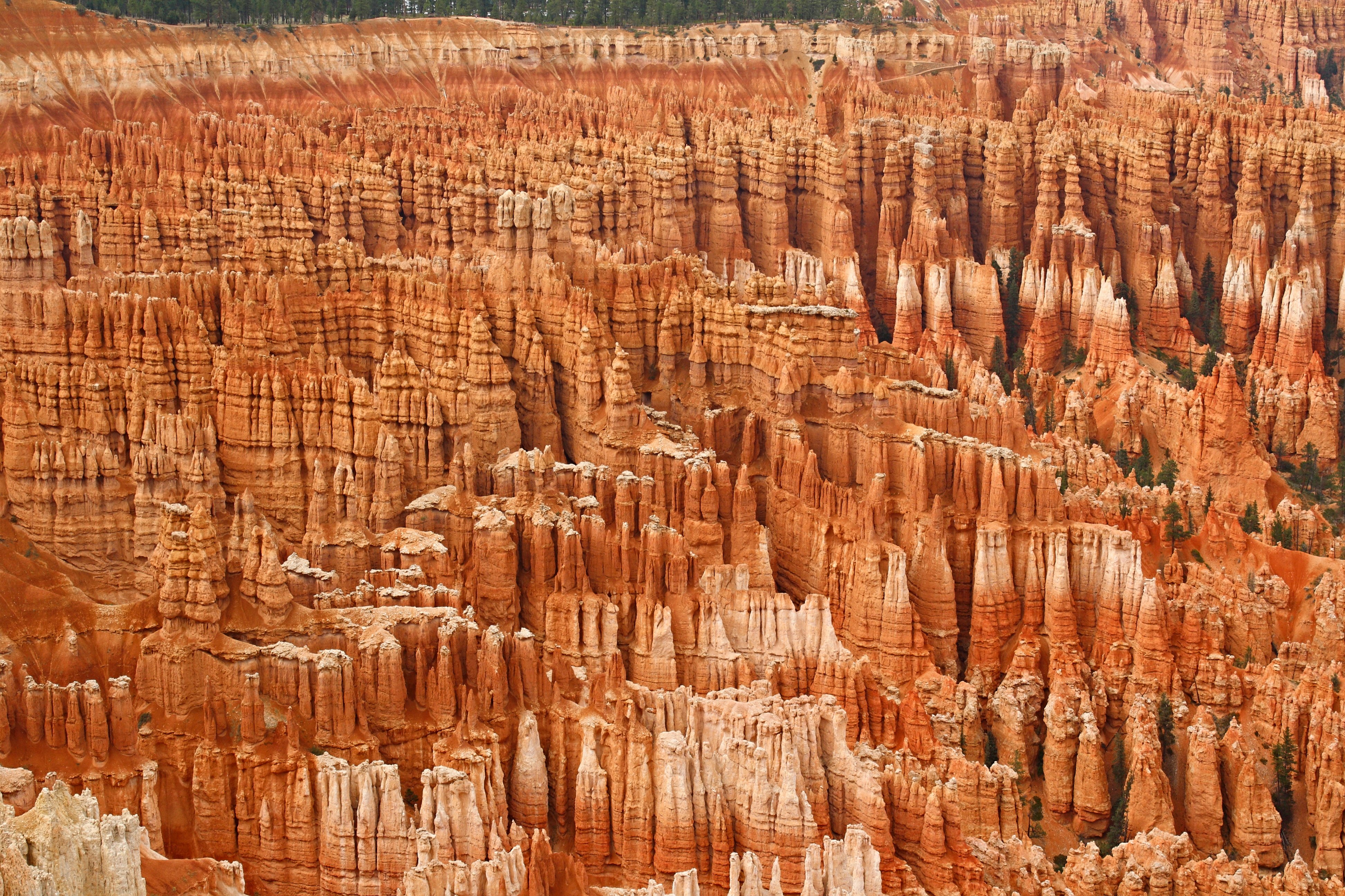
Settings: Canon EOS DIGITAL REBEL XS, ISO 200, f/10, 1/200 s, 42 mm.
Bryce Canyon National Park
“By far the most iconic section of the park, the Bryce Amphitheater is home to the greatest concentration of irregular rock spires (called “hoodoos”) found anywhere on Earth. Viewpoints along the first 3 miles (4.8 km) of the main road provide access to views overlooking this area. This area is referred to as an “amphitheater” as it is a bowl-shaped area shaped by the drainage of seasonal rains and melting snow (not truly a canyon, as those are shaped by flowing rivers)” — https://www.nps.gov/thingstodo/see-the-bryce-amphitheater.htm
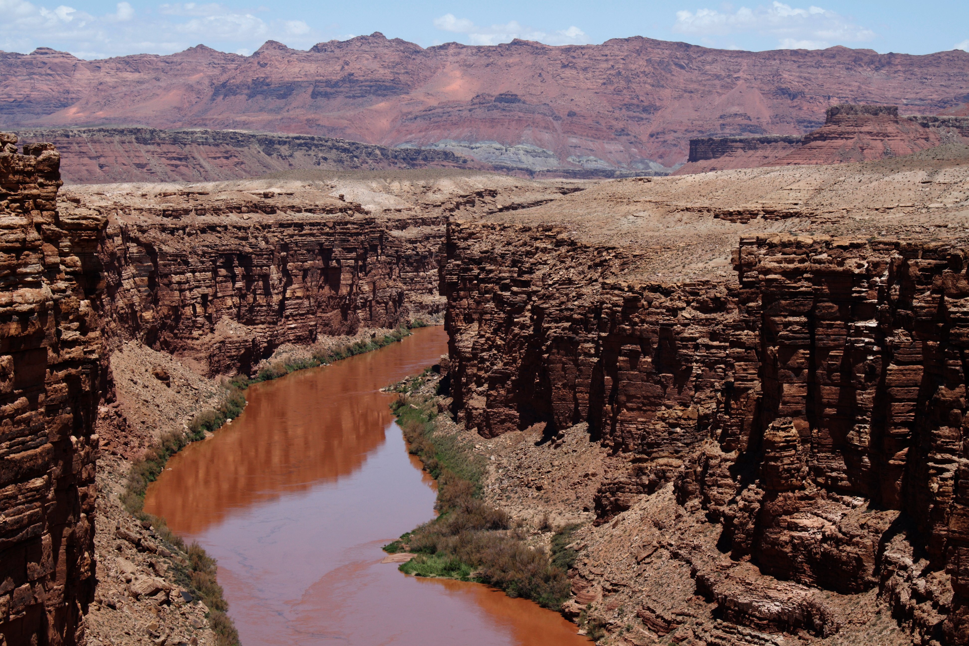
Friday, 04/08/2022: Post photo — View from Navajo Bridge.
Settings: Canon EOS DIGITAL REBEL XS, ISO 200, f/10, 1/125 s, 48 mm.
View from the Navajo Bridge
“Those traveling across the country on Highway 89A between Bitter Springs and Jacob Lake, AZ arrive at two bridges similar in appearance spanning the Colorado River. These two bridges, one historic and one new, represent one of only seven land crossings of the Colorado River for 750 miles (1207 km).” — https://www.nps.gov/glca/learn/historyculture/navajobridge.htm
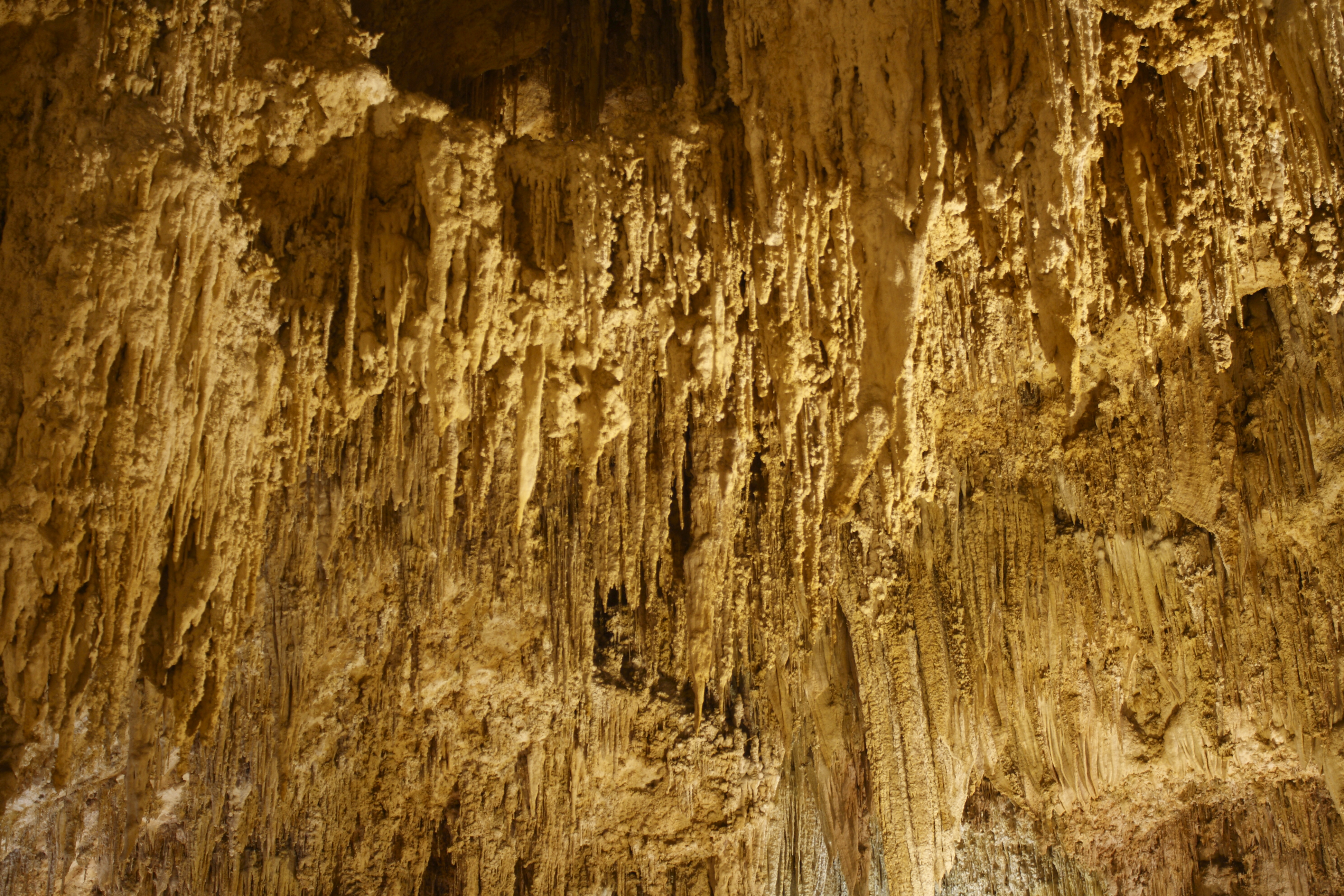
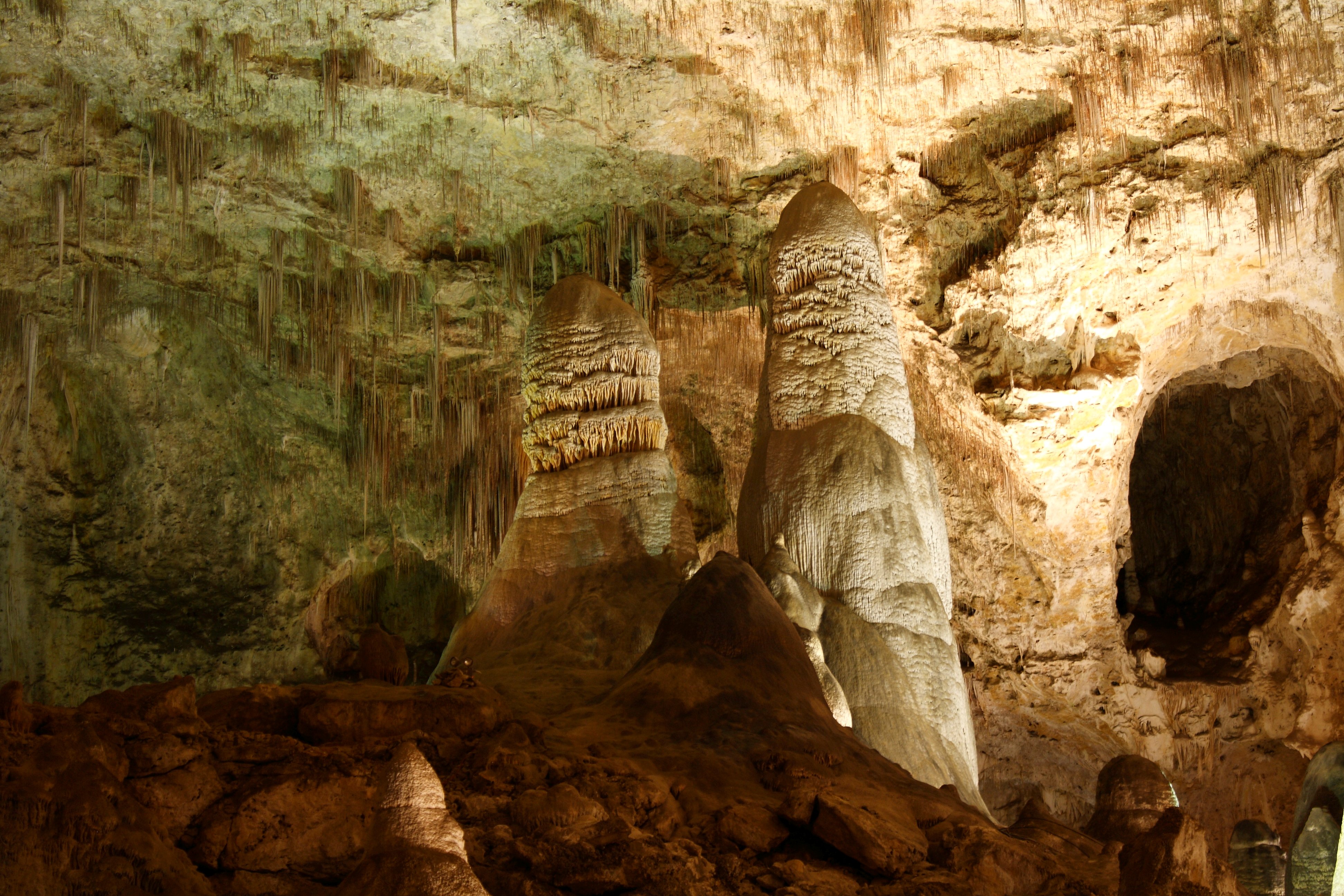
Saturday, 04/09/2022: Post photo — Carlsbad Caverns.
Settings: Canon EOS DIGITAL REBEL XS, ISO 200, f/4.5, 6 s, 33 mm.
“High ancient sea ledges, deep rocky canyons, flowering cactus, and desert wildlife—treasures above the ground in the Chihuahuan Desert. Hidden beneath the surface are more than 119 caves—formed when sulfuric acid dissolved limestone leaving behind caverns of all sizes.” — https://www.nps.gov/cave/index.htm
Thank you for all the new views and likes from last week, it helps keep me inspired.
Starting to take more photos. Still will be posting photos from past trips for a little while longer. Sill a long recovery ahead of me.
Enjoy some more travel photos from past trips.
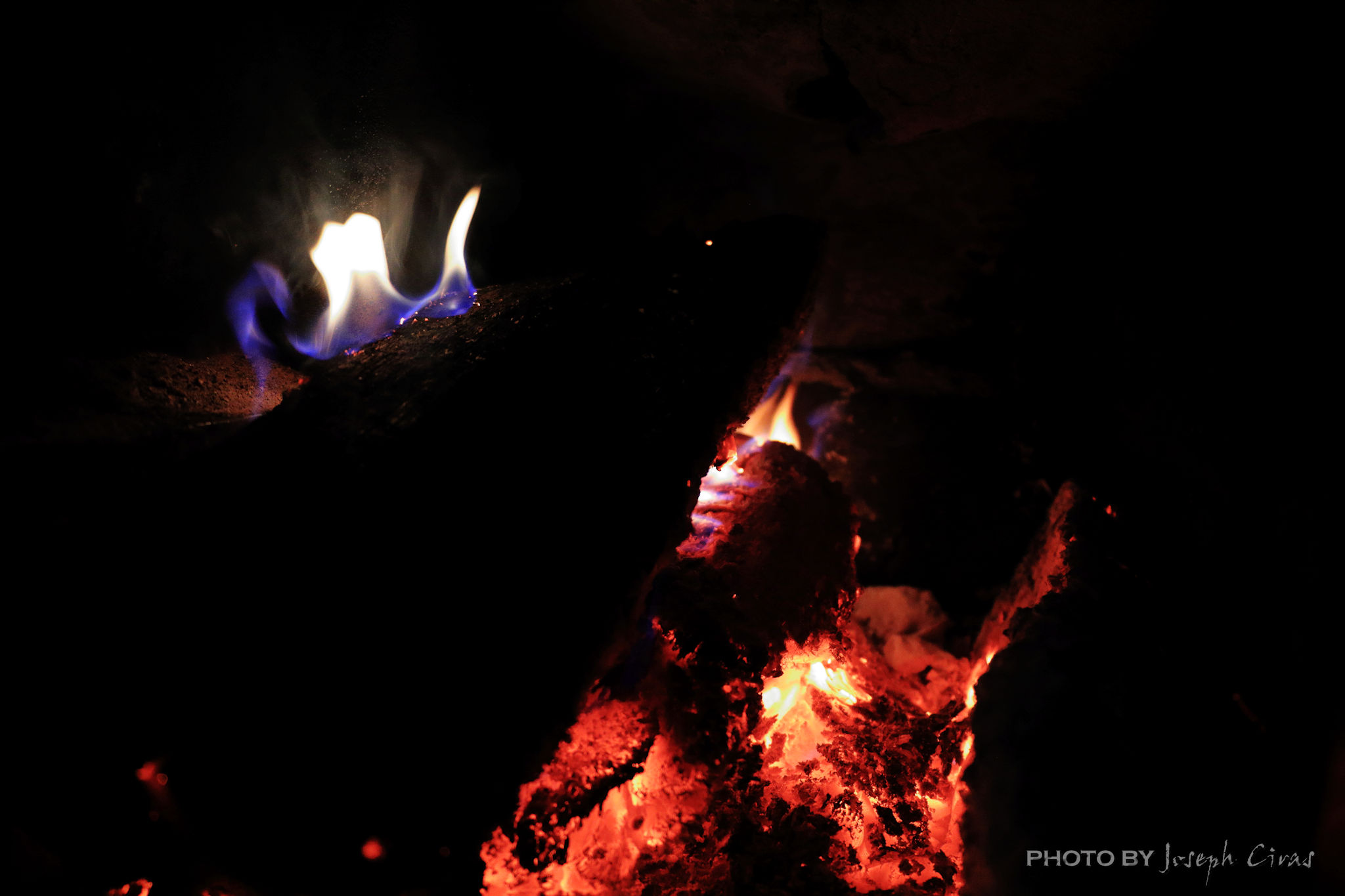
Sunday, 03/13/2022: Posted photo — Low Key.
Settings: Canon EOS 60D, ISO 2500, f/3.5, 1/40 s, 18 mm.
A low key image is one that contains predominantly dark tones and colors. Low key photography conveys atmosphere and mood. One of my photo projects had a low key image challenge this week. I was thinking about what photo to take to meet this challenge. I would have had many options if I had not just been operated on. With limited mobility, I thought about what there might be around the house. Since low key images contain predominantly dark tones and colors, I took a photo of the fire in our wood stove.
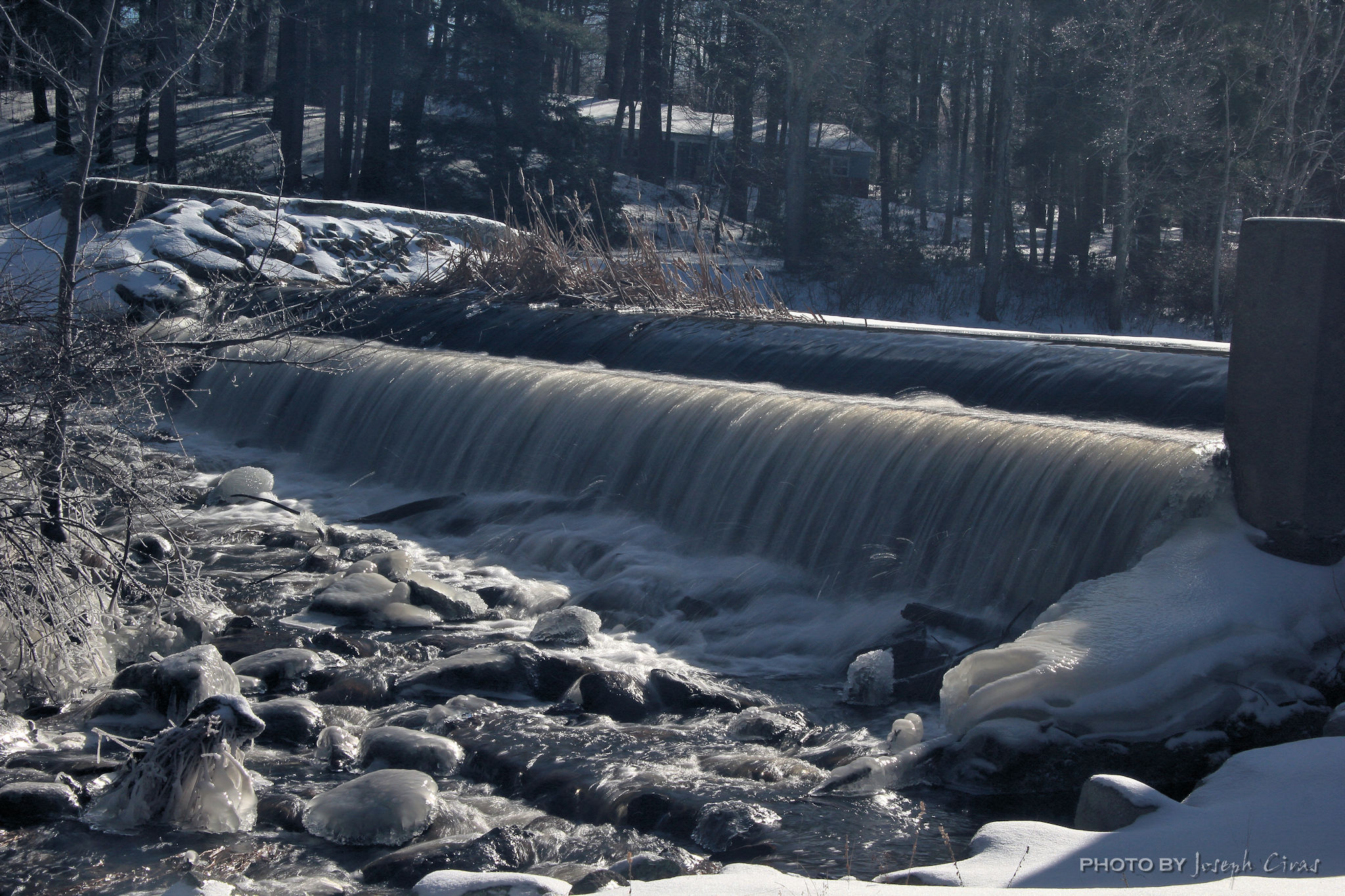
Monday, 03/14/2022: Posted photo — Cameron Falls.
Settings: Canon EOS DIGITAL REBEL XS, ISO 100, f/22, 10 s, 28 mm.
Cameron Falls, Waterton Lakes National Park, Alberta.
Cameron Falls is a very uniquely shaped waterfall of about 75 feet in height found in the heart of the Waterton townsite in Waterton Lakes National Park. After heavy rainfall, the waters upriver from the falls get stirred up with a red mudstone called argillite. As the water flows towards the falls, it turns to a beautiful pink hue when light reflects on the mineral water. We did not see the pink falls since the weather was dry when we visited Waterton Lakes National Park just after we visited Glacier National Park in Montana.
Tuesday, 03/15/2022: Posted photo — New Boot.
Settings: Google Pixel 2, ISO 195, f/1.8, 1/60 s, 4 mm.
I had a post op follow-up today a week and a half after surgery. My recovery is going as planned. I was fitted with this very uncomfortable boot. I still cannot put pressure on my ankle for another four weeks. Need to go back on Tuesday for another follow-up since the first one was close to my surgical date and the doctor would like to see my progress and remove some items from my ankle.
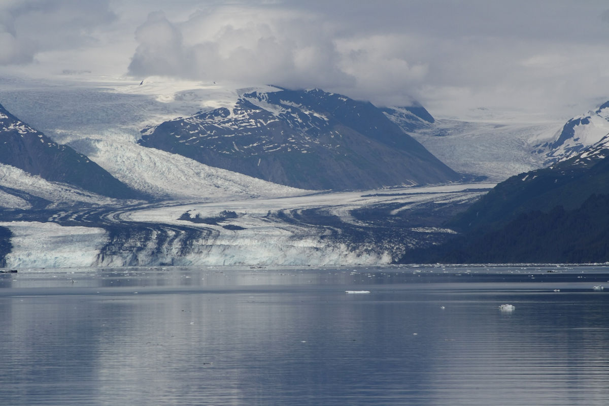
Settings: Canon EOS DIGITAL REBEL XS, ISO 200, f/8, 1/2000 s, 160 mm.
Harvard Glacier, College Fjord, Alaska.
The glacier has a 1.5-mile (2 km) wide face where it calves into the College Fjord. It is 300 ft thick and covers 120,000 acres of Chugach National Forest. The Harvard Glacier is the second largest glacier in the Prince William Sound, after the Columbia Glacier.
It is amazing to see how large a glacier is when you look at it from a distance. In this photo, we were about a mile from the glacier.
The names of the glaciers in College Fjord are: Amherst, Barnard, Bryn Mawr, Harvard, Smith, Vassar, and Yale. The glaciers of the northwest side feature the names of women’s colleges, and the glaciers of the fork and the southeast side sport the names of men’s colleges. What of Princeton? According to my research on the names, the scholars that named the glaciers took delight in ignoring it since none of them were Princeton alum.
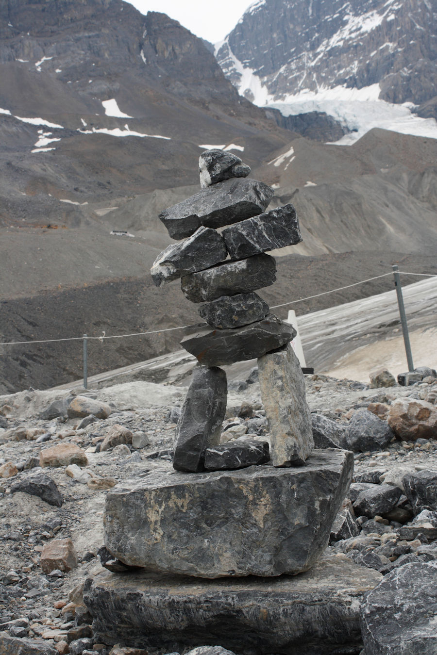
Thursday, 03/17/2022: Posted photo — Cairn.
Settings: Canon EOS DIGITAL REBEL XS, ISO 200, f/11, 1/200 s, 34 mm.
On the trail near the Athabasca Glacier, Jasper National Park, Alberta.
A cairn is a mound of rough stones built as a memorial or landmark, typically on a hilltop or skyline. This cairn is shaped like a person. In Canada this is called an Inuksuk.
The Athabasca Glacier is one of the six principal ‘toes’ of the Columbia Icefield, located in the Canadian Rockies. The glacier currently loses depth at a rate of about 16.4 feet (5 meters) per year and has receded more than 1 mile (1.5 km) and lost over half of its volume in the past 125 years.
From the Canadian Encyclopedia: “Inuksuk (also spelled inukshuk, plural inuksuit) is a figure made of piled stones or boulders constructed to communicate with humans throughout the Arctic. Traditionally constructed by the Inuit, inuksuit are integral to Inuit culture and are often intertwined with representations of Canada and the north.” — https://www.thecanadianencyclopedia.ca/en/article/inuksuk-inukshuk
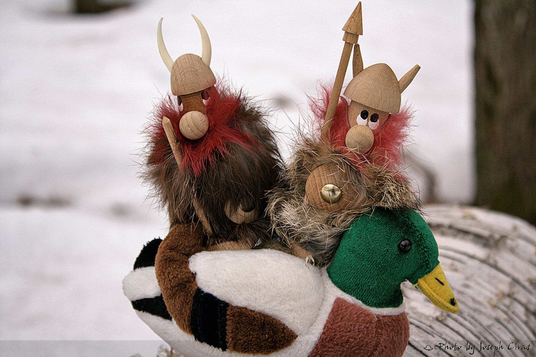
Friday, 03/18/2022: Post photo — Pall (and Rekard).
Settings: Canon EOS DIGITAL REBEL XS, ISO 200, f/5.6, 1/160 s, 55 mm.
These are my two buddied from Denmark. Earlier on in my photo projects, I featured Pall every week with Pall telling a story about his life. When I went back to Denmark, I picked up Rekard. They ventured together for next year or two. Might be time to bring their adventures back.
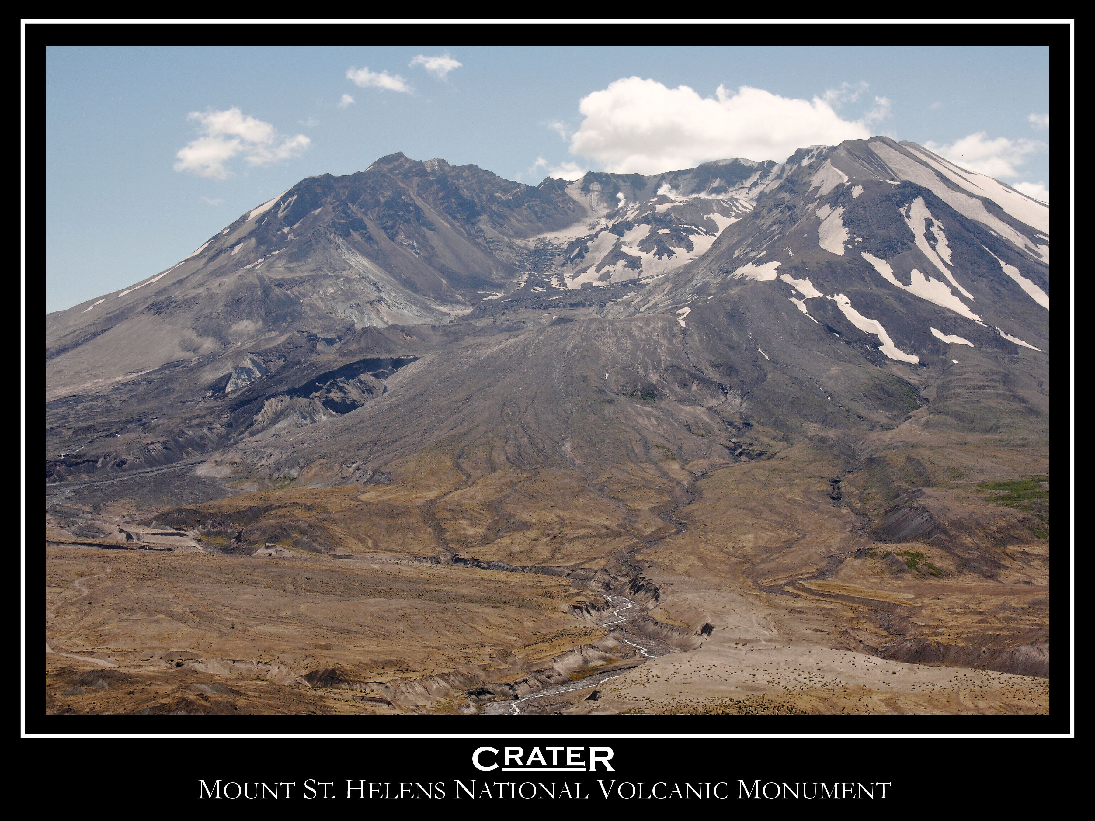
Saturday, 03/19/2022: Post photo — Crater.
Settings: N/A.
Mount St. Helens National Volcanic Monument
From the USGS:
“Prior to 1980, Mt. St. Helens had the shape of a conical volcano sometimes referred to as the Mount Fuji of America. During the 1980 eruption the upper 400 m (1,300 ft) of the summit was removed by a huge debris avalanche, leaving a 2 x 3.5 km horseshoe-shaped crater now partially filled by a lava dome and a glacier. It is primarily an explosive dacite volcano.”
Quick Facts:
Location: Washington, Skamania County Latitude: 46.2° N Longitude: 122.18° W Elevation: 2,539 (m) 8,330 (f) Volcano type: Stratovolcano Composition: Basalt to Rhyodacite Most recent eruption: 1980, 2004-2008 Nearby towns: Castle Rock, WA; Olympia, WA; Vancouver, WA; Yakima, WA; Portland, OR Threat Potential: Very High
Dacite: Volcanic rock (or lava) that characteristically is light in color and contains 62 to 69 percent silica and moderate amounts of sodium and potassium.
Stratovolcano: Steep, conical volcanoes built by the eruption of viscous lava flows, tephra, and pyroclastic flows. They are usually constructed over tens to hundreds of thousands of years and may erupt a variety of magma types (basalt to rhyolite). They typically consist of many separate vents. Synonym is composite volcano.
I have been to Mt. St. Helens a few times over the years. The first time was about ten years after the eruption, and we saw the logs floating in Sprit Lake. I just pictured Harry Truman looking up at the mountain from his lodge and wondering why he did not leave. Then again, there were may false alarms in the past. I am amazed on how nature is recovering in the area. I can still remember the first time that I drove into the blast zone. Very lush, dense forest along the road, turn the corner and nothing. Trees looking like toothpicks laying down in the direction of the blast. There were some cars left for visitors to see how powerful the eruption was.
“It’s weird that photographers spend years or even a whole lifetime, trying to capture moments that added together, don’t even amount to a couple of hours.” — James Lalropui Keivom
Thank you for all the new views and likes from last week, it helps keep me inspired.
This week will only be photos. I have been writing my blog every day this week on thumbdrive. That thumbdrive has been misplaced so I am just posting photos. A photo is worth a thousand words. This phrase emerged in the USA in the early part of the 20th century. Its introduction is widely attributed to Frederick R. Barnard, who published a piece commending the effectiveness of graphics in advertising with the title “One look is worth a thousand words”, in Printer’s Ink, December 1921.
Sunday, 02/06/2022: Posted photo — Long Exposure.
Settings: Canon EOS 60D, ISO 100, f/16, 1/10 s, 42 mm.
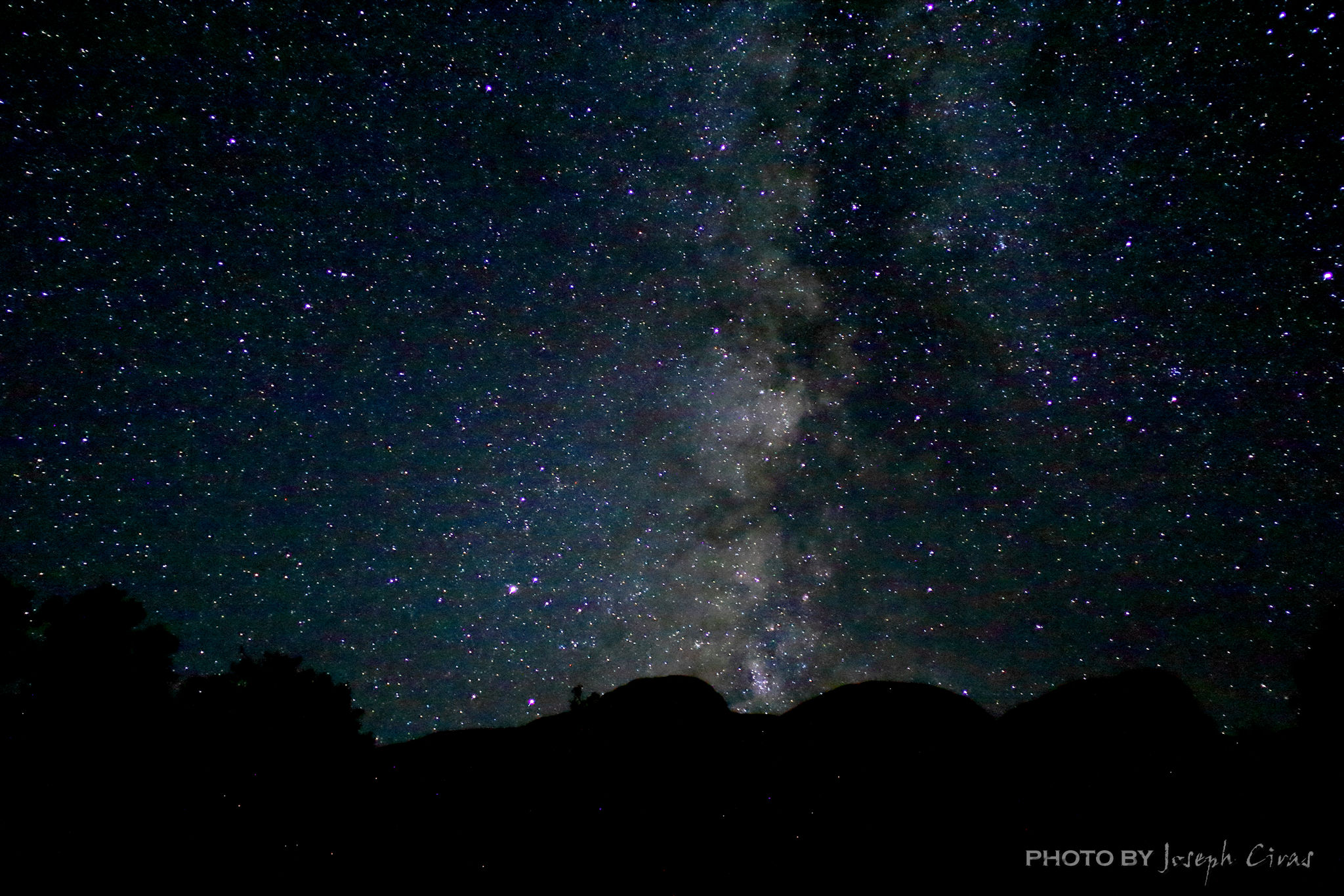
Monday, 02/07/2022: Posted photo — Alaska.
Settings: Canon EOS DIGITAL REBEL XS, ISO 400, f/8, 1/4000 s, 75 mm.
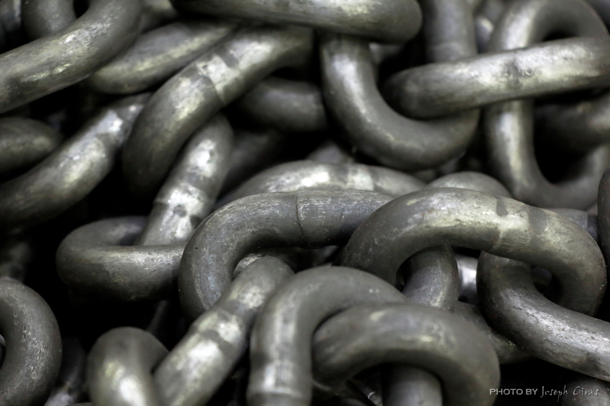
Tuesday, 02/08/2022: Posted photo — Chain.
Settings: Canon EOS 60D, ISO 1600, f/5.6, 1/15 s, 88 mm.