Settings: KODAK DX6490 ZOOM DIGITAL CAMERA, ISO 80, f/6, 1/253 s, 9 mm.
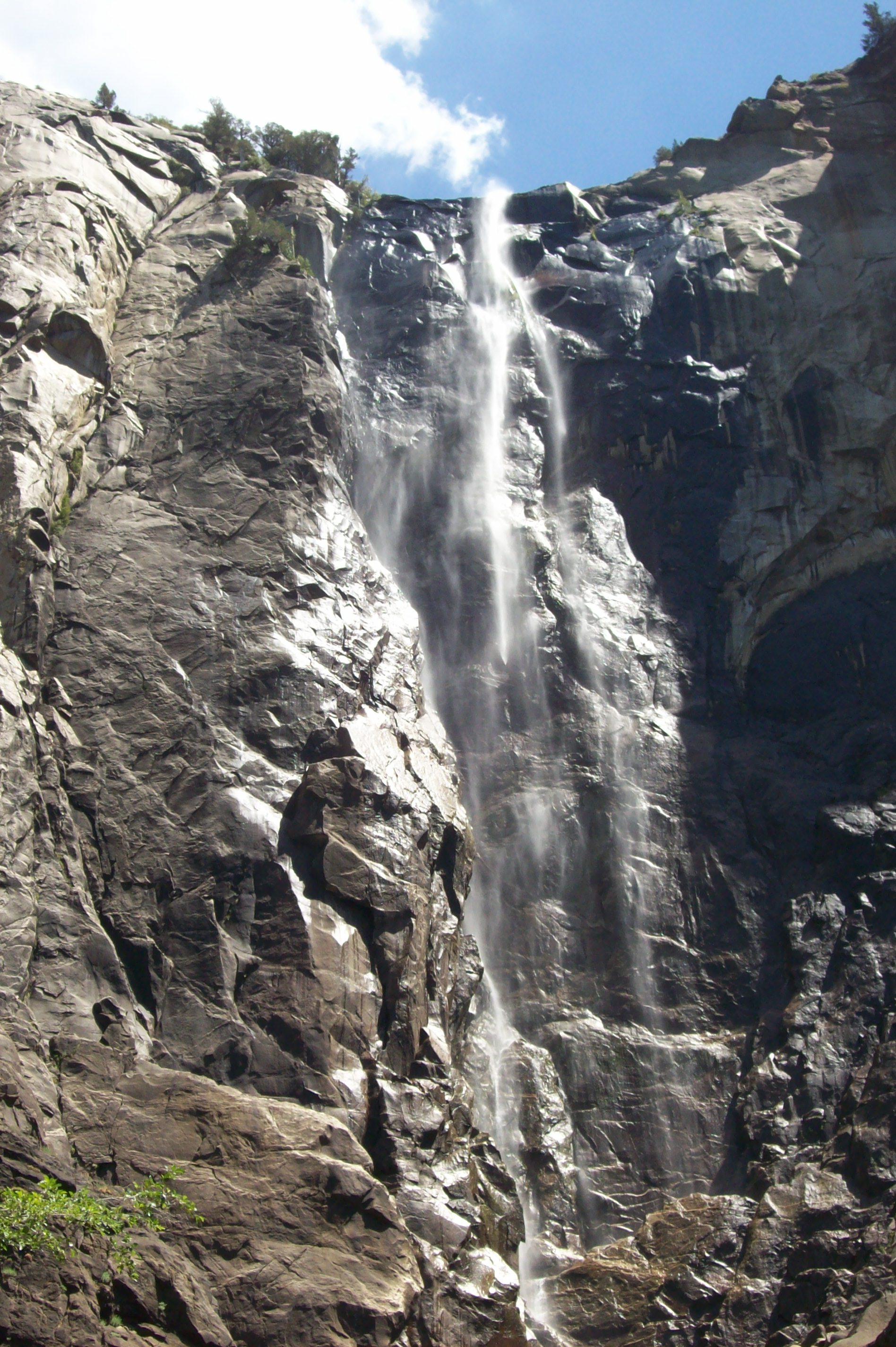
We arrived at Yosemite National Park late one evening in 2008 and did not see the valley. Today we went hiking to Bridalveil Falls. Since this trip took place in the summer, the water was not flowing over the falls as well as it does other times of the year.
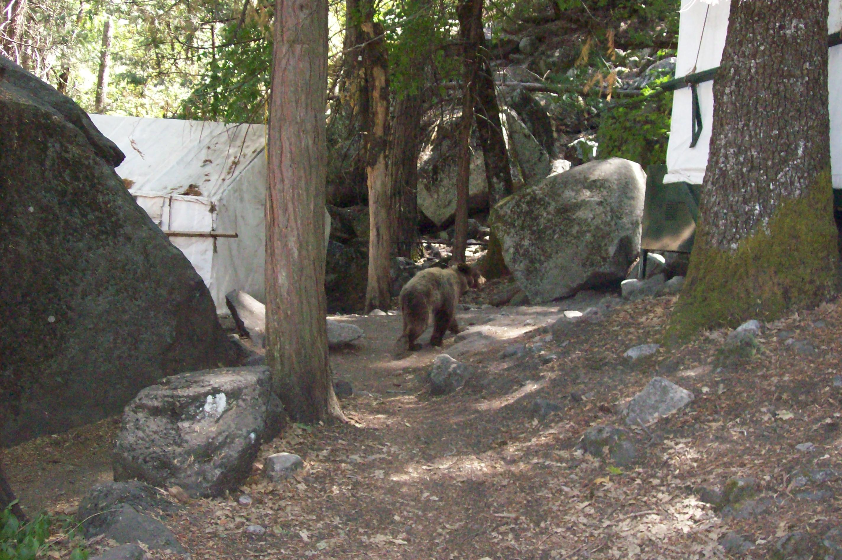
Monday, 04/25/2022: Posted photo — Camp Curry.
Settings: KODAK DX6490 ZOOM DIGITAL CAMERA, ISO 400, f/3, 1/147 s, 8 mm.
This is where we camped, Camp Curry. We occasionally had a visitor near our site. Yosemite bears will open your car doors to get food. All your items that have odor were to be placed inside a bear locker. Yosemite bears are the only bears in the National Park system that will open your door for you.
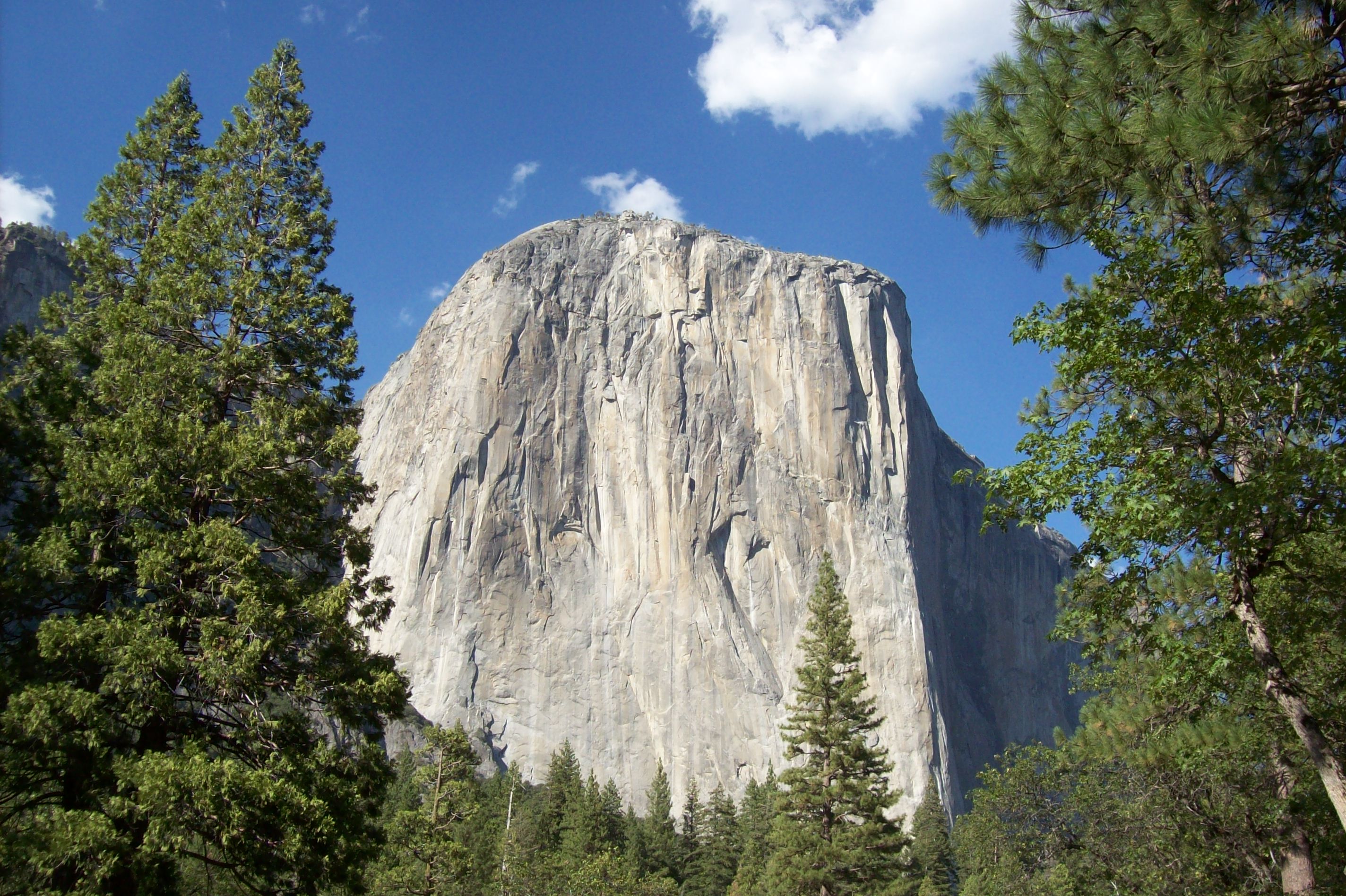
Tuesday, 04/26/2022: Posted photo — El Capitan.
Settings: KODAK DX6490 ZOOM DIGITAL CAMERA, ISO 80, f/4.8, 1/434 s, 6 mm.
The famous El Capitan. We saw some climbers on the side of the cliff. It is interesting at night to see their flashlights as they are setting up their sleeping ledges.
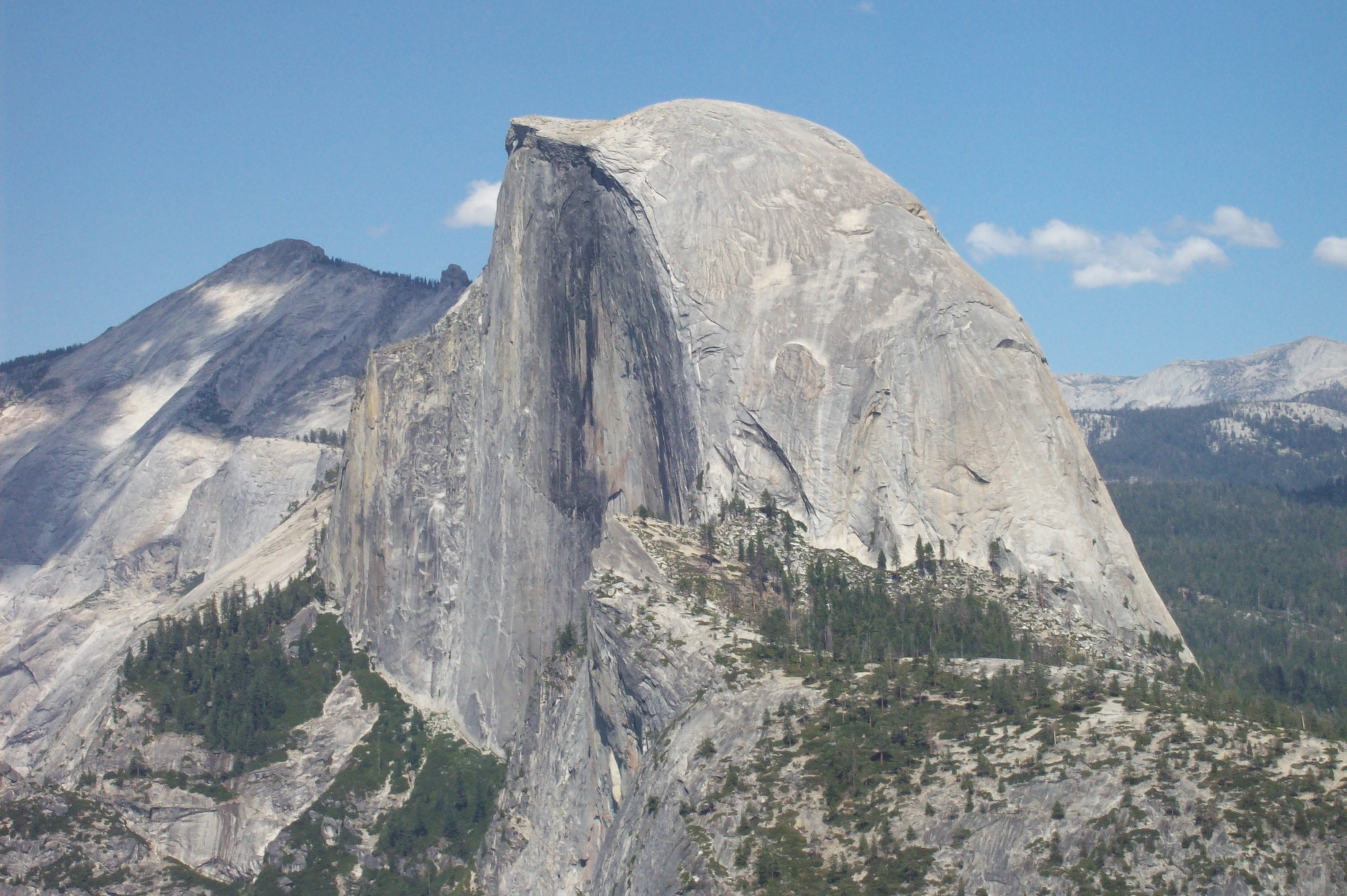
Wednesday, 04/27/2022: Posted photo — Half Dome.
Settings: KODAK DX6490 ZOOM DIGITAL CAMERA, ISO 80, f/8.5, 1/274 s, 18 mm.
Also next to our camp is Half Dome. We did some hiking around Half Dome but did not have the time to climb it ourselves.
Settings: KODAK DX6490 ZOOM DIGITAL CAMERA, ISO 80, f/4.8, 1/360 s, 18 mm.
Here is Yosemite Valley. One of the most picturesque placed that I have visited. We drove in at night and did not see the valley. When we did see the valley later in our visit, we were not disappointed. As I stated above, this was the start of me taking photographs daily. I have an inexpensive camera and did not have much experience with post processing my images.
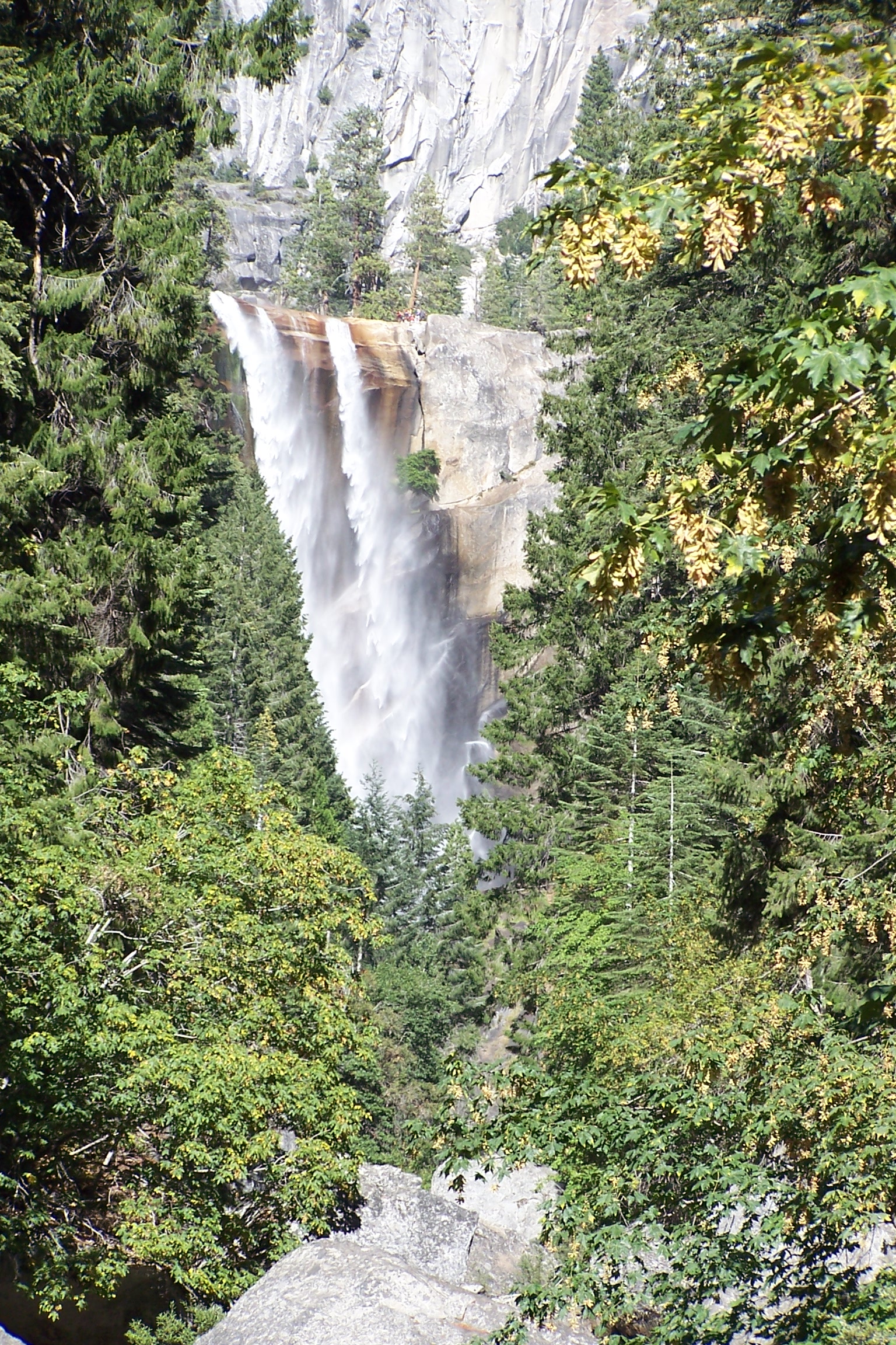
Friday, 04/29/2022: Post photo — Vernal Falls.
Settings: KODAK DX6490 ZOOM DIGITAL CAMERA, ISO N/A, f/3.2, 1/350 s, 28 mm.
Another hike, another waterfall.
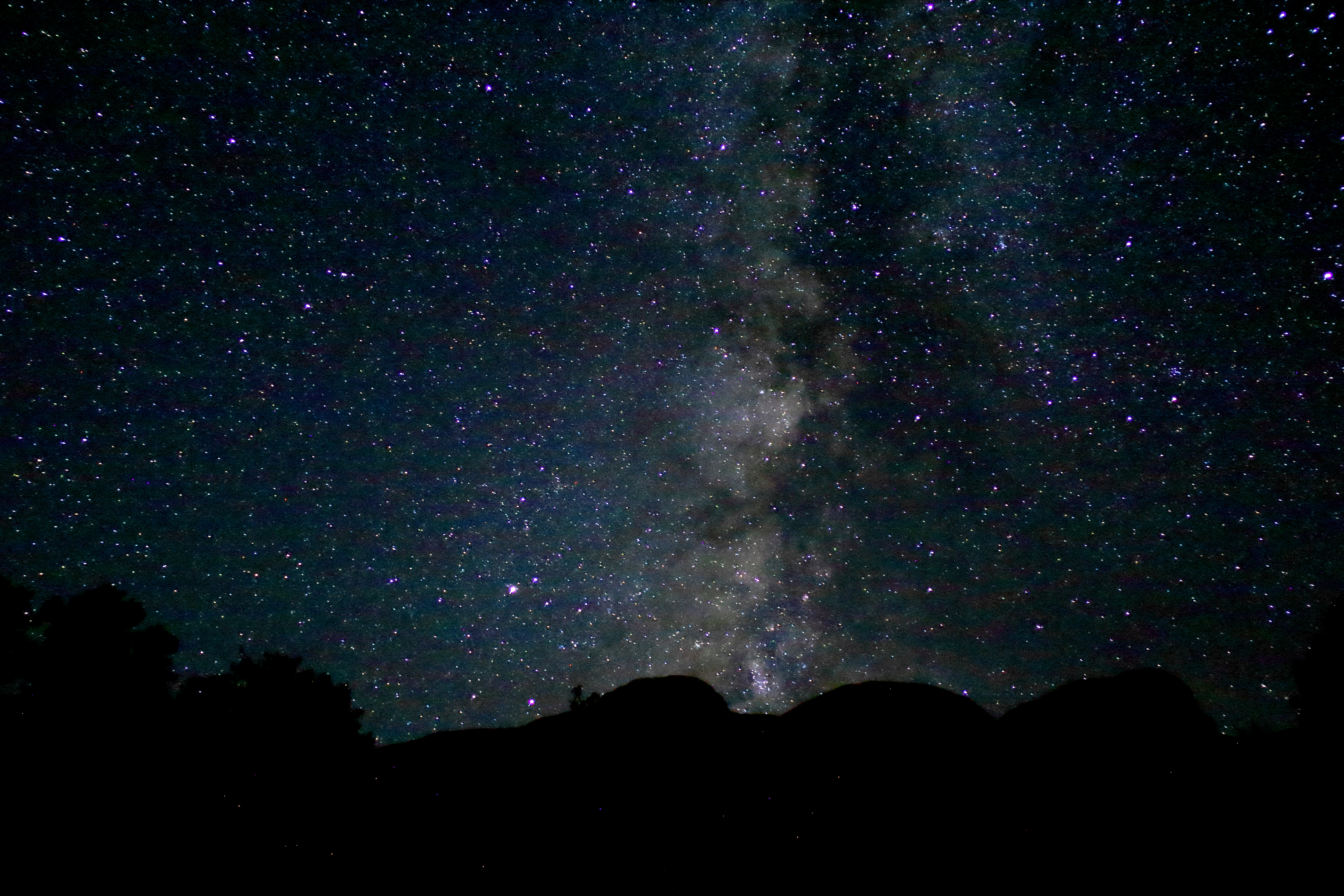
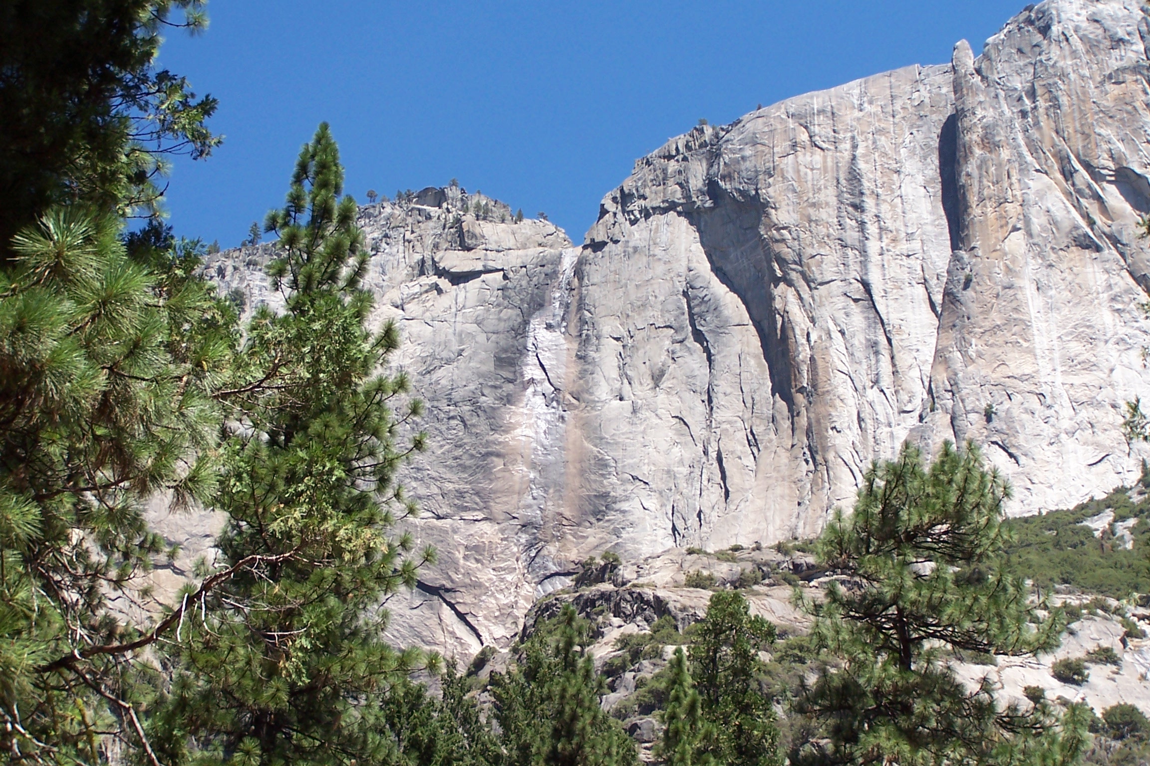
Saturday, 04/30/2022: Post photo — Yosemite Falls.
Settings: KODAK DX6490 ZOOM DIGITAL CAMERA, ISO N/A, f/3.2, 1/500 s, 11 mm.
Since our trip was in the middle of the summer, upper and lower Yosemite Falls were not flowing. Would be nice to get back to Yosemite National Park in the spring to see the water flowing.
“A thing that you see in my pictures is that I was not afraid to fall in love with these people.” — Annie Leibovitz
Thank you for all the new views and likes from last week, it helps keep me inspired.
This week we visit the north rim of the Grand Canyon.
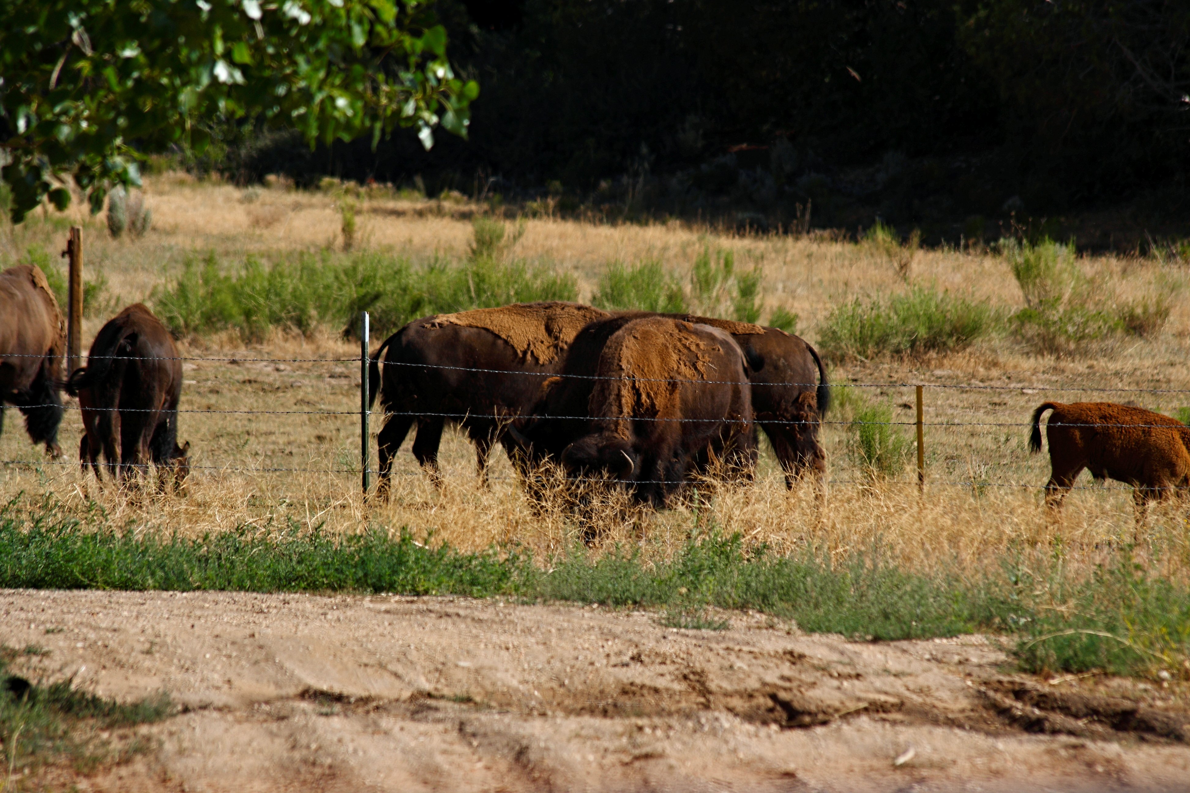
Sunday, 04/17/2022: Posted photo — Bison outside the Park.
Settings: Canon EOS DIGITAL REBEL XS, ISO 200, f/6, 1/500 s, 300 mm.
This week I am posting from a trip we took to the North Rim of the Grand Canyon. Not many people go to the north rim since it is not near any population area. To drive from the north rim to the south rim of the Grand Canyon takes about 8 hours from closest entrance to closes entrance.
Before you get the sign for the north rim, you go past a bison farm. What a majestic animal to see up close.
Monday, 04/18/2022: Posted photo — North Rim Entrance.
Settings: Canon EOS DIGITAL REBEL XS, ISO 200, f/5.6, 1/60 s, 32 mm.
Here is the sign for the north rim. I have signs from all the national parks that I have entered. It is a good way to remember what parks the following photos were taken. I also like to take photos of signs along the trails.
Tuesday, 04/19/2022: Posted photo — View from our Campsite.
Settings: Canon EOS DIGITAL REBEL XS, ISO 200, f/8, 1/100 s, 55 mm.
This is the view we had when we woke up the few days we were at the north rim. Not a bad view!
Settings: Canon EOS DIGITAL REBEL XS, ISO 200, f/6.3, 1/100 s, 20 mm.
We were walking the Transept Trail to Bright Angel Point to head into the canyon. We saw a sign for ruins that were used 1000 years ago by Pueblo people. There are many historical ruins in Grand Canyon National Park and other parks in the area.
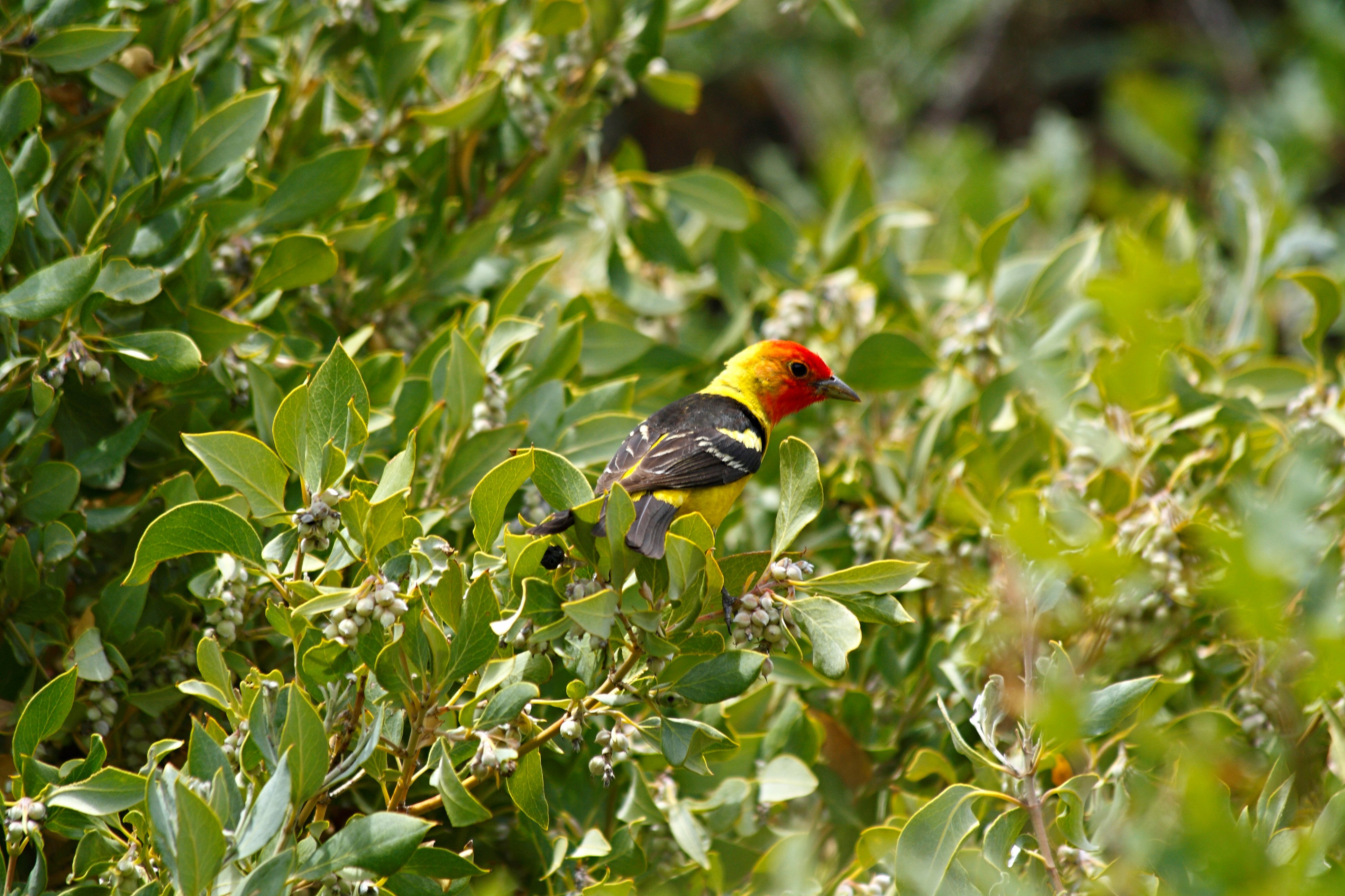
Thursday, 04/21/2022: Posted photo — Western Tanager.
Settings: Canon EOS DIGITAL REBEL XS, ISO 200, f/6.3, 1/320 s, 300 mm.
As we were approaching the trailhead area, I spotted this colorful bird in a bush. I like how colorful it is. I have sold a few prints of this photo during some of my gallery showings.
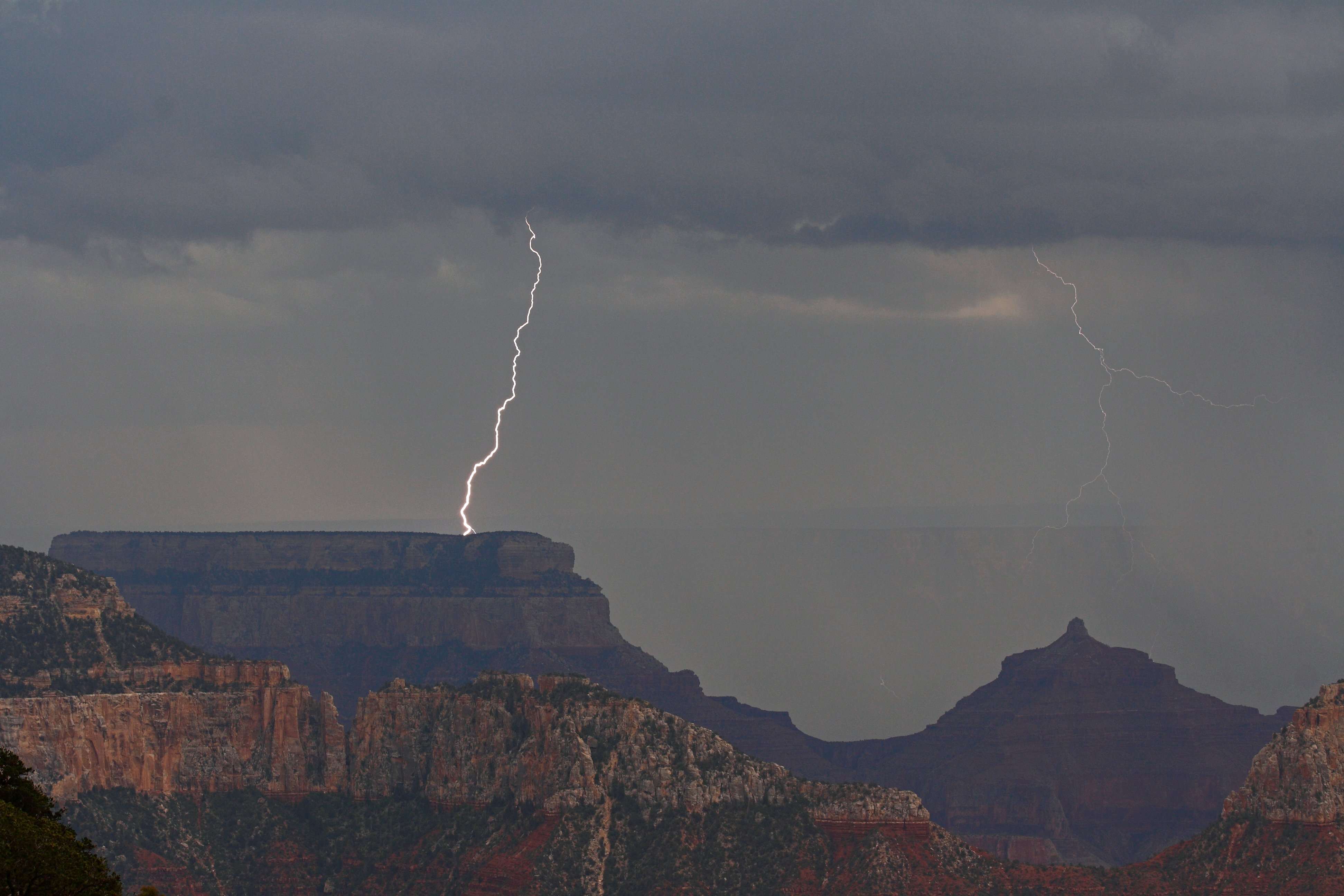
Friday, 04/22/2022: Post photo — Lightning.
Settings: Canon EOS DIGITAL REBEL XS, ISO 200, f/10, 1/400 s, 70 mm.
We did not go down into the canyon because of storms in the area. There was tornado and severe thunderstorm warning in the area. When this storm was approaching, I took out my camera and started to take photos. I did not see the second bolt of lightning until I looked at the photo on my computer.
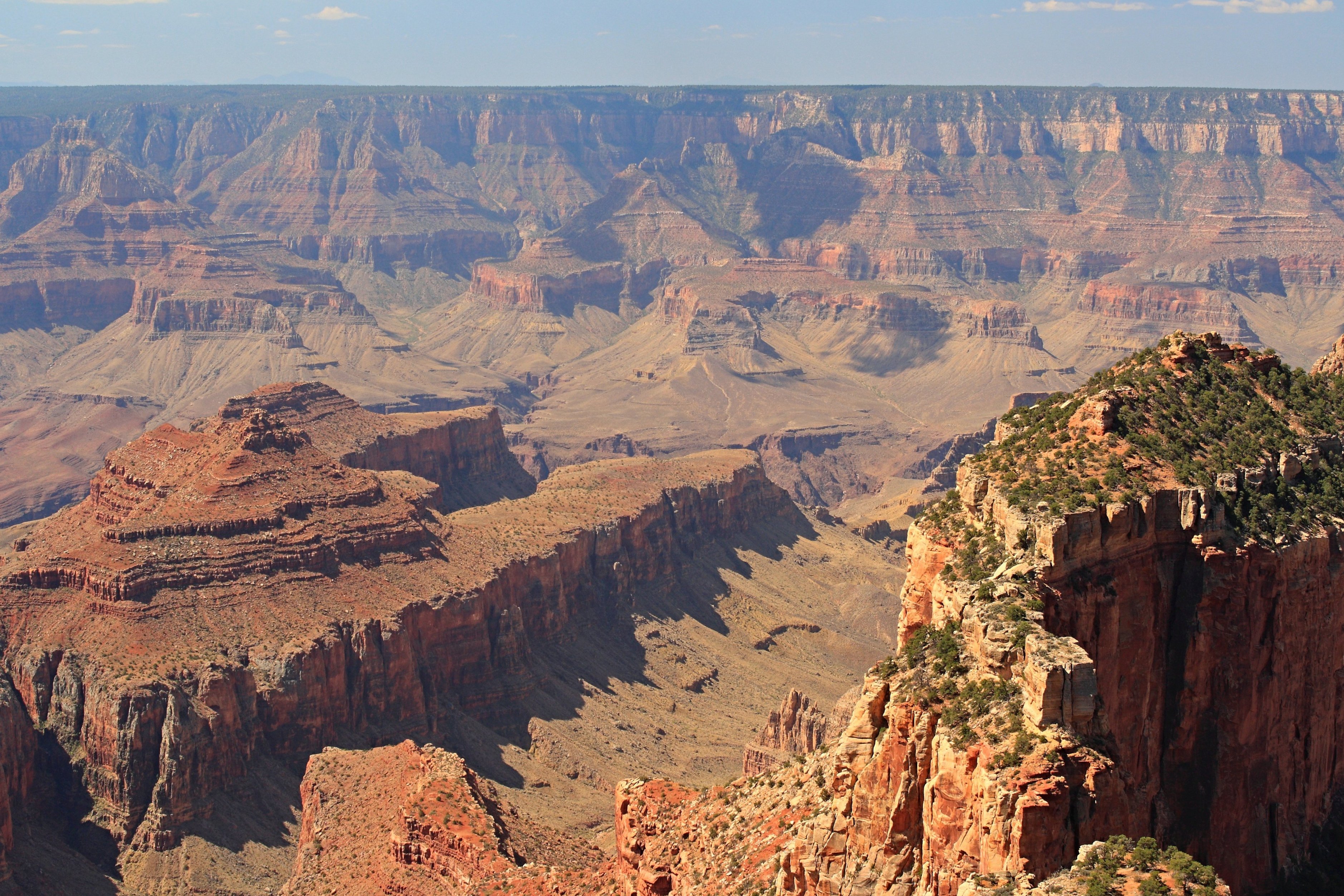
Saturday, 04/23/2022: Post photo — View of the Canyon.
Settings: Canon EOS DIGITAL REBEL XS, ISO 200, f/8, 1/125 s, 40 mm.
As we were leaving the canyon to go from the north rim to the south rim, we stopped an looked at the temples.
“We are making photographs to understand what our lives mean to us.” — Ralph Hattersley
Thank you for all the new views and likes from last week, it helps keep me inspired.
Happy and blessed Easter Sunday to your all. Here are my thought from last week. This week’s post has somethings new and somethings old.
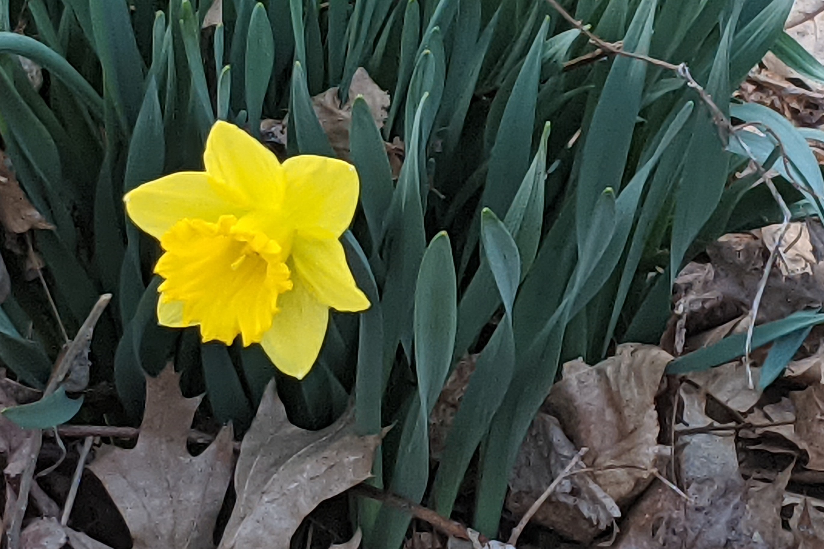
Sunday, 04/10/2022: Posted photo — Daffodil.
Settings: Google Pixel 2, ISO 37, f/1.8, 1/125 s, 4 mm.
Sign of spring, our daffodils are blooming. I have not gotten out of the house much these last few months. Was able to get out today to walk around our yard. Nice to see plants flowering. We do have more daffodils and tulip in front of our house that I have been watching as I walk from the car to inside the house. I have not noticed any crocus this year. I must have been inside when they were blooming.
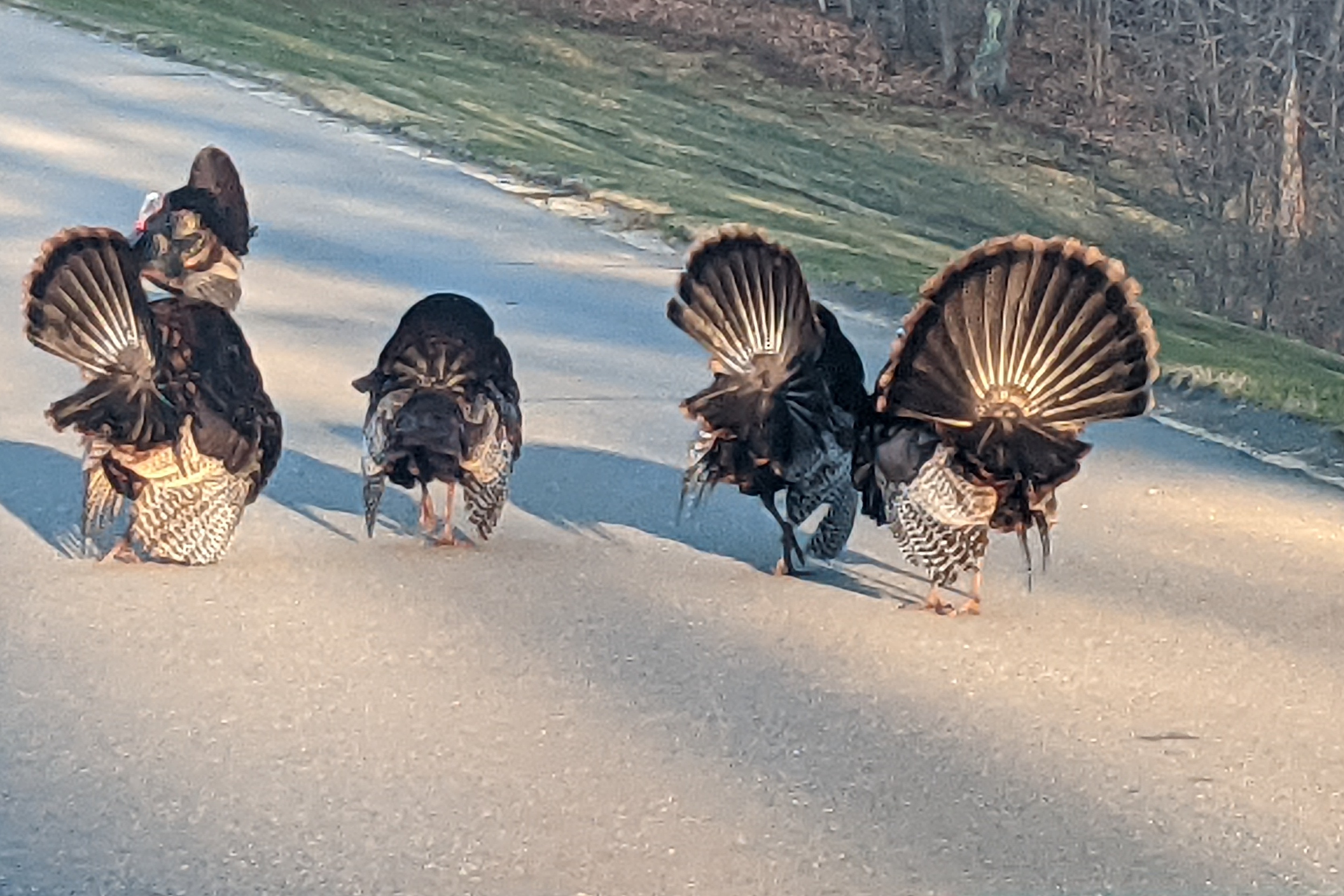
Monday, 04/11/2022: Posted photo — Roadblock.
Settings: Google Pixel 2, ISO 62, f/1.8, 1/198 s, 4 mm.
The turkeys are back. On my way into work, we ran into this rafter of turkeys. I am still not driving so I took this photo from the passenger seat.
Tuesday, 04/12/2022: Posted photo — The Cause of My Pain.
Settings: Google Pixel 2, ISO 251, f/1.8, 1/120 s, 4 mm.
I have not looked at my microspikes since my accident. There were put in the back seat of my car when one of my hiking companions drove my car back to my house. I just left them there since the car was not used that often. My car has a manual transmission, so I am not able to shift since I cannot use my left foot for the clutch. We are trading in my car for one with an automatic transmission so I can drive myself to work.
I took out my microspikes to see if they were broken. The first one I looked at had a stick embedded in one of the spikes. The was why I went down, no spike available to grip the ice! What a freak accident. I am glad that I know what happened and happy that it was not an equipment malfunction.
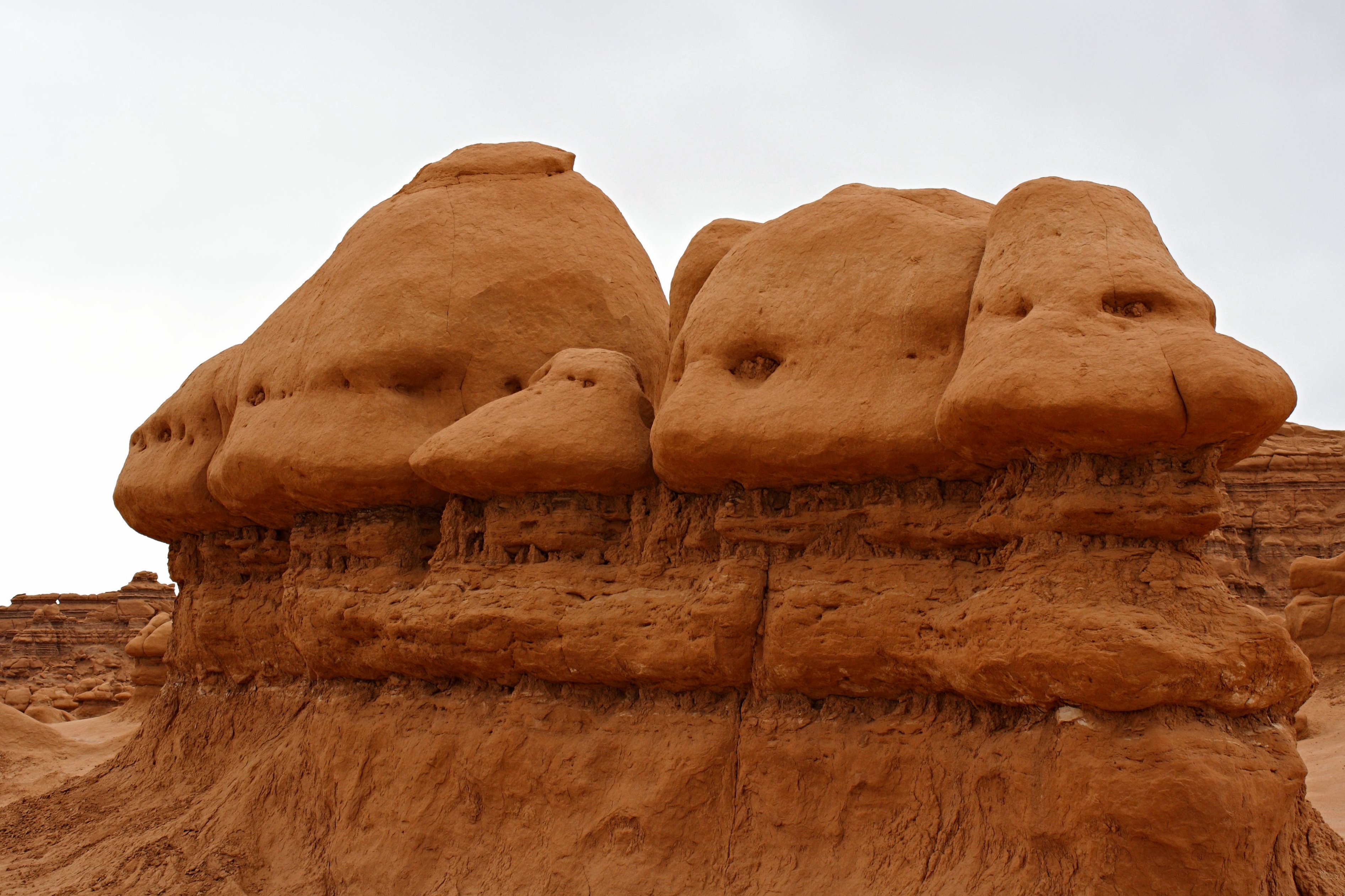
Wednesday, 04/13/2022: Posted photo — Hoodoos.
Settings: Canon EOS DIGITAL REBEL XS, ISO 200, f/8, 1/160 s, 37 mm.
These are hoodoos in Goblin Valley State Park. Goblin Valley State Park is in Green River, UT. Goblin Valley was the set for the movie “Galaxy Quest”, one of our favorite movies. We were surprised that we were able to into the goblins, which we did, and we reenacted some scenes from the movie. The park features thousands of hoodoos, referred to locally as goblins, which are formations of mushroom-shaped rock pinnacles, some as tall as several yards.
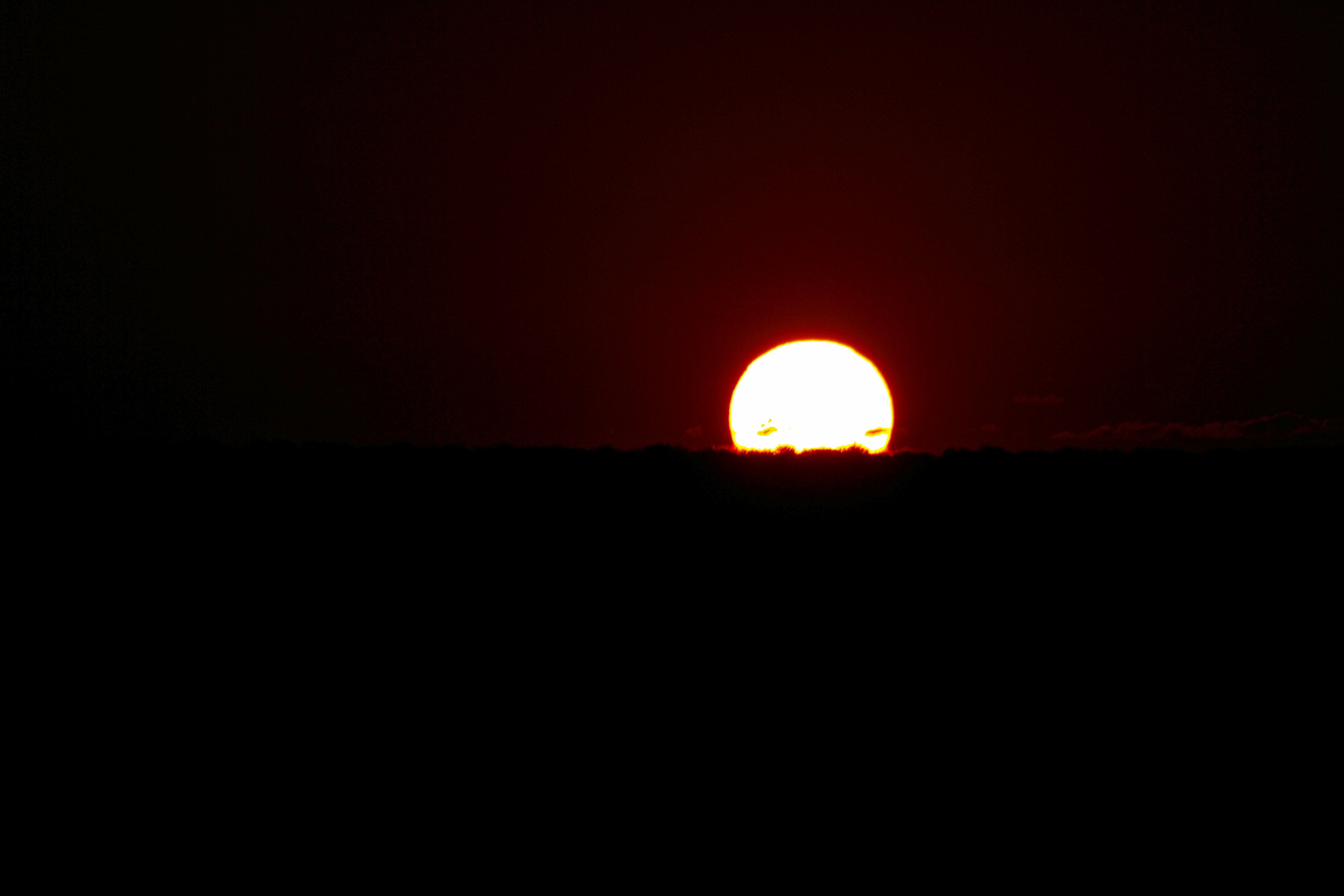
Thursday, 04/14/2022: Posted photo — Sunrise.
Settings: Canon EOS DIGITAL REBEL XS, ISO 200, f/16, 1/2000 s, 300 mm.
This is the sunrise from Goblin Valley. We had a wonderful dark sky night and a great sunrise.
Friday, 04/15/2022: Post photo — Delicate Arch.
Settings: Canon EOS DIGITAL REBEL XS, ISO 100, f/5.6, 1/200 s, 300 mm.
This is as close as we were to Delicate Arch in Arches National Park. Delicate Arch is a 52-foot-tall freestanding natural arch. What you do not see is the drop off just after the arch. Delicate Arch stands at the edge of a cliff. We arrived in the park late and did not do the hike out to the arch. We did other hikes in the park the couple of days we were there. The longest hike was about a 10-mile hike in extremely hot weather. We followed the rule of at least one gallon of water per person per day. I carried the water and my wife and son carried other supplies during our hike.
Saturday, 04/16/2022: Post photo — Upper Slot Canyon.
Settings: Canon EOS DIGITAL REBEL XS, ISO 640, f/3.5, 1/25 s, 18 mm.
We found Antelope Slot Canyon by accident. We were looking for grocery stores in the area as we were traveling between the north and south rim of the Grand Canyon. We saw pickup truck that had Antelope Slot Canyon on then. My wife had a friend that went to a canyon in that area that looked like a great stop for us. We did some research and found out the canyon was Antilope Slot Canyon. We arrived in Page, AZ midday to the upper slot canyon was the only place we could get tickets. I know of others that have gone to lower slot and they also looked impressive. Need to go back to visit.
For those of you who know the area, we did not go to Horseshoe Bend since we were just camping at Goosenecks State Park a few nights before.
“When I have a camera in my hand, I know no fear” — Alfred Eisenstaedt
Thank you for all the new views and likes from last week, it helps keep me inspired.
Surgery went well last Friday. I have plenty of hardware in my ankle. It will be a while until I am able to hit the mountains again in full force. My goal to finish my second round of hiking the 48 highest peaks in New Hampshire will be delayed for at least a year until my ankle fully recovers. Thank you all for your words of encouragement and for all your support.
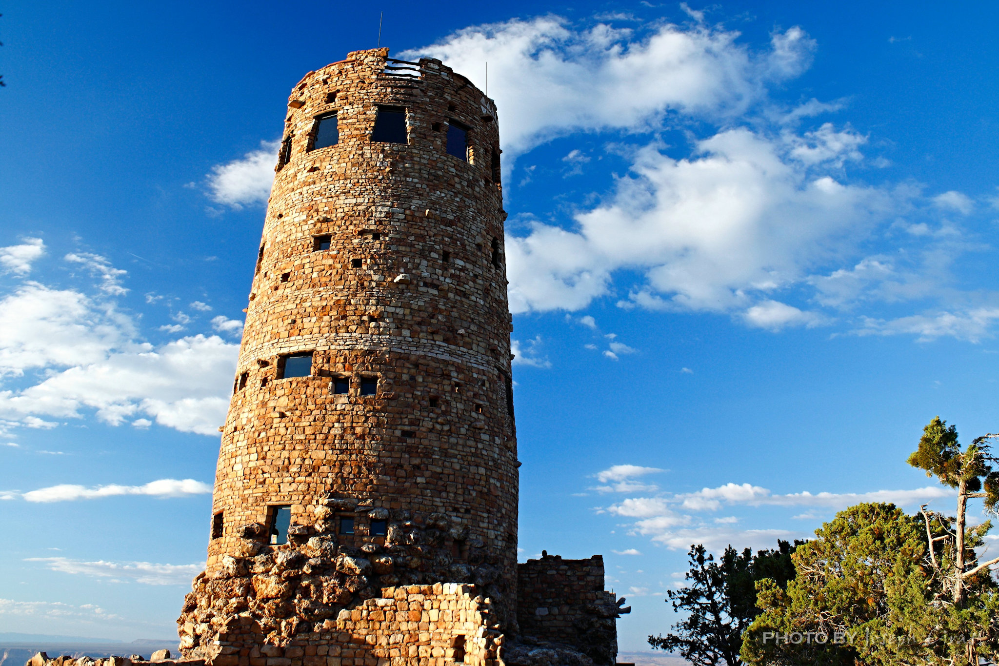
Settings: Canon EOS DIGITAL REBEL XS, ISO 200, f/5.6, 1/100 s, 20 mm.
Desert View Watchtower, South Rim Grand Canyon National Park.
Desert View Watchtower, Grand Canyon National Park
We arrived at the South Rim of the Grand Canyon just before sunset. We spent the last couple of nights camping and hiking along the North Rim of the Grand Canyon and would be spending time on the South Rim. I have been to the Canyon before, but never from this entrance.
From the National Parks Service: “A National Historic Landmark, the Watchtower was constructed in 1932.The design by Mary Colter, is based on the architecture of the Ancestral Puebloan people of the Southwest. This particular tower was patterned after those found at Hovenweep and the Round Tower of Mesa Verde.”
We have been to Hovenweep and to Mesa Verde and agree with that statement.
Settings: Canon EOS DIGITAL REBEL XS, ISO 200, f/16, 1/400 s, 49 mm.
The Four Corners Monument marks the quadripoint in the Southwestern United States where the states of Arizona, Colorado, New Mexico, and Utah meet. It is the only point in the United States shared by four states.
Four Corners USGS monument
Tuesday, 03/08/2022: Posted photo — Great Sand Dunes National Park and Preserve.
Settings: Canon EOS DIGITAL REBEL XS, ISO 200, f/13, 1/800 s, 90 mm.
Great Sand Dunes National Park and Preserve, Mosca, CO.
One of the amazing things about the Great Sand Dunes is that you can see them from miles away. As you turn off the main road and head towards the dunes, they are right in front of you. We spent the day hiking the dunes pretending we were in a desert. When you look at this photo, you see a couple of dots in the sand. Those are people. The sand was hot. According to Park Service, the sand surface can reach 150 degrees F (65 degrees C) on a summer afternoon or drop to minus 20 degrees F (minus 29 degrees C) on a winter night. It was close to the 150 degrees when we were walking on the sand.
Sand Dunes with the Sangre de Cristo Mountains as a backdrop
From the National Parks Service: “The tallest dunes in North America are the centerpiece in a diverse landscape of grasslands, wetlands, forests, alpine lakes, and tundra. Great Sand Dunes National Park is a complex geologic story going back millions of years. Intense volcanic activity built the San Juan mountain range to the west of the modern day dunes and tectonic activity raised the Sangre de Cristo Mountains to the north and east.”
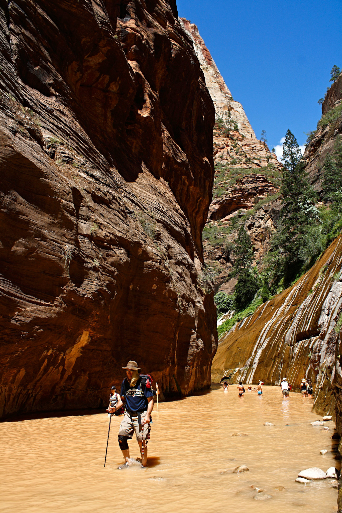
Wednesday, 03/09/2022: Posted photo — Hiking the Narrows.
Settings: Canon EOS DIGITAL REBEL XS, ISO 200, f/9, 1/2050 s, 18 mm.
Zion National Park Springdale, UT.
This is a photo my wife took of me as we were hiking the Narrows in Zion National Park. It was a refreshing hike on a hot summer day. When you hike the Narrows, you need to be very aware of the weather. Because it is so narrow, there is no escape route if there happens to be a flash flood.
Hiking in the murky waters of the Narrows in Zion National Park
From the National Parks Service: “The Narrows is the narrowest section of Zion Canyon. This gorge, with walls a thousand feet tall and the river sometimes just twenty to thirty feet wide, is one of the most popular areas in Zion National Park. You can see The Narrows by hiking along the paved, wheelchair accessible Riverside Walk for one mile from the Temple of Sinawava. If you wish to see more, you will be walking in the Virgin River. This can involve wading upstream for just a few minutes or it can be an all day hike.”
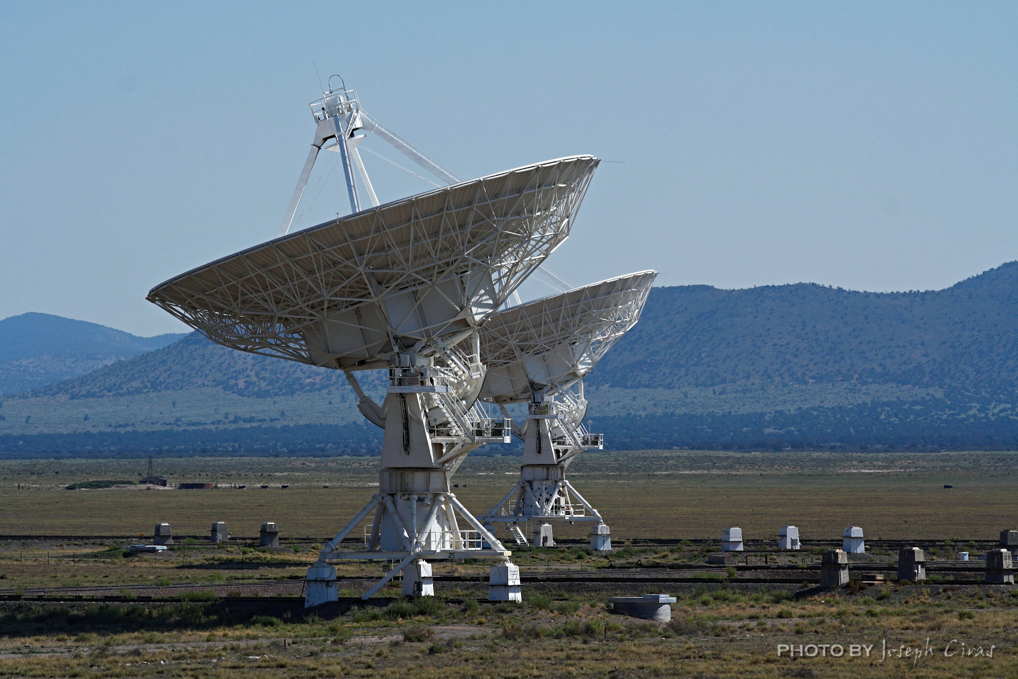
Thursday, 03/10/2022: Posted photo — NRAO Very Large Array.
Settings: Canon EOS DIGITAL REBEL XS, ISO 200, f/10, 1/800 s, 165 mm.
NRAO Very Large Array, Magdalena, NM.
Radio Antennas in the Very Large Array
One of the most interesting places to visit. As you can see from the description below, the array can be very large. When we visited, there were 26 radio antennas pointing in one direction and one pointing in an opposite direction. We thought that was strange. They told up that the odd one was scanning the sky.
“The Very Large Array, one of the world’s premier astronomical radio observatories, consists of 27 radio antennas in a Y-shaped configuration on the Plains of San Agustin fifty miles west of Socorro, New Mexico. Each antenna is 25 meters (82 feet) in diameter. The data from the antennas is combined electronically to give the resolution of an antenna 36 km (22 miles) across, with the equivalent sensitivity of a dish 130 meters (422 feet) in diameter.” — http://www.vla.nrao.edu/
Friday, 03/11/2022: Post photo — Owachamo Bridge.
Settings: Canon EOS DIGITAL REBEL XS, ISO 100, f/7.1, 1/125 s, 18 mm.
Owachamo Bridge, Natural Bridges National Monument, UT.
Owachomoa Bridge looking from below
Owachomo is the smallest and thinnest of the three natural bridges in the National Monument and is commonly thought to be the oldest. We had a great hike out to the bridge.
We like to travel to the lesser know parks. These parks are lesser know mostly because of location. They are not close to any major city or town. We like to say it is great to have a park to ourselves.
Saturday, 03/12/2022: Post photo — Spruce Tree House.
Settings: Canon EOS DIGITAL REBEL XS, ISO 200, f/5, 1/50 s, 20 mm.
Spruce Tree House, Mesa Verde National Park, CO.
From the National Park Service: “Spruce Tree House, the third largest cliff dwelling (Cliff Palace and Long House are larger), was constructed between about 1211 and 1278 CE by the ancestors of the Pueblo peoples of the Southwest. The dwelling contains about 130 rooms and 8 kivas (kee-vahs), or ceremonial chambers, built into a natural alcove measuring 216 feet (66 meters) at greatest width and 89 feet (27 meters) at its greatest depth. It is thought to have been home for about 60 to 80 people.”
Spruce Tree House cliff dwelling
We were lucky enough to get to the park prior to 2012 during one of our northern National Park tours. We were able to explore the Spruce Tree House. We went into some of the rooms and into the kivas. Due to the unstable cliff about the Spruce Tree House, the entire site was closed to the public in October 2015. We have visited the park since then since I have a relative that works at the park. We were able to obtain permits to do some backcountry hiking with my relative guide to some dwellings that are off limits to the public.
Settings: Canon EOS 60D, ISO 100, f/7.1, 1/640 s, 35 mm.
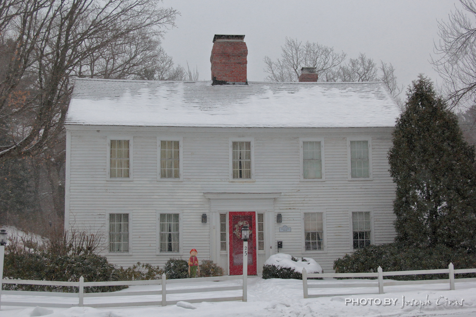
This is the first in what I hope will be a weeklong series of some of the historic houses around town. I will look for any information I can find on these houses. I have done a search of these housed prior to my starting my blog. There might me more information on them now.
The Squire Dusting house was built in 1810 and is located near the town commons.
Monday, 01/31/2022: Posted photo — Upton School.
Settings: Canon EOS 60D, ISO 200, f/7.1, 1/250 s, 35 mm.
“Westminster philanthropists Charles Upton and Frank Fenor donated the money and land to build the school, which opened in 1912 and taught all grades for the town. In 1927, it became crowded, and the last three grades were taught in neighboring towns, like Fitchburg and Gardner.
The grades got cut back again when the Oakmont School was built in 1960 for grades 7 through 12. The Upton School was supposed to close in 1993, when the Meetinghouse School was built. However, the roof of the new school building leaked and classes went on for an additional three months.” — Fitchburg Sentinel @ Enterprise, October 13, 2012.
Some of my relative remember going to school in the Upton Building. There still is some talks in town about what to do with the building. Should they renovate it, donate to some charity or organization, move a town office into it? Only time will tell.
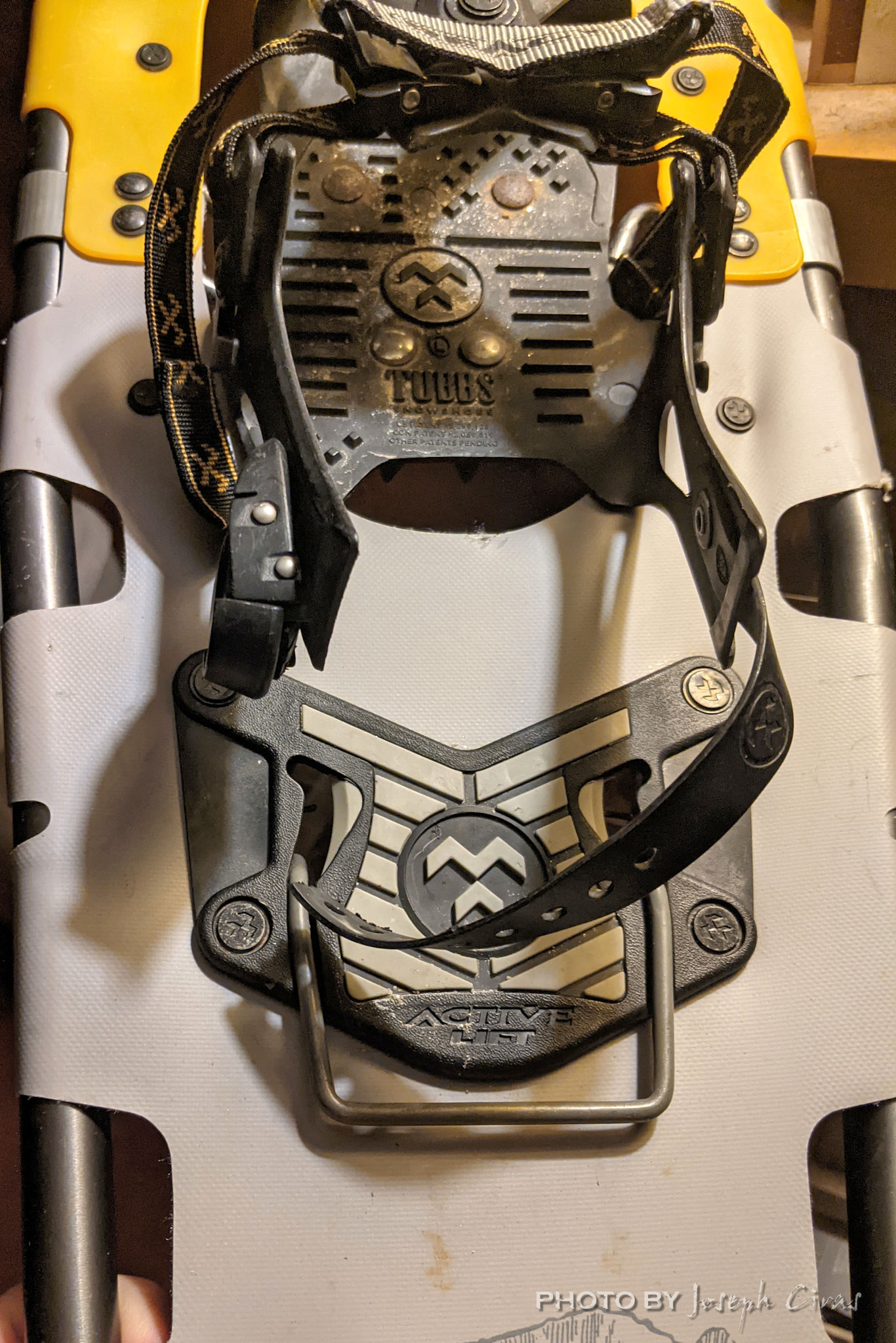
Tuesday, 02/01/2022: Posted photo — Broken.
Settings: Google Pixel 2, ISO 604, f/1.8, 1/40 s, 4 mm.
Last night was my weekly Monday night Wachusett Mountain hike. Snowshoes were not needed but did help on the hike. Without the snowshoes there would be some “potholing”. I made it to summit and part of the way down before the heal strap on my left snowshoe broke. I did not expect it to last that long on the hike. The strap broke once already last year, and I was able to make some adjustments to make it last longer. The good people at the Tubbs will be sending me replacement straps to install.
Pays to spend some money on snowshoes of you used them as much as I do in the winter. These are the pair that I am using hiking to work; on Wachusett Mountain and other local mountains; and in the White Mountains of New Hampshire.
Wednesday, 02/02/2022: Posted photo — 1815 Reverend Cyrus Mann House.
Settings: Canon EOS 60D, ISO 100, f/8, 1/125 s, 38 mm.
Year built: 1815
Here is a continuation of my historic houses around town week.
The view of Wachusett Mountain from the Rev. Cyrus Mann House in on the Westminster town seal.
One of the houses in Westminster Village-Academy Hill Historic District in Westminster, MA. The district was founded in 1734 and added to the National Register of Historic Places in 1983. I just love the look of this house along with the other houses in this district.
Thursday, 02/03/2022: Posted photo — Philip Bemis House.
Settings: Canon EOS 60D, ISO 400, f/6.3, 1/1000 s, 33 mm.
This house was built in 1759 by Philip Bemis who owned the Old Mill nearby. The Old Mill is now the Old Mill Restaurant. I go to the Old Mill often to photograph the duck and geese that live in the duck pond year-round. They have covered walkways at the Old Mill that frame a waterfall.
“History of the Old Mill:
From its earliest beginning, the Old Mill has served a useful purpose in the community. Originally a sawmill where logs were processed for the new homes of the neighborhood, the Old Mill and its whirling saw sang a song of progress and industry through five generations of ownership before its wheels were stilled and it fell into disrepair in the late 1800’s.
In 1921, the sawmill was converted into a tea-room and operated as such during the summer months by Miss Keough, until 1942 when war restrictions forced her to close. Upon his return from serving in World War II, Ralph Foster and his wife Ruth bought the Old Mill and reopened it as a restaurant, making it a year-round operation, thus the mill was reborn.” — http://www.1761oldmill.com/about.html
Friday, 02/04/2022: Post photo — Freezing Rain.
Settings: Canon EOS 60D, ISO 200, f/7.1, 1/50 s, 64 mm.
Once again, I need to pause my photo tour of the historic houses around town. We are in the middle of a rain/snow/sleet/freezing rain event, and I want to do as little driving as possible.
During a storm, I like to walk into work. Today I did not walk into work since the storm was mostly a heavy rain event in the morning and I wanted to get to work before the sleet and freezing rain arrived. If it is raining heavy and I was going to do a five-mile hike in the wood, or hike up a mountain, I would not mind the weather. Walking to work in the heavy rain is another story.
Other colleagues told me about all the accidents on the road when they arrived. Cars were off the road and a few of my colleague saw cars speeding down the highways and slipping off the road when they hit a patch of slush or ice. They came in after the change in weather. There was about an inch of slush in the parking lot at work. The maintenance people did a great job of keeping the parking lot clean.
I will wait for the rain to slow down before I go out and clean out my driveway and walkway.
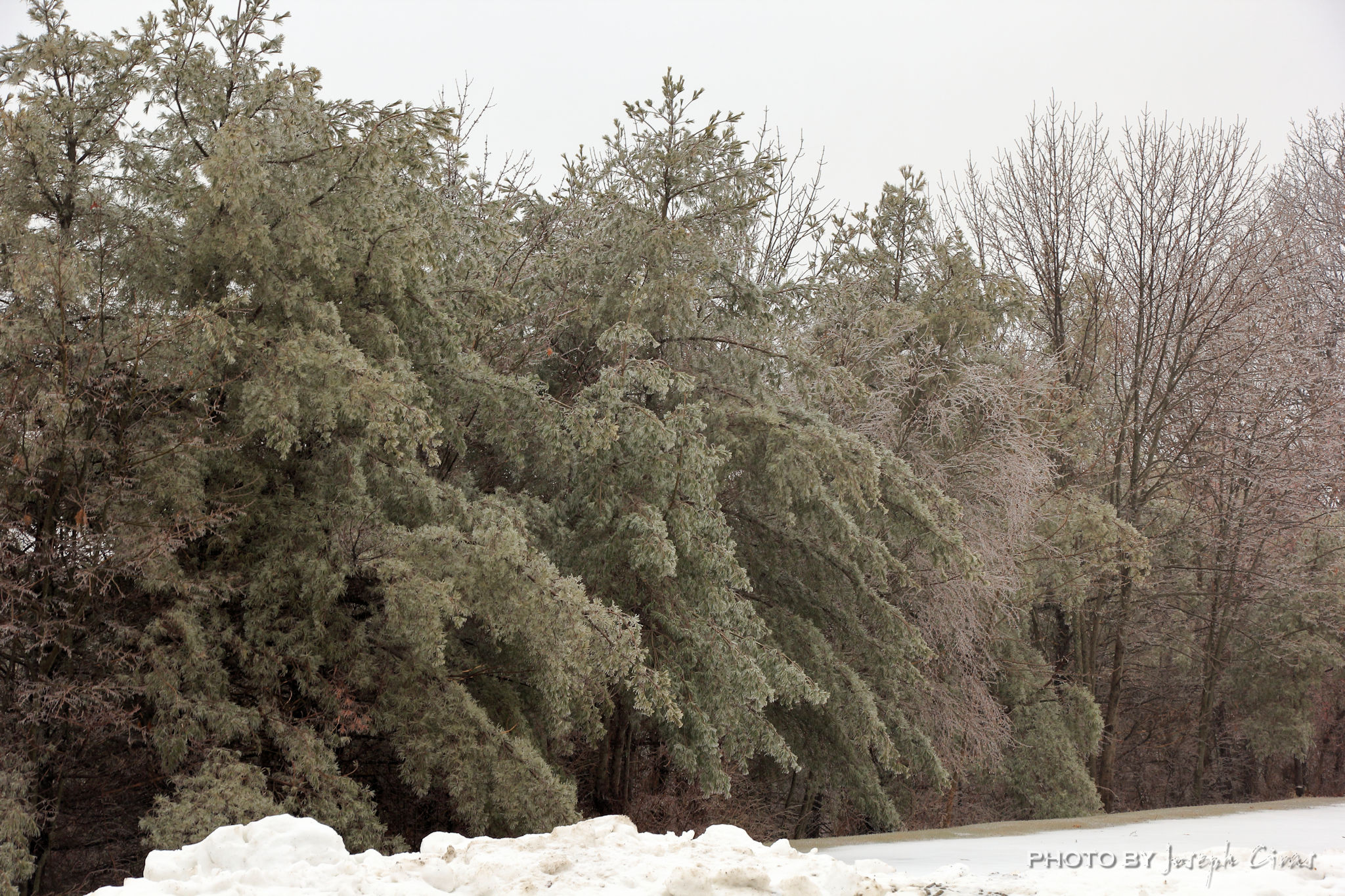
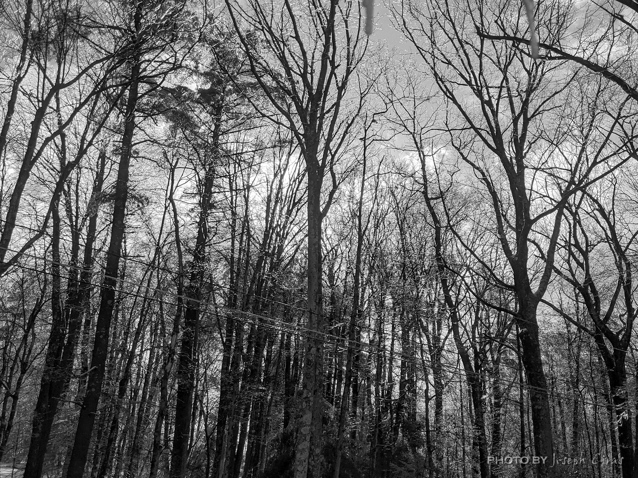
Saturday, 02/05/2022: Post photo — Black and White.
Settings: Google Pixel 2, ISO 252, f/1.8, 1/120 s, 4 mm.
Cool morning today. I left the house early to run some errands. I was planning on hiking Wachusett Mountain this morning and it turned out to be an afternoon hike.
During the day I liked the way the sun was glistering off the ice-covered trees, so I took this photo. I needed a black and white photo for a photo project I am working on, so I converted the photo to black and white.
Thank you for all the new views and likes from last week, it helps keep me inspired.
Happy New Year to all!
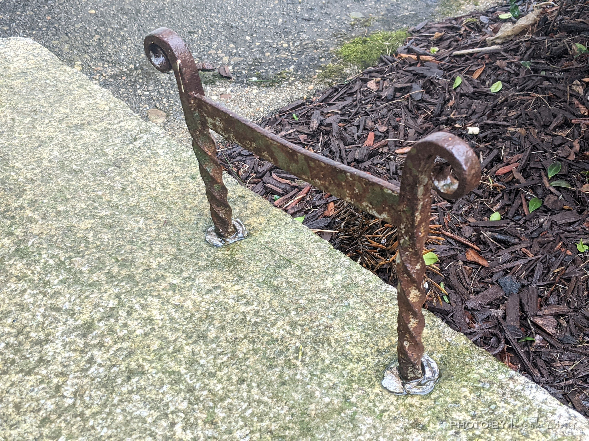
Sunday, 01/02/2022: Posted photo — Boot Scraper.
Settings: Google Pixel 2, ISO 193, f/1.8, 1/125 s, 4 mm.
Have you ever walked around a historic district and noted a metal “H” shaped object on the sides of stairways? Those are boot scrapers.
Before roads were paved, people walked, or rode horsed to their destination. When they did, their boots became muddy. To keep the insides of their houses clean, boot scrapers were place on the stairway leading to the entrances of the dwellings. Modern boot scrapers use a brush. You might have seen them at golf courses or visitor centers at national park or other hiking trails since they do a better job cleaning boots. They can get into the groves of the treads much better than just scraping boot on a metal rod.
Monday, 01/03/2022: Posted photo — Academy Hill.
Settings: Canon EOS 60D, ISO 200, f/7.1, 1/80 s, 35 mm.
Westminster Village–Academy Hill Historic District encompasses the historic first town center of my town, Westminster, MA. It was the commercial core of the town in the early-19th century. Centered at the junction Main and South Streets with Academy Hill Road, it contains fine examples of Colonial, Federal, and Greek Revival architecture, including the 1839 town hall. The district was listed on the National Register of Historic Places in 1983.
Shown in this photo is the gazebo that hosts events, such as band concerts, during the warmer weather and in the background is the Rev. Cyrus Mann House that was built in 1815.
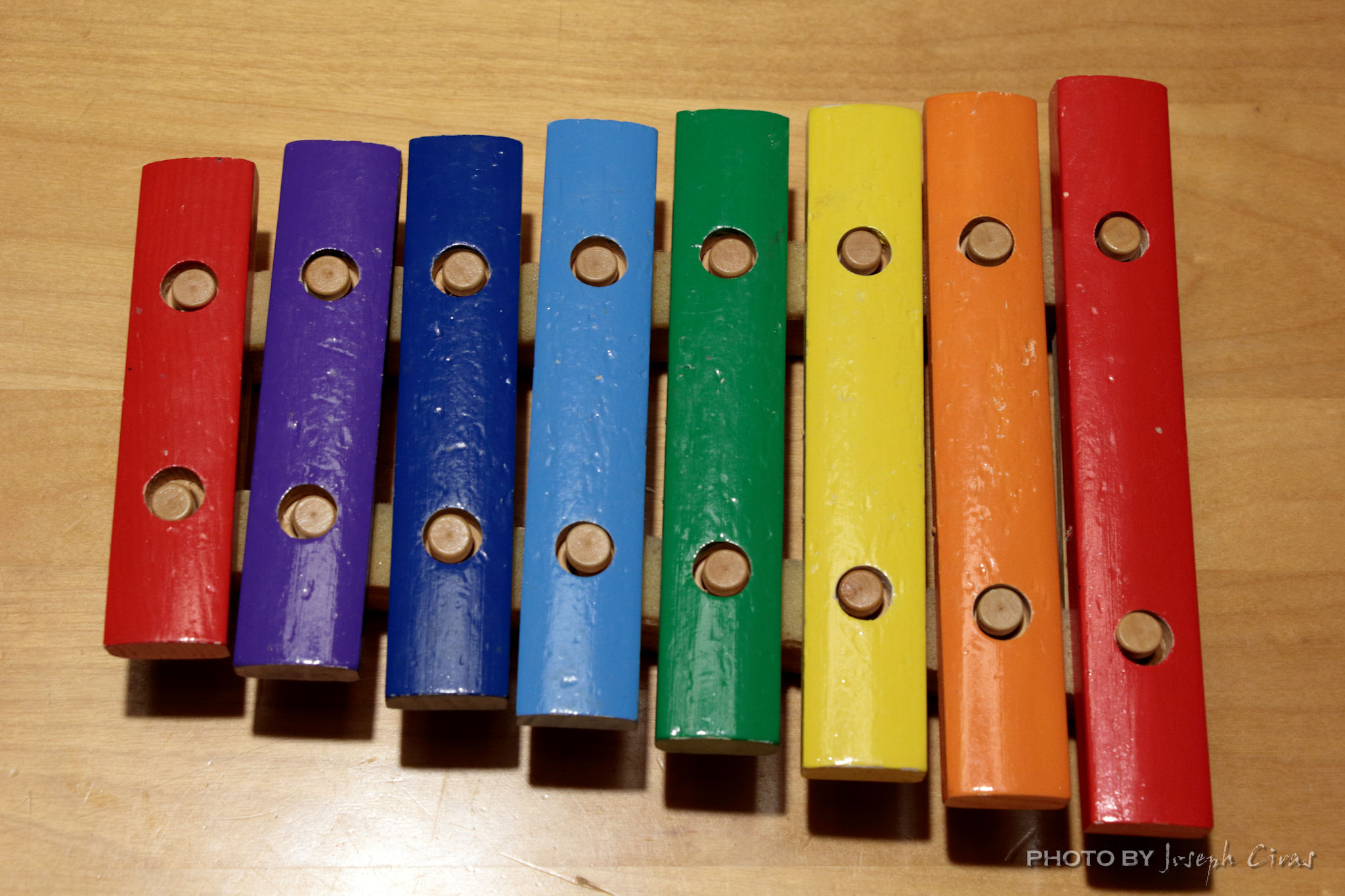
Tuesday, 01/04/2022: Posted photo — Xylophone.
Settings: Canon EOS 60D, ISO 800, f/7.1, 1/13 s, 50 mm.
This toy xylophone belongs to my son. He used it just over 20 years ago. It is now being used by my almost three year old grandniece. She had a great time this afternoon playing with it, naming the colors on it, and just making up songs.
How do I know it is a xylophone and not a glockenspiel? They both have bars. They’re both melodic pieces of percussion. You hit them with a stick. There is one notable difference: A Glockenspiel is made from metal and a xylophone is made with wood. Glock in German is Bell, ergo the Glockenspiel. The Xylophone is made of Xylos, aka wood. Metal bars and Wooden bars. Glock and Xylos.
Wednesday, 01/05/2022: Posted photo — Off to Play.
Settings: Canon EOS 60D, ISO 800, f/7.1, 1/25 s, 64 mm.
This compass is pointing to the direction of the mountains in the area. It is the direction that I do most of my playing or hiking and mountain climbing.
Historians think China may have been the first civilization to develop a magnetic compass that could be used for navigation. Chinese scientists may have developed navigational compasses as early as the 11th or 12th century. Western Europeans soon followed at the end of the 12th century.
“The First compass was invented in China during the Han Dynasty between the 2nd century BC and 1st century AD, (we don’t know precisely when). At first, it was used for divination, fortune-telling and geomancy, for finding precious gems and in Feng Shui but in time people discovered that it can be used for navigation and orientation. People knew about magnetite even before then, but it took centuries for it to get at least some purpose.” (http://www.historyofcompass.com/)
The compass in this photo does not work very well. It does not always point in the correct direction, so I use it only for demonstration purposes. It was defective from the first time I received it. REI was very nice to me and sent me a new working compass at no cost to replace this one.
Thursday, 01/06/2022: Posted photo — Sunrise.
Settings: Canon EOS 60D, ISO 400, f/7.1, 1/640 s, 85 mm.
Some day I take many photos for myself, other days I do not. Today was one of those days that I did not take many photos for myself. I took this photo at work. Not the best sunrise to photograph. I took it just incase I did not take another one for myself during the day. I was correct, I did not. This just proves that you should take a photo of anything during the day just incase you do not have the opportunity to take another.
Friday, 01/07/2022: Post photo — Tree in Snow.
Settings: Canon EOS 60D, ISO 200, f/7.1, 1/250 s, 50 mm.
Today it snowed. We did not get much, many five inches in this area, but it snowed all day. I walked into work and home from work. A great five mile round trip hike from my house to work and back. I am luck to live within walking distance of work with most of it being through the Midstate Trail. I did not bring my snowshoes since there was not going to be enough snow to use them so I only had my microspikes with me, just in case I needed them.
This photo was taken during the day while it was still snowing. There was going to be not much of an opportunity to take outside photos today and I did not want to take an indoor photo because I wanted to show the day as a snowy day for historical purposes.
Saturday, 01/08/2022: Post photo — Motor.
Settings: Google Pixel 2, ISO 332, f/1.8, 1/60 s, 4 mm.
This motor is off my father’s lathe. My father passed almost 29 years ago so the lathe has not been turned on for at least 25 years. Not that I have it, I plan on cleaning it up to use. The motor was made in 1952 by the name plate. It will be great to get it working and to turn some wood on my father’s old lathe.
“If I could tell the story in words, I wouldn’t need to lug around a camera.” — Lewis Hine
Thank you for all the new views and likes from last week, it helps keep me inspired.
This week’s post will have short descriptions each day since I am getting ready for Christmas.
Sunday, 12/26/2021: Posted photo — Ice on Mountain Laurel.
Settings: Canon EOS 60D, ISO 200, f/5.6, 1/25 s, 78 mm.
Another day of freezing rain today. The good news is that it was only in the morning. We postponed our Christmas gathering until today because of the bad weather we had yesterday.
When I went out to clear off the driveway and to warm up the car, I decided to take a photo of the ice off the mountain laurel that is in our yard.
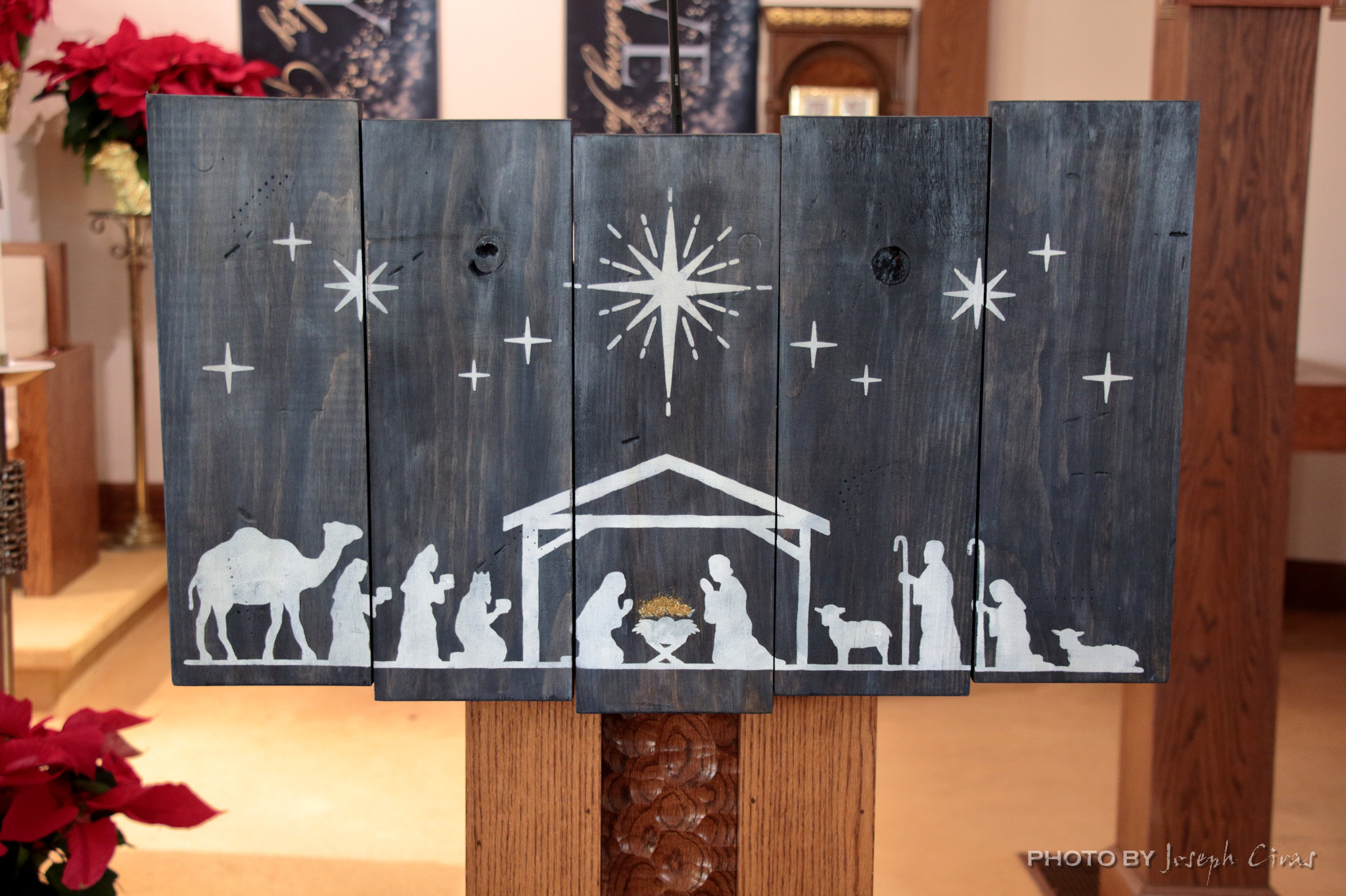
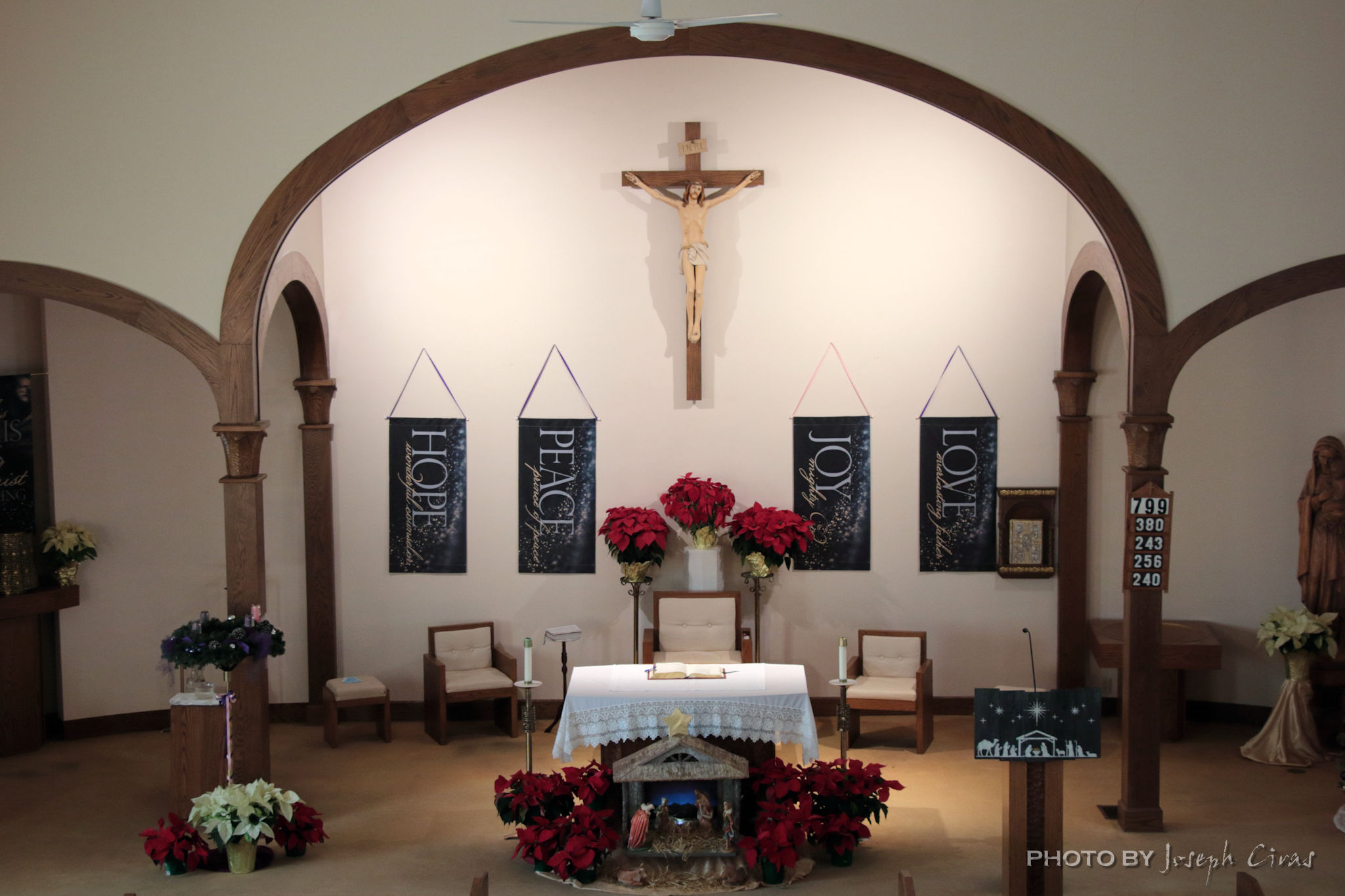
The other possible post for today was that of the nativity seen at church. Before mass today, I took photos of the crèche and the wooden hanging on the lectern. I have also taken a photo of the altar from the choir loft.
Settings: Canon EOS 60D, ISO 800, f/5.6, 1/1250 s, 91 mm.
Tonight’s challenge, hike Wachusett Mountain on ice covered trails.
Usually not a challenge for me and my experienced hiking partners, it is more challenging when you hike with a group of various abilities. Some of the people in the group have not hiked in the winter.
During the hike, I had on my “rock” microspikes because of the ice cover and not much snow. These spikes are inexpensive, so I do not mind if they get damaged during the hike. That is what happened tonight. One of the chains broke on them so I need to order a new pair. I use my “rock” spikes so that I do not damage my “good” microspikes on the trail. It is less costly for me to replace the “rock” spikes than the “good” spikes. My inexpensive spikes were purchased off Amazon and my “good” spikes are Hillsound Trail Crampon.
Tuesday, 12/28/2021: Posted photo — That Spot Again.
Settings: Canon EOS 60D, ISO 200, f/22, 1/10 s, 35 mm.
Had to run out and do some errands today. I went shopping during the day since it was a day off for me. Because it was daytime, I wanted to take a photo of the dam at Round Meadow Pond. This is a usual spot for me to take during the year and it is many people’s favorite location to see in my photos.
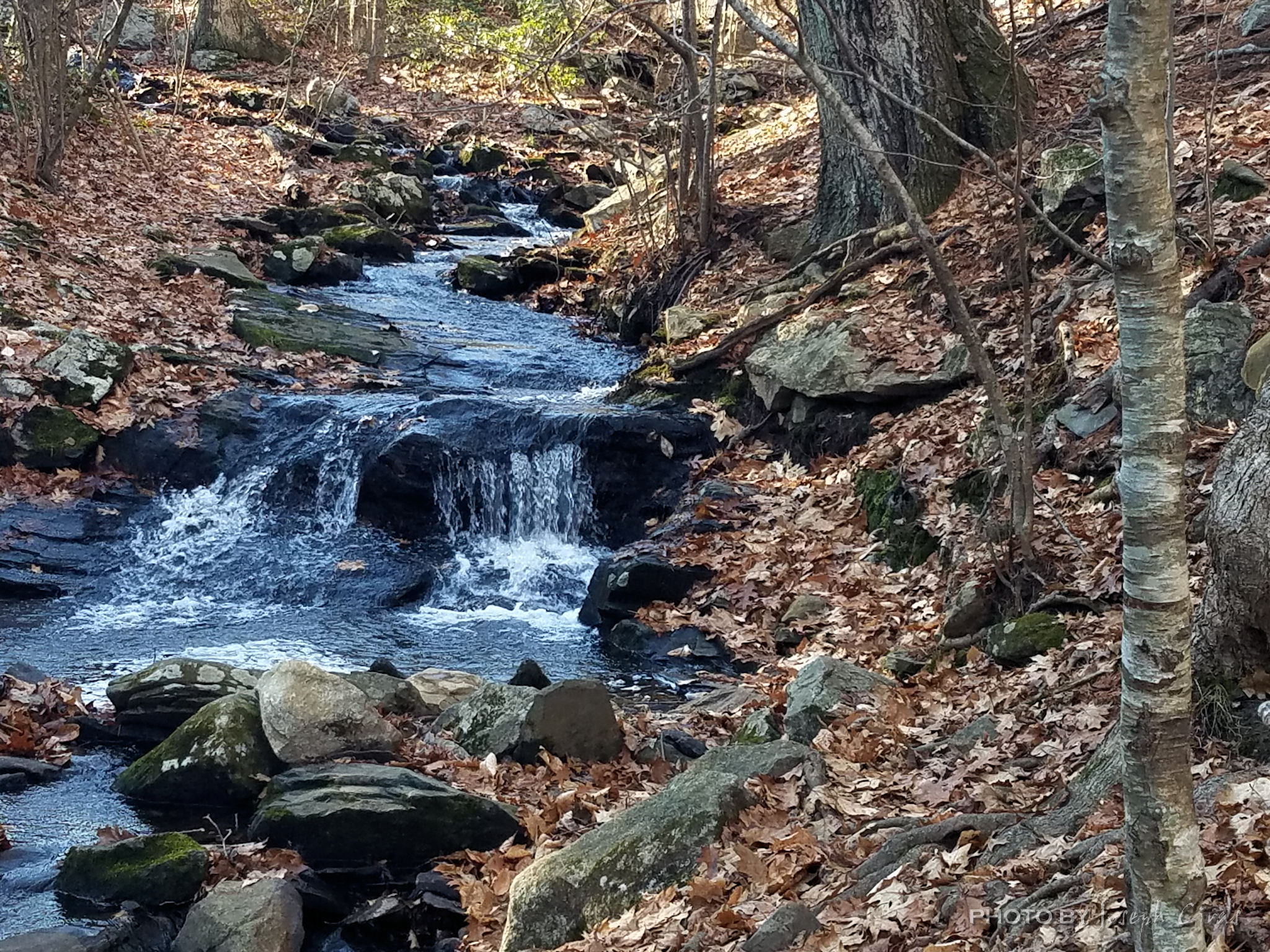
Wednesday, 12/29/2021: Posted photo — Top of the Cascade.
Settings: Canon EOS 60D, ISO 200, f/14, 1/10 s, 62 mm.
A few weeks ago, I did a hike with the AMC leaders and we went past this Cascade in Worcester, MA. Today I was in the city go do some cleaning at my mother’s house when I decided to stop by the cascade with my good camera to take a photo of the falls. This photo was a handheld photo by leaning on the bridge that overlooks the falls.
Thursday, 12/30/2021: Posted photo — Sand Dunes.
Settings: Canon EOS DIGITAL REBEL XS, ISO 200, f/13, 1/800 s, 95 mm.
Great Sand Dunes National Park and Preserve, Mosca, CO
The tallest dunes in North America are the centerpiece in a diverse landscape of grasslands, wetlands, forests, alpine lakes, and tundra. Elevations within the park and preserve range from 8,200 feet to 13,604 feet and keep changing due to the weather. In summer months during mid-day, sand temperatures can reach 150 degrees F. Hike during the morning or evening to avoid heat exhaustion and/or burned feet. Wear closed-toe shoes. This is something that we experienced in the park. We were there in the summer of 2012 and could feel the heat through our shoes.
An amazing thing about the park is that you can see the dunes and the Sangre de Cristo mountains from miles away. When you turn off the main road to the access road, there they are.
Our national parks are wonderful, and everyone should have the opportunity to explore them all.
Friday, 12/31/2021: Post photo — Mom.
Settings: N/A
This year my mother passed at age 95. I did not know what photo to post for the last one of the year, saw a photo of my mother, and posted the photo of her with all her boys.
For your information, here are the final count of photos for the year 2021:
Total
Portrait
6
Still Life
82
Landscape
105
Food
8
Sports
9
Wildlife
25
Macro
5
Event
11
Documentary
1
Weather
35
Architectural
22
Long exposure
8
Flowers
48
Saturday, 01/01/2022: Post photo — Cushion.
Settings: Google Pixel 2, ISO 556, f/1.8, 1/120 s, 4 mm.
Happy New Year! The start of year 13 of my project. I started on January 1, 2010 and have been taking and posting a photo a day.
The seat cushion on my wife’s aunt’s couch. We had our annual gathering at her house. I normally post a photo of the sunrise on New Year’s morning, but the weather had something to say about that.
“It is more important to click with people than to click the shutter.” — Alfred Eisenstaedt
Thank you for all the new views and likes from last week, it helps keep me inspired.
Sunday, 12/12/2021: Posted photo — Stream.
Settings: Samsung SM-G930V (Galaxy S7), ISO 50, f/1.7, 1/154 s, 4 mm
“The Cascades is made up of several parcels of land: Boynton Park, Cascades West, Cascades East, Cascades Park, and Cascading Waters. Most of the area is wooded, but there is a meadow in Cascades West that has been enlarged to expand the opportunities for wildlife habitat. Several trails follow along streams and there are vernal pools that can be explored in the Spring. Views of the falls are spectacular in the Spring or after a heavy rain.”https://www.gwlt.org/lands-and-trails/four-town-greenway/cascades/
When I was growing up in the city of Worcester, this trail system did not exist. It was established in 1991 and completed in 2005 by the Greater Worcester Land Trust. What a great trail to have in the city and a great location for families to get outdoors and explore nature and the hidden wonders of the city.
This was my first time hiking in the Cascades. I passed the trailheads many times when I was driving home from my mother’s house and have wondered how long the trail system was and why was it called the Cascades. The Appalachian Mountain Club (AMC) had a leadership meeting on the trail ending with a four mile hike on the trail system. At one of the trailheads is the AMC equipment hut. Part of the leadership trailing was to learn about the equipment hut and how to access its resources. It is place that equipment can be borrowed by families or individuals that are just starting out with outdoor activities and need to borrow equipment. It is a great way for those in the city who cannot afford the proper equipment to borrow some to be used in a guided hike or camping trip.
This photo is one of the many cascades along the trail. I only had my cell phone with me so please excuse the quality of this photo. I will be going back with my good camera to take better photos.
Monday, 12/13/2021: Posted photo — Ornament.
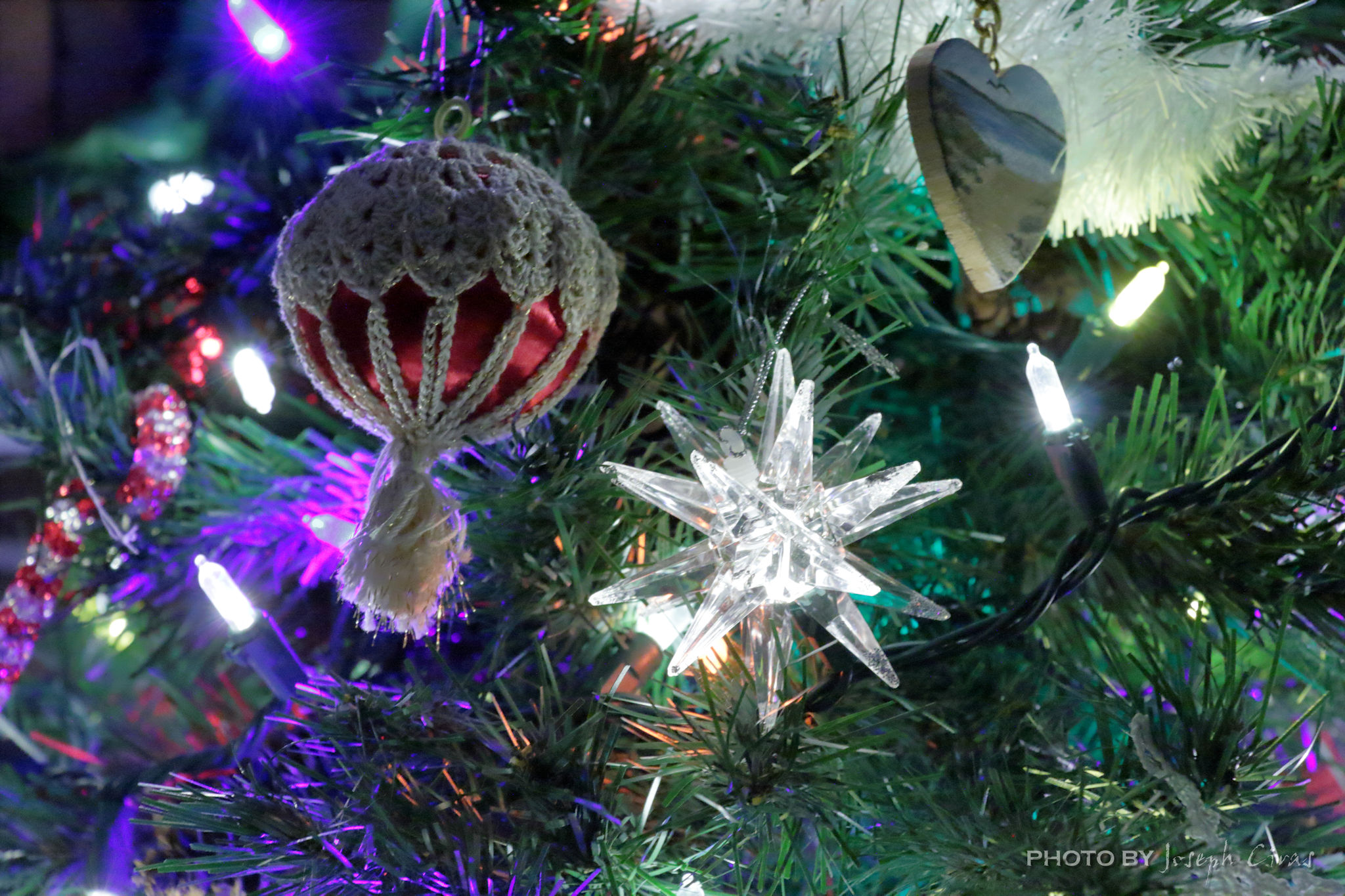
Settings: Canon EOS 60D, ISO 3200, f/7.1, 1/20 s, 98 mm.
This is the first photo I took with my new lens. My old lens was having issues focusing past 35 mm so I needed to replace it.
Thought to have originated in 16th century Germany, the first ornaments were nothing like what we know today. The ‘modern’ Christmas tree tradition is thought to have originated in 16th century Germany, where small evergreen trees were decorated with the likes of candles, apples, nuts, and berries as “Paradise trees” in church plays. Over time, devout Christians integrated these decorated trees into their homes during the holiday season. The tradition, which became a Christian ritual, began to spread across Europe. (https://theculturetrip.com/europe/germany/articles/a-brief-history-of-the-christmas-ornament-3/)
There is nothing particularly interesting about these ornaments. I just took my camera, pointed it at the tree, and took this photo.
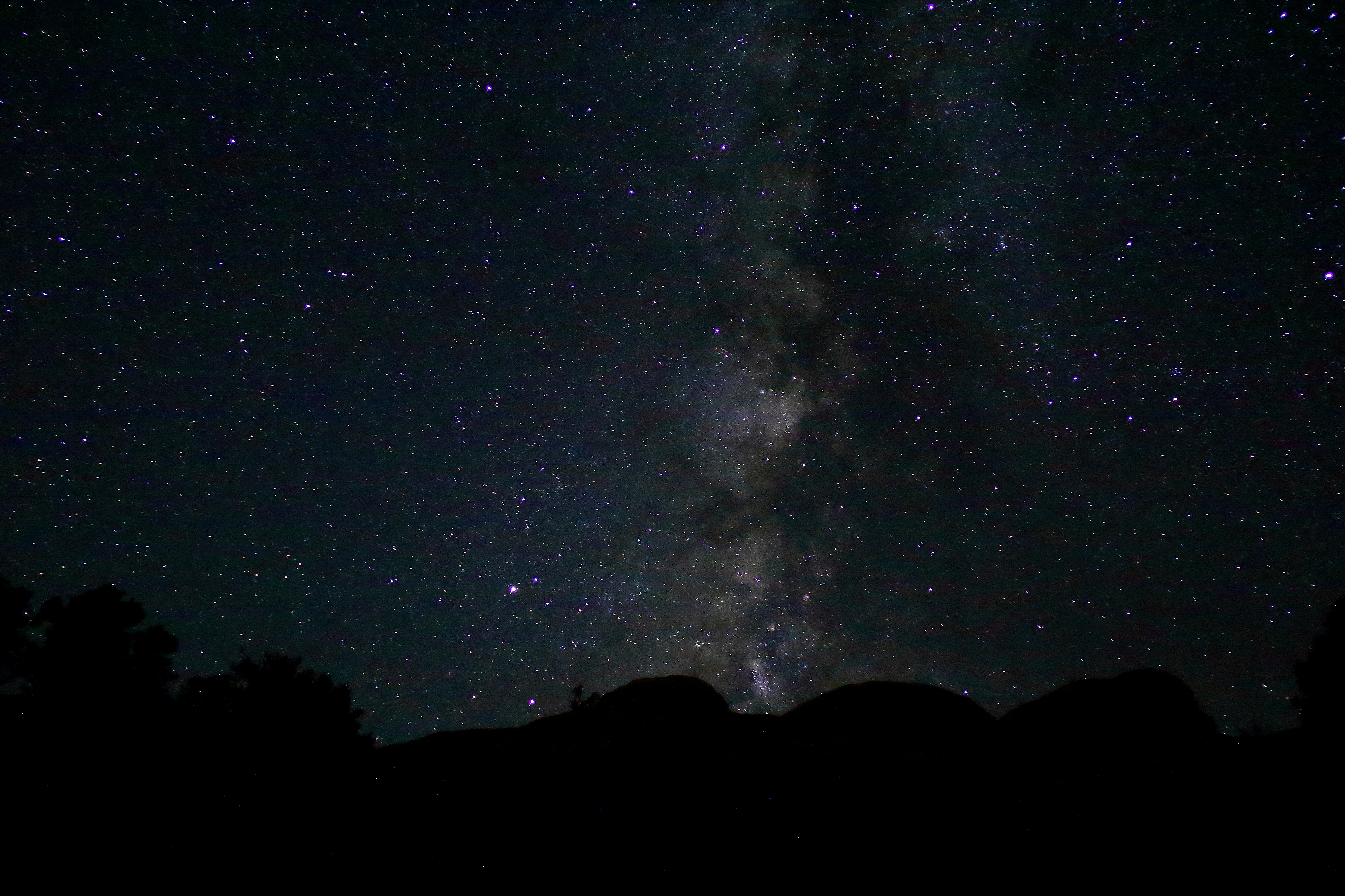
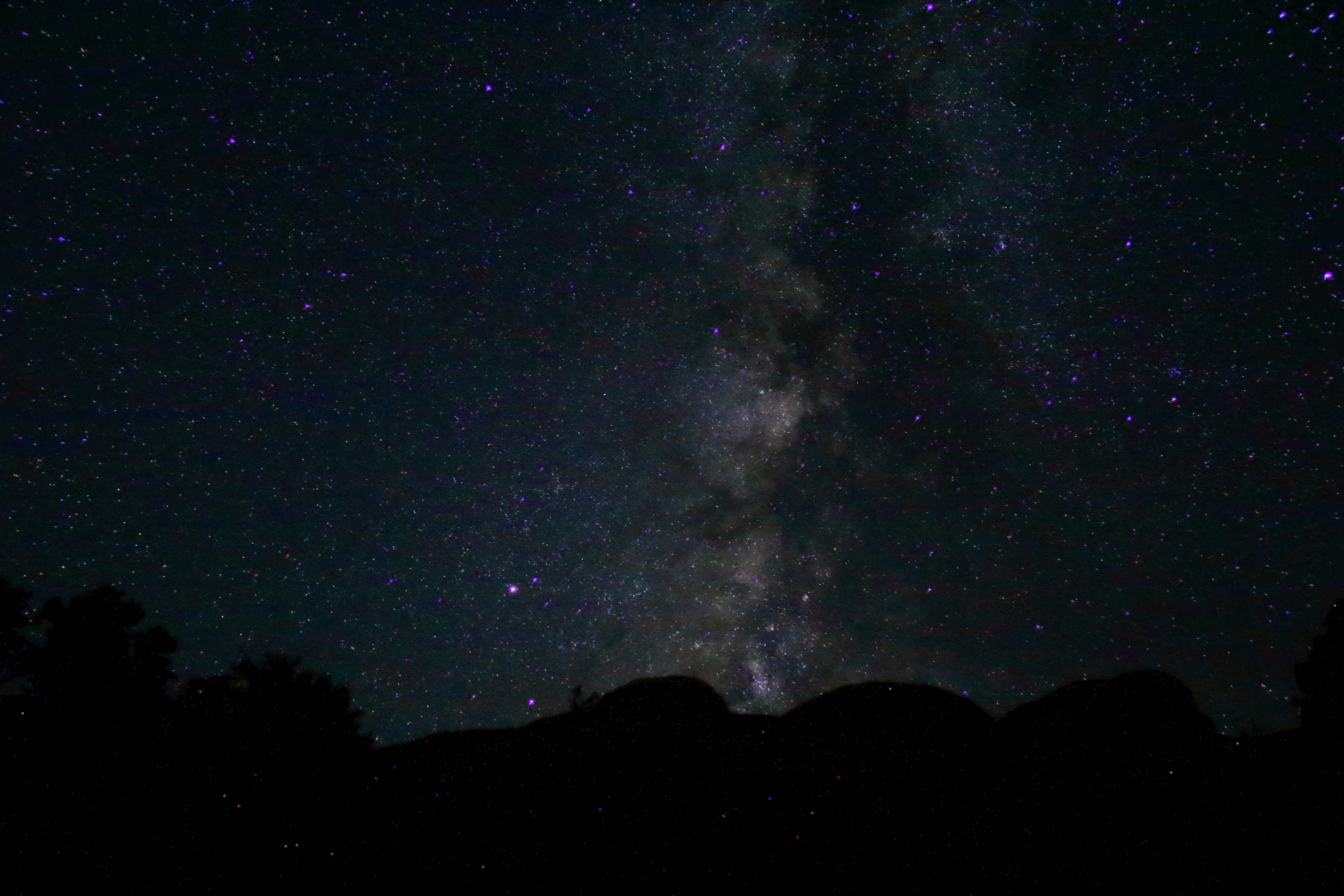
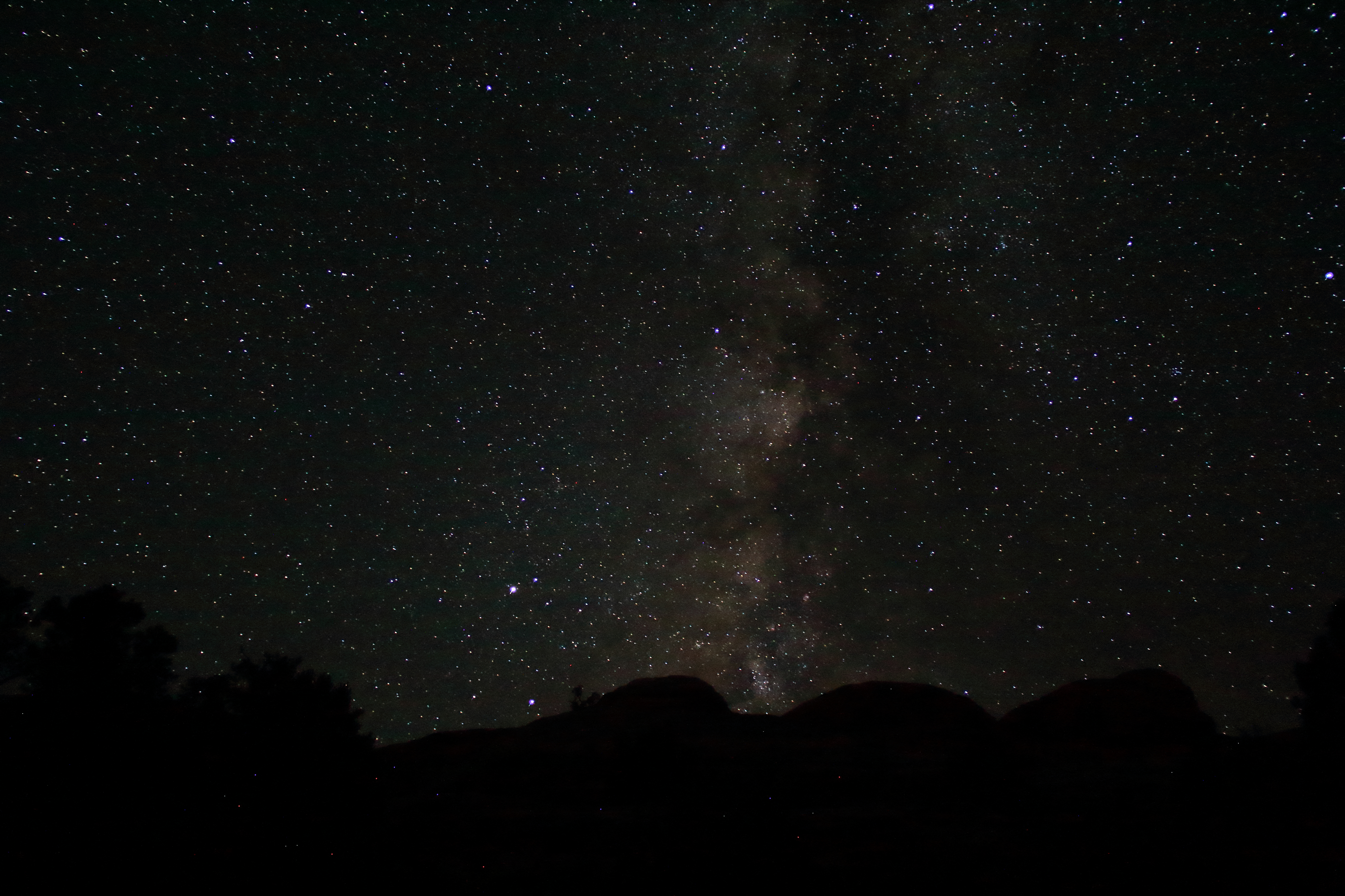
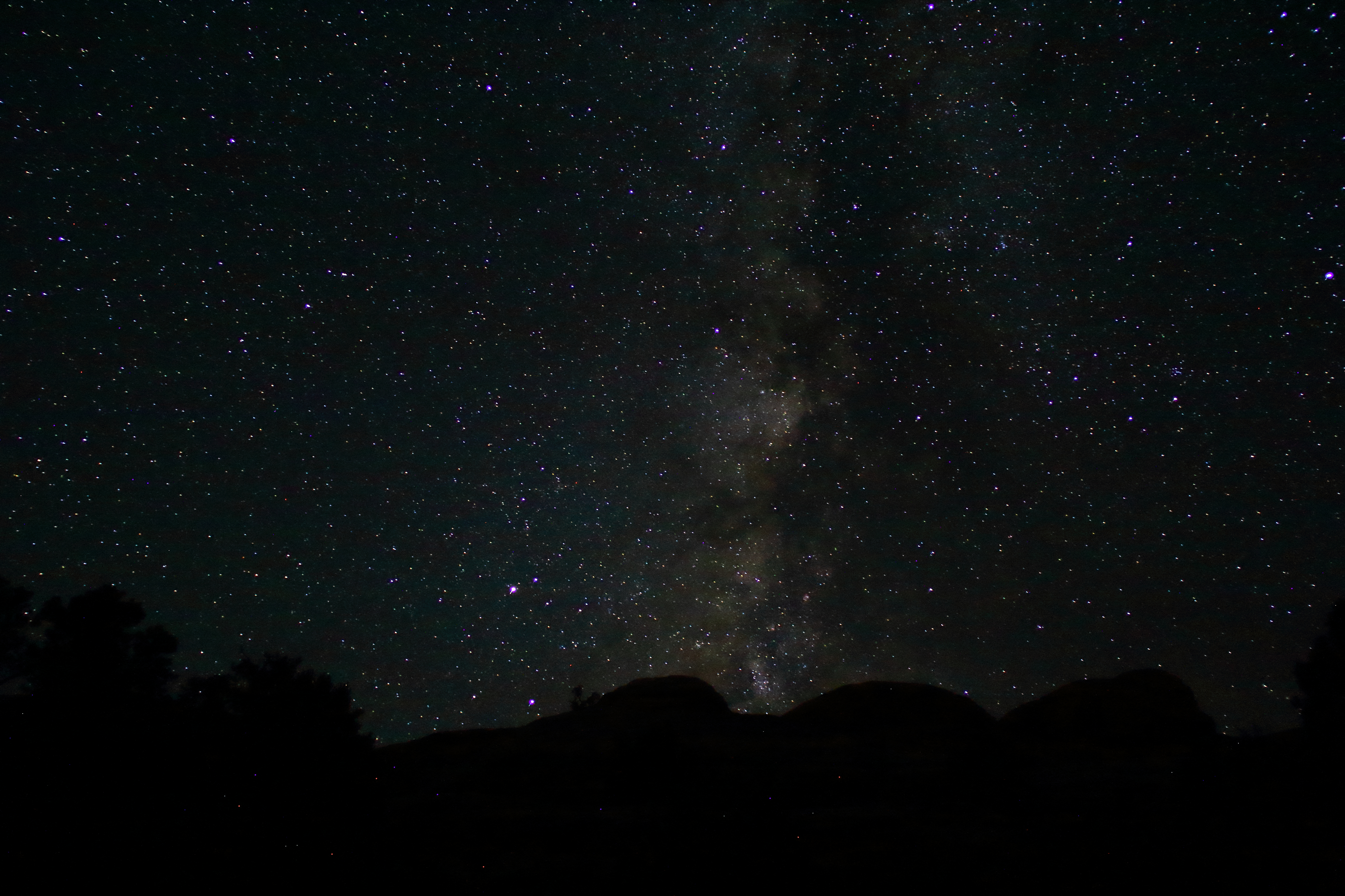
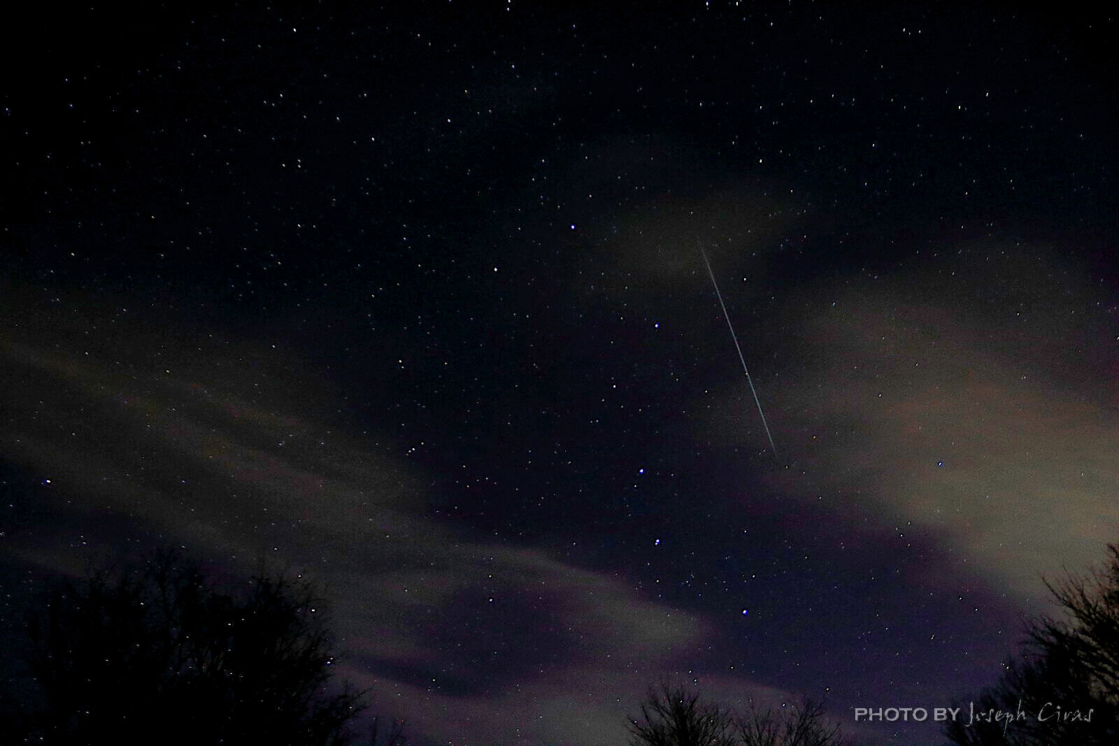
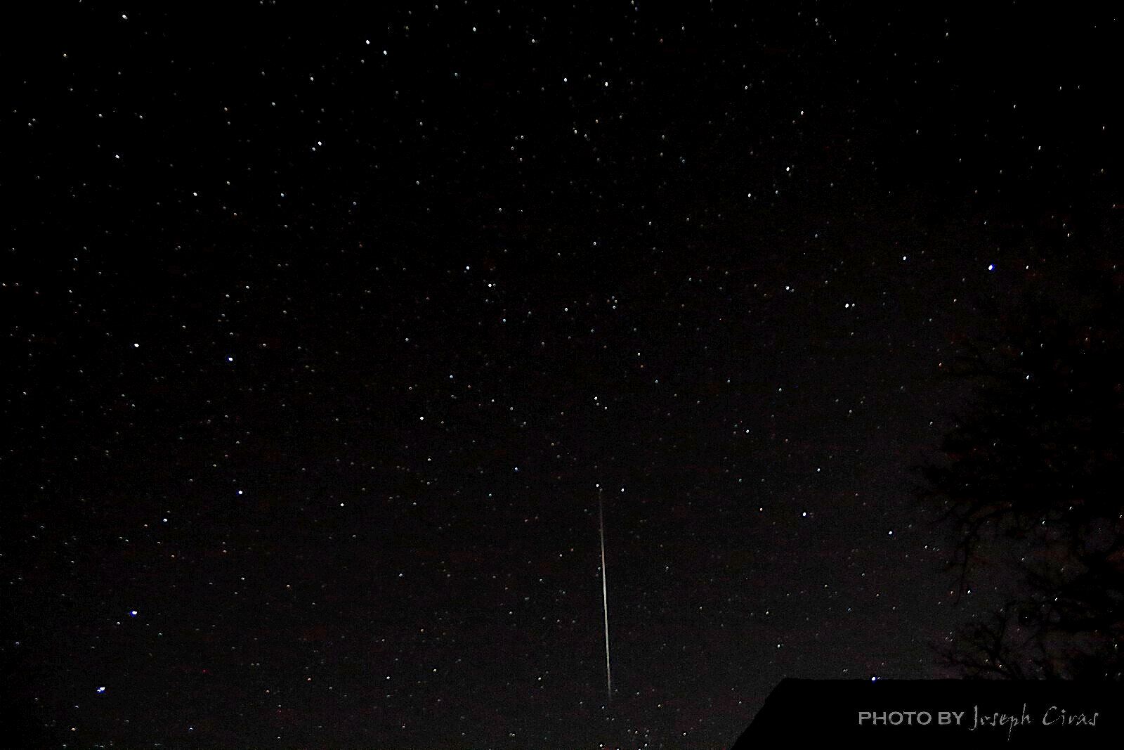
Tuesday, 12/14/2021: Posted photo — Geminids.
Settings: Canon EOS 60D, ISO 3200, f/9, 14 s, 18 mm.
“The Geminids are considered one of the best meteor showers every year because the individual meteors are bright, and they come fast and furious. The Geminid meteor shower is nearly 200 years old, according to known records — the first recorded observation was in 1833 from a riverboat on the Mississippi River — and is still going strong. In fact, it’s growing stronger. That’s because Jupiter’s gravity has tugged the stream of particles from the shower’s source, the asteroid 3200 Phaethon, closer to Earth over the centuries.”https://www.space.com/34921-geminid-meteor-shower-guide.html
I was up this morning at 2:30 ET to watch the Geminids. What a spectacular show! I was planning on being outside for an hour before going back to bed. I was watching the show until 4 a.m. before taking a short nap to get up for work at 4:30 a.m. I did see some of the meteors during last night’s hike. They were not very bright since the moon did not set until 2:41 a.m. with the peak of the Geminids at 2:40 a.m.
One of the questions was were to direct my camera. I placed it heading north, then heading south, and then to the east. I was pointing it in the direct of the greatest activity at the time. The photo that I posted, the one where the meteor underlines the Big Dipper, was with my camera pointing north. The other photo, the one with the roofline of my house, was with the camera pointing east. There were no bright meteors in the photos with my camera facing south. This is the east facing photo.
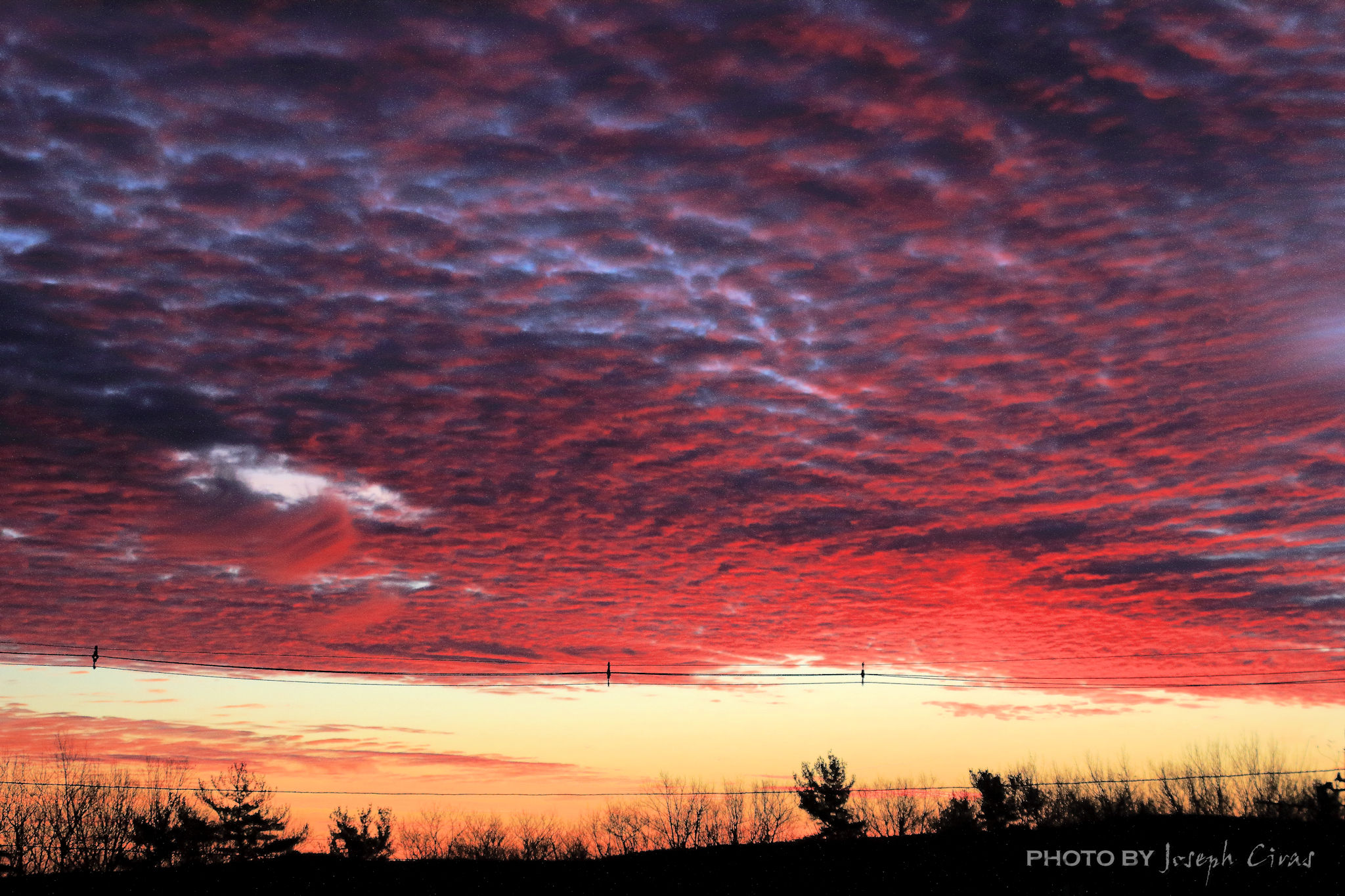
Wednesday, 12/15/2021: Posted photo — Sunrise.
Settings: Canon EOS 60D, ISO 400, f/5.6, 1/400 s, 50 mm.
Last week I posted a photo of the sunset from my office. Today I am posting a photo of the sunrise.
I was going between buildings this morning and watching the sunrise. I saw different colors in the woods around the property and was looking at the clouds changing color. When I got back to my office, I went to an eastern facing window and looked at the clouds.
This photo is what I saw when looking out the window.
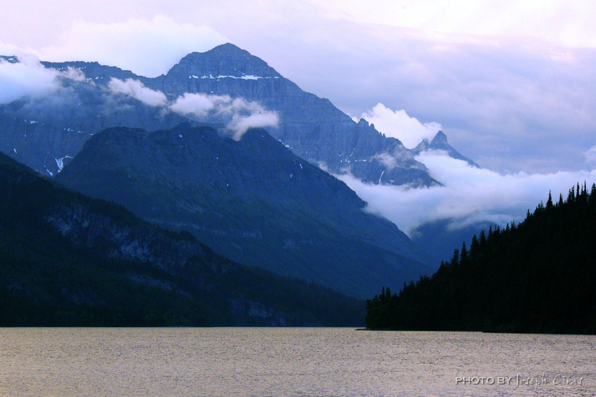
Thursday, 12/16/2021: Posted photo — Waterton Lake Sunset Alberta.
Settings: Canon EOS 60D, ISO 100, f/5.6, 1/1000 s, 25 mm
Waterton Lakes National Park is in southern Alberta, Canada, bordering Montana’s Glacier National Park. We camped there a few years ago after sending time in Glacier.
I took this photo the first night we were at the park. I took it at the blue hour. You need to search my previous blogs for the definition of blue hour as it pertains to sunsets. I was able to post edit this photo to make it look like what I saw. Most times the camera will wash out photos or make them look different that that you see. This proves the adage that you can never justify the colors that you can see with a photograph.
Friday, 12/17/2021: Post photo — Off We Go.
Settings: Canon EOS 60D, ISO 100, f/7.1, 1/1000 s, 121 mm
Off to Chicago Midway we go!
I was driving around this afternoon and stopped by an airport to watch the planes. It is very relaxing to see the plans take-off and land. Even after studying aerodynamics, I am still in wonder to see a plane fly. I know the time that I took this photo and then went to the airports website to see were that flight was heading. I took photos of the plans to practice AI Servo focusing.
The focus modes on my camera are:
ONE SHOT : One-Shot AF
AI FOCUS : AI Focus AF
AI SERVO : AI Servo AF
[One-Shot AF] for Still Subjects: Suited for still subjects. When you press the shutter button halfway, the camera will focus only once.
[AI Servo AF] for Moving Subjects: This AF mode is for moving subjects when the focusing distance keeps changing. While you hold down the shutter button halfway, the subject will be focused continuously. When you use this focus mode, the camera does not “beep” when the object is in focus, so you need to trust your skills.
[AI Focus AF] for AI Focus AF switches the AF mode from One-Shot AF to AI Servo AF automatically if the still subject starts moving. AI Focus AF mode is one that I do not use, and do not recommend using. It does not work very well.
Saturday, 12/18/2021: Post photo — Statehouse
Settings: Samsung SM-G930V (Galaxy S7), ISO 50, f/1.7, 1/154 s, 4 mm
The statehouse in Columbus OH. My nephew was the lead male in a ballet across the street today. He is 14 years old and is a great dancer. We saw the show twice. Great show.
“The camera is an excuse to be someplace you otherwise don’t belong. It gives me both a point of connection and a point of separation.” — Susan Meiselas
Thank you for all the new views and likes from last week, it helps keep me inspired.
Sunday, 11/28/2021: Posted photo — Summit of Mt Norwottuck.
Settings: Samsung SM-G930V (Galaxy S7), ISO 50, f/1.7, 1/268 s, 4 mm
Mount Norwottuck or Mount Norwottock, 1,106 feet above sea level, is the highest peak of the Holyoke Range. It was the first stop today. The second one was Long Mt at 920 feet. Not tall mountains, but the hike was 9 miles in length. Mount Norwottuck received its name from Edward Hitchcock, a former professor of geology at Amherst College. Hitchcock coined the term “Scenographical Geology” in 1841 to describe the dramatic geologic landscape of the Holyoke Range. Originally called Hilliard Knob, Hitchcock applied the Native American name Norwottuck to the mountain. Norwottuck is the Indian name of the village of Hadley.
Reference mark at on the summit of Mount Norwottock. The reference mark points to the summit.
An interesting fact about the Holyoke Range is that it is a Transverse Range. The mountain range runs east to west. There are two other major mountain ranges that are transverse in the United States. They are the Transverse Ranges in California and the Uinta Mountains in Utah.
Today would have been my mother’s 96th birthday. She passed away July 17 this year, so this is the first birthday without her. She is with my father who passed in 1993 and my daughter who passed in 1992. They get to meet their granddaughter together and celebrate their birthdays together for the first time in 28 years. My father would have turned 99 a few days ago.
Hiking clears your mind. Hiking with friends is very therapeutic.
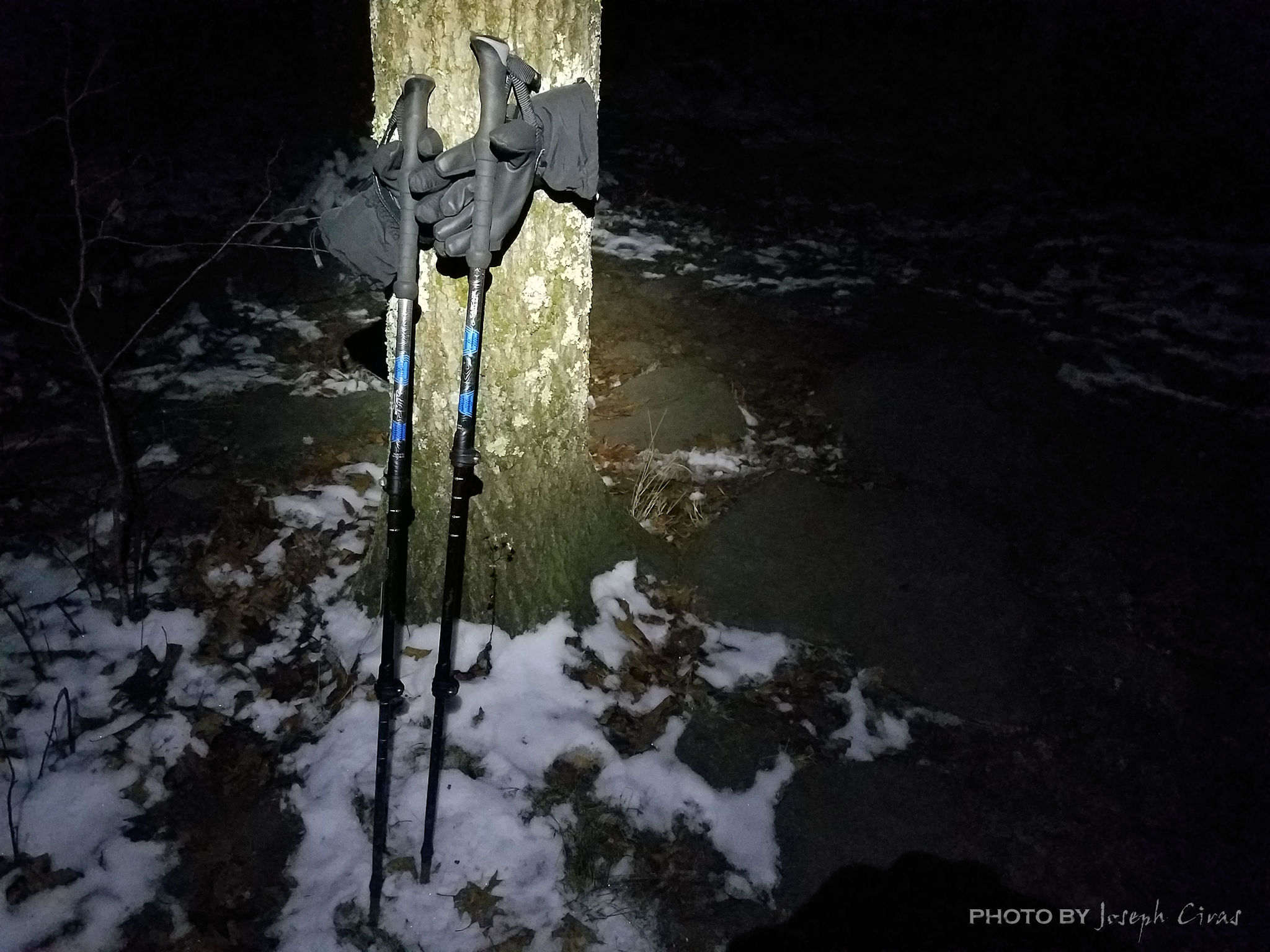
Monday, 11/29/2021: Posted photo — Poles Against a Tree.
Settings: Samsung SM-G930V (Galaxy S7), ISO 1000, f/1.7, 1/10 s, 4 mm
Monday nights is hiking night. I hike with a Meetup group on Mondays for a few months now. It is a good group to hike with since the pace is a little faster than other groups that I have hiked with in the past.
My poles at the junction of the Jack Frost and High Meadow Trails on Wachuestt Mountain
Tonight’s hike was in the cold and dark. The temperature was in the high 20s (F). It was the first time that I used my microspikes to hike with this year. I did not need to use them, but I did not know the trail conditions on one of the hills on the hike and I wanted to get ready for possible ice. We did get snow last week and the trails were snow covered the ground was frozen.
Why do I hike at night? I hike at night for the peacefulness of it. Even with a group, your senses are challenged, and you are more aware of your surroundings. As a leader for the hike, I keep my eyes and ears open for the less experienced people in the group.
As you can see from the photo, it was cold. I wore my gloves and not my -30 F mittens for this hike. Dressing is layers for winter hiking is also important, so you do not overheat or become too cold. You should have at least three layers. A base layer (underwear layer) that wicks sweat off your skin, a Middle layer (insulating layer) that retains body heat to protect you from the cold, and an outer layer (shell layer) that shields you from wind and rain. Here is a website that describes layering, https://www.rei.com/learn/expert-advice/layering-basics.html.
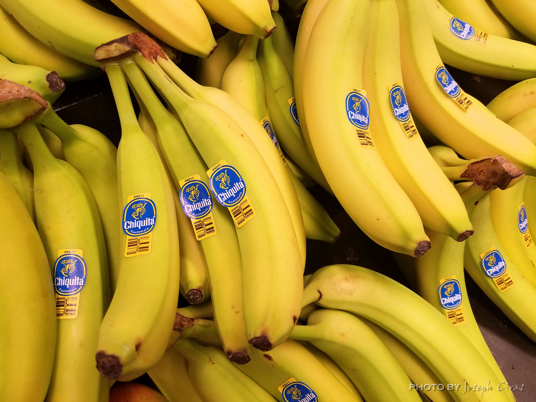
Tuesday, 11/30/2021: Posted photo — Yes, We Have No….
Settings: Samsung SM-G930V (Galaxy S7), ISO 80, f/1.7, 1/120 s, 4 mm
“Yes! We Have No Bananas” was written by Frank Silver and Irving Cohn and was published March 23, 1923. “The story goes that one day in 1922, songwriting duo Frank Silver and Irving Cohn were on their way to work in New York City when they stopped for a snack. At a greengrocer’s, the Greek immigrant owner told the tunesmiths in his broken English, “Yes! We have no bananas today.” The reason the grocer had no bananas? A blight in Central America had caused a shortage.” (https://www.mentalfloss.com/article/31253/music-history-3-yes-we-have-no-bananas)
Bannanas
I thought about titling this photo “Going …” after the expression that has its roots on American college campuses in the 1960s. It is believed that the term going bananas is a term that evolved from the idiom going ape, which also means to go crazy, to explode with anger or to erupt with enthusiasm.
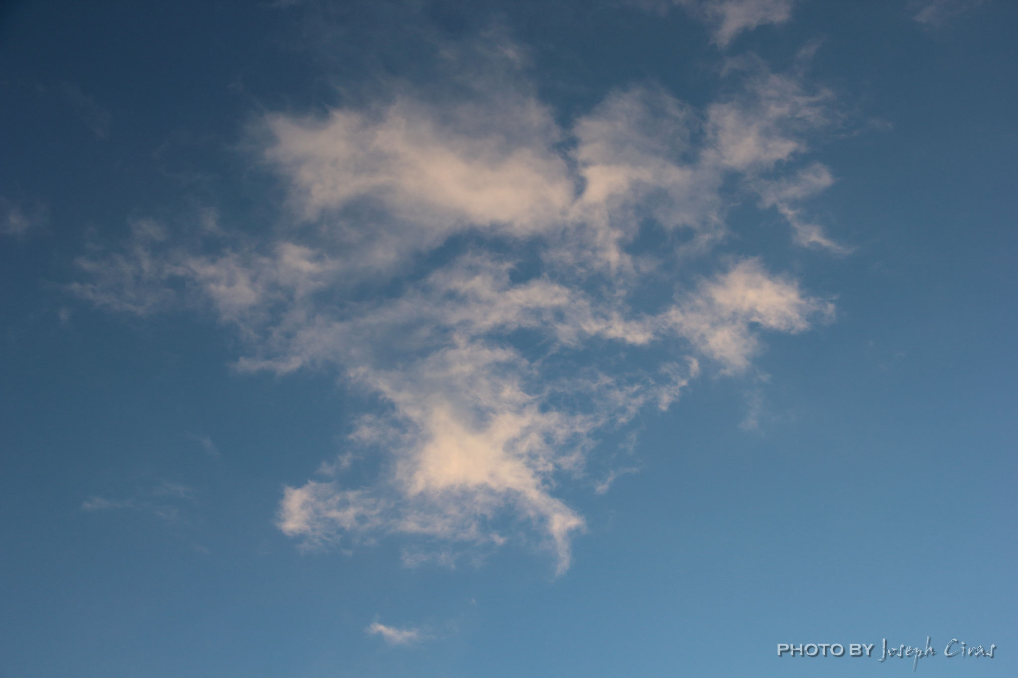
Wednesday, 12/01/2021: Posted photo — Just a Cloud or is it?
Settings: Canon EOS 60D, ISO 200, f/22, 1/6 s, 35 mm.
This could be just a cloud. Or it could be a winged buffalo tilting down to the left.
Cloud formation
I have posted in the past what seeing objects in clouds is called. Pareidolia is a sign of creativity. I took this photo today, not because I saw an object in it, it was because I needed a photo for today. I did not see the object until I was post processing the photos.
What do you see?
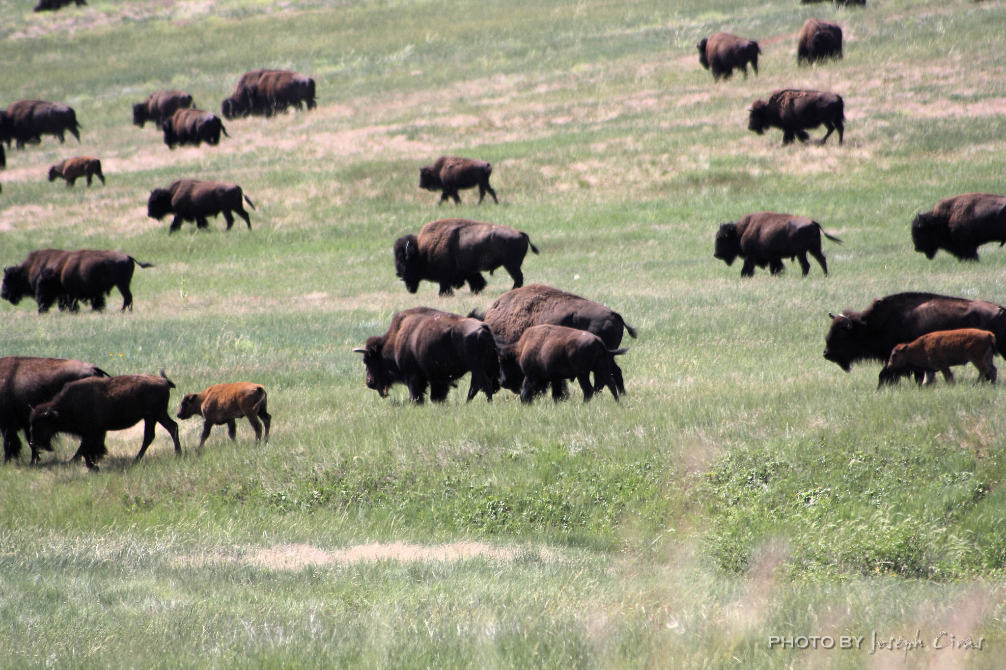
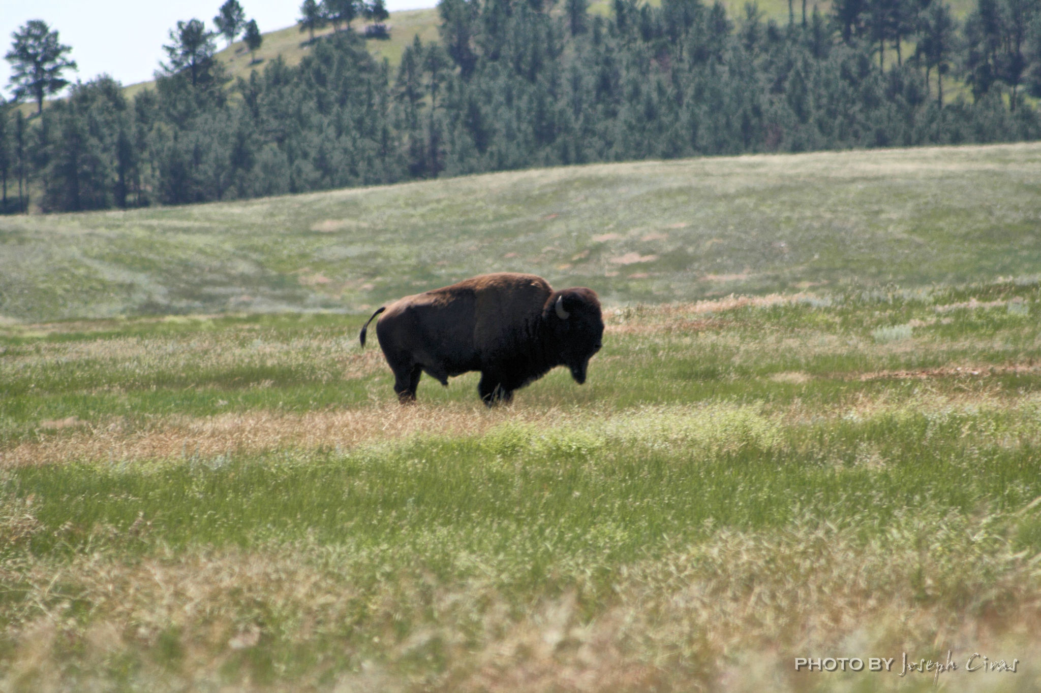
Thursday, 12/02/2021: Posted photo — American Bison.
Settings: Samsung SM-G930V (Galaxy S7), ISO 80, f/1.7, 1/120 s, 4 mm
This photo was taking at Wind Cave National Park in South Dakota. I have a feeling that I have posted this photo in a previous post. If I did, I am sorry for the repeat. I like this photo.
American Bison
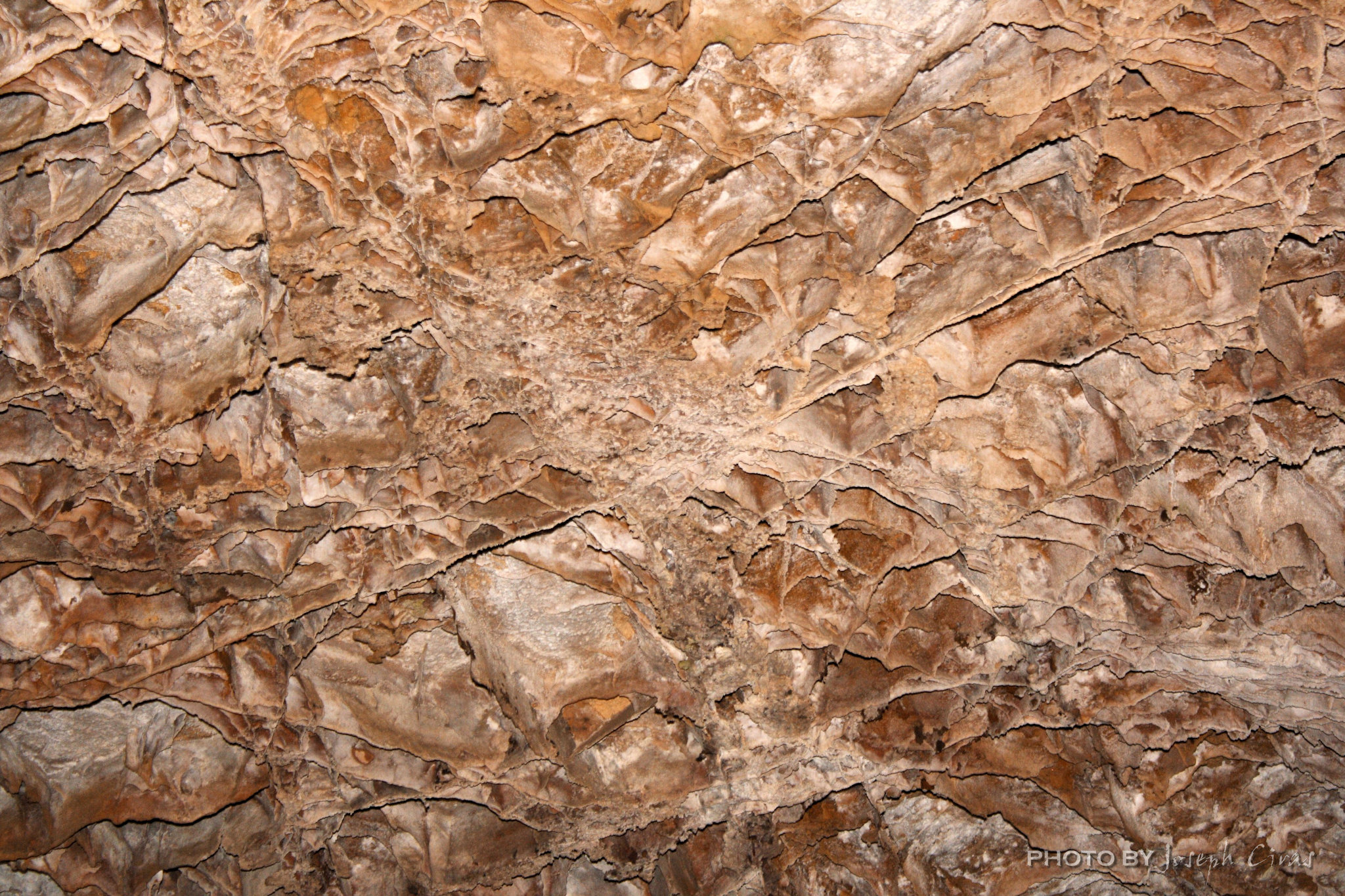
Wind Cave, one of the longest and most complex caves in the world. Named for barometric winds at its entrance, this maze of passages is home to boxwork, a unique formation rarely found elsewhere.
Here are a few more photos from Wind Cave National Park.
The bull of the herdBoxwork in Wind Cave
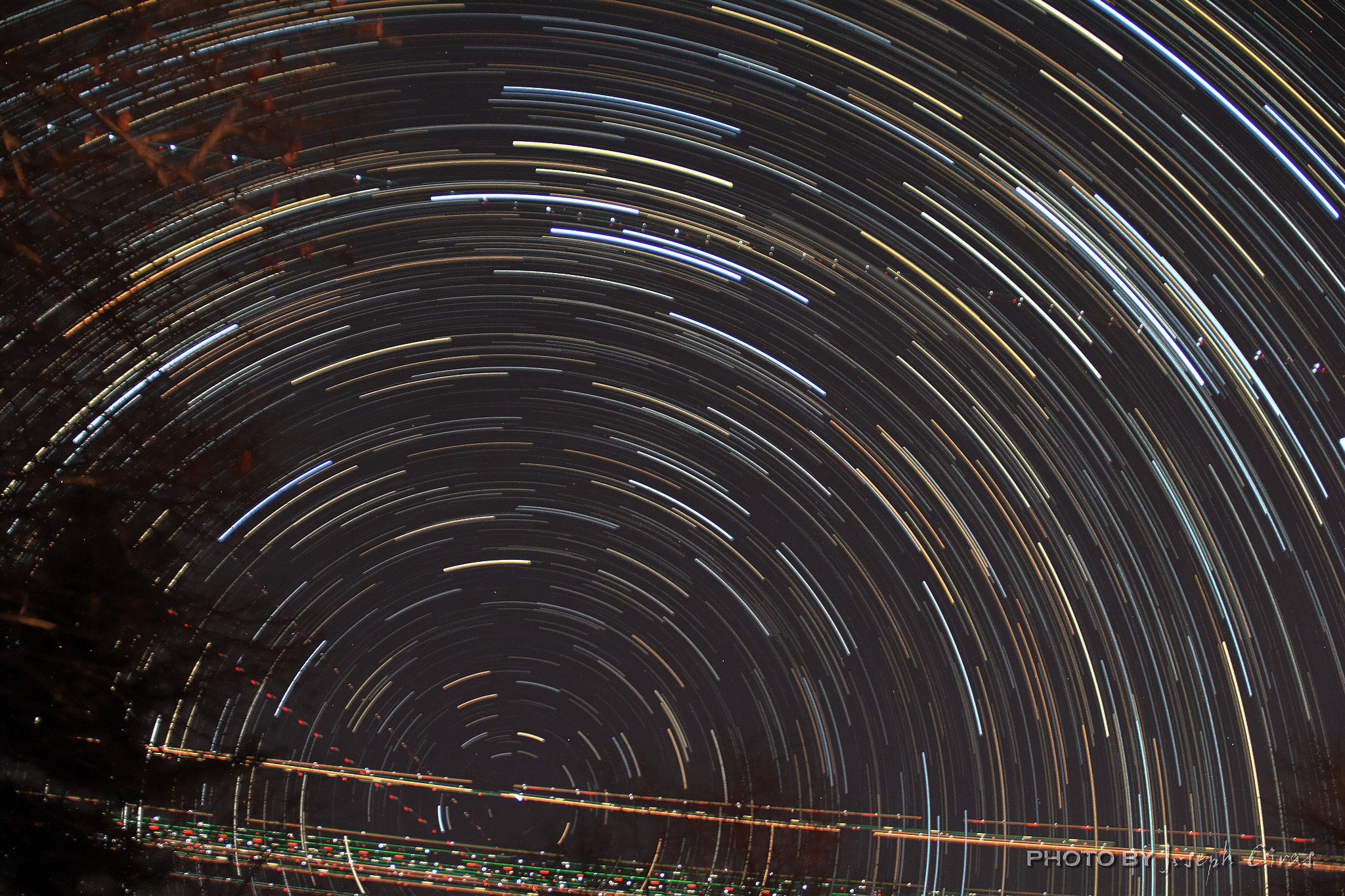
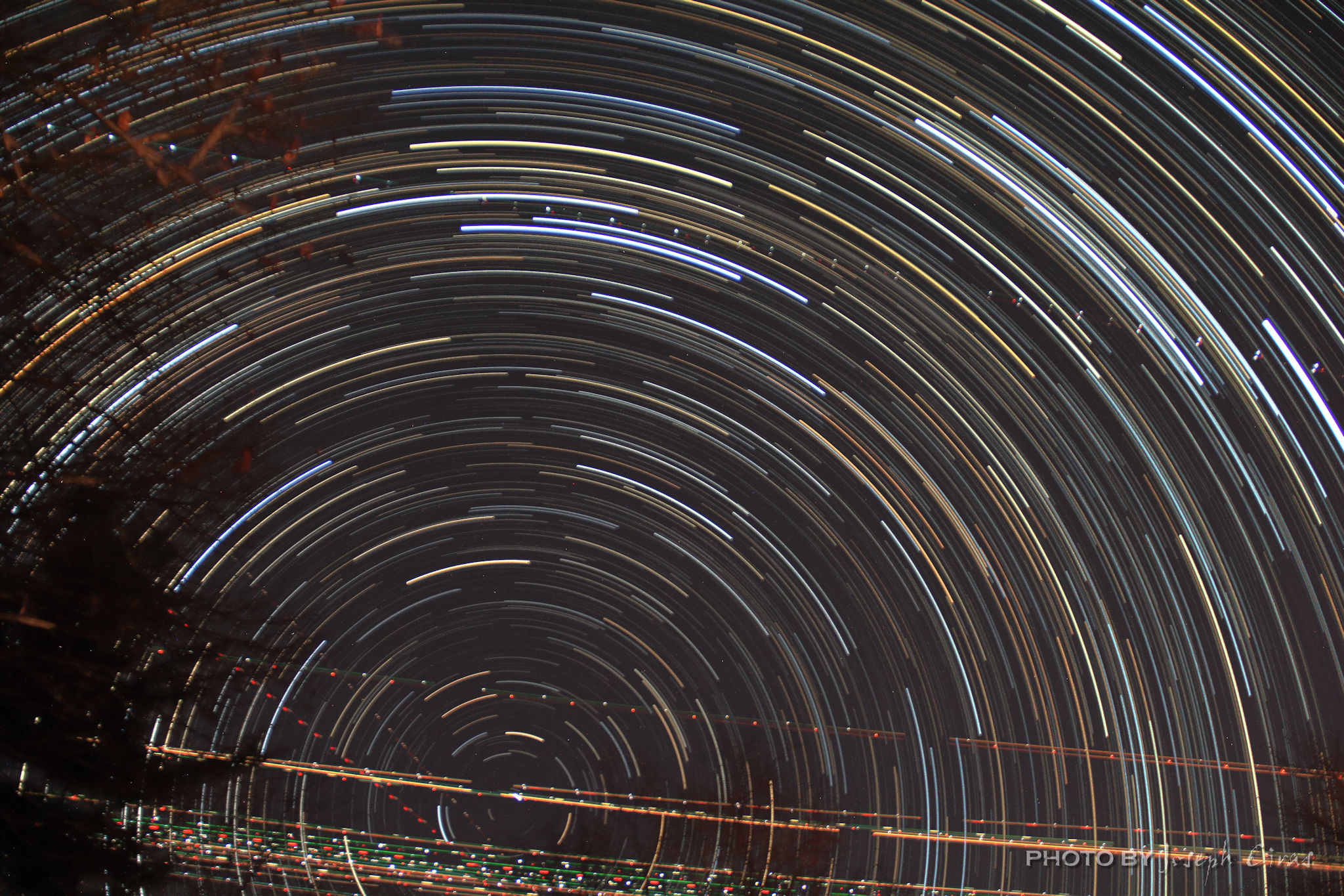
Friday, 12/03/2021: Post photo — Star Trail.
Settings: Canon EOS 60D, ISO 3200, f/3.5, 9 s, 18 mm
I took a star trail photo today. It was great to take a star trail photo earlier in the evening and not after 10 p.m. The photo I posted was a composite of 437 photos stacked together. The secondary photo that I am posting in this post is a composite of 637 photos.
437 composite photo start trail
There is a lot of airplane activity north of my house at night.
637 composite photo start trail
Saturday, 12/04/2021: Post photo — Sunrise at the Pier.
Settings: Canon EOS 60D, ISO 100, f/22, 1/4 s, 62 mm.
I took this photo a few years ago on Jacksonville Beach. This pier was damaged by a hurricane a few years after I took this photo. This is one of my favorite photos that I took that morning. I took this because I liked the way the heron was silhouetted against the pier and the ocean.
Please note that I have not been able to post to my Weebly page for over a week, so the photos are a little behind there. Weebly technical support is still working on the issue.