“Photography for me is not looking, it’s feeling. If you can’t feel what you’re looking at, then you’re never going to get others to feel anything when they look at your pictures.” — Don McCullin
Thank you for all the new views and likes from last week, it helps keep me inspired.
Happy New Years!
Sunday, 12/31/2023: Posted photo — Catchup.
Waiting around for people to arrive at our house to do the traditional New Year’s Eve jig saw puzzle, I saw this container of catchup that we have been saving for some reason. I noticed Connecticut was different from the rest which led to this photo. Each one of the states has a different fact on it.
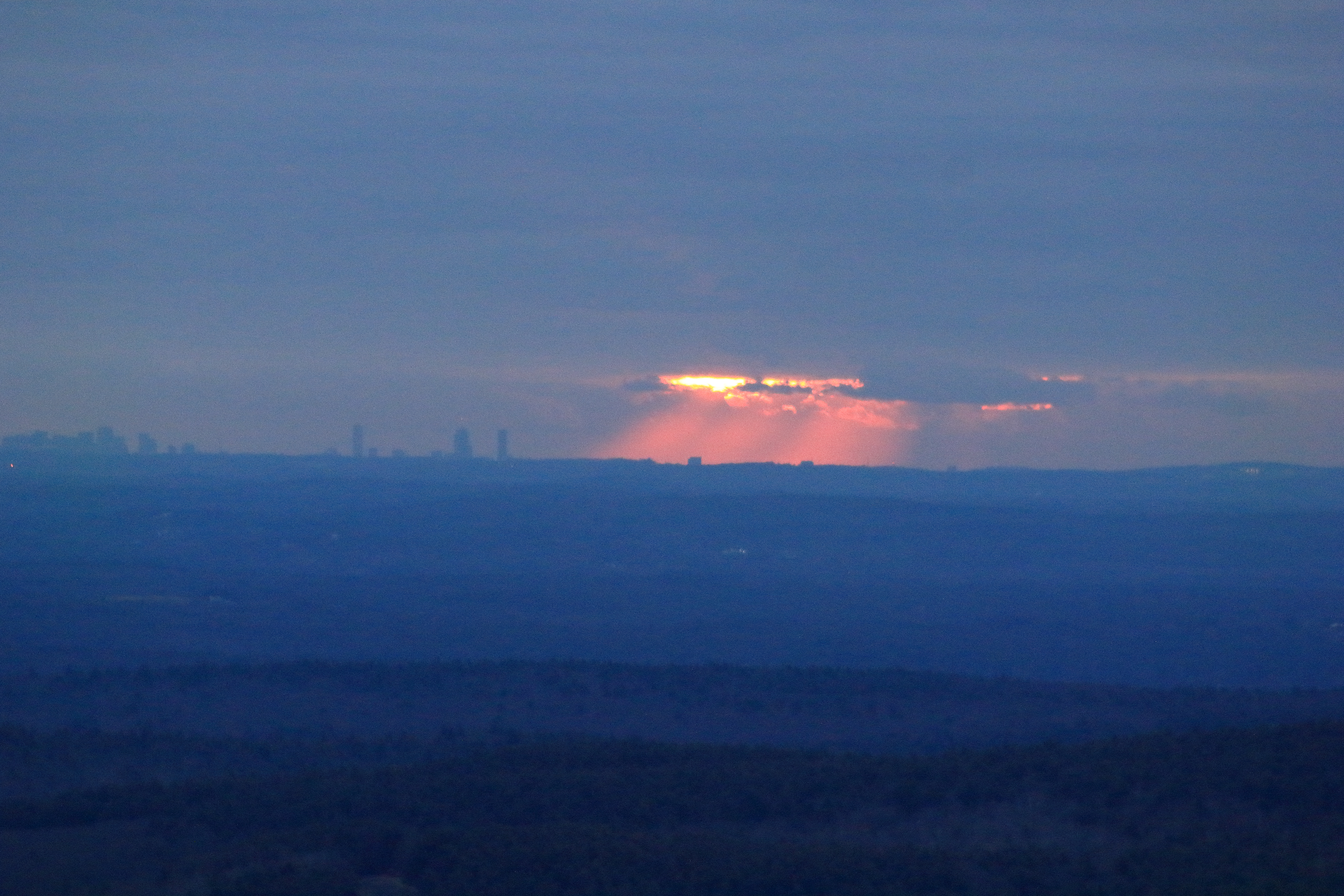
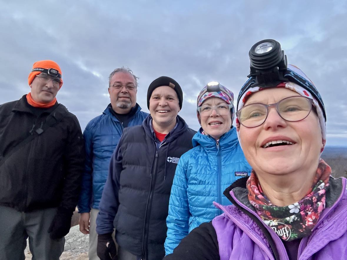
Monday, 01/01/2024: Posted photo — New Year’s Hike.
I have been hiking a local mountain every New Year’s morning for Sunrise with a group of friends over many years. This year marked the 10thyear that we hiked Mount Watatic. Mount Watatic is a smaller mountain than Mount Wachusett but has fewer people hiking on it. It is further away from populated areas. It is the northern terminus of the Midstate Trail.
We have had -25°F temperatures on the summit, 45°F temperatures on the summit, cloudy days, rainy days, and average 20-30°F temperatures. This year we had cloud cover in the ocean past Boston, so Boston was clear, but the sun was not to be seen.
Here is a photo of what we saw as the sunrise, Mount Wachusett from the summit, and our traditional group photo.
Tuesday, 01/02/2024: Posted photo — Yellow Yams.
Yellow yam is born by a perennial vine plant, which stretches up to 2 meters long. Yellow yams are like sweet potatoes; however, they are not an alternative for sweet potatoes. The main difference between the two tubers is that yams are large and have thicker skin, whereas sweet potatoes are relatively small and have a thin peel. Yellow yam, a tropical root veggie, is also alternatively known as “Jamaican Yellow Yam.” Jamaican yellow yam is traditionally consumed with Jamaican meals.
The grocery store in which I shop does have some interesting fruits and vegetables.
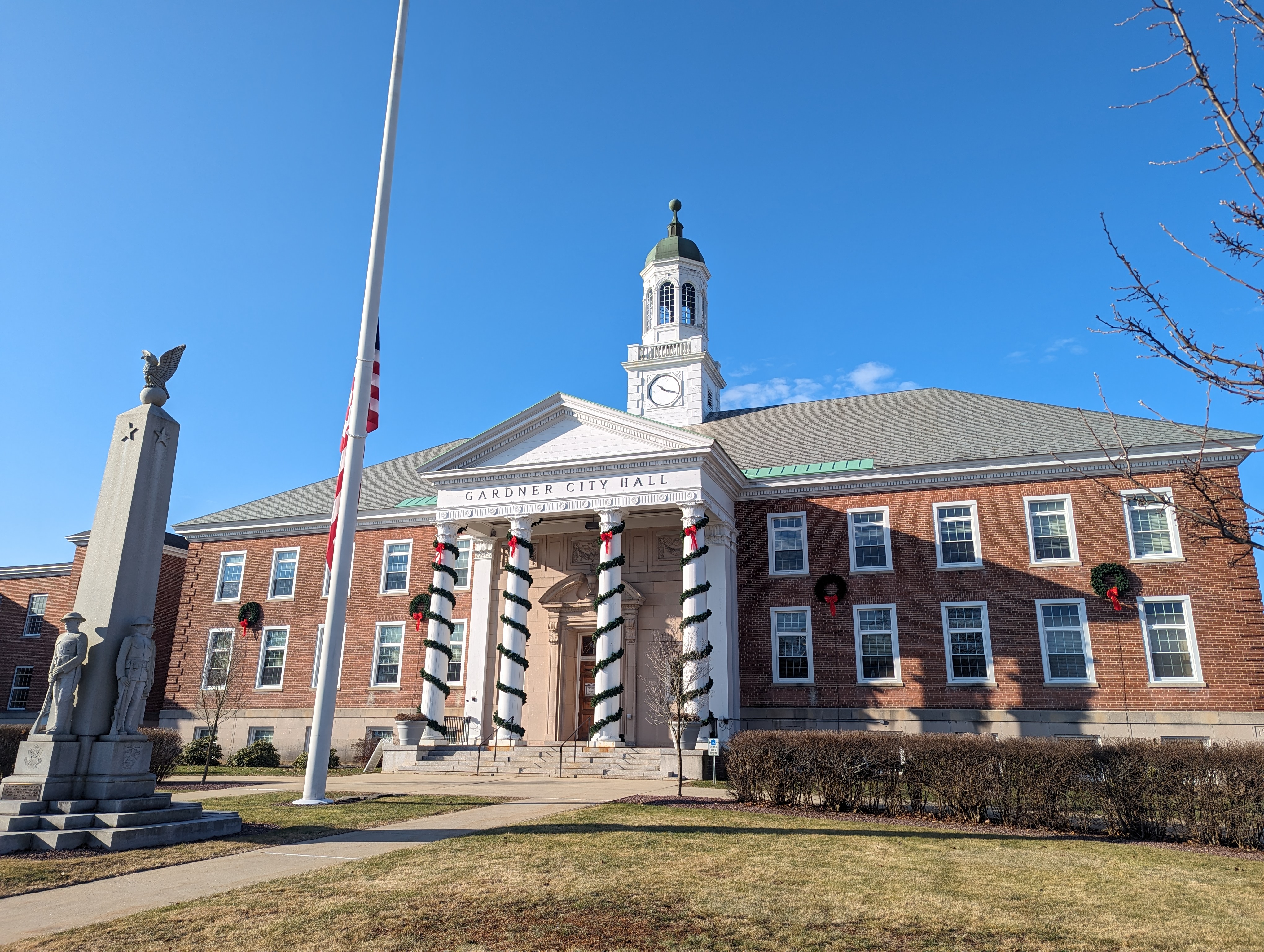
Wednesday, 01/03/2024: Posted photo — City Hall.
Today was my yearly physical. It is in the city of Gardner Massachusetts. The city hall is a block away from my doctor’s office. Town Hall first opened in 1860, the ground floor was inhabited by the First National and Gardner Savings banks, while another section housed the district court. On January 1, 1923, the Town of Gardner officially became the City of Gardner. City Hall was opened in January of 1940 when all city government offices were transferred to the new building.
Thursday, 01/04/2024: Posted photo — Bridge.
One of the trails on Mount Watatic goes by a body of water that was formed by a beaver dam. That beaver dam held the water back for many years. Over the last few years, the beaver dam started to breach. This bridge has been constructed to go over the new streams that are forming.
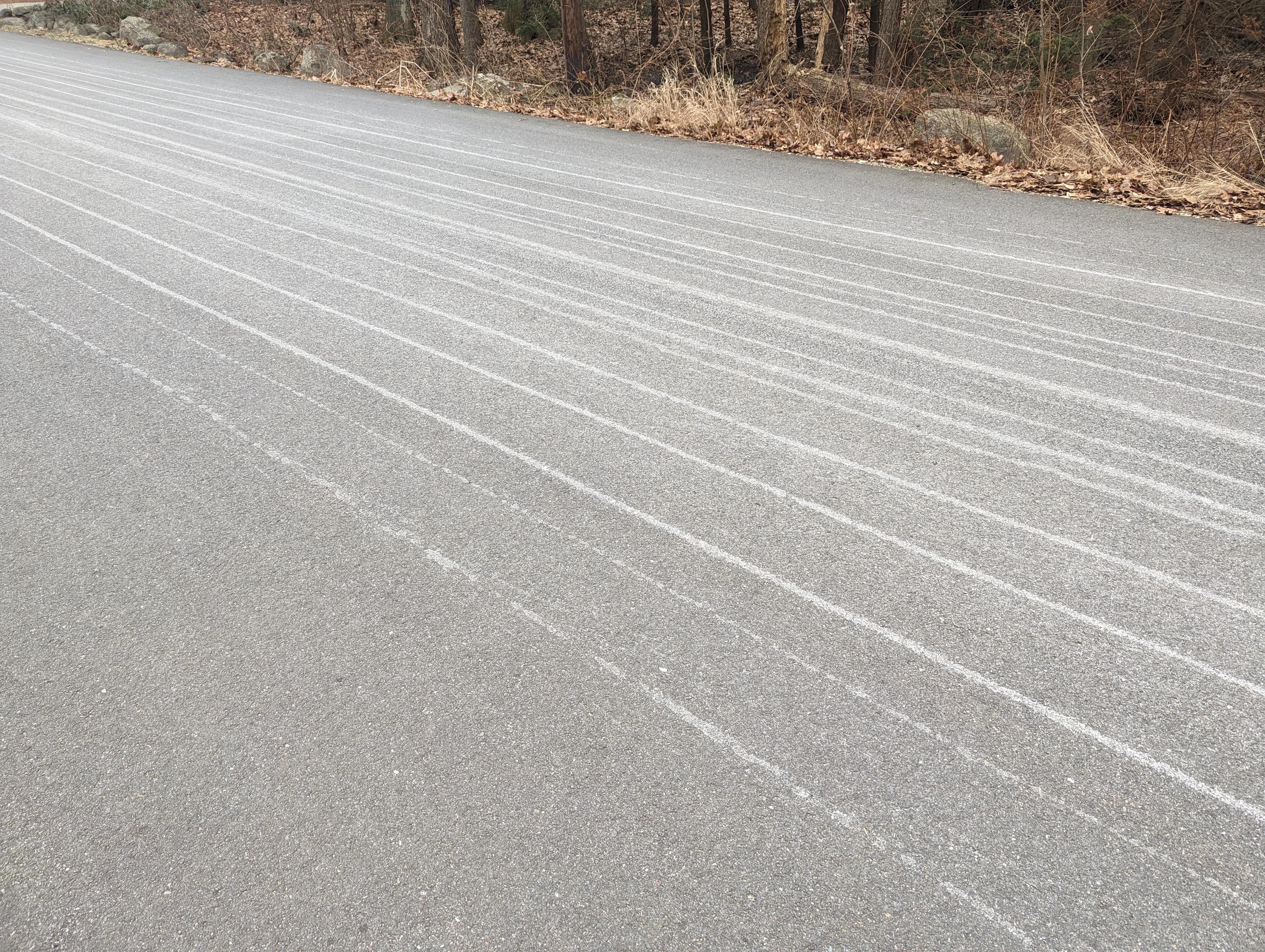
Friday, 01/05/2024: Post photo — Lines in Road.
Salt brine, typically sodium chloride, is sprayed onto the pavement before a storm (this is known as “pre-treating”). The town I live uses a liquid mixture of salt brine and an organic sugar carbohydrate. Applying the liquid mixture to the roads lessens the time it takes to activate the conventional rock salt making the cleaning of the roads more efficient.
We have a predicted 8 to 12 inches of snow falling into our area Saturday night into Sunday morning.
Saturday, 01/06/2024: Post photo — Epiphany.
Epiphany, celebrated on 6 January, marks the day when the Three Wise Men visited baby Jesus in Bethlehem. It’s a Christian holiday that honors this event and represents the revelation of Jesus Christ. This day is also called “Little or Old Christmas” and is the last day of the Christmas season.
“There are always two people in every picture: the photographer and the viewer.” — Ansel Adams
Thank you for all the new views and likes from last week, it helps keep me inspired.
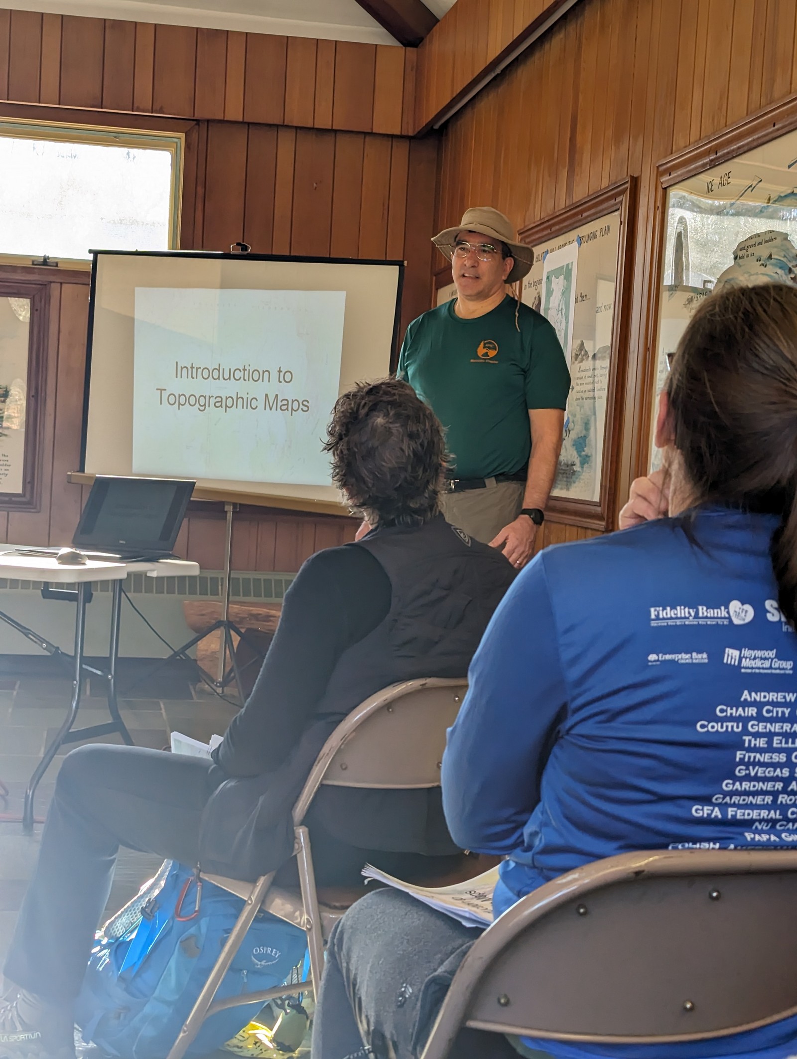
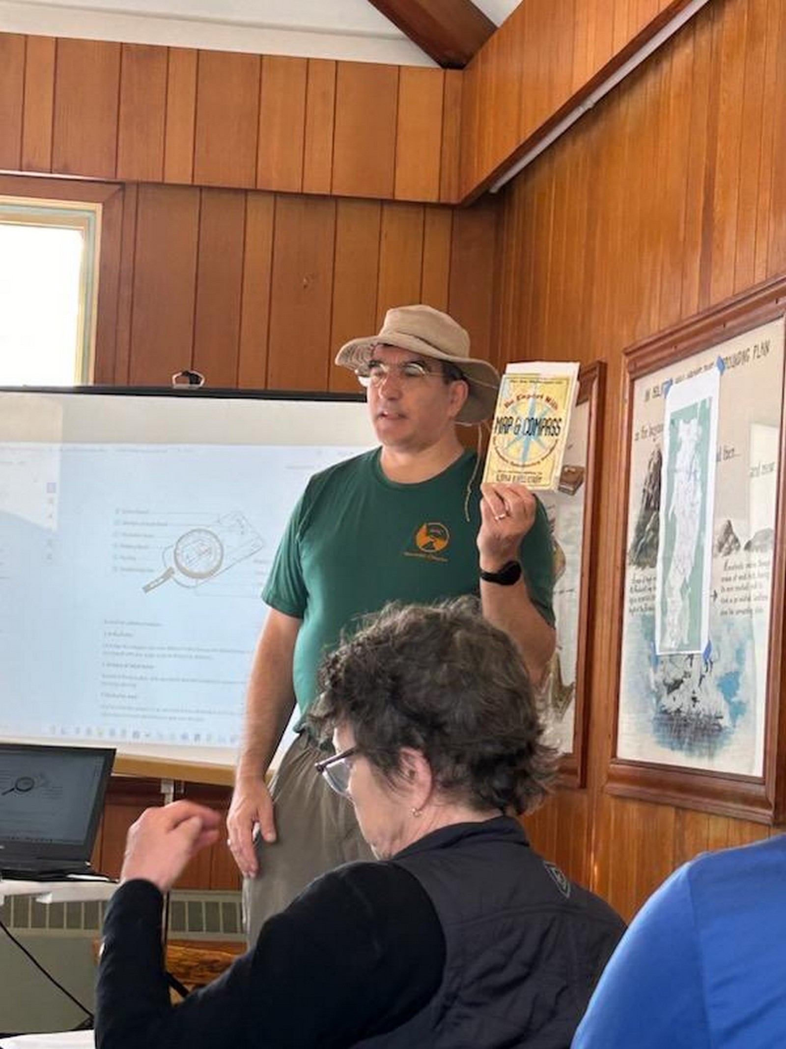
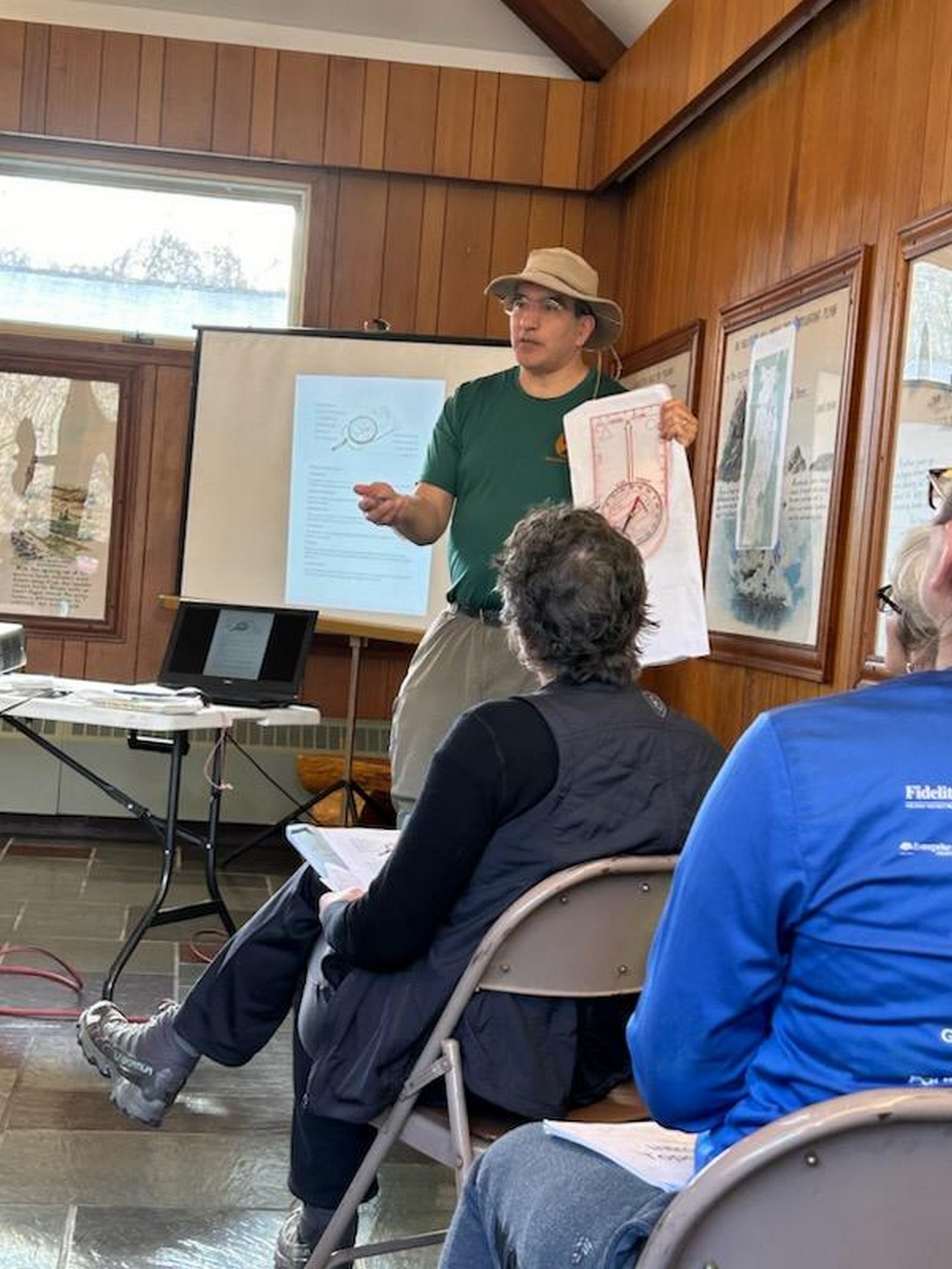
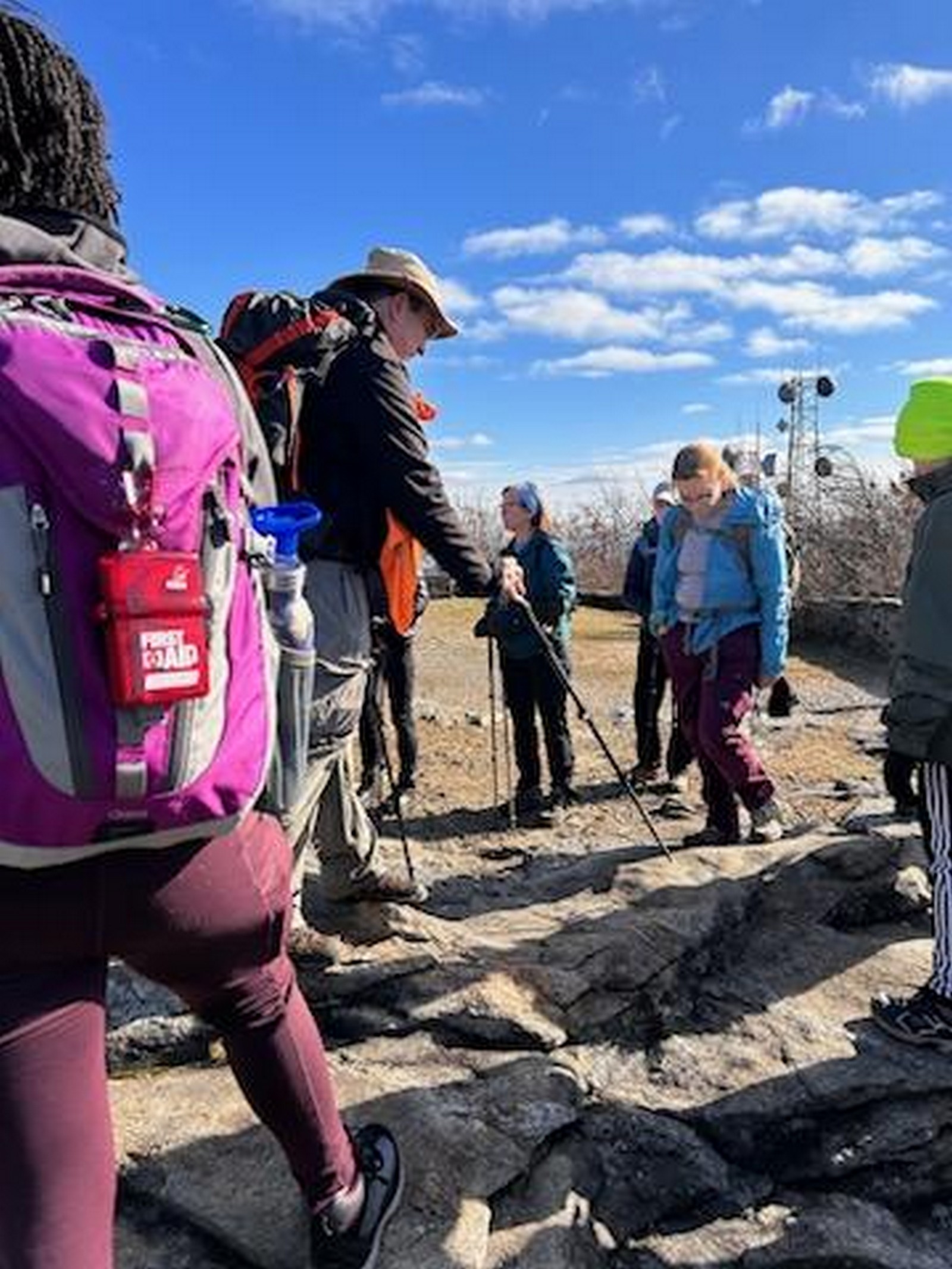
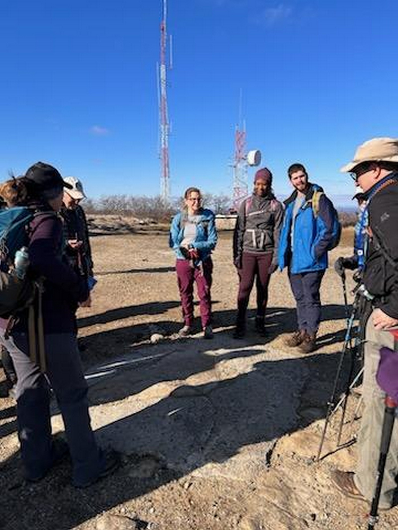
Sunday, 11/12/2023: Posted photo — Training.
Today I taught 17 hikers how to use a map and compass. Some of the students were experienced hikers who needed a refresher and some never used a map and compass before today. The training was through the AMC and was held at Wachusett Mountain. This was the first of a two-part training. The second part will be in the spring when I plan to use an orienteering course to fine tune navigational skills.
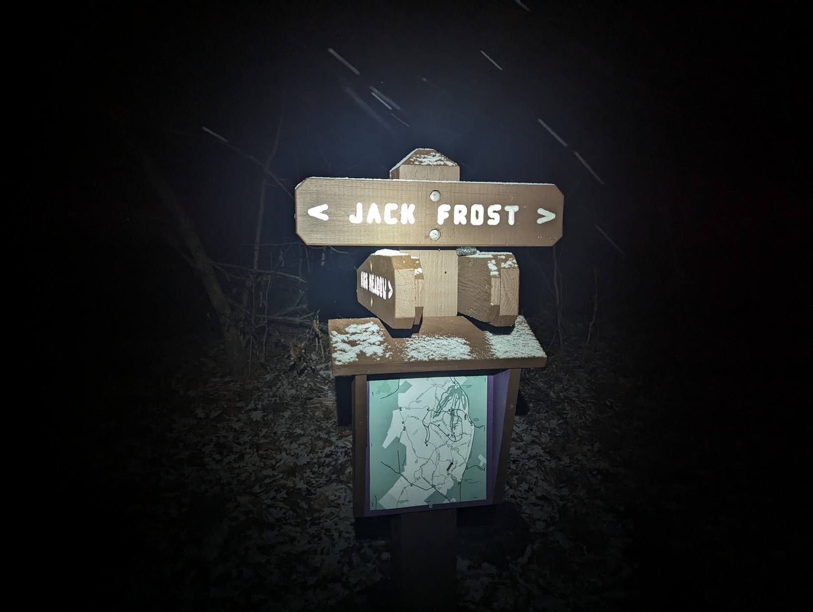
During this training, the participants learned how to read a topographical map and how to determine a route on the map. Having a map and compass are part of the Ten HikeSafe Essentials. Knowing how to use a map and compass could be lifesaving. After the planning of the route, we went on the trail to enhance the training. It is one thing to just use a map and compass in a classroom setting, it is another to get out on the trail and use it. One situation that I gave them was, what if someone turned a trail junction sign to lead you in the wrong direction. Using your map and compass will guide you in the correct direction.
During the training, I discussed the differences between a reference mark, azimuth mark, magnetic station, and a benchmark. All these markers can be found on the mountain. It is surprising to me that hikers do not know the difference between a reference mark and a benchmark. I guess we all started out that way. It was a great training and there was positive feedback from the group.
Pointing out a reference markGathering at the summit
Looking forward to the advanced training in the spring. I am considering doing an introductory training in the spring also since there was many people on my waiting list and others that wanted to sign up after registration was closed.
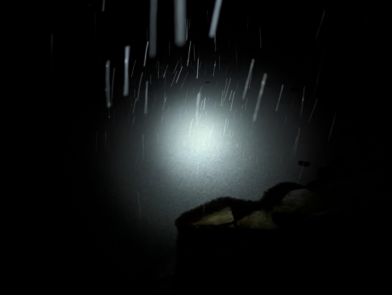
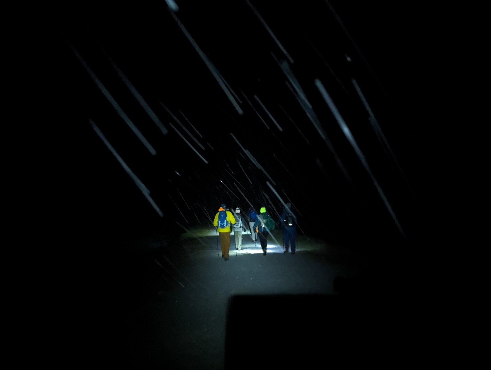
Monday, 11/13/2023: Posted photo — First Snow Hike in a While.
Tonight, it started to snow as I was driving to the trailhead for my Monday night hike. There were eight people that hiked tonight. Wachusett Mountain is not a tall mountain in most people’s minds. It is only 2006 feet tall. A far cry from its 23,000 feet height in its youth. The mountain does still affect the weather in the area.
As we started towards the summit, there was more snow on the trail. The hike was slow due to the snow and the snow-covered maple leaves on the trail. Wet leaves are dangerous. Wet leaves covered with snow with possible ice under them are more dangerous. The group took a “safe” trail to the summit.
On the decent, four of the eight took the trail down and the other four walked the roads. I was with the group that took the trails. I was very careful on the trails, not wanting to reinjure my ankle. The trail we took had a gentler slope than others on the mountain. As expected, we arrived at the trailhead before the road walkers, but only one to two minutes before them.
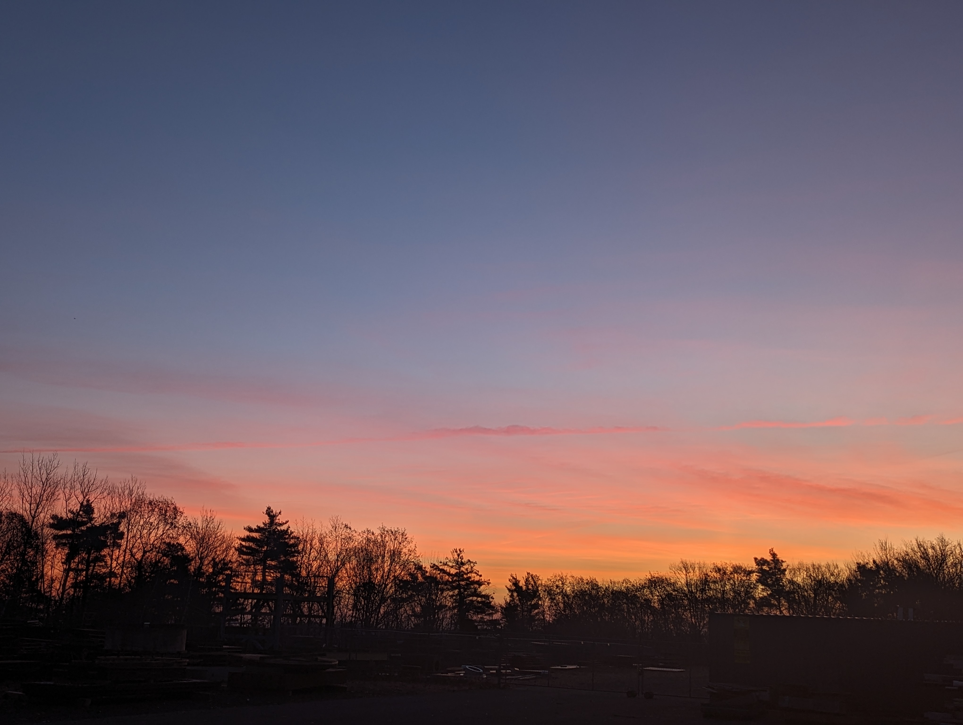
Tuesday, 11/14/2023: Posted photo — Morning Snow.
Drove by one of my favorite photos locations on my way to work this morning. The sun was just rising, and I was able to practice low light photography. I wanted to get a photo of this scene just in case the snow melted today. The temperature rose a little today melting all the snow. Later this week, rain is predicted.
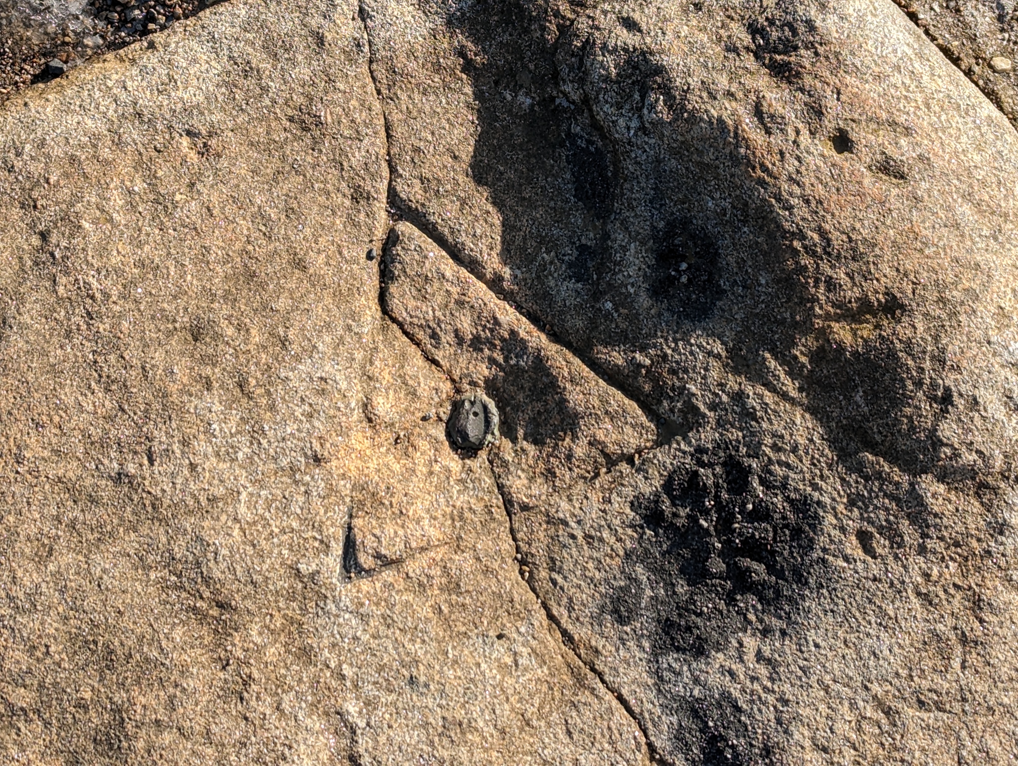
Wednesday, 11/15/2023: Posted photo — USGS Control Points.
Benchmarks can be divided into two general groups: the “vertical control points” are points that mark a very precise elevation above the standard datum plane (usually referred to as elevation above sea level) and the “horizontal control points” are points with precisely established latitude and longitude. The National Geodetic Survey, not the U.S. Geological Survey, is the Maintainer of federal Vertical Control Marks.
Here are photos of the control points on Wachusett Mountain.
Triangulation Stations: are markers with positions determined by measuring distances and angles from other stations. The triangulation station on Wachusett is a pin in a stone.
Wachusett Mountain Triangulation Station
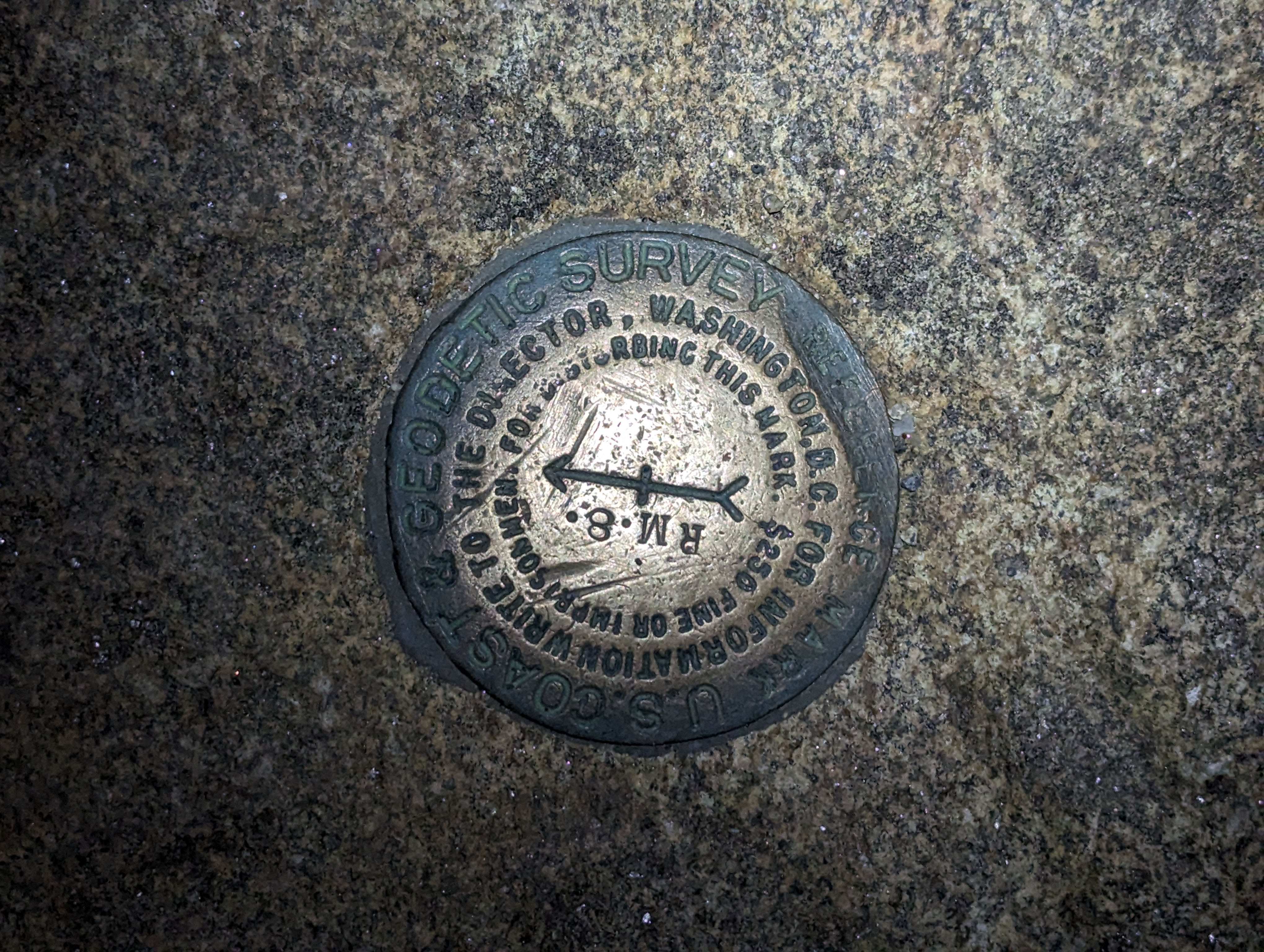
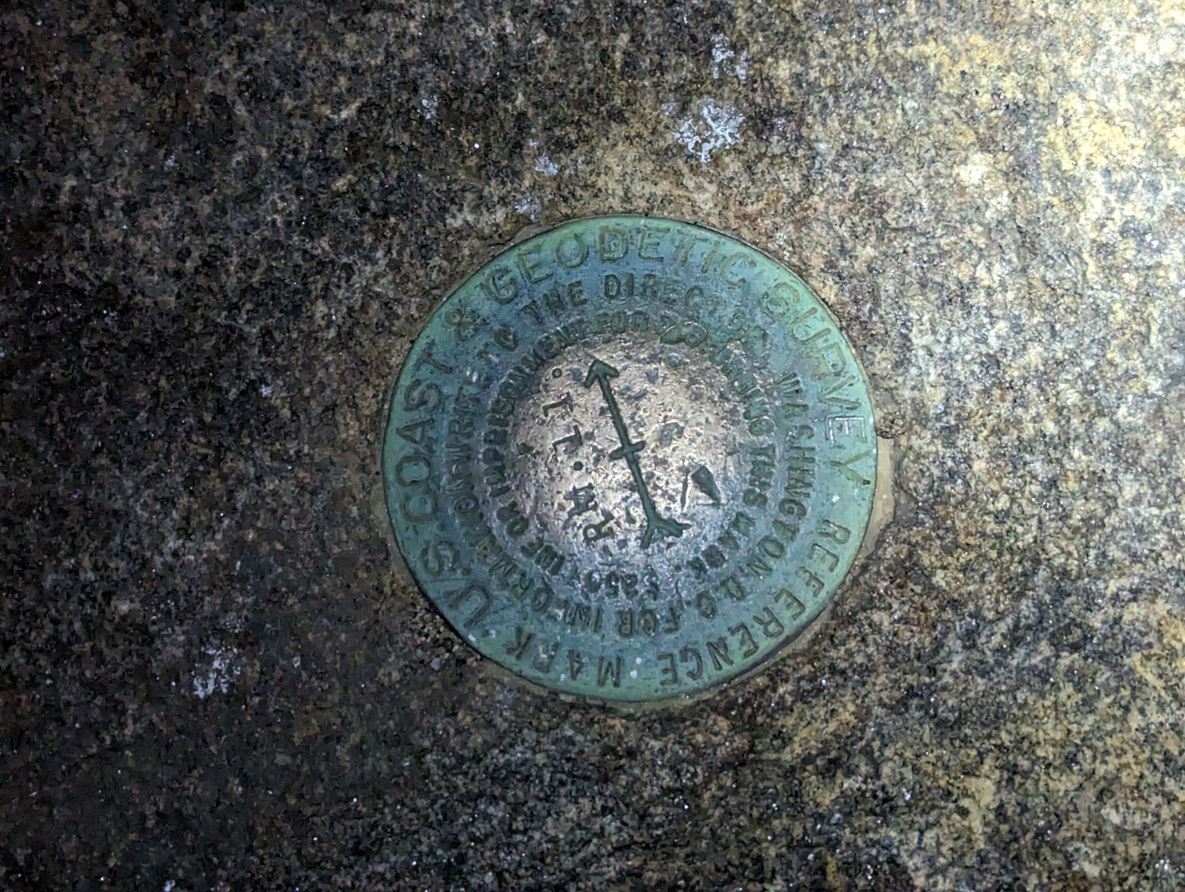
Reference marks: help keep triangulation stations from being lost with arrows on their disks pointing in the direction of their referenced triangulation station.
Reference mark RM8Reference mark RM11
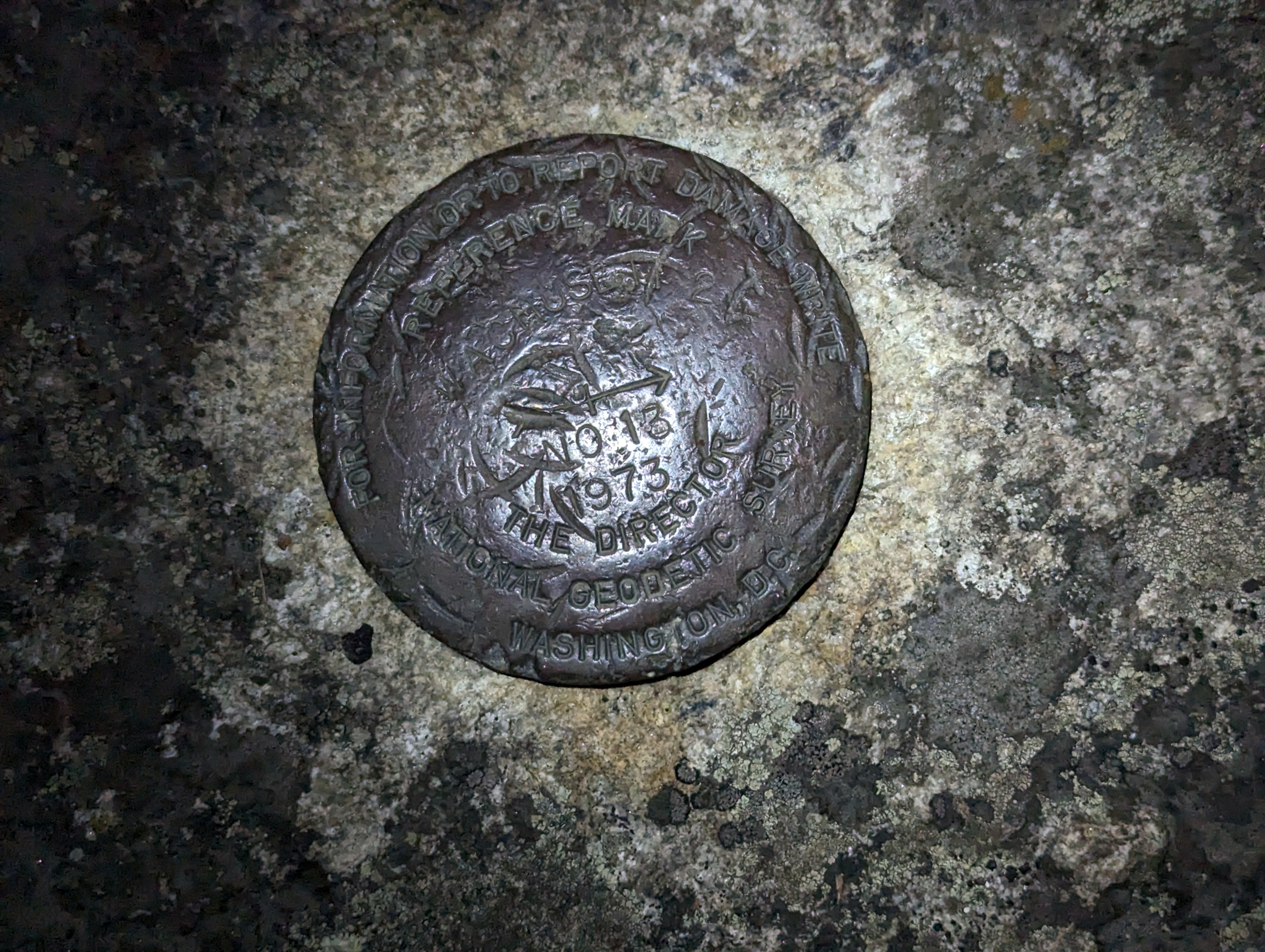
Azimuth marks: coupled with its triangulation station, provide a compass direction of the true north. The azimuth on Wachusett is RM13. The USGS webpage calls it an azimuth. I was wondering if they did since this mark is away from the RM11 and RM8.
RM13 an Azimuth mark
Magnetic Stations: are stamped with a six-pointed star in the center. The original purpose was to supply magnetic measurement information for the nautical charts, but later observations were extended into the interior to aid local surveyors. This is the magnetic station near the summit of Wachusett Mountain.
Wachusett Magnetic station
That was the educational portion of this week’s blog.
Thursday, 11/16/2023: Posted photo — Warmth.
The weather is cool in the morning, warm in the afternoon, and cool in the evening. Tonight, we had a fire in our woodstove to get the chill out of the house. It reminds me that I need to order the firewood that will take up through the winter. I think the way the light bounces off the phone lens give a nice feeling to this photo.
Friday, 11/17/2023: Post photo — Morning Glow.
I went to work a little earlier than I normally do on a Friday because I needed to get some work done before the Thanksgiving holiday week. Many of the workers in the shop will be on vacation next week and there was a project that needed to get done. When I arrived at work, I looked to the east and saw a glow in the sky. It was not sunrise yet. I waited a few minutes and then took this photo. Still not sunrise, but there was a nice glow in the sky.
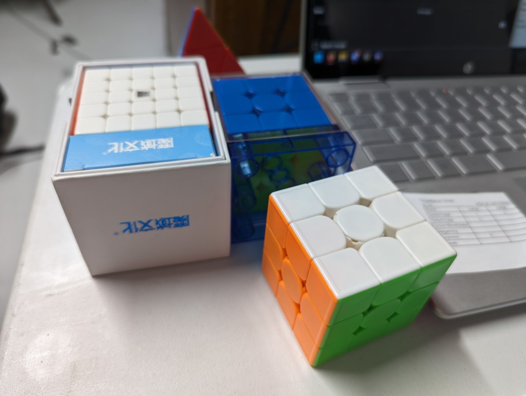
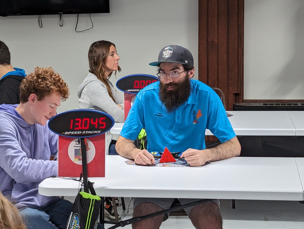
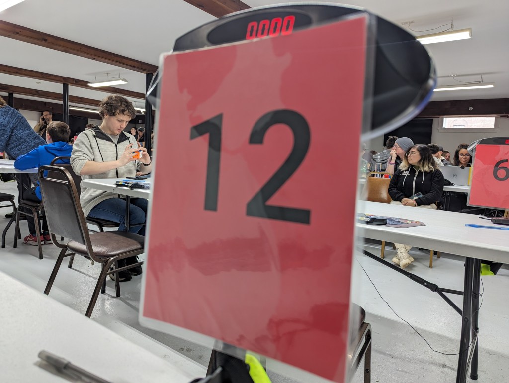
Today in the small town of Bellows Falls, VT. There was a cube competition at the Moose Lodge.
The venue was small and cramped but the people did not mind. During lunch, two of the cubers took out their violins and played a few classical movements for the crowd. This was the first time I saw that happen at an event.
Here are a few more photos from the event.
That’s it for this week. Time to rest up for Thanksgiving.