“There is one thing the photograph must contain, the humanity of the moment.” —Robert Frank
Thank you for all the new views and likes from last week. It helps keep me going. Enjoy my blog post!
This week’s post will be short. I will explain why later in this month.
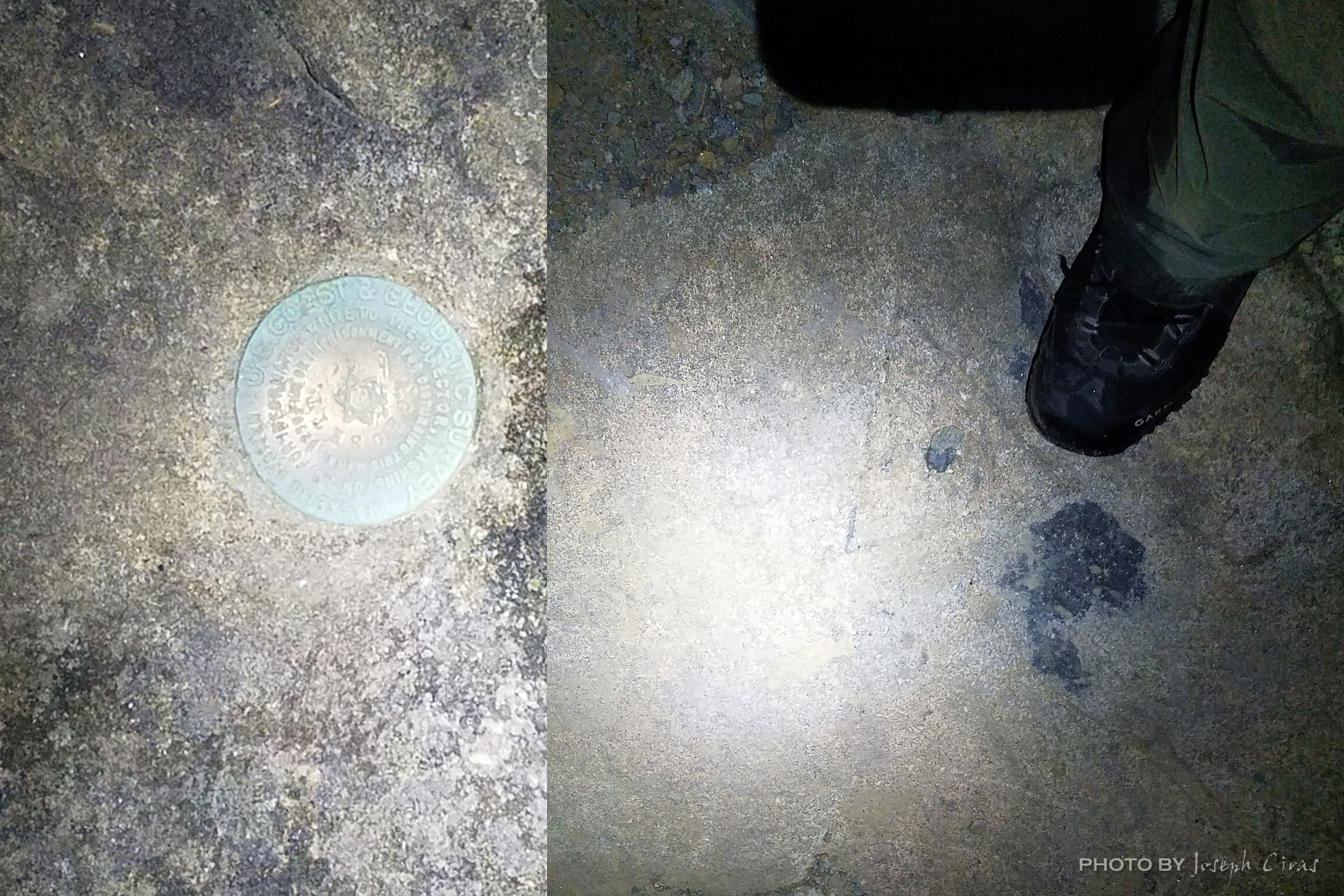
Sunday, 03/07/2021: Posted photo—Reference Mark 8.
Settings: Canon EOS 60D, ISO 100, f/7.1, 1/500 s, 55 mm
This was my fifth hike in seven days on Wachusett Mountain. Just as last Sunday, I hiked with my son and two of his friends this time. This was a shorter hike than I did on Saturday for no reason. I did take the kids, young adults, up one of the more difficult trails on the mountain. The steep part of Jack Frost Trail was pure ice with no snow cover. I took this trail on Saturday and wanted to see how they would handle it today. They only did it once, I did it twice. Like last week, I wanted to challenge myself to get to the trailhead before them. I knew that they would get there first this week since, when I established the challenge, they only have a flat trail to hike and I had to go back up the steep, icy trail and then back down the other side. They arrived at the trailhead about ten minutes before I did. Still a fun day and they like the challenge.

This photo is of a National Geodetic Survey (NGS) reference mark. A reference mark differs from a benchmark in that reference marks point to benchmark. There are three reference marks on the summit of Wachusett Mountain. There used to be four but one of them must have been removed when they were putting in the new watch tower. Either that or I have not been able to find it yet. A benchmark can either show location or elevation. A benchmark for location can be a random point determined by the surveyor or it could be something permanent in nature such as the corner of a concrete pad or a survey monument. A benchmark for elevation can be given a random elevation number or the exact number of feet above sea level can be determined.
One of my rules is that you are not on the summit of a mountain until you touch the benchmark. If there is not benchmark, they I need to look at my map and/or GPS device to estimate the location of the summit.
Monday, 03/08/2021: Posted photo—Walkway.
Settings: Canon EOS 60D, ISO 400, f/14, 1/10 s, 40 mm.
The walkways at the Old Mill Restaurant are covered walkways. They are very picturesque year-round but especially this time of year with snow on the rocks and the water gently flowing under the walkways.
This photo is not as easy to take as you would think. There is a busy road that goes in front of the restaurant, so you must time your shot not to have any vehicles in it. You also need to walk down to the stream to get the correct angle for the shot. That is not an issue during most of the year. Today I had to walk on icy snow to get into position. Not a problem for me but could be a problem for some.

A covered bridge, or a covered walkway, is a timber-truss bridge with a roof, decking, and siding, which in most covered bridges, or walkways, create an almost complete enclosure. The purpose of the covering is to protect the wooden structural members from the weather. “The first long covered bridge in America, with a 55-meter (180-foot) center span, was built by Timothy Palmer, a Massachusetts millwright, over the Schuylkill River at Philadelphia in 1806. Covered timber-truss bridges soon spanned rivers from Maine to Florida and rapidly spread westward. There is no evidence of timber-truss bridges, with or without covering, in the ancient world, but the 13th-century sketchbook of the French architect Villard de Honnecourt depicts a species of truss bridge, and the Italian Andrea Palladio’s “Treatise on Architecture” (1570) describes four designs.” — Encyclopedia Britannica.
Tuesday, 03/09/2021: Posted photo—Cirrus Clouds.
Settings: Canon EOS 60D, ISO 400, f/7.1, 1/400 s, 47 mm.
Cirrus Clouds (“Delicate cloud streaks”)
Typical Altitude: 16,500–45,000 ft
Precipitation: None that reaches ground
Composition: Ice crystals
Formation: Fall streaks of ice crystals in upper troposphere winds.

Cirrus clouds are the highest of all clouds and are composed entirely of ice crystals. Cirrus clouds are precipitating clouds, although the ice crystals evaporate high above the earth’s surface. The crystals, caught in 100–150 mph winds, create wisps of cloud.
This morning I saw four well defined “x’s” in the sky and thought that this would be a good photograph. The white was a wonderful contrast to the morning blue sky. These cloud formations do not last very long because of the high winds that form them.
Some people think these are contrails. The condensation trail left behind jet aircrafts are called contrails. Contrails form when hot humid air from jet exhaust mixes with environmental air of low vapor pressure and low temperature. The mixing is a result of turbulence generated by the engine exhaust. I am not sure about that, so I am sticking with calling them Cirrus clouds.
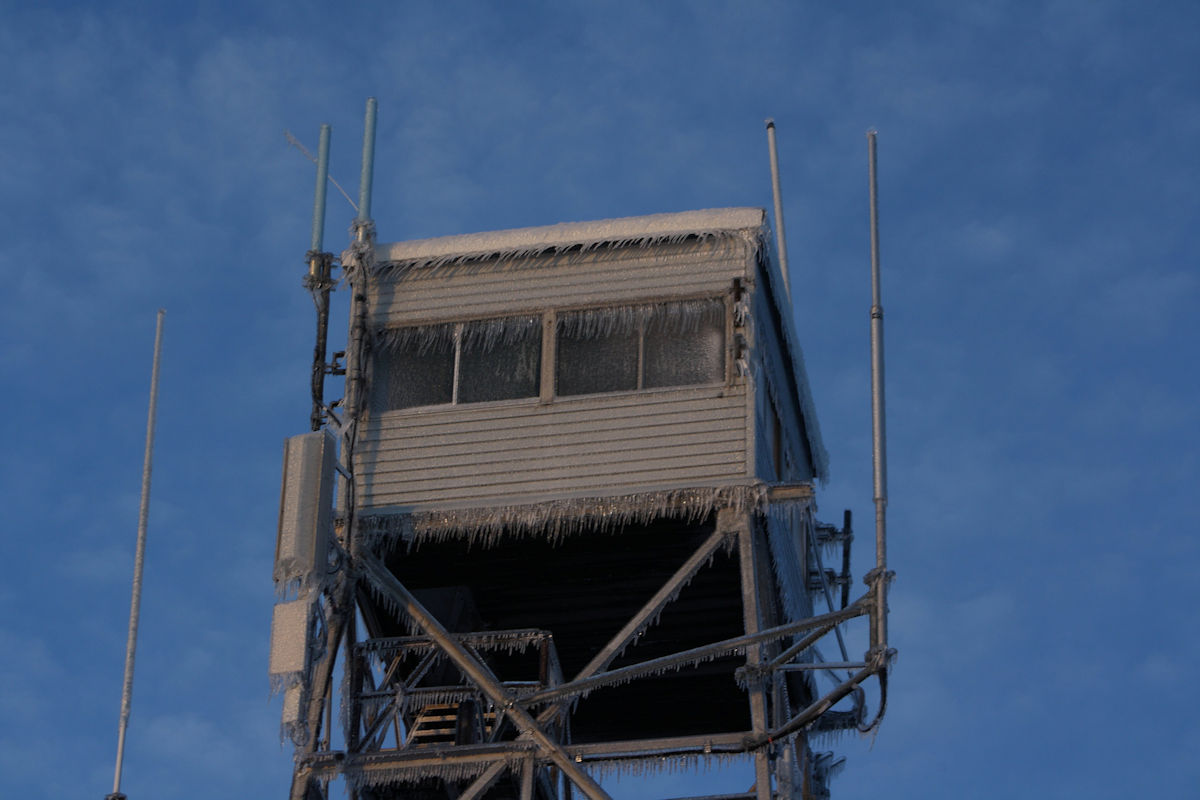
Wednesday, 03/10/2021: Posted photo—Watch Tower.
Settings: Samsung SM-G930V, ISO 200, f/1.7, 1/18 s, 4 mm.
On February 27, 2014 this new 80-foot steel fire tower was installed on the summit of the Wachusett Mountain state reservation in Princeton. The structure replaces the old tower which was built in 1966.
I cannot believe it has been so many years since it was open. I still remember when they were constructing it. We would hike to the summit and watch it being built over a few months.

Here is a photo of the old watch tower in the winter.
Thursday, 03/11/2021: Posted photo— Kolding Denmark.
Settings: KODAK DC3200 DIGITAL CAMERA, n/a, f/3.6, 1/90 s, n/a mm.
This was one of the very first travel photos I have taken. I took this photo on my first of three trips to Denmark. Kolding is a Danish seaport located at the head of Kolding Fjord in the Region of Southern Denmark. It is the seat of Kolding Municipality. It is a transportation, commercial, and manufacturing center, and has numerous industrial companies, principally geared towards shipbuilding.
One thing I like about this photo is that you can see the age of the building. If you look at the side walls, they are warped due to the age of the building and the material that was used to make it.

One day I will go back to Denmark with my family. Great place to visit.
Friday, 03/12/2021: Post photo— Two Summits.
Settings: Samsung SM-G930V, ISO 200, f/7.1, 1/13 s, 4 mm
On Sunday, I wrote about the difference between reference marks and benchmarks. These are the two benchmarks on the summit of Wachusett Mountain. The one that looks like a plate is one of the original benchmarks that was moved during the construction of one of the hotels that were on the summit. The one with inside the triangle is the current Wachusett Reset benchmark. This is the benchmark to which the three reference marks point.
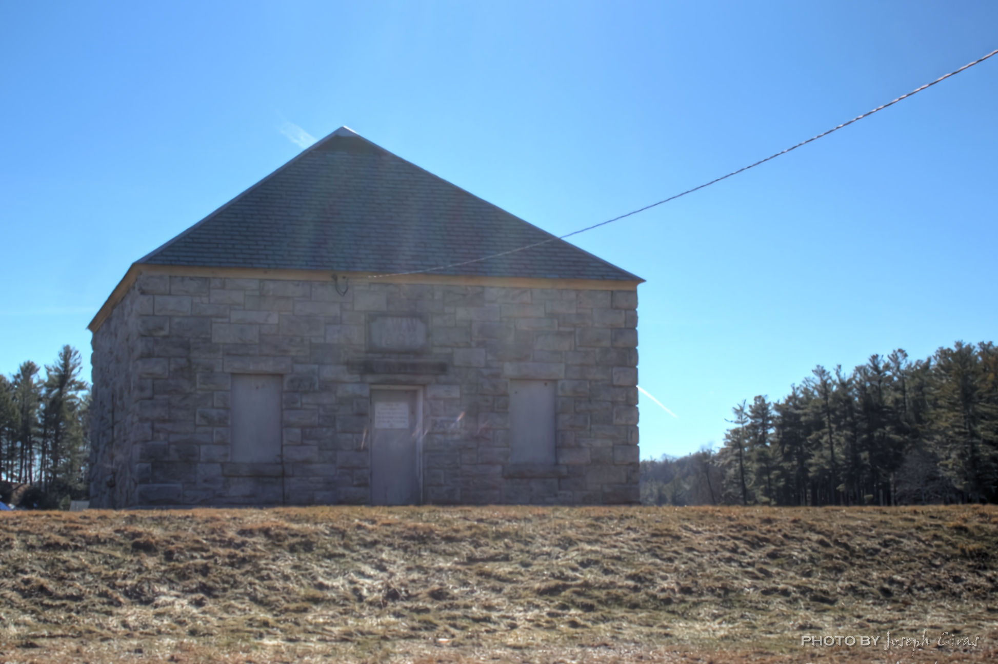
Saturday, 03/13/2021: Post photo—Gatehouse.
Settings: Canon EOS 60D, ISO 100, f/7.1, 1/320 s, 36 mm
A gatehouse outlet works or valve house for a dam is a structure housing sluice gates, valves, or pumps (in which case it is more accurately called a pumping station). Many gatehouses are strictly utilitarian, but especially in the nineteenth century, some were very elaborate.
Wyman Pond was constructed by the City of Fitchburg in1892 as a compensating reservoir to provide water to the mills downstream. It was rarely used and soon became a summer getaway for area residents. Trolleys ran right to the gatehouse for those wanting to spend an afternoon at Sunne’s Beach. Its popularity soon sprouted summer cottages all around the lake which now are mostly year-round homes.
I love the old architecture of this gatehouse. The stone walls and slate roof shows how it was constructed.
For more photo of other project I have work, visit my website: https://photobyjosephciras.weebly.com/ or visit me on Facebook at https://www.facebook.com/PhotobyJosephCiras/.
COVID is real! Be safe out there, keep your social distance, and remember to always wear your mask and wash your hands.
